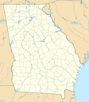
Allatoona dam
| Allatoona dam | ||
|---|---|---|
| location | ||
|
|
||
| Coordinates | 34 ° 9 '51 " N , 84 ° 43' 44" W | |
| country |
|
|
| place | Bartow County , Georgia | |
| Waters | Etowah River | |
| Height upstream | 256 m | |
| power plant | ||
| owner | United States Army Corps of Engineers (USACE) | |
| operator | USACE | |
| construction time | 1946 to 1950 | |
| Start of operation | 1950 | |
| technology | ||
| Bottleneck performance | 82.2 megawatts | |
| Turbines | 3 | |
| Others | ||
The dam Allatoona ( English Allatoona Dam ) is a dam with hydropower plant in Bartow County , Georgia , USA . It dams the Etowah River to a reservoir (English Lake Allatoona ). The small town of Cartersville is about 5 km west of the dam.
In addition to generating electricity, the dam is also used for flood protection and drinking water supply. The first plans to build a dam go back to 1910. After further studies in the 1920s and 1930s, the dam was then approved by the US Congress through the Flood Control Act of 1941 and the Flood Control Act of 1944 . Construction of the dam began on February 8, 1946. It was completed in late 1949. The dam is owned by the United States Army Corps of Engineers (USACE) and is also operated by the USACE.
Barrier structure
The barrier is a concrete gravity dam with a height of 57.9 m (190 ft ) above the river bed. The top of the wall is at an altitude of 268 m (880 ft) above sea level . The length of the dam is 381 m (1250 ft).
The dam wall has both a flood relief with 11 segment weirs and a bottom outlet with 4 openings. A maximum of 5210 m³ / s (184,000 cft / s) can be discharged via the flood discharge, and a maximum of 458 m³ / s (16,200 cft / s) via the bottom outlet.
Reservoir
At the normal storage target of 256 m (840 ft) above sea level , the reservoir extends over an area of around 48 km² (11,862 acres ) and holds 453.69 million m³ (367,471 acre-feet ) of water. The maximum storage target during high tide is 265.8 m (872 ft). At a level of 262 m (860 ft), the reservoir extends over an area of around 77.7 km² (19,201 acres) and holds 826.49 million m³ (670,047 acre-feet) of water. The reservoir has a length of 45 km (28 miles ). The impoundment began on December 27, 1949.
power plant
The power plant is located at the foot of the dam on the left side of the river. It went into operation in January 1950. The installed capacity with 3 turbines amounts to a total of 82.2 (or 85) MW ; 2 turbines each produce 40 MW and the third turbine 2.2 MW. The flow rate is 92 m³ / s (3250 cft / s) for each of the two large turbines. In the switchgear , the generator voltage is increased from 13.8 kV to 115 kV using power transformers.
Others
The total cost of the project with 31.5 million USD given.
See also
Web links
- DJI Phantom 4 4K UHD raw footage - Allatoona Dam (Drone Video) (from min 3:00). YouTube , August 23, 2016, accessed March 3, 2019 .
Individual evidence
- ↑ a b c d e Allatoona Dam and Lake Allatoona. (PDF) United States Army Corps of Engineers (USACE), 2013, pp. 15, 17–23, 25–26 , accessed on March 9, 2019 (English).
- ↑ Hydropower. USACE, accessed March 9, 2019 .
- ^ Allatoona Lake. USACE, accessed March 9, 2019 .

