Lalgaye
| Lalgaye | ||
|---|---|---|
| Status: | commune rurale | |
| Region: | Center-Est | |
| Province: | Koulpé logo | |
| Surface: | ||
| Residents: | 15,063 | |
| Population density: | ||
| Structure: | 17 villages | |
| Mayor: | Guibrilla Koudougou | |
| Prefect: | ||
| location | ||
|
|
||
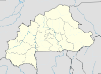
Lalgaye is both a municipality ( French commune rurale ) and a department encompassing the same area in the West African state of Burkina Faso in the Center-Est region and the province of Koulpélogo . The community has 15,063 inhabitants in 17 villages. Lalgaye lies on the Precambrian granite pedestal, which was formed more than two billion years ago and makes up three quarters of the country's area and forms part of the central section of the Upper Guinea Sill. The relief of this flat wave plateau is by lowering, crests, hills and isolated inselbergs embossed in the Birimian have emerged, usually from laterite tanks are covered and granite intrusions have. Lalgaye was an independent kingdom until colonization by the French. The place is on the national road 17 east of Tenkodogo , the neighboring place in the east is Dourtenga .
Web links
Individual evidence
- ↑ Preliminary results of the 2006 census ( Memento of the original from July 21, 2015 in the Internet Archive ) Info: The archive link was inserted automatically and has not yet been checked. Please check the original and archive link according to the instructions and then remove this notice. (PDF; 3.16 MB)
Coordinates: 11 ° 36 ′ N , 0 ° 4 ′ W

