
Dourtenga
| Dourtenga | ||||
| Status: | commune rurale | |||
| Region: | Center-Est | |||
| Province: | Koulpé logo | |||
| Surface: | 112.77 km² | |||
| Residents: | 9,538 (2006) | |||
| Population density: | 85 inhabitants per km² | |||
| Structure: | 12 villages ( French villages administratifs ) | |||
| Mayor: | Charles Salouka | |||
| Prefect: | Christian Abo | |||
| location | ||||
|
||||
| 11 ° 35 ′ N , 0 ° 1 ′ W | ||||

Dourtenga is a department ( French département ) and a municipality ( French commune rurale "rural community") and their capital in the southeast of the West African state of Burkina Faso . Both administrative units cover the same area with twelve villages and only differ in their administrative tasks. Dourtenga is located in the Koulpélogo province, part of the Center-Est region, and is characterized by the climate and vegetation of the Sudanese savannah belt. From its founding in the 15th century until the French conquest around 1900, Dourtenga was an independent chieftainship ( French chefferie ), located between the kingdoms of Lalgaye and Ouargaye in the Yanga region, the land of the Yaama, who are closely related to the Mossi . These make up the majority of the approximately 9500 inhabitants of Dourtengas and live mainly as subsistence farmers from agriculture.
geography
location

Dourtenga is located in the large Sudan landscape in the southeast of Burkina Faso and in the west of the province of Koulpélogo , which belongs to the administrative region Center-Est . Neighboring communities are Lalgaye in the north and west , Comin-Yanga in the northeast, Yondé in the east and Ouargaye in the south . The area of the municipality is 112.77 km² or 2.13% of the total area of Koulpélogos; this makes Dourtenga the smallest municipality in the province. The neighboring towns of Lalgaye and Ouargaye are both around 10 km from Dourtenga.
Relief and waters
Dourtenga lies on the Precambrian granite pedestal, which was formed more than two billion years ago and makes up three quarters of the country's area and forms part of the central section of the Upper Guinea Sill. The relief of this flat wave plateau is by lowering, crests, hills and isolated inselbergs embossed in the Birimian have emerged, usually from laterite tanks are covered and granite intrusions have. The Dourtengas area reaches its lowest altitudes on the rivers. Laterite soils, which are poor in mineral elements and organic material, are predominant, while muddy clay soils exist in the lowlands . The watercourses in the municipality of Dourtengas only carry water in the rainy season and flow to the Koulpélogo and the Nouaho , tributaries of the Nakambé (White Volta). In the rainy season they make the slopes impassable, but in January and February they are dry and have numerous dead river arms.

A rainwater retention basin in February 1999
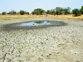
Dry pool in January 2008

A river bed during the dry season


Climate and vegetation

Dourtenga is subject to the influence of the tropical climate with a Sudanese Sahelian character, characterized by an alternation of rainy and dry seasons . The relatively short rainy season lasts from May to September, with an average of 51.5 rainy days with a rainfall of 868 mm per year. Since Dourtenga does not have a weather station itself, data from Ouargaye is used, where weather data has been recorded since 2000. Dourtenga is located in the phytogeographical zone of Sudan, part of the Sudanese Sambesian savannah belt. Characteristic is the typical vegetation of the dry savannah with dense grass growth (including pennon cleaner grass ) and isolated trees , including native species such as tamarind tree , African baobab, shea tree , seyal acacia , desert date and Diospyros mespiliformis . In Dourtenga there is practically no original dense vegetation, the reasons are anthropogenic and climatic influences. Mango , red eucalyptus and neem trees have been planted in the past .
environment

The severe storms in parts of West Africa in the summer of 2007 also caused damage to Dourtenga. Numerous trees were uprooted and tin roofs were blown away. The rains destroyed part of the harvest, completely destroyed the dam of a rain retention basin that had previously been damaged and brought many of the round huts built using traditional clay construction to collapse. In April 2008 there was another storm that caused considerable damage and injured people.
population

According to the preliminary results of the 2006 census, Dourtenga has 9,538 people. The population is distributed over 1587 households in twelve villages and consists, in addition to a few Mossi, mainly of closely related Yaama and Fulbe . 5042 women are compared to 4496 men, so for every 100 women there are 89 men. At the 1996 census, Dourtenga had 6,949 inhabitants and 53% of Dourtenga's residents were under 20 years of age. The population density is 84.6 inhabitants per km², the population growth for 1996 was estimated at 2.5%.
The rural exodus is not very pronounced among the young residents of Dourtenga . For those who leave the place, the capital Ouagadougou , Fada N'Gourma or the neighboring countries are the destination. Dourtenga is considered a transit point for child trafficking .
language
As in all of Burkina Faso , the official language is French , the language of the former colonial power.
The Yaama talk to the Yaana a dialect of Mòoré that the Niger-Congo languages scoring Gur language of the Mossi . Mòoré and Yaana show a high lexical similarity and the mutual intelligibility is 90%. The children grow up with both variants and mix them up in everyday life, with the youngest having the most problems understanding Mòoré. The variant of Yaana spoken in Dourtenga as well as in Comin-Yanga and Yondé differs from the Yaana spoken further south in Sanga and Soudougui . The language of the Fulbe is the Fulfulde , a Niger-Congo language that is largely related to the Mòoré.
religion
The traditional religion of the Yaama of Dourtenga is primarily defined by the making of offerings . In their conception there is a Great God called Naaba Wnde . According to their belief, this is so great that it is inaccessible to humans. Numerous deities belonging to the two groups of tangama and kinkirsi (singular: kinkirga ) therefore serve as mediators. The tangama are close to God because of their power and are partly assimilated with the ancestors of the people. Life, fertility, health and rain belong to the tangama , who often inhabit hills, rivers or rocks. The kinkirsi are spirits from whom the good can bring wealth and the bad can punish mistakes with diseases, for example. Every deity is regularly offered sacrifices, for example in the form of animals or the gift of zom-koom (millet flour water). The priesthood is not reserved for individual individuals or groups; every head of the family, for example, is also a priest. Their religion was of great importance for the Yaama in the past, was the basis of human life and prescribed the behavior of the individual.
Only with the colonization did Dourtenga come under the influence of foreign religions. The area of the Yaama belongs to the regions of Burkina Faso with the fewest followers of Islam . Catholic and Protestant missionary activity began with the colonization, today most of the residents of Dourtenga's are Catholics. However, many of the Christians in Dourtenga continue to seek prophecies and make offerings. There are no problems between the individual religious groups.
history

Dourtenga's origins
The origins of the founders of Dourtengas - as well as those of the Mossi empires and the Gurma empire Gulmu - are believed to be in Gambaga , a place in the north of present-day Ghana . It is from there that Princess Yennenga , founder of the Mossi dynasties, as well as Diaba Lompo , founder of the Gulmu Empire, and his brother Tarwêna are said to have moved north. The latter had two grandchildren, Pihiga and Segda (Segueda), who lived in Pihitenga , a village that is now part of Lalgaye. Pihiga, founder of the village and its head, was a violent ruler, which led his brother to leave Pihitengas. He founded a new village, Dourtenga, on the opposite side of a hill, of which he became the first chief (naaba) . He was able to secure his rule through a large number of descendants who founded new villages in the neighborhood. These events are presumed to have taken place in the second half of the 15th century, between 1465 and 1480, making Dourtenga older than the neighboring kingdoms of Lalgaye and Ouargaye , which are in the land of the Yaama, but were founded by Mossi and were part of their power structures. Dourtenga, on the other hand, was an independent chieftainship ( French chefferie ) until the French conquest at the end of the 19th century .
Traditional rule
The rule over the pre-colonial Dourtenga was exercised by a naaba ( French chef ), each a descendant of Segda, the village founder and the first Naaba. Political rule was thus linked to family origins. To be born into the ruling family was God's will. Political power, called naam , was accordingly a gift from God that could not be appropriated in any other way without angering the gods. This explains the absence of succession conflicts in Dourtenga; the succession was regulated by a rotation system of different dynastic segments of the individual villages. The Naabas system continues to exist to this day, even during colonial times and after independence, although they no longer have any official powers.
Segda's successor was Kulweogo, who founded the village of Niondin . The heads of the villages founded by the following descendants showed their connection to Dourtenga, among other things, by letting themselves be buried there. However, the Dourtengas area also included villages that were not founded by descendants of Segda, such as Kobré and Tangoko . Today's Dourtenga roughly covers the area of the pre-colonial chieftainship, with the village of Boussirabogo now part of Yondé. Dourtenga was rarely involved in external conflicts. This can be explained with a self-sufficiency and the fact that Dourtenga was surrounded by sister chieftains. An exception is the time of Naaba Guugu, who went down in oral history as bloodthirsty and aggressive.
Colonization by France
With the arrival of the French at the end of the 19th century, Dourtenga's autonomy ended. The ruling Naaba Yussablega at the time did not oppose the French who came from Lalgaye to the village. This was probably done in the awareness of the futility of such an undertaking in view of the French superiority, which had previously forced the Naaba of Tenkodogo to flee. Yussablega had never met the French before, but had heard of their brutality. Dourtenga was captured without any clashes, but for the French it was only a transit station to Ouargaye, which subsequently became the local administrative center. Like the rest of today's Burkina Faso, Dourtenga initially came under military administration and later became part of the newly founded colony of Upper Senegal and Niger and then the colony of Upper Volta, which was separated from this area . When this was divided up among the neighboring colonies in 1932, Dourtenga came to the colony of Niger until Upper Volta was restored in 1947 .
Dourtenga in the independent Upper Volta (since 1984 Burkina Faso)
After independence in 1960, Dourtenga initially belonged to the department of Ouargaye, from which the canton of Dourtenga was separated in 1982 and made an independent department. This belonged to the province of Boulgou until the establishment of Koulpélogos in 1996 . In 2004, as part of the nationwide decentralization, the establishment of a commune rurale ( French commune rurale "rural community") was decided. In 2006, local elections took place for the first time, in which Charles Salouka was elected first mayor.
There is a conflict between Dourtenga and Lalgaye over the villages of Tensobtenga and Pissiribouli , which belong to Lalgaye and which should originally have been subordinate to the boss of Dourtenga. The Naaba Dourtengas claims sovereignty over the two villages that are said to have been called Tensobtenbili and Guingodin in the past. In August 2007, armed clashes almost broke out during a reforestation project on unclear terrain. Only the security forces, who had been called in to reinforce them from Tenkodogo , were able to prevent the conflict parties, armed with rifles, from engaging in violence.
The traditional village chief has been Naaba Boulga since 1997.

| List of Naabas from Dourtenga | |||||||||||||||||||||||||||||||||||||||||||||||||||||||||
|---|---|---|---|---|---|---|---|---|---|---|---|---|---|---|---|---|---|---|---|---|---|---|---|---|---|---|---|---|---|---|---|---|---|---|---|---|---|---|---|---|---|---|---|---|---|---|---|---|---|---|---|---|---|---|---|---|---|
|
|
||||||||||||||||||||||||||||||||||||||||||||||||||||||||
Representation after Segda, who assumes an average reign of 20 years.
Politics and administration

Two administrative units exist in parallel in the same area; the Dourtenga department is administered by a prefect appointed by the state. Its task is to represent the state, to coordinate state administrative tasks and, among other things, to keep the population register. The prefect is also the chairman of the departmental court and in this function can speak law. In 2006 Noélie Zongo was appointed Prefect of Dourtenga; Christian Abo is the new prefect by decree of December 30, 2011.
As part of the political decentralization, a rural community ( French commune rurale ) was also established in 2006 , which is administered by a mayor and a municipal council, which are determined by the population in free elections. With a turnout of 47.96%, 1,791 of 4,022 eligible voters voted for the ruling CDP party and 28 for the ADF-RDA . 110 votes were invalid. This means that all 24 municipal council members - twelve women and twelve men - belonged to the CDP. Charles Salouka was elected the first mayor of the rural municipality of Dourtenga. The result of the 2012 elections was as follows: 2,487 of 3,044 eligible voters took part in the vote (turnout 81.7%); 1378 votes went to the CDP, which won 17 seats and 810 to the UPC , which won seven seats. ADF-RDA with 61 and PRDF with 51 votes could not win a seat.
After President Blaise Compaoré resigned after violent protests in October 2014, the interim administration dissolved all municipal councils in Burkina Faso, including that of Dourtenga.
Other parties active in Dourtenga are the social democratically oriented PDP / PS founded by Joseph Ki-Zerbo , the Sankarist UNIR / MS , CFD and PDS. Two seats in the Center-Est Regional Council are reserved for delegates from Dourtenga.
structure
The table below shows the population of the villages according to the 1996 census. In addition to the twelve village administratifs, there are individual hamlets such as Tilobré , Nienghin , Kobré or Zabdèla .
| Village | Residents |
|---|---|
| Dourtenga | 3276 |
| Sougoudin | 1039 |
| Katoulbéré | 831 |
| Kangretenga | 617 |
| Gogo | 578 |
| Tangoko | 505 |
| Niondin | 473 |
| Gorin | 406 |
| Zargoama | 319 |
| Yambili | 316 |
| Kanlé | 267 |
| Youmtenga | 66 |
Economy and Infrastructure
economy


The main occupation of the residents of Dourtenga is subsistence farming . Among other things, sorghum , millet , corn , rice , peanuts , soy and cotton are grown . Their production is insignificant and is only 30 tons. Even livestock is operated, including cattle, sheep, goats, pigs and poultry, the cattle is traditionally reserved for the Fulani. The gross value of the livestock is estimated at around 1.5 million euros, and there is a cattle market every three days. Handicrafts and trade have traditionally only played a subordinate role in Dourtenga's rural society.
The provisional budget of the municipality for 2006 was given as around 2300 euros.
Infrastructure

Dourtenga is located on national road 17 (route national 17) , which crosses the province from the east from Tenkodogo to the west towards the border with Togo . The road has not yet been paved, which is why it is often difficult to pass as a sandy road in the rainy season. Minibuses run on this route between Ouargaye and Tenkodogo. The main town of Dourtenga is connected to the surrounding villages by slopes. Mopeds, bicycles, and donkey-drawn carts are the predominant modes of transport.
Dourtenga is not yet connected to the SONABEL power grid . The main source of energy for the population is firewood. Dourtenga has 28 water points, either pumps or open wells, where the water is drawn up in buckets. The dam, built in French colonial times, is dilapidated, as are the small dikes used to irrigate the fields.

The ONATEL telephone line leading through the village to Ouargaye cannot be used. In some places, the Airtel Africa network can be received with mobile phones ; the transmitter is located in Ouargaye.
The RTB television program can be received in Dourtenga, but this is made more difficult due to the lack of electricity.
Six people work in the hospital ward, the power supply is ensured by a solar system , and drinking water is also fed into the ward rooms with the help of a solar pump. The station has had a donated ambulance since 2002.
In addition to the eleven primary schools (for the 2005/06 school year) in the individual villages, a secondary school has recently been built ( French collège ), which is to be expanded into a grammar school ( French lycée ). The number of boys and girls who attend school is roughly balanced.

Primary school in the main town of Dourtenga
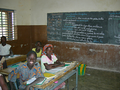
During class in a school

Building of collège under construction (2004)


Culture and society
Social strata of pre-colonial society
Since Dourtenga's founding, the founding families (Segueda or Segda and Sawadogo) as well as the Yarsé and Fulbe who moved to the area have formed the three social strata of the pre-colonial society of the place. The top layer was formed by the nakombse and the nabiisi ; the former were the descendants of the village founder, i.e. the members of the ruling family, the latter were the immediate family of the respective chief. Because of their origins alone, they held political authority and, because of their higher position , could expect respect and gifts from the rest of the population, called talse .
The yemse were located below these layers . These were the slaves who were either prisoners of war or criminals. Since there was seldom armed conflict, the number of slaves was also low. The slaves were seen as spoils of war, had to work as domestic slaves without rights and act as executioners. However, they were released very quickly. Dourtenga did not fall victim to the transregional slave trade and did not participate in it.
The Yarsé who moved there, mostly weavers, and the Yaama, who lived mainly as farmers, had their own quarters (saakse) , the Fulbe cattle herding lived a little further away, just as the few blacksmiths lived outside the villages. The smallest units of society were the families. Their head was always a man who had sole decision-making power - including over his already married sons - while the women were treated as material goods. Her role was limited to giving birth and raising children who served her husband's reputation. Weddings were initiated either through advertising with the help of dowry gifts or a system called lete in which a sister was exchanged for a woman from another family.
Festivals and crafts
One of the traditional festivals is the harvest festival karemtaaka , which was probably introduced under Naaba Abga. On this occasion, dolo (beer) was offered to the ancestors . Another important festival is ziitango , a festival of sacrifices that was celebrated in Kobré two days before karemtaaka . At both festivals the gods were thanked for their support with the harvest. The Islamic festivals were of little importance to the Yaama, the tabaski festival of sacrifice was rededicated as a festival in honor of the dead. In all Yaama celebrations, the focus is on the performance of sacrifices with which ancestors and invisible higher beings are asked for protection. Because of their connection to the existential importance of the harvest, they were a “psychological motor for production”. They also provided opportunities for dance ( ressembaonlgo for women and kiegba for men) and singing.

The handicrafts were only of secondary importance next to agriculture and were mainly practiced during the dry season. The weaving is exerted since the founding days Dourtengas predominantly by men of Yarsé, while women in the spinning helped. The weavers were mostly also tailors and sold the clothes they made on the market. There is also shoemaking and the weaving of baskets or hats. The blacksmithing and pottery trade is carried out by certain families who passed it on to subsequent generations. The work of the blacksmith has always been of great importance to the peasant population, as it was able to provide them with the tools they needed for agriculture and hunting. Nevertheless they lived - also spatially - apart from society, also because of the risks associated with their work.
Architecture and landmarks

Traditional round buildings made of adobe bricks with thatched roofs, which are arranged in a circle and connected by walls, are predominant . A few buildings have a rectangular floor plan and are covered with tin roofs. Since no parcelling has yet been carried out, new structures are created in a disordered manner. The sacred hill and the graves of the former Naabas are considered sights for the Ministry of Tourism. These are located in the courtyard of today's Naaba.
Partnership with Brühl and development cooperation
Since 1997, Dourtenga has had a partnership with the municipality of Brühl in Baden-Württemberg within the framework of municipal development cooperation . On the German side, the Förderkreis Dourtenga (formerly Förderkreis Third World ), on the Burkinabe side, the local partnership committee ( French comité de jumelage ) is responsible. Education, water supply and health are focal points of the partnership, friendship and understanding between the residents is the goal. A village de Brühl was built in the traditional circular construction and serves as accommodation for the guests from Brühl and as a meeting place for the youth.
The Danish aid organization BØRNEfonden , which has a base in Dourtenga and has been active there since 1996, built a sports field that can be used for football, handball and volleyball and is maintained by the youth of Dourtenga. BØRNEfonden also supports schools and kindergartens and is active in vocational training. Other organizations are active in various areas such as well construction, vocational training, afforestation and assistance for the disabled in the area. There are also 35 village self-help groups and the Association Zitongo pour le Développement de Dourtenga (AZDD).
Sons and daughters of the place
- Gérard Segda , President of Koudougou University and former member of the national parliament
literature
- Daogo Félix Segda: L'Histoire précoloniale de la chefferie de Dourtenga , Ouagadougou 1989
Web links
- Monograph by Dourtenga (French; PDF; 1.16 MB)
- Website of the Dourtenga – Brühl partnership association
Individual evidence
- ↑ Results of the 2006 census ( Memento from December 15, 2018 in the Internet Archive ) (PDF; 92 kB).
- ↑ a b www.inforoute-communale.gov.bf ( Memento from October 11, 2008 in the Internet Archive ). Retrieved April 3, 2015.
- ↑ a b www.legiburkina.bf . Retrieved April 3, 2015.
- ↑ a b c d e f g h i j k l m n o monograph by Dourtenga ( memento from April 2, 2015 in the Internet Archive ). Retrieved April 3, 2015.
- ↑ Reconstruction after devastation . In: Schwetzinger Zeitung , March 8, 2008. Accessed April 3, 2015.
- ^ Website of the Third World Sponsorship Association in Brühl
- ↑ Preliminary results of the 2006 census (PDF; 3.3 MB) ( Memento of the original from July 21, 2015 in the Internet Archive ) Info: The archive link was inserted automatically and has not yet been checked. Please check the original and archive link according to the instructions and then remove this notice. . Retrieved April 3, 2015
- ^ John Berthelette, Carol Berthelette: Sociolinguistic Survey Report for the Yaana Dialect of Mooré (PDF; 2.7 MB). SIL International 2001. Retrieved April 3, 2015.
- ↑ Segda 1989, pp. 45-48
- ↑ Ladji Bama: Conflit foncier au Koulpélogo . In: Le Pays , September 4, 2007. Retrieved October 22, 2009.
- ↑ Segda 1989, p. 87
- ↑ www.legiburkina.bf . Retrieved April 3, 2015.
- ↑ Page no longer available , search in web archives: Results of the local elections 2006
- ^ Website of the Third World Sponsorship Association in Brühl ( Memento from July 4, 2008 in the Internet Archive )
- ↑ Results of the 2012 local elections . Retrieved April 3, 2015.
- ↑ Burkina: Zida Dissout conseils et municipaux régionaux . aOuaga.com , November 19, 2014. Retrieved April 3, 2015.
- ↑ Segda 1989, p. 35
- ↑ Segda 1989, p. 41
- ↑ Segda 1989, p. 55
- ↑ List of sights in Burkina Faso . Retrieved April 3, 2015.
Comin-Yanga | Dourtenga | Lalgaye | Ouargaye | Sanga | Soudougui | Yargatenga | Yondé