Landeyjahöfn
| Landeyjahöfn | |||
|---|---|---|---|
| Data | |||
| UN / LOCODE | IS LAN | ||
| opening | July 21, 2010 | ||
| Port type | seaport | ||
| Geographic information | |||
| place | Rangárþing eystra | ||
| region | Southurland | ||
| Country | Iceland | ||
| Landeyjahöfn harbor building | |||
| Coordinates | 63 ° 31 '49 " N , 20 ° 7' 7" W | ||
|
|||
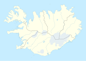
The Landeyjahöfn [ ˈlanteiˑjaˌhœpn̥ ] is a port on the south coast of Iceland . It is located in the municipality of Rangárþing eystra , west of the mouth of the Markarfljóts .
history
The port was opened on July 21, 2010 and replaced the port of Þorlákshöfn on the ferry connection between Herjólfur and Heimaey on the Westman Islands . The road distance between Reykjavík and the new port is now 134 kilometers, compared to 51 kilometers to Þorlákshöfn. But the significantly shorter sea voyage shortens the entire journey time considerably.
The port is threatened by silting, especially after the eruption of Eyjafjallajökull in 2010.
Web links
Commons : Landeyjahöfn - collection of images, videos and audio files
Individual evidence
- ↑ (IS) ICELAND. In: service.unece.org. Retrieved May 9, 2019 .


