Landmannaleið
| Highland road F225 Iceland |
||||||||||||||||||||||||||||||||||
| Landmannaleið | ||||||||||||||||||||||||||||||||||

|
||||||||||||||||||||||||||||||||||
| map | ||||||||||||||||||||||||||||||||||
| Basic data | ||||||||||||||||||||||||||||||||||
| Operator: | Vegagerðin | |||||||||||||||||||||||||||||||||
| Start of the street: |
Landvegur ( 64 ° 6 ′ N , 19 ° 45 ′ W ) |
|||||||||||||||||||||||||||||||||
| End of street: |
Fjallabaksleið nyrðri ( 64 ° 2 ′ N , 19 ° 2 ′ W ) |
|||||||||||||||||||||||||||||||||
| Overall length: | 50.50 km | |||||||||||||||||||||||||||||||||
| Development condition: | not paved | |||||||||||||||||||||||||||||||||
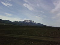
| The Hekla seen from the Landmannaleið | ||||||||||||||||||||||||||||||||||
|
Course of the road
|
||||||||||||||||||||||||||||||||||
The Landmannaleið ![]() is a highland road in the south of Iceland .
is a highland road in the south of Iceland .
It is also called Dómadalsleið . The Landmannaleið branches off to the west from Landvegur ![]() and runs north of the Hekla . After 51 km of the ski trail reaches north of Frostastaðavatn the Fjallabaksleið nyrðri
and runs north of the Hekla . After 51 km of the ski trail reaches north of Frostastaðavatn the Fjallabaksleið nyrðri ![]() that used Landmannaleið was called. An alternative route that leads via Landmannahellir is no longer listed in the street directory. As a highland road , this is classified as impassable (Ófært) after the summer. In spring, when the snow melts, it is forbidden to drive here and will not be released again for all-drag vehicles until next summer. Landmannaleið has been reopened between June 18 and July 3 in recent years.
that used Landmannaleið was called. An alternative route that leads via Landmannahellir is no longer listed in the street directory. As a highland road , this is classified as impassable (Ófært) after the summer. In spring, when the snow melts, it is forbidden to drive here and will not be released again for all-drag vehicles until next summer. Landmannaleið has been reopened between June 18 and July 3 in recent years.
See also
Individual evidence
- ↑ Vegaskrá 2018 - kaflaskipt. Retrieved July 29, 2019 (Icelandic).
- ↑ Bundið slitlag á þjóðvegum 2019. Retrieved July 23, 2020 (Icelandic).
- ↑ DÓMADALSLEIÐ. Retrieved November 5, 2018 (Icelandic).
- ↑ Opnun_fjallvega_is_2018. Retrieved November 5, 2018 (Icelandic).


