Langøya
| Langøya | |
|---|---|
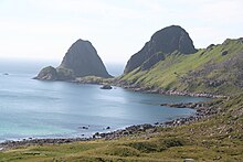
| Utskor on Malnesfjorden in the west | |
| Waters | European Arctic Ocean |
| Archipelago | Vesterålen |
| Geographical location | 68 ° 48 ' N , 15 ° 7' E |
| length | 45 km |
| width | 42 km |
| surface | 850.2 km² |
| Highest elevation | Snykolla 763 moh. |
| Residents | 12,288 14 inhabitants / km² |
| main place | Sortland |
Langøya in Vesterålen is Norway's third largest island. It completely encloses the municipality of Bø and parts of the municipalities of Øksnes , Sortland and Hadsel in Fylke Nordland . The island is divided into three broad and large-area members, which is why it is also known in Norway as the island of the Eide (isthmus, land bridge , Latin isthmus ).
geography
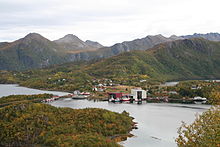
The western "nose" with the municipality of Bø is separated from the southern one with Sortland by the Eidsfjorden , while the municipality of Øksnes is located in the northern part. Many landmarks here have an “eid” in their name, including Vikseidet and Frøskelandseidet . Langøya offers a variety of landscapes. Mountain formations rising directly from the sea alternate with fjords , skerries and lonely mountain valleys. There are a few sandy beaches that convey the flair of the south. The inland is characterized by an arctic tundra landscape with raised bogs, which discharge the water in several rivers and lakes towards the coast.
From a geological perspective, the island reflects the entire spectrum of geological history. In the west near Bø the more than 600 million year old primary rock, so-called deep rock, emerges in many places . This underground was created by volcanic activity 2.5 billion years ago. This “tipping effect” causes the rock to rejuvenate into the east of the island. The oldest rock that has ever been discovered in the world has been found in Bø.
The roads Fv 82 and Rv 85 connect Langøya with the neighboring island of Hinnøya in the east . In the extreme south of the island is Stokmarknes Airport, Skagen . The Lofoten can be reached via Hadseløya and a ferry connection across the Hadselfjorden . A little more than half of the island's population live in this area, mainly around the Sortland transport hub . The area around Sortland is the only one on the island where agriculture is practiced on a large scale. However, the main employer is still the fishing industry, whereby tourism is steadily gaining ground with better transport connections. The leisure industry offers a wide range of activities, from fishing, boating and hiking to whale watching .


