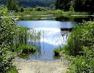
Lansermoor
| Lanser Moor (water lily pond) | ||
|---|---|---|

|
||
| North side of the lake | ||
| Geographical location | above the Lanser See | |
| Drain | without natural surface drainage, to Lanser See → Viller Bach → Sill → Inn | |
| Location close to the shore | Lans | |
| Data | ||
| Coordinates | 47 ° 14 '35 " N , 11 ° 25' 9" E | |
|
|
||
| Altitude above sea level | 854 m above sea level A. | |
| surface | 0.4 ha | |
| volume | 24,000 m³ | |
| Maximum depth | 3 m | |
|
particularities |
||
The Lanser Moor , also known as the Seerosenweiher , is located north of the Lanser See at 854 m above sea level. A. am Paschberg in the municipality of Lans in Tyrol . With an area of around 4,000 m², the lake is much smaller than the Lanser See and 3 m deep. The lake was declared a natural monument in 1950 .
The lake is under nature protection. In order to preserve its natural beauty, bathing in the lake has been banned by the city of Innsbruck , which has the right to use the water. The moor has banks with tall reeds. The water quality varies between I and II. Smaller carp species live in the lake . Numerous ducks use the lake as a habitat.

