Leeton (New South Wales)
| Leeton | |||||||
|---|---|---|---|---|---|---|---|
 Pine Avenue, Main Street |
|||||||
|
|||||||
|
|||||||
|
|||||||
|
|||||||
|
|||||||
|
|
|||||||
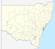
Leeton (6,733 inhabitants) is a city in the Riverina , in the state of New South Wales in Australia , 580 kilometers west of Sydney and 450 kilometers north of Melbourne . The city is the administrative seat of the Leeton Shire .
Leeton is located in the center of the Murrumbidgee -Bewässerungsgebiets (Murrumbidgee Irrigation Area, MIA), one of the agriculturally most productive areas of Australia, are grown in especially citrus fruits, apricots, wine, rice and wheat.
The city is the seat of SunRice , the largest rice trading company in Australia.
Leeton's plan, with streets arranged in concentric circles, was designed by the American architect Walter Burley Griffin , as were the capital Canberra and the neighboring city of Griffith . In 1912 the first public buildings (water tower, post office) were erected for the settlement initially consisting of tents. The official establishment took place in 1913 with the start of the sale of building plots.
Photo gallery
sons and daughters of the town
- John Faulkner (* 1954), politician
- Matthew Dunn (* 1973), swimmer
- Mala Ghedia (* 1976), actress and voice actress
Web links
- Leeton Shire Council - Community website
- Leeton Visitors Information Center
Individual evidence
- ^ Australian Bureau of Statistics : Leeton ( English ) In: 2016 Census QuickStats . June 27, 2017. Retrieved January 26, 2020.


