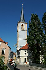
Lehmann Bridge
The Lehmannsbrücke is a bridge in the Thuringian city of Erfurt . It was first mentioned in the year 1108 as Liepwinesbrucca and is the oldest bridge in the city in the order of the documentary mentions. The name should refer to Lebuin von Deventer . In the course of Augustinerstraße it leads about halfway between Michaelisstraße and Augustinerkloster over the Breitstrom . According to an Erfurt legend, it was built by a shepherd named Lehmann.
The legend of the shepherd Lehmann
According to an Erfurt legend, a shepherd named Lehmann is said to have been grazing his sheep at the ford below the Schildchenmühle when one of his lambs scooped up a gold pot near a rose bush. Due to the unexpected wealth, he decided to move to the city, but shepherds were not allowed. Schäfer Lehmann thereupon offered the city to build a stone bridge on the spot, if the city fathers in return would allow him as much land north of the ford as he could throw a lump of clay. After the Erfurt councilors agreed, Schäfer Lehmann threw the lump with the help of his Schäferschippe and erected the Lehmann Bridge as promised.
history
The first documentary mention of the Lehmann Bridge took place in 1108 when Archbishop Ruthard transferred a courtyard at the northern end of the bridge to the abbot of Reinhardsbrunn Monastery . From the 13th century, a branch of the Via Regia in the direction of Merseburg led over the bridge. It thus belonged to the medieval trading center of Erfurt, which was located between the Lehmannsbrücke, the Krämerbrücke and the All Saints Church and which also included the Erfurt Jewish quarter. Immediately on the bridge was the so-called Judenzoll , a building in which the Erfurt Jews had to pay their taxes to the emperor every Christmas. At the southern end of the bridge is the Georgenburse , where the young Martin Luther lived as a student from 1501 until he entered the Augustinian monastery in 1505. At the northern end of the bridge, the Nikolaikirche was the bridgehead church until 1747 , of which only the steeple is preserved today.
Originally built as a wooden bridge, it was built as a stone bridge in 1342 after repeated destruction by floods. It was a 28 meter long, 7.5 meter wide arch bridge made of limestone masonry. It had four vaults with clear widths of 5.4 meters to 5.8 meters. In 1884, the parapets were replaced by iron railings to widen the roadway. Due to the inadequate stability of the structure, a replacement new building with prestressed concrete beams was carried out in 1977 .
The bridge is now closed to through traffic, but will be opened to residents during construction work and inner-city events such as the Krämerbrückenfest . Retractable bollards enable emergency vehicles and city tours to pass through.
literature
- Stephanie Wolf: Erfurt in the 13th century: urban society between the Archbishop of Mainz, the nobility and the empire . Böhlau Verlag , 2005, ISBN 978-3-412-12405-2 , pp. 16-18 .
Web links
- The builder of the Lehmannsbrücke , reading series, accessed on May 13, 2011.
Individual evidence
- ↑ Erfurt Short Chronicle ( Memento of the original from May 27, 2011 in the Internet Archive ) Info: The archive link was inserted automatically and has not yet been checked. Please check the original and archive link according to the instructions and then remove this notice. on the website of the city of Erfurt, accessed on May 14, 2011.
- ^ Wolf: Erfurt in the 13th century , p. 8.
- ^ Adolph Jaraczewsky: The history of the Jews in Erfurt . C. Villaret, Erfurt 1868, p. 8 .
- ↑ Die Georgenburse ( Memento of the original from May 5, 2011 in the Internet Archive ) Info: The archive link was inserted automatically and has not yet been checked. Please check the original and archive link according to the instructions and then remove this notice. on the website of the Augustinian monastery , accessed on May 13, 2011.
- ↑ Hans-Jörg Vockrodt, Dietrich Baumbach: Bridges and footbridges in old Erfurt. State capital Erfurt, city administration, 2004, pp. 39–40
Coordinates: 50 ° 58 ′ 50.5 ″ N , 11 ° 1 ′ 40.6 ″ E

