Linden main head
| Linden main head | ||
|---|---|---|
|
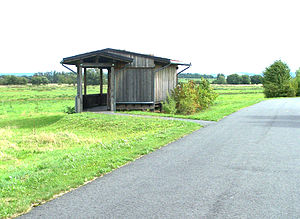
(NSG Dankmarshäuser Rhäden) Observation point on the main head of the linden tree. |
||
| height | 225.5 m above sea level HN | |
| location | Thuringia ( Germany ) | |
| Mountains | Seulingswald | |
| Coordinates | 50 ° 56 '19 " N , 10 ° 1' 15" E | |
|
|
||
| rock | Red sandstone | |
| particularities | Nature reserve, archaeological site | |
The main head of the linden tree is a 225.5 m high elevation and is located in the corridor of Dankmarshausen in the Wartburg district in Thuringia . In terms of nature, the Lindenhauptskopf is part of the Werra Valley and the Seulingswald . The northern part is used for agriculture.
The Lindenhauptskopf was settled early on. The flat summit plateau had an ideal topographical location for people living as fishermen and hunters. These are mainly living and rubbish pits of isolated Neolithic, but above all Iron Age settlements. Up until two centuries ago, to the north was the shallow Seulingsee , which is still a resting place for migratory birds today; to the south, the wide floodplain of the Werra extends. The hill only protrudes about 10 meters above the valley floor, but was protected from flooding. The area, which was inaccessible in the GDR period due to its border location, developed into a retreat for threatened animal species. After the fall of the Wall, the nature reserve that had already been created on the Hessian side was considerably expanded by the designation of the Dankmarshäuser Rhäden nature reserve . Along the circular hiking trail, visitors will find several observation towers and an information pavilion on the main head of the linden tree with display boards on the nature reserve and the early settlement history.
Web links
Individual evidence
- ↑ Official topographic maps of Thuringia 1: 10,000. Wartburgkreis, district of Gotha, district-free city of Eisenach . In: Thuringian Land Survey Office (Hrsg.): CD-ROM series Top10 . CD 2. Erfurt 1999.
- ↑ City of Heringen (ed.): Hiking guide long-distance hiking in the land of the white mountains . Heringen (Werra) 2000, circular hiking trail 5 (Dankmarshausen), p. 75-82 .

