List of architectural monuments in Lügde
The list of architectural monuments in Lügde contains the listed buildings in the area of the city of Lügde in the district of Lippe in North Rhine-Westphalia (as of February 2019). These architectural monuments are entered in the list of monuments of the city of Lügde; The basis for the admission is the Monument Protection Act North Rhine-Westphalia (DSchG NRW).
| image | designation | location | description | construction time | Registered since |
Monument number |
|---|---|---|---|---|---|---|
|
Building (monument protection restricted) |
Niese Am Buchenberge 2 map |
07/15/1993 | 1
|
|||
|
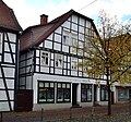
building | Lügde Am Markt 2 card |
10/27/1987 | 2
|
||

|
building | Lügde Am Markt 4 card |
09/23/1981 | 3
|
||
 more pictures |
Warrior Memorial | Rischenau Am Friedhof map |
10/17/2005 | 4th
|
||
| Ratsiek watermill | Sabbenhausen Am Teiche 4 card |
10/12/1988 | 5
|
|||
| building | Elbrinxen on the Rothe 1 map |
09/05/1996 | 6th
|
|||
| building | Elbrinxen on the Rothe 3b map |
04/29/1993 | 7th
|
|||

|
Former post office | Lügde Bahnhofstr. 4 card |
03/10/1992 | 8th
|
||

|
Incl. sep. stable building | Lügde Bahnhofstr. 9 card |
03/23/2011 | 9
|
||
 more pictures |
Former Station building | Lügde Bahnhofstr. 12 card |
December 8, 1992 | 10
|
||

|
building | Lügde Brückenstr. 6 card |
03/09/1989 | 11
|
||

|
Building (monument protection restricted) |
Lügde Brückenstr. 10 card |
03/24/2003 | 12
|
||
 more pictures |
Former fire brigade tool shed / Dechenheim | Lügde Brückenstr. 11 card |
01/31/1996 | 13
|
||
| building | Rischenau Dunger Tor 4 map |
01/27/1994 | 14th
|
|||
| building | Sabbenhausen Eulenwinkel 3 map |
03/29/1996 | 15th
|
|||
 more pictures |
Ev.-ref. Church / remter building | Falkenhagen Falkenhagen 24 card |
1497 | 08/01/1984 | 16
|
|
 more pictures |
Rectory ev. Ref. KG | Falkenhagen Falkenhagen 24 card |
1509 | 08/01/1984 | 17th
|
|
 more pictures |
Monastery / Chapter House | Falkenhagen Falkenhagen 24 card |
08/01/1984 | 18th
|
||
 more pictures |
Kötterhaus | Falkenhagen Falkenhagen 24 card |
08/29/1985 | 19th
|
||
 more pictures |
Stone walls | Falkenhagen Falkenhagen 24 card |
05/06/1991 | 20th
|
||
 more pictures |
Catholic rectory | Falkenhagen Falkenhagen 37 map |
09/23/1981 | 21st
|
||
 more pictures |
Catholic Church of St. Michael | Falkenhagen Falkenhagen 37 map |
08/01/1984 | 22nd
|
||

|
building | Rischenau Hauptstr. 10 card |
1848 | 09/05/1996 | 23
|
|

|
building | Lügde Hintere Str. 2 card |
07/21/1987 | 24
|
||

|
building | Lügde Hintere Str. 10 card |
05.12.1984 | 25th
|
||

|
building | Lügde Hintere Str. 12 map |
05.12.1984 | 26th
|
||

|
building | Lügde Hintere Str. 14 map |
05.12.1984 | 27
|
||

|
building | Lügde Hintere Str. 21 map |
08/05/1984 | 28
|
||

|
building | Lügde Hintere Str. 24 card |
05.12.1984 | 29
|
||

|
building | Lügde Hintere Str. 26 map |
05.12.1984 | 30th
|
||

|
Building (monument protection restricted) |
Lügde Hintere Str. 36 map |
08/29/1985 | 31
|
||

|
building | Lügde Hintere Str. 38 map |
08/05/1987 /
08/30/1988 |
32
|
||

|
building | Lügde Hintere Str. 46 map |
01/02/1984 | 33
|
||

|
building | Lügde Hintere Str. 52 map |
08/31/1993 | 34
|
||

|
building | Lügde Hintere Str. 54 map |
05.12.1984 | 35
|
||

|
Quarry stone wall | Lügde Hintere Str. 56–58 map |
12/14/1983 | 36
|
||
 more pictures |
Half-timbered house | Lügde Hintere Str. 56 map |
05.12.1984 | 37
|
||

|
Building (monument protection restricted) |
Lügde Hintere Str. 84 map |
05.12.1984 | 38
|
||
 more pictures |
Local museum | Lügde Hintere Str. 86 card |
January 17, 1983 | 39
|
||

|
"Pizzeria" restaurant | Lügde Hintere Str. 88 map |
08/05/1987 | 40
|
||

|
Hist. Landmarks d. County / Principality of LIP | Lie |
06/21/2013 | 41
|
||

|
Wall around the Kilian's Church | Lügde Höxterstr. 9 card |
09/30/1981 | 42
|
||
 more pictures |
Kilian's Church | Lügde Höxterstr. 9 card |
09/30/1981 | 43
|
||
 more pictures |
building | Lügde Kanalstr. 1 u. 3 card |
1798 | 02/05/1988 | 44
|
|

|
building | Lügde Kanalstr. 6 card |
08/20/1990 | 45
|
||
 more pictures |
building | Lügde Kanalstr. 7 card |
08/18/1986 | 46
|
||

|
Building (monument protection restricted) |
Lügde Kanalstr. 10 card |
06/17/1997 | 47
|
||

|
building | Lügde Kanalstr. 12 card |
08/20/1990 | 48
|
||

|
Building (monument protection restricted) |
Lügde Kanalstr. 17 card |
December 15, 2009 | 49
|
||

|
building | Lügde Kanalstr. 23 card |
05.12.1984 | 50
|
||

|
Jewish cemetery, Grabz. | Rischenau Klostertor map |
December 23, 1993 | 51
|
||
| building | Niese Köterbergstrasse. 3 card |
06/22/1988 | 52
|
|||
| building | Niese Köterbergstrasse. 19 card |
07/16/1993 | 53
|
|||
| building | Sabbenhausen Kuhlenweg 3 map |
11/08/1996 | 54
|
|||

|
building | Sabbenhausen Lange Str. 18 map |
10/03/1986 | 55
|
||

|
building | Lügde Mittlere Str. 1 card |
11/12/1987 | 56
|
||

|
Former Franciscan monastery church | Lügde Mittlere Str. 2 card |
05.12.1984 | 57
|
||
 more pictures |
Former Franciscan monastery | Lügde Mittlere Str. 2 card |
05.12.1984 | 58
|
||

|
building | Lügde Mittlere St. 3 card |
05.12.1984 | 59
|
||

|
Building (monument protection restricted) |
Lügde Mittlere St. 6 card |
10/12/2005 | 60
|
||

|
Building (monument protection restricted) |
Lügde Mittlere St. 8 card |
04/20/2006 | 61
|
||

|
Building (monument protection restricted) |
Lügde Mittlere St. 10 card |
09/09/2002 | 62
|
||

|
building | Lügde Mittlere St. 12 card |
08/05/1987 | 63
|
||

|
building | Lügde Mittlere St. 14 card |
May 16, 2000 | 64
|
||

|
building | Lügde Mittlere St. 16 card |
08/31/1983 | 65
|
||

|
building | Lügde Mittlere Str. 18 card |
07/16/1984 | 66
|
||
 more pictures |
Catholic rectory | Lügde Mittlere Str. 22 card |
04/13/1984 | 67
|
||
 more pictures |
Catholic parish church St. Marien | Lügde Mittlere Str. 23 card |
05.12.1984 | 68
|
||

|
Building (monument protection restricted) |
Lügde Mittlere St. 24 card |
09/04/1997 | 69
|
||

|
Building (monument protection restricted) |
Lügde Mittlere St. 25 card |
02/03/1989 | 70
|
||

|
Building (monument protection restricted) |
Lügde Mittlere St. 26 card |
07/26/1995 | 71
|
||

|
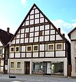
Gasthof "Zum Adler" | Lügde Mittlere Str. 28 card |
06/27/1988 | 72
|
||
|
building | Lügde Mittlere St. 30 card |
09/05/1990 | 73
|
||

|
building | Lügde Mittlere St. 35 card |
08/05/1987 | 74
|
||
 more pictures |
Building (monument protection restricted) |
Lügde Mittlere St. 40 card |
1851 | 08/31/1988 | 75
|
|
| Lügde Mittlere Str. 48 |
06/19/2015 | 76
|
||||

|
building | Lügde Mittlere St. 53 card |
08/15/1989 | 77
|
||

|
building | Lügde Mittlere Str. 62 card |
October 16, 1990 | 78
|
||
|
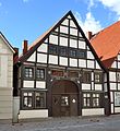
building | Lügde Mittlere St. 64 card |
November 15, 1985 | 79
|
||

|
Building (monument protection restricted) |
Lügde Mittlere Str. 72 card |
04/09/1992 | 80
|
||

|
building | Lügde Mittlere Str. 74 card |
04/09/1992 | 81
|
||
 more pictures |
Krachthof (bakery) | Hummersen Mühlenberg 1 map |
03/27/1987 | 82
|
||
 more pictures |
Krachthof (holiday home) | Hummersen Mühlenberg 1 map |
03/27/1987 | 83
|
||
 more pictures |
Krachthof (main building) | Hummersen Mühlenberg 1 map |
08/30/1988 | 84
|
||

|
building | Lügde Mühlenstr. 3 card |
08/05/1987 | 85
|
||
| Elbrinxen Obere Dorfstr. 7th |
06/19/2015 | 86
|
||||
|
Building (monument protection restricted) |
Elbrinxen Obere Dorfstr. 9 card |
05/23/1996 | 87
|
|||
| Former school-building | Hummersen Parkstrasse 1 map |
09/06/2005 | 88
|
|||

|
Jewish cemetery Elbrinxen / Grabz. | Elbrinxen Postweg card |
1848 | December 21, 1993 | 89
|
|
 more pictures |
Evangelical Church Elbrinxen | Elbrinxen Postweg 11 card |
second half of the 12th century | 08/01/1984 | 90
|
|
|
Building (monument protection restricted) |
Rischenau Schmiedeberg 8 map |
09/13/1999 | 91
|
|||
 more pictures |
building | Lügde Schulstr. 3 card |
07.03.1988 | 92
|
||
 more pictures |
Ev. Church “St. Johannis " | Lügde Seilerstr. 6 card |
05.12.1984 | 93
|
||
 more pictures |
City wall including 2 defense towers with ramparts and moats | Lügde city wall map |
09/23/1981 / 03/22/1985 | 94
|
||
|
Building (monument protection restricted) |
Elbrinxen Steinweg 8 map |
12/08/2005 | 95
|
|||
|
Building (monument protection restricted) |
Hummersen Tönsweg 3 map |
02/13/1996 | 96
|
|||

|
Watermill | Rischenau Triftweg 22 map |
05/20/1994 | 97
|
||
|
Building (monument protection restricted) |
Hummersen Vogelsang 2 card |
09/15/1998 | 98
|
|||

|
Part of the city wall | Lügde Vordere Str. 1 card |
05.12.1984 | 99
|
||
 more pictures |
Building (monument protection restricted) |
Lügde Vordere Str. 2 card |
03/07/1988 / 03/17/2004 | 100
|
||

|
building | Lügde Vordere Str. 5 card |
06/29/1988 | 101
|
||

|
building | Lügde Vordere Str. 8 card |
08/29/1985 | 102
|
||

|
Building (monument protection restricted) |
Lügde Vordere Str. 10 card |
11/17/1997 | 103
|
||

|
building | Lügde Vordere Str. 13 map |
07.03.1988 | 104
|
||

|
Building (monument protection restricted) |
Lügde Vordere Str. 14 map |
06/29/1995 | 105
|
||
 more pictures |
building | Lügde Vordere Str. 18 map |
1799 | 05.12.1984 | 106
|
|
 more pictures |
Building (monument protection restricted) |
Lügde Vordere Str. 26 map |
1798 | 07/04/1997 | 107
|
|

|
building | Lügde Vordere Str. 28 map |
06/07/1989 | 108
|
||
| Lügde Vordere Str. 29 |
02/26/2019 | 109
|
||||
|
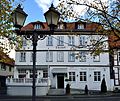
building | Lügde Vordere Str. 35 map |
09/02/1987 | 110
|
||

|
building | Lügde Vordere Str. 37 map |
07/16/1984 | 111
|
||

|
building | Lügde Vordere Str. 39 map |
07/20/1992 | 112
|
||
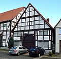
|
building | Lügde Vordere Str. 41 map |
04/08/1992 | 113
|
||

|
building | Lügde Vordere Str. 46 map |
09/20/1988 | 114
|
||

|
building | Lügde Vordere Str. 50 card |
12/22/1987 | 115
|
||

|
building | Lügde Vordere Str. 51 map |
1798 | 08/13/1986 | 116
|
|

|
Building (monument protection restricted) |
Lügde Vordere Str. 52 map |
05.12.1984 / 01.03.1985 | 117
|
||
 more pictures |
Former Post office building | Lügde Vordere Str. 53 map |
1801? | 08/31/1983 | 118
|
|

|
building | Lügde Vordere Str. 58 map |
08/29/1985 | 119
|
||

|
building | Lügde Vordere Str. 67 map |
04/18/1988 | 120
|
||

|
Building (monument protection restricted) |
Lügde Vordere Str. 83 map |
02/17/1995 | 121
|
||

|
building | Lügde Vordere Str. 85 map |
01/19/1989 | 122
|
||
 more pictures |
Lügde Jewish cemetery | Lügde Waldstr. / At the Rote Kuhle map |
04/14/1994 | 123
|
||
| building | Rischenau Wallgraben 4 map |
09/26/1989 | 124
|
|||
| Hünkergrund | Wörderfeld Wörderfeld 17 map |
09/21/1993 | 125
|
|||
| building | Wörderfeld Wörderfeld 21 card |
04/15/1994 | 126
|
|||
| Former School (monument protection restricted) |
Wörderfeld Wörderfeld 46 map |
04/28/1997 | 127
|
|||
| Former Tithe barn | Wörderfeld Wörderfeld 64 card |
07.03.1990 | 128 |
Objects removed from / deleted from the list of monuments:
| image | designation | location | description | construction time | Registered since |
Monument number |
|---|---|---|---|---|---|---|
| Elbrinxen Bergweg 10 map |
03/21/11 |
|
||||
| Rischenau Biesterfeld 8 card |
05/18/94 |
|
||||
| Lügde Brückenstr. 16 card |
08/31/89 |
|
||||
| Lügde Hintere Str. 70 card |
03/17/08 |
|
||||
| Elbrinxen Im Winkel 1 card |
08/16/96 |
|
||||
| Lügde Mittlere Str. 56 card |
05/21/08 |
|
||||
| Lügde Mittlere Str. 57 card |
12/15/09 |
|
||||
| Lügde Mittlere Str. 63 card |
05.09.02 |
|
||||
| Lügde Mittlere Str. 66 card |
02/06/92 |
|
||||
| Lügde Vordere Str. 6 card |
06/29/88 |
|
||||
| Lügde Vordere Str. 9 card |
02/26/93 |
|
||||
| Niese Zehntweg 6 card |
07/26/96 |
Web links
Commons : Architectural monuments in Lügde - Collection of images

