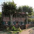
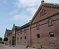
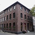
List of architectural monuments in Tönisvorst
The list of architectural monuments in Tönisvorst contains the listed buildings in the area of the city of Tönisvorst in the Viersen district in North Rhine-Westphalia (as of September 2011). These monuments are entered in the list of monuments of the city of Tönisvorst; The basis for the admission is the Monument Protection Act North Rhine-Westphalia (DSchG NRW).
| image | designation | location | description | construction time | Registered since |
Monument number |
|---|---|---|---|---|---|---|

|
Water tower | St. Tönis Am Wasserturm 54 map |
8-storey polygonal brick building with crowning cornice and two lower attic storeys / 1920. | 1920 | Jan. 11, 1984 | 16
|

|
Path chapel and linden tree | Vorst Anrather Straße next to house number 45 map |
Brick building on a square floor plan with large pilaster strips, hollow figure of the Madonna and Child; dated in Keilstein 1896. | 1896 | Dec. 7, 1983 | 15th
|

|
Path stick | Vorst Clörath 82 card |
Walkway from the 18th century, brick building with deep niche and saddle, rough plastered in the 20th century. | 18th century | Nov 23, 1983 | 13
|

|
Half-timbered house | Vorst Dellstrasse 9 map |
Half-timbered house from the 18th century, the areas of which were later supplemented with decorative brick. | 18th century | 22 Aug 1984 | 20th
|

|
Bushkeeper House | St. Tönis Feldstrasse 102 map |
Semi-detached farm workers house. | 1938 | June 13, 1995 | 59
|

|
Bushkeeper House | St. Tönis Feldstrasse 104 map |
Semi-detached farm workers house. | 1938 | June 13, 1995 | 60
|

|
Tomb from 1844 ( St. Cornelius ) | St. Tönis old cemetery at the church map |
Tomb with a decorated tower structure and a smooth cross. | 1844 | Feb 16, 1987 | 51
|

|
Tomb from 1876 ( St. Cornelius ) | St. Tönis old cemetery at the church map |
Tomb with figure and smooth tower and smooth cross. | 1876 | Feb 16, 1987 | 52
|

|
Tomb from 1952 ( St. Cornelius ) | St. Tönis old cemetery at the church map |
Tomb with a high base and a simple cross. | 1852 | Feb 16, 1987 | 53
|

|
Tomb from 1919 ( St. Cornelius ) | St. Tönis Friedhof am Westring map |
Tomb with the figure "Wanderer". | 1919 | Feb 16, 1987 | 54
|

|
Mausoleum, tombstones and tombstones | St. Tönis Friedhof am Westring map |
Mausoleum made of shell limestone and tombstones as well as two grave crosses Building permit from 1910 is available. | 1910 | Dec. 19, 1986 | 50
|

|
Priestly crypt | Vorst cemetery Vorst card |
4-digit crypt with grave slabs, 1-digit crypt with tomb in a tower-like structure and chalice. | 1880 | Nov 25, 1986 | 48
|

|
Burial chamber with a concrete cross | Vorst cemetery Vorst card |
Burial chamber from 1908 with a large concrete cross. | 1908 | Apr. 14, 1987 | 55
|

|
Tomb | Vorst cemetery Vorst card |
Tomb with a standing figure from 1860. | 1860 | Nov 25, 1986 | 49
|

|
Jewish cemetery Vorst | Vorst Gotthardusweg map |
no description | 1861 | June 11, 2008 | 64
|

|
Truss | Vorst Hahnenweide 28 card |
Half-timbered framework in a hall construction. | 17th century | 16 Sep 1993 | 57
|

|
Götschkeshof | Vorst Hauptstrasse 42 map |
4-wing closed courtyard with a 2-storey residential building in 1903. | 1903 | Apr 9, 1985 | 25th
|

|
"House Brempt" | Vorst Haus Brempt 1 card |
Late Gothic manor house, 17th / 18th centuries Century in 2-storey construction in 4: 2 axes, sandstone walls, including trench system. | 17./18. Century | 21 Sep 1984 | 21st
|

|
House Donk | Vorst Haus Donk 2 card |
2nd half of the 15th century / beginning of the 16th century, 2-storey manor house with axes not drawn through, round tower with a tented roof in front, brick with split pins. | 2nd half of the 15th century | Aug 2, 1984 | 19th
|

|
House Neersdonk | Vorst Haus Neersdonk 1 card |
Former late Gothic manor house, which is surrounded by water. 2-storey with high plinth, plastered brick, with baroque hoods, anchor pins with the year 1667 | 1167 | Oct 12, 1981 | 4th
|

|
Farm buildings house Neersdonk | Vorst Haus Neersdonk 1 card |
Farm buildings and gateway from 1755, 1908 and 1940 | 1755 | Nov 22, 1985 | 35
|

|
House Raedt | Vorst Haus Raedt 1 card |
17th century and later a former late Gothic mansion, mansion 2-storey in 3 axes with arched windows and stepped gable on the entrance facade, 6-sided 3-storey brick courtyard including moat. | 17th century | Feb. 28, 1983 | 9
|

|
Residential and commercial building | St. Tönis Hochstrasse 21 map |
3-storey brick house with a small transverse gable, built in 1857. | 1857 | May 25, 1982 | 6th
|

|
Residential and commercial building | St. Tönis Hochstrasse 63 map |
2-storey brick house in 3 broad axes from the beginning of the century. Decorative stone molds above the windows and the dormer windows decorated in a neo-Gothic style are particularly worth preserving. | Early 19th century | Apr 28, 1981 | 1
|

|
Residential and commercial building | St. Tönis Hochstrasse 65 + 67 map |
Early 19th century brick, 2-storey, semi-detached house with mezzanine in 9: 2 axes with a crooked hip roof; 1-storey extension to the rear, front doors from the turn of the century. | Early 19th century | Nov 23, 1983 | 14th
|

|
Residential building | St. Tönis Hospitalstrasse 9 map |
Two-storey residential building, exterior brick walls with integrated pilaster strips, foot and hip roof, protruding covered entrance area, planned and built in 1932 by the architect Karl Buschhütter. | 1932 | 17th July 1984 | 18th
|

|
Bronze bell | St. Tönis Hülser Strasse 57a map |
Bronze bell in the bell tower of the Evangelical Church. | around 1500 | Oct 10, 1994 | 58
|

|
Overingshof | Vorst Hüserheide 52 map |
Main characteristic features, 4-wing brick courtyard with 2-storey residential building in 3: 4 axes, 2-storey central bay on the side, 3-storey corner axis. 1897/1898. | 1897/1898 | May 31, 1983 | 11
|

|
Koitzhof | Vorst Huverheide 20 card |
1731; End of the 19th century. Multi-winged brick courtyard, 1-storey residential building in non-continuous axes, partly half-timbered, barn tracts including gate building half-timbered or brick. | 1731 | Apr 9, 1985 | 24
|

|
Wayside chapel | Vorst Huverheide 30 card |
Brick building, plastered at the end of the 19th century, tail gable and jagged bell, inscription in the gable. | Late 19th century | Jan. 13, 1986 | 41
|

|
Hofanlage "Klein Klaus" | Tönisvorst Kehn 21 card |
Early 19th century, 4-wing brick courtyard with a 2-storey residential building. | Early 19th century | Apr 15, 1985 | 28
|

|
Path chapel in the field | Tönisvorst Kehn 50 card |
Brick building on a rectangular floor plan with a gable roof, the year 1722 in anchor pins on the sides. | 1722 | Jan. 13, 1986 | 39
|

|
Syringe house fire department | Tönisvorst Kehn 52a card |
Former fire department store. | 1722 | Nov 9, 2000 | 61
|

|
"Reinershof" farm complex | Tönisvorst Kehn 62 map |
4-wing brick courtyard, 2-storey residential building in 5 axes with integrated pilaster strips. | 1886 | Apr 16, 1984 | 31
|

|
“Berfes Gelleshof ” and moat | Tönisvorst Kehn 65 map |
Berfes including moat at the end of the 16th century / 1719 | Late 16th century, 1719 | Apr 9, 1985 | 27
|

|
" Gelleshof " and moat | Tönisvorst Kehn 67 card |
Residential buildings including stables and gate buildings as well as moats from 1719/19. Century | 1719 | Apr 9, 1985 | 26th
|
 more pictures |
Wayside cross | Tönisvorst Kehner Weg map |
Bluestone cross, base with inscription, shell niche, cross with metal body, renewed in 1811. | 1706, 1811 | Jan. 13, 1986 | 40
|
|
|
Big Lind | Tönisvorst Kehner Weg 144 map |
Round barn, manor house and Berfes with adjoining stable buildings, former residential building next to the manor house and the park. 18th century | 18th century | 5th July 1984 | 12
|

|
Parish Church of St. Cornelius | St. Tönis Kirchplatz map |
3-aisled neo-Gothic brick basilica with a polygonal choir, transept with a western tower (1483, 1642) with a neo-Romanesque structure, neo-Gothic furnishings partially preserved. | 1483, 1642 | May 28, 1986 | 46
|

|
Wayside shrine | St. Tönis Kirchplatz 17 map |
Wayside shrine with niche 15th century | 15th century | 5th Sep 1985 | 32
|

|
Residential building and 2-storey halls | St. Tönis Kirchstrasse 14 map |
Baroque brick house built in 1745. Gate passage from the 2nd half of the 19th century to the 2-storey brick buildings adjoining at the rear. | 1745 | Aug 3, 1981 | 2
|

|
Path stick | Vorst Kokenstrasse map |
Plastered brick path, gable roof with curved gable and plaster pieta. | unknown | Jan. 13, 1986 | 38
|

|
Jewish cemetery St. Tönis | St. Tönis Krefelder Strasse map |
not described | in the middle of the 19th century | June 11, 2008 | 63
|

|
Old chaplaincy | Vorst Kuhstrasse 13 map |
End of the 18th century. Two-storey residential building in 5 axes, plastered with stone sills and stone edging of the door, 1-storey plastered brick buildings flanking on the right and left with a hipped roof. | 5
|
||
 more pictures |
Parish Church of St. Godehard | Vorst Markt 1 card |
3-aisled neo-Gothic brick hall church with transept, polygonal choir and west tower in front; Year of construction 1895/96. | 1895/1896 | Feb. 20, 1986 | 45
|

|
Half-timbered house | Vorst Markt 7 card |
2-storey half-timbered house from the 17th century with a cantilevered upper floor, non-continuous axes and a hipped roof. | 1580 | 5th Mar 1985 | 22nd
|

|
Splinter protection cell (one-man bunker) | St. Tönis Maysweg 6 map |
About a man-high concrete body in the shape of a thimble. | unknown | Dec 19, 2007 | 62
|
 more pictures |
Windmill including outbuildings | St. Tönis Nordring 96 map |
Windmill - called Streuffmühle - built in 1769 consists of a conical mill tower with a surrounding brick gallery and remains of the technical equipment as well as the associated outbuildings. | 1769 | 28 Sep 1981 | 3
|
 more pictures |
town hall | St. Tönis Rathausplatz 1 / Hochstraße 20a map |
3-storey building, erected around 1900 in 5: 2 axes, plastered facade with pilaster arrangement and gabled column porch, hipped roof with ridge turret. | around 1900 | Apr 12, 1983 | 10
|

|
Residential and commercial building | St. Tönis Rathausplatz 4 map |
3-storey residential and commercial building built in the middle of the 19th century. Original external appearance of both facades, brick facing, eaves cornice, window openings with sills and partitions, front door and plinth. | Mid 19th century | May 25, 1982 | 7th
|

|
"Busch Hof" courtyard complex | Vorst Schmitzheide 10 map |
4-wing brick courtyard, 2-storey residential building in 5 axes 1857. | 1857 | Apr 15, 1985 | 30th
|

|
Wayside chapel | Vorst Schmitzheide 4 map |
Rectangular path chapel, 19th century, with a large niche, framed by pilasters with round arches, sandstone plastered. | 19th century | Jan. 13, 1986 | 42
|

|
Administration building Vorst | Vorst St. Töniser Strasse 8 map |
Beginning of the 20th century, two-storey brick building with a flat central projection in the form of a Renaissance ornament with a large portal, brick decorations. | Early 20th century | 28 Mar 1984 | 17th
|

|
Residential building and service area | St. Tönis Steinheide 6 and tree population map |
Former stable house around 1800, expanded into a multi-winged courtyard in the 19th century. | 1800 | Nov 22, 1985 | 36
|

|
Half-timbered barn | St. Tönis Stiegerheide 40 map |
Half-timbered barn in the middle of the 18th century, with regular head strut arrangements, brick shelves with decorations, hipped roof. | Middle of the 18th century | Jan. 13, 1986 | 44
|

|
Courtyard complex “Route Castle” including grave complex | Vorst Stiegerheide 5, and tool shed map |
End of the 19th century, 4-wing brick courtyard with a 2-storey house, mansard roof with lantern structure, barn wings and tool shed. | Late 19th century | Apr 15, 1985 | 29
|

|
Stations of the Cross in the Vorst district | Vorst Tönisvorst - Vorst Kreuzwegstation, Hahnenweide map |
Stations of the cross in brick or ashlar, some with inscription panels or framed terracotta panels. | unknown | Jan. 13, 1986 | 37
|

|
Stations of the Cross in the Vorst district | Vorst Tönisvorst - Vorst Kreuzwegstation VI, Hahnenweide |
as before | unknown | as before | 37 (a)
|

|
Stations of the Cross in the Vorst district | Vorst Tönisvorst-Vorst Kreuzwegstation VII, Hahnenweide |
as before | unknown | as before | 37 (b)
|

|
Stations of the Cross in the Vorst district | Vorst Tönisvorst - Vorst Kreuzwegstation IX, Hahnenweide |
as before | unknown | as before | 37 (c)
|

|
Stations of the Cross in the Vorst district | Vorst Tönisvorst - Vorst Kreuzwegstation XIII, to the right of the church entrance |
as before | unknown | as before | 37 (d)
|

|
Stations of the Cross in the Vorst district | Vorst Tönisvorst - Vorst Kreuzwegstation XIV, left of the church entrance |
as before | unknown | as before | 37 (e)
|

|
"Meerhof" farm complex | St. Tönis Unterweiden 114 map |
2-storey Berfes, four-sided courtyard brick courtyard area 1727/1897. | 1727/1897 | Oct. 30, 1985 | 34
|

|
Breymes courtyard | St. Tönis Unterweiden 115 map |
Four-sided courtyard made of brick, building from 1851–1858. | 1851-1858 | Jan. 12, 1988 | 56
|

|
Foot drop stations in St. Tönis | St. Tönis Different Roads Map |
Brick building, some with figures. | 19th century | Jan. 13, 1986 | 43
|

|
Wayside cross | St. Tönis Viersener Strasse map |
Road cross with sandstone dating 1880. | 1880 | 2nd July 1986 | 47
|

|
Courtyard complex "Kröntscheshof" | St. Tönis Viersener Strasse 145 map |
1886, 4-wing, closed courtyard with a 2-storey residential building in 5 axes. | 1886 | Apr 16, 1985 | 33 |
Web links
Commons : cultural monuments in Tönisvorst - collection of pictures
- Monuments in the district of Viersen ; Accessed September 12, 2011
