List of cultural monuments in Boderitz (Bannewitz)
The list of cultural monuments in Boderitz contains the cultural monuments in the Bannewitz district of Boderitz that are listed in the official list of monuments of the State Office for the Preservation of Monuments in Saxony . The notes are to be observed.
This list is a partial list of the list of cultural monuments in the district of Saxon Switzerland-Eastern Ore Mountains .
This list is a partial list of the list of cultural monuments in Saxony .
Legend
- Image: shows a picture of the cultural monument and, if applicable, a link to further photos of the cultural monument in the Wikimedia Commons media archive
- Designation: Name, designation or the type of cultural monument
-
Location: If available, street name and house number of the cultural monument; The list is basically sorted according to this address. The map link leads to various map displays and gives the coordinates of the cultural monument.
- Map view to set coordinates. In this map view, cultural monuments are shown without coordinates with a red marker and can be placed on the map. Cultural monuments without a picture are marked with a blue marker, cultural monuments with a picture are marked with a green marker.
- Dating: indicates the year of completion or the date of the first mention or the period of construction
- Description: structural and historical details of the cultural monument, preferably the monument properties
-
ID: is awarded by the State Office for the Preservation of Monuments in Saxony. It clearly identifies the cultural monument. The link leads to a PDF document from the State Office for the Preservation of Monuments in Saxony, which summarizes the information on the monument, contains a map sketch and often a detailed description. For former cultural monuments sometimes no ID is given, if one is given, this is the former ID. The corresponding link leads to an empty document at the state office. The following icon can also be found in the ID column
 ; this leads to information on this cultural monument at Wikidata .
Boderitz
| image | designation | location | Dating | description | ID |
|---|---|---|---|---|---|
|
|
Rundling Boderitz monument protection area | (Map) |
09301803 |
||
 |
Residential stable house (Teichplatz 5), side building (Cunnersdorfer Straße 1/3, formerly Teichplatz 5a), barn (behind No. 5) and gate system (archway and gate) of a farm | Cunnersdorfer Strasse 1; 3 (card) |
re. 1828 | Solid buildings that characterize the village, of architectural, social and economic importance.
Plastered facades, massive, entrance with garland |
08964267 |
 |
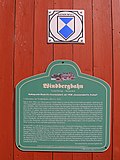
Entirety of component of the entirety of Windbergbahn , Part Bannewitz, OT Boderitz, with the individual monuments: vault passage and Myriameterstein (. See Obj 09301632) as well as the entirety of part of the route and the post-house GH 4 (Schachtstraße 6) (see also entirety of 09,301,623) | Schachtstrasse (map) |
1855-1856 | Totality with all railway systems, including track systems with substructure and superstructure, route kilometers, telecommunication and signaling systems, railway stations including all functional buildings, guard houses, bridges and culverts in the communities of Freital (OT Potschappel, Birkigt, Burgk and Kleinnaundorf), Bannewitz (OT Bannewitz, Boderitz, Cunnersdorf, Hänichen and Possendorf) and Dresden (OT Gittersee), technically outstanding, singular mountain line from the early days of railway history for the transport of the coal mined in the Freitaler Revier and connection of the local industry of industrial and railway history as well as local historical importance.
The Windbergbahn was created from a coal railway for the transport of the Hähnichen coal into the Weißeritztal, the Hähnichen coal branch railway from 1856. In 1857, King of Saxony Johann referred to it for the first time as the "Saxon Semmering Railway". As early as 1857, the line was also used for passenger traffic. Today's appearance was decisively shaped in 1907 by the construction of several high-rise buildings. The route designed by Guido Brescius in 1856 had an incline ratio of 1:40 (25 percent). On the first construction phase (valley station to today's Gittersee train station), 120 meters of altitude were overcome in a straight line distance of only 1600 m, with a stretched route length of 5700 m. Overall, the railway overcame a height difference of almost 157 m to Possendorf, crossed 21 bridges, culverts and 41 curved tracks, the smallest with only 84 m. First partial closures from 1951, under monument protection since 1980, complete cessation of operations in 1993. - Vault passage made of sandstone and myriameter stone (1894/95) Subject entity part: Postenhaus GH 4 (Schachtstraße 6), renovated, certificate of the Albertsbahn (1855/56 to 1906) |
09301631
|
 |
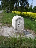
Individual features in the above Subject entity in the sub-section Bannewitz, OT Boderitz: vault passage and myriameter stone (see subject entity component list, OT Boderitz - Obj. 09301631) | Shaft street | 1907 (vault passage) | Vaulted passage made of sandstone and Myriameter stone as originally preserved evidence of the Windbergbahn of importance in terms of traffic history, the Myriameter Stone as a rare evidence of the kilometrage of technical historical importance.
Vault passage: km 9.9, sandstone, 1855, probably renewed around 1907 as part of the construction work to extend the route to Possendorf. Myriameter stone (Schachtstraße): sandstone, 1894/95, km 10 (= 10,000 m) Inscription: 1 M. The Windbergbahn was created from a coal railway for the transport of the Hänichen coal into the Weißeritztal, the Hänichen coal branch railway from 1856. In 1857, King of Saxony Johann referred to it for the first time as the "Saxon Semmering Railway". As early as 1857, the line was also used for passenger traffic. Today's appearance was decisively shaped in 1907 by the construction of several high-rise buildings. The route designed by Guido Brescius in 1856 had an incline ratio of 1:40 (25 percent). On the first construction phase (valley station to today's Gittersee train station), 120 meters of altitude were overcome in a straight line distance of only 1600 m, with a stretched route length of 5700 m. Overall, the railway overcame a height difference of almost 157 m to Possendorf, crossed 21 bridges, culverts and 41 curved tracks, the smallest with only 84 m. First partial closures from 1951, under monument protection since 1980, complete cessation of operations in 1993. |
09301632 |
 |
Individual monument belonging to the Marienschacht as a whole: former expedition of the shaft (see also Obj. 08964242, Schachtstrasse 8, 10, 12) | Schachtstrasse 8 (map) |
before 1900 (expedition) | Significance in terms of building history and local history.
Former "Expedition" (in this case the office building) of the Marienschacht coal mine, two-story solid plastered building with a flat hipped roof, end of the 19th century. The Marienschacht was a branch of the Burgker Steinkohlenwerke. As an ensemble, to which this building also belongs, it is of particular importance in terms of architectural and local history. LfD / 2014. Two-storey solid plastered building, intact wall-opening ratio, flat hipped roof, sandstone walls |
09221632
|
 |
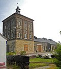
Material entity Marienschacht, with the following individual monuments: Shaft tower (Malakoffturm), hoisting machine house, former boiler house, social building with mooring, boiler house and sandstone loading walls (see object 09301516, Schachtstrasse 12), former expedition (see 09221632, Schachtstrasse 8) and former hut house (see Obj. 09221627, Schachtstraße 10) | Schachtstrasse 8; 10; 12 (card) |
1886–1959 (mining facility) | Plant of particular importance in terms of mining history, technology history, building history and local history as well as a high impact on the landscape
The whole Marienschacht, with the individual monuments: Shaft tower (Malakoffturm), hoisting machine house, former boiler house, social building with mooring, boiler house and sandstone loading walls, former expedition and former hut house; Tower with three-storey structure with brick strips such as pilaster strips on polygonal masonry, polygonal masonry and the former machine and boiler house - all segmented arch style; Tower with pyramid roof (riveted steel construction) with roof turret, in it formerly a bell; Depth once 566 m, shaft is still around 10 m deep (concrete slab); Boiler plant until shutdown in 1930; all fixtures from GDR times, including the social building from this time; Piston compressor 1942, machine built in 1949, installation 1956; Sacrificial roof. The Marienschacht coal mine, built in 1886–93, was a branch of the Burgker coal works. As an ensemble, it is of particular importance in terms of architectural and regional history and has a major role in shaping the landscape. This includes not only the machine and boiler house with their characteristic polygonal masonry, but also the so-called expedition (office building) and a hut house (social building), which are located at Schachtstrasse 8 and 10. The so-called Malakoffturm is a structurally outstanding building. Malakoff towers, to be found mainly in the Ruhr area, are known in the mining industry as enclosures for conveyor systems that, with their expansive proportions, are reminiscent of the defensive towers from the Crimean War (1853–56). At the Marienschacht, its three-storey structure with brick strips and its polygonal masonry shows how sophisticated industrial buildings used to be decorated and structured. |
08964242 |
 |
Individual monument belonging to the Marienschacht as a whole: former hut house of the shaft ("Revierhaus") (see also Obj. 08964242, Schachtstrasse 8, 10, 12) | Schachtstrasse 10 (map) |
1891 | Significance in terms of building history and local history.
Former hut house ("Revierhaus") of the Marienschacht, two-storey plastered building from 1891 on a base made of polygonal masonry that is visible on the valley side, on the right-hand side approaching staircase to the entrance level, portal with keystone in the flat central projection, ground floor and base with segmented arched windows, the very flat hipped roof shows as shape towards the upscale function of the building as a social building for the coal mine. The Marienschacht was a branch of the Burgker Steinkohlenwerke. As a structural ensemble to which this hut house belongs, it is of particular importance in terms of local history and architectural history and also has a strong impact on the landscape. LfD / 2014. Two-storey solid plastered building on a rustic base, hipped roof, flat central projection, ground floor segment arch style, keystone of the entrance with mining signs, old door leaf, intact wall-opening ratio |
09221627
|
 |
Individual features of the whole Marienschacht: Shaft tower (Malakow tower), hoisting machine house, former boiler house, social building with mooring, boiler house and sandstone loading walls of the former shaft (see also Obj. 08964242, Schachtstrasse 8, 10, 12) | Schachtstrasse 12 (map) |
re. 1886 (shaft tower) | Plant of particular importance in terms of mining history, technology history, building history and local history as well as a high impact on the landscape.
Material entity Marienschacht, with the individual monuments: Shaft tower (Malakow tower), hoisting machine house, former boiler house, social building with mooring, boiler house and sandstone loading walls, former expedition and former hut house, tower with three-storey structure through brick bands such as pilaster strips on polygonal masonry, polygonal machine masonry and boiler house - all segment arch style, tower with pyramid roof (riveted steel construction) with roof turret, in it formerly bell, depth once 566 m, shaft to about 10 m depth available (concrete slab), boiler system up to the closure in 1930, all fixtures from GDR times, The social building is also from this period, piston compressor 1942, machine built in 1949, installation 1956, sacrificial roof. The Marienschacht coal mine, built in 1886–93, was a branch of the Burgker coal works. As an ensemble, it is of particular importance in terms of architectural and regional history and has a major role in shaping the landscape. This includes not only the machine and boiler house with their characteristic polygonal masonry, but also the so-called expedition (office building) and a hut house (social building), which are located at Schachtstrasse 8 and 10. The so-called Malakow Tower is a structurally outstanding building. Malakow towers, mainly to be found in the Ruhr area, are known in the mining industry as enclosures for conveyor systems that, with their expansive proportions, are reminiscent of the defensive towers from the Crimean War (1853–56). At the Marienschacht, its three-storey structure with brick strips and its polygonal masonry shows how sophisticated industrial buildings used to be decorated and structured. Finkler LfD / 2014. 1886 Marienschacht coal mine built as a branch of the former Freiherrlich Burgker Steinkohlenwerke (administration at Burgk Castle / Freital), mostly completely preserved surface facilities, depth of the shaft: 566 m, swamped by SDAG Wismut shaft after 1945 and restarted, mining company "Willi Agatz" served as Material, weather and emergency driving shaft, shut down in 1989/90. Tower with three-storey structure by brick strips such as pilaster strips on polygonal masonry, polygonal masonry, also the former machine and boiler house - all segment arch style, tower with pyramid roof (riveted steel construction) with roof turrets, in it formerly bell, boiler system until it was closed in 1930, all fixtures from GDR times , also the social building is from this time, piston compressor 1942, machine built in 1949, installation 1956, sacrificial roof |
09301516
|
 |
Residential building | Schachtstrasse 28 (map) |
1st half of the 19th century | Plastered half-timbered upper floor, significance in terms of building history.
Half-timbered, solidly stocky (half-timbered plastered), massive gable, sandstone walls, beaver tail covering |
08964262
|
 |
Residential stable house and side building (on an angular floor plan) of a former four-sided courtyard and courtyard wall with gate entrance and pond with remnants of the metal enclosure | Teichplatz 1 (map) |
End of 18th century | Residential stable house, half-timbered upper floor plastered, farm that defines the townscape, of architectural and socio-historical importance.
Stable house: half-timbered, solidly stocky, sandstone walls, side building: solid, hipped roof |
08964271
|
 |
Residential building | Teichplatz 2 (map) |
around 1860 | characteristic rural building of the 19th century, of importance in terms of building and settlement history |
08960540
|
 |
Stable house of a farm | Teichplatz 3 (map) |
End of 18th century | Stately building, upper floor half-timbered, of importance in terms of building history, social history and the image of the village.
Half-timbered, solidly stocky, massive gable ends, hipped roof, sandstone walls |
08964264
|
 |
Residential stable house, barn and archway of a farm | Teichplatz 3a (map) |
End of 18th century | Residential stable house on the courtyard side, upper floor half-timbered, of architectural, social and economic significance, defining the image of the village.
Residential stable house: half-timbered, solidly stocky, half-hipped roof, beaver tail covering, archway made of sandstone |
08964265
|
 |
Two residential buildings (No. 4 and No. 4a / 4b from two parts of the house) and courtyard wall with gate system (two gate pillars and gate) of a three-sided courtyard | Pond place 4; 4a; 4b (card) |
End of 18th century | Structurally, socially and economically of importance, characterizing the village.
Residential houses: solid hipped roofs, sandstone walls, keystone in the entrance of one of the houses, the other with plaster ornamentation |
08964266
|
 |
Residential stable house (Teichplatz 5), side building (Cunnersdorfer Straße 1/3, formerly Teichplatz 5a), barn (behind No. 5) and gate system (archway and gate) of a farm | Teichplatz 5 (map) |
re. 1828 | Solid buildings that characterize the village, of architectural, social and economic importance.
Plastered facades, massive, entrance with garland |
08964267 |
 |
Residential house (No. 6), side building (No. 6a), barn and archway of a three-sided courtyard | Pond place 6; 6a (card) |
re. 1834 | Farmhouses that characterize the village, partly in half-timbered construction, of architectural, social and economic importance.
A massive side building, sandstone window frames, the other half-timbered structure, solidly stocky, several building parts joined together, both with plaster ornamentation |
08964268 |
 |
Residential stable house (No. 7), side building (No. 7a) and courtyard wall with gate to a three-sided courtyard | Pond place 7; 7a (card) |
re. 1790 (stable house) | The plastered buildings that characterize the village are of importance in terms of building history, social history and economic history |
08964269 |
 |
Half of a stable house and gate system (archway and gate) of a farm | Teichplatz 8 (map) |
End of the 18th century (stable house) | Upper floor half-timbered, of architectural and socio-historical importance, defining the image of the village |
08964270 |
Remarks
- This list is not suitable for deriving binding statements on the monument status of an object. As far as a legally binding determination of the listed property of an object is desired, the owner can apply to the responsible lower monument protection authority for a notice.
- The official list of cultural monuments is never closed. It is permanently changed through clarifications, new additions or deletions. A transfer of such changes to this list is not guaranteed at the moment.
- The monument quality of an object does not depend on its entry in this or the official list. Objects that are not listed can also be monuments.
- Basically, the property of a monument extends to the substance and appearance as a whole, including the interior. Deviating applies if only parts are expressly protected (e.g. the facade).