List of cultural monuments in Rippien
The list of cultural monuments in Bannewitz contains the cultural monuments in the Bannewitz district of Rippien that are listed in the official list of monuments of the State Office for the Preservation of Monuments in Saxony . The notes are to be observed.
This list is a partial list of the list of cultural monuments in the district of Saxon Switzerland-Eastern Ore Mountains .
This list is a partial list of the list of cultural monuments in Saxony .
Legend
- Image: shows a picture of the cultural monument and, if applicable, a link to further photos of the cultural monument in the Wikimedia Commons media archive
- Designation: Name, designation or the type of cultural monument
-
Location: If available, street name and house number of the cultural monument; The list is basically sorted according to this address. The map link leads to various map displays and gives the coordinates of the cultural monument.
- Map view to set coordinates. In this map view, cultural monuments are shown without coordinates with a red marker and can be placed on the map. Cultural monuments without a picture are marked with a blue marker, cultural monuments with a picture are marked with a green marker.
- Dating: indicates the year of completion or the date of the first mention or the period of construction
- Description: structural and historical details of the cultural monument, preferably the monument properties
-
ID: is awarded by the State Office for the Preservation of Monuments in Saxony. It clearly identifies the cultural monument. The link leads to a PDF document from the State Office for the Preservation of Monuments in Saxony, which summarizes the information on the monument, contains a map sketch and often a detailed description. For former cultural monuments sometimes no ID is given, if one is given, this is the former ID. The corresponding link leads to an empty document at the state office. The following icon can also be found in the ID column
 ; this leads to information on this cultural monument at Wikidata .
Ribs
| image | designation | location | Dating | description | ID |
|---|---|---|---|---|---|
 |
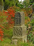
Memorial to Traugott Ernst Sommerschuh | Dorfplatz (map) |
re. 1904 | reminiscent of the architect and founder, approx. 2.5 m high monolith with medallion, of local historical importance.
Inscription: Traugott Ernst Sommerschuh, medallion with a portrait of Sommerschuh, probably electroplated |
08963193
|
 |
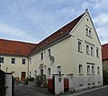
Two stable houses and barn of a three-sided courtyard as well as gate entrance and enclosure | Dorfplatz 2 (map) |
re. 1797 | dominant three-sided courtyard, largely preserved in its original appearance, characterizing the townscape and structure, significance in terms of building history and economic history.
Solid residential building, two-storey plastered building, cornice visually separates the storeys, gable with triple windows, all windows with sandstone walls, older side building possibly partly still plastered half-timbered, inscribed 1797 (side building panel), crooked hip roof, beaver tail covering, 3rd side building (= barn) more recent |
08963195
|
 |
Residential stable house, side building and barn of a three-sided courtyard, plus two gate pillars of the courtyard access and memorial plaque on the house | Dorfplatz 3 (map) |
re. 1848 | a farm that has largely been preserved in structure and appearance, memorial plaque commemorates the village fire in 1844, which is decisive for the appearance of the village and the structure of the village, as well as architectural and economic significance.
all sides solid, the gables with window decorations and a hint of Palladio motif, house gable crowned with Zippus, cranked eaves, memorial plaque: sandstone, emblem with agricultural implements, inscription "Ausgebaut und Renovirt 1848 by Johann Graf August Morschberg" and "1898 Theodor Mörer" |
08963194
|
 |
Triangulation column | Höhenweg - (map) |
re. 1865 (triangulation column) | Station of the Royal Saxon Triangulation, 2nd order network, scientifically and technologically significant.
The point Gohlig was measured and set up in June 1865 in the gardens of the restoration to the golden height by graduation assistant Friedrich Robert Helmert. The approximately 4 m high, artistically designed column is made of Gohlig sandstone and bears the inscription Sächs.Station / GOHLIG / der / Mitteleurop. Degree measurement / 1865. "The regional group" Goldene Höhe "in the Landesverein Sächsischer Heimatschutz e.V. initiated the restoration of the triangulation column in 2005. On June 3, 2005, the restored triangulation column and the restored park with pond and paths of the On the way to the station you will find a board with further information. In the period from 1862 to 1890, a land survey was carried out in the Kingdom of Saxony, in which two triangular networks were formed. On the one hand, there is the network for grade measurement in the Kingdom of Saxony (network I. class / order) with 36 points and the royal Saxon triangulation (network II. Class / order) with 122 points. This national survey was led by Christian August Nagel , according to which the triangulation columns are also referred to as "Nagelsche columns". This surveying system was one of the most modern layer networks in Germany. The surveying columns set for this purpose remained almost entirely in their original locations. They are an impressive testimony to the history of land surveying in Germany and in Saxony. The system of surveying columns of both orders is in its entirety a cultural monument of supraregional importance. (LfD / 2013) Surveying column made of Gohlig sandstone, cube-shaped base, the transition is designed with four shield arches, followed by a profiled ring, cylindrical shaft with profiled cover plate, inscription: "Sächs.Station / GOHLIG / der / Mitteleurop. Gradmessage / 1865.", height 4.0 m, high stepped, block-shaped base with round arch |
08963281
|
 |
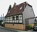
Residential building | Hornschänkenweg 3 (map) |
18th century | Upper floor half-timbered, relic of rural timber construction, architectural significance.
Boarded up gable, otherwise exposed framework preserved in the construction, gable window possibly slightly enlarged |
08963190
|
| Memorial tree (1905) and memorial stone (1833) in memory of Friedrich Schiller | Pirnaer Strasse - (map) |
1833 | of local importance. |
08963188
|
|
 |
Prayer pillar head | Pirnaer Straße 17 (near) (map) |
09304822
|
||
 |
Residential building | Pirnaer Strasse 18 (map) |
around 1850 | small half-timbered house, significance in terms of building history, characterizing the streetscape.
Possibly a former side building, massive ground floor, windows in original size upstairs, but with blinds, hipped roof with horizontal windows |
08963187
|
 |
Residential house, attached side building and further side building of a former four-sided courtyard and keystone in the courtyard wall | Pirnaer Strasse 31 (map) |
re. 1854 | large farm, building with a defining effect on the street scene, significance in terms of building history.
Solid residential building, two-storey, sandstone walls, open staircase, marked 1854 (plaque above front door), remains of window crowns, on the street side keystone with horse marked 1737 (from the former archway), stable barn also massive |
08963198
|
 |
Residential stable house, angled side building and barn of a farm | Pirnaer Strasse 38 (map) |
re. 1817, older in essence | Residential stable house and side building: upper floor and gable half-timbered, largely preserved in appearance and structure, significance in terms of building history.
Massive ground floor, first floor windows in original size, some with six-span projections, except for the street side, stable vault preserved, sandstone door walls with keystone, marked 1817 (keystone door frame), residential and side buildings but at least 50 years older, solid side building on the third side Barn from 1924 |
08963189
|
 |
Residential house with extension | Pirnaer Strasse 39 (map) |
around 1700 | in the manner of a small hooked courtyard, upper floor half-timbered, the oldest generation of regional timber construction still preserved, in a place that characterizes the townscape, of architectural significance.
Solid ground floor with sandstone door and window frames, upper floor windows in original size (some very small), boarded gable, half-timbered with one and two transoms, somewhat younger corner building with a crooked hipped roof |
08963192
|
 |
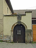
Gate and keystone walled in over it in the courtyard wall of a farm | Pirnaer Strasse 54 (map) |
re. 1765 | Gate Sandstone door jambs with fighter and keystone, depicting ploughshare and sixth, above another keystone marked 1765, of local history. |
08963191
|
 |
Residential stable house, side building and barn of a three-sided courtyard, as well as gate entrance and walled crucifixion relief | Sommerschuhstraße 1 (map) |
around 1850 | Plastered solid buildings, triple windows in the gable of the residential stable house, two sandstone gate pillars of the courtyard access, weathered crucifixion relief 16th century, courtyard largely preserved in its original appearance, has a decisive influence on the village image and structure, of architectural and economic importance.
Residential stable house with remnants of decoration (cornice, triple windows, supraport), side building with sandstone walls, twin windows, cranked eaves, double-storey barn, all buildings solid, street side Palladi motif |
08963196
|
 |
Residential house, side building and barn as well as the entrance to a three-sided courtyard | Sommerschuhstraße 6 (map) |
2nd half of the 19th century | Residential house facades with some decoration, two sandstone gate pillars of the courtyard access, largely preserved in their original appearance, courtyard has a decisive influence on the village image and village structure, of architectural and economic significance.
Solid, two-story residential building, jamb, window crowning, sandstone walls, belt cornice, obelisk as gable crowning, window rung, decorated jamb openings, old lightning rod. |
08963197 |
Remarks
- This list is not suitable for deriving binding statements on the monument status of an object. As far as a legally binding determination of the listed property of an object is desired, the owner can apply to the responsible lower monument protection authority for a notice.
- The official list of cultural monuments is never closed. It is permanently changed through clarifications, new additions or deletions. A transfer of such changes to this list is not guaranteed at the moment.
- The monument quality of an object does not depend on its entry in this or the official list. Objects that are not listed can also be monuments.
- Basically, the property of a monument extends to the substance and appearance as a whole, including the interior. Deviating applies if only parts are expressly protected (e.g. the facade).