Ribs
|
Ribs
Municipality Bannewitz
Coordinates: 50 ° 58 ′ 53 ″ N , 13 ° 43 ′ 55 ″ E
|
|
|---|---|
| Height : | 297 m above sea level NN |
| Residents : | 521 (June 30, 2019) |
| Incorporation : | March 1, 1994 |
| Incorporated into: | Possendorf |
| Postal code : | 01728 |
| Area code : | 0351 |
|
Location of Rippien in Bannewitz
|
|
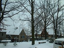
Rippien is a district of the Saxon community of Bannewitz in the district of Saxon Switzerland-Eastern Ore Mountains .
geography
The place is southeast of the main town Bannewitz. State road 191 runs through the village .
Rippien is the southern end point of the surveying system by Wilhelm Gotthelf Lohrmann from 1828. Other measuring points were at the Zwinger in the inner old town of Dresden and at Rähnitz north in Dresden, where the "Meridian Column" (a 10 meter high sandstone column ) is the northern end point of the exactly aligned north-south line marked.
The village is connected to the local public transport network by bus lines 351 and 353, which are operated by RVSOE .
history
The Sorbian town was first mentioned in a document in 1295 as Rypin . The place is marked as Rüpchen on a map from the second half of the 18th century .
From 1550 to 1900 sandstone was mined in one large and several small quarries.
The already since the beginning of the 16th century in the Plauen reason operated coal mines reached in the 19th century on the surrounding communities. From 1850 to 1854 the Hänichener Steinkohlenbauverein zu Dresden sunk the 470 meter deep persistence shaft in Rippien , which from 1857 had a 940 meter long siding to the Hänichen coal branch line . The shaft was sunk another 100 meters in 1889. Due to the exhaustion of coal reserves and increasingly falling productivity due to domestic and foreign competition, the association had to stop mining in 1906 and go into liquidation. With the coal mining industry, Rippien developed into a workers' community.
A first school lesson took place in 1764, in 1845 a school building was built in the village. Another schoolhouse was built in 1875, where the children of Goppeln, Hänichen and Rippien went to school.
In 1959 the individual farmers began to join the " LPG Progress Bannewitz". In 1960 a dairy cattle combine for 360 animals was built on the road to Bannewitz, which is used today as stables for pasture and fattening cattle for Dresdner Vorgebirgs Agrar AG. On the road between Possendorf and Golberode, a dairy cattle combine for 2000 animals was set up in the 1970s, which is now used as a dairy cattle plant with a biogas plant by the Vorgebirgsmilch- und slaughterhouse cooperative .
The summer shoe foundation
The Dresden architect Ernst Sommerschuh , born in Rippien in 1844 , also built in his hometown. One example is the upper part of the church tower, which had to be rebuilt in 1885.
Sommerschuh had become wealthy through diligence. He gave away a large part of his fortune to the people of Rippien. In 1904 he set up a foundation . The purpose of the foundation is the fulfillment of specific charitable purposes.
A monument was erected for Sommerschuh during his lifetime. A street was also named after him.
Others
- The mayor is Mirco Synde.
literature
- Cornelius Gurlitt : ribs. In: Descriptive representation of the older architectural and art monuments of the Kingdom of Saxony. 24. Issue: Amtshauptmannschaft Dresden-Altstadt (Land) . CC Meinhold, Dresden 1904, p. 114.
Web links
- Rippien in the Digital Historical Directory of Saxony
- Rippien on www.bannewitz.de
Individual evidence
- ↑ Timetable for bus route 351. December 15, 2019, accessed on March 30, 2020 .
- ↑ Timetable for bus route 353. RVSOE, December 15, 2019, accessed on March 30, 2020 .
- ^ Local council , community Bannewitz


