List of cultural monuments in Freiberg-Süd
The list of cultural monuments in Freiberg-Süd contains the cultural monuments of the Freiberg-Süd district of the Saxon city of Freiberg , which were recorded in the list of monuments by the State Office for Monument Preservation of Saxony as of June 20, 2013.
Legend
- Image: shows a picture of the cultural monument and, if applicable, a link to further photos of the cultural monument in the Wikimedia Commons media archive
- Designation: Name, designation or the type of cultural monument
-
Location: If available, street name and house number of the cultural monument; The list is basically sorted according to this address. The map link leads to various map displays and gives the coordinates of the cultural monument.
- Map view to set coordinates. In this map view, cultural monuments are shown without coordinates with a red marker and can be placed on the map. Cultural monuments without a picture are marked with a blue marker, cultural monuments with a picture are marked with a green marker.
- Dating: indicates the year of completion or the date of the first mention or the period of construction
- Description: structural and historical details of the cultural monument, preferably the monument properties
-
ID: is awarded by the State Office for the Preservation of Monuments in Saxony. It clearly identifies the cultural monument. The link leads to a PDF document from the State Office for the Preservation of Monuments in Saxony, which summarizes the information on the monument, contains a map sketch and often a detailed description. For former cultural monuments sometimes no ID is given, if one is given, this is the former ID. The corresponding link leads to an empty document at the state office. The following icon can also be found in the ID column
 ; this leads to information on this cultural monument at Wikidata .
List of cultural monuments in Freiberg-Süd
| image | designation | location | Dating | description | ID |
|---|---|---|---|---|---|
 More pictures |
Train station complex | At the train station (map) |
1862 (train station) | Reception building, post expedition, platform roofs (platforms 1, 2–5, 6–7) and railings (platforms 1, 2–5); A railway station building with ancillary facilities, built in the English Gothic style and very representative for small towns, significant in terms of building history, urban development history and traffic history |
09200076 |
 More pictures |
Industrial building | At station 3 (map) |
1919–1920 (factory) | Industrial building; Representative building with a dominant corner tower, facade structure by colossal pilasters, stylized jewelry, special accent by means of a structure visible from afar, including gallery, columns, urns, baroque-looking hood and atlantic, architectural history, artistically (unmistakable and unusual factory), significant industrial history and local history |
09200079 |
 |
Heap | Am Maßschacht 7 (near) (map) |
16./17. Century (stockpile) | Halde (see Turmhofstraße 2) |
09200242 |
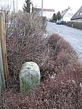 |
Royal Saxon milestones (totality) | Am Seilerberg 23 (in front) (map) |
around 1860 | Royal Saxon half-milestone as a memorial stone |
|
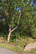
| Heap | Am St. Niclasschacht (map) |
17th century (mining) | Dump; forms with several heaps like Niclas, Roter Löwe etc. south of the railway facilities an interesting and still vivid mining area, significant mining and local history |
08992414 |
|
 |
Heap | At St. Peter Schacht (map) |
16th century (mining) | Dump; Mining and local history significant |
09200157 |
 |
Footpath design | Annaberger Strasse (map) |
around 1895 (pavement) | Footpath design with mosaic paving from Dörnerzaunstrasse to Turnerstrasse; in terms of design quality and in this form unique in Freiberg |
09200043 |
 |
villa | Annaberger Strasse 2 (map) |
around 1875 (villa) | Villa; striking late classicist building with a remarkably clearly structured facade made of pilaster strips, floor profiles, jamb and battlement frieze, the windows restrained, of architectural, artistic and urban development historical value |
09200035 |
 |
Villa-like building | Annaberger Strasse 4 (map) |
3rd quarter of the 19th century (corporation building) | Villa-like building; rectangular building built in neo-Gothic style; today the original interior fittings are of particular architectural and artistic importance |
09200036 |
| Residential building | Annaberger Strasse 6 (map) |
1st half of the 19th century (residential building) | Residential house in open development; simple, characteristic suburban house, remarkable historicizing door on the side, of value in terms of building history, craft history and urban development history |
09200054 |
|
 |
Tenement house | Annaberger Strasse 10 (map) |
around 1890 (residential building) | Apartment building in open development; Stately Wilhelminian style building with a historicizing facade (round arch style), as a striking example of architecture of architectural value until 1900, also significant in terms of urban development history |
09200044 |
 |
Residential building | Annaberger Strasse 11 (map) |
re. 1836 (residential building) | Dated residential building and extension with Kummethalle, entrance with segmental arch in the apex; Significant in terms of building history, local history and urban development history |
09200042 |
 |
Villa-like residential building | Annaberger Strasse 12 (map) |
3rd quarter of the 19th century (residential building) | Villa-like house with partially landscaped garden; Residential house of a mountain official, characteristic single-storey historicism building, architectural history, of value in terms of local history and urban development history |
09200037 |
 |
Villa-like residential building | Annaberger Strasse 15 (map) |
around 1910 (residential building) | Villa-like house with fencing; Remarkable example of residential building architecture after 1900 with unmistakably designed middle section (gable, bay window, etc.), of value in terms of building history and urban development |
09200040 |
 |
villa | Annaberger Strasse 19 (map) |
re. 1909 (villa) | Villa; Factory owner's villa with a large, remarkable hallway and vestibule, built in the style of Early Objectivity and Art Nouveau, of value in terms of building history, local history and urban development history |
09200039 |
 |
villa | Annaberger Strasse 20 (map) |
around 1880 (villa) | Villa; striking historicizing residential building, of value in terms of building history and urban development history |
09200041 |
 |
villa | Annaberger Strasse 22 (map) |
around 1880 (villa) | Villa, striking historicizing building; of value in terms of building history and urban development history |
09200038 |
 |
Tenement house | Bahnhofstrasse 4 (map) |
re. 1895 (tenement) | Apartment building with shop in half-open development; distinctive building with historicism facade, structured by three risalits, accentuated by bay windows, one of the most elaborate residential buildings of the late 19th century in Freiberg, historically and artistically significant and unique |
09200104 |
 |
Residential and commercial building | Bahnhofstrasse 10 (map) |
around 1890 (residential and commercial building) | Residential and commercial building in a corner and in closed development; Significant in terms of urban development history |
09200099 |
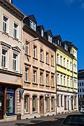 |
Tenement house | Bahnhofstrasse 12 (map) |
around 1890 (tenement) | Apartment building with shop area in closed development; Part of the most artistically demanding and most originally preserved area of Bahnhofstrasse, significant in terms of urban development |
09200098 |
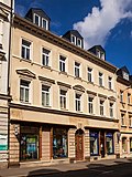 |
Tenement house | Bahnhofstrasse 14 (map) |
around 1890 (tenement) | Apartment building with shop area in closed development; Distinctive historicizing building from the Wilhelminian era, historically important also part of the most artistically demanding and most originally preserved area of Bahnhofstrasse, significant in terms of urban development history |
09200097 |
 |
Double tenement house | Bahnhofstrasse 16; 18 (card) |
around 1890 (tenement) | Double apartment building with a shop area in closed development; Distinctive historicizing building from the Wilhelminian era, historically important also part of the most artistically demanding and most originally preserved area of Bahnhofstrasse, significant in terms of urban development history |
09200096 |
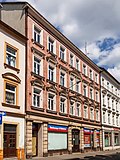 |
Tenement house | Bahnhofstrasse 20 (map) |
around 1890 (tenement) | Apartment building with shop area in closed development; Part of the most artistically demanding and most originally preserved area of Bahnhofstrasse, significant in terms of urban development |
09200095 |
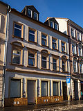 |
Tenement house | Bahnhofstrasse 22 (map) |
around 1890 (tenement) | Apartment building with shop area in closed development; Part of the most artistically demanding and most originally preserved area of Bahnhofstrasse, significant in terms of urban development |
09200094 |
 |
Tenement house | Bahnhofstrasse 24 (map) |
around 1890 (tenement) | Apartment building with shop area in closed development; Part of the most artistically demanding and most originally preserved area of Bahnhofstrasse, significant in terms of urban development |
09200103 |
 |
Tenement house | Bahnhofstrasse 26 (map) |
around 1890 (tenement) | Apartment building with shop area in closed development; Part of the most artistically demanding and most originally preserved area of Bahnhofstrasse, significant in terms of urban development |
09200102 |
 |
Tenement house | Bahnhofstrasse 28 (map) |
around 1890 (tenement) | Apartment building with shop area in closed development; Distinctive historicizing building from the Wilhelminian era, historically important also part of the most artistically demanding and most originally preserved area of Bahnhofstrasse, significant in terms of urban development history |
09200101 |
 |
skyscraper | Bahnhofstrasse 28a (map) |
1929 (tenement) | Skyscraper; one of the few buildings of classical modernism in Freiberg, to which the oldest skyscraper in the city, significant in terms of building and urban development history, also of local historical value as the work of the city planning councilor Salzmann |
09200100 |
 |
Tenement house | Bahnhofstrasse 32 (map) |
around 1890 (tenement) | Apartment building with shop in closed development; Distinctive historicizing building from the Wilhelminian era, historically important also part of the most artistically demanding and most originally preserved area of Bahnhofstrasse, significant in terms of urban development history |
09200093 |
 |
Residential building | Bergstiftsgasse 6 (map) |
re. 1791, re. 1823 (residential house) | Residential house in closed development; Suburban small bourgeois house with a simple perforated facade, saddle roof and distinctive segment arch portal, largely preserved in its original state, significant in terms of urban development |
09200126 |
 |
Residential building | Bergstiftsgasse 26 (map) |
around 1800 (residential building) | Residential house in closed development; Suburban small bourgeois house with a simple perforated facade, roof including horizontal towing hatch and segmental arch portal, significant in terms of urban development history, largely in its original state |
09200127 |
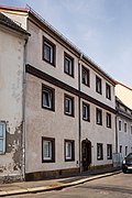 |
Residential building | Bergstiftsgasse 28 (map) |
re. 1794 (in the apex of the entrance) | Residential house in closed development; Significant in terms of urban development history |
09200128 |
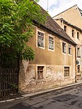 |
Residential building | Bergstiftsgasse 40 (map) |
around 1800 (residential building) | Residential house in semi-open development and in a corner location; Suburban small bourgeois house, probably a miner's house, with a perforated facade and high saddle roof, significant in terms of building and urban development history, largely original |
09200129 |
| Stockpile train | Berthelsdorfer Strasse (map) |
16th to 19th century (Halde) | Dump train on the Hohe Birke ore vein standing with several heaps (see also Zug district, main street) |
08992417 |
|
 More pictures |
Bridge ensemble | Berthelsdorfer Strasse (map) |
1896–1899 (bridge) | Bridge ensemble; Architecturally and structurally remarkable underpass consisting of two railway bridges, gate-like designed entrance areas (especially on the southern side) and track feeder or loading street, significant in terms of building history and traffic history, also of relevance to the townscape |
09200781 |
 |
Residential building | Berthelsdorfer Strasse 4 (map) |
1st half of the 19th century (residential building) | Residential house in closed development; characteristic suburban petty bourgeois house, significant in terms of urban development history |
09200143 |
 |
Residential building | Berthelsdorfer Strasse 7 (map) |
1st half of the 19th century (residential building) | Residential house in closed development; two-storey characteristic small bourgeois house in the suburbs with a perforated facade, portal and gable roof, significant in terms of urban development |
09200146 |
 |
Residential building | Berthelsdorfer Strasse 9 (map) |
1st half of the 19th century (residential building) | Residential house in closed development; two-storey characteristic small bourgeois house in the suburbs with a perforated facade, portal and gable roof, significant in terms of urban development |
08992418 |
 |
Tenement house | Berthelsdorfer Strasse 10 (map) |
around 1900 (tenement) | Apartment building in closed development; Significant in terms of urban development history |
09200141 |
 |
Residential building | Berthelsdorfer Strasse 12 (map) |
around 1875 (residential building) | Residential house in closed development; characteristic suburban small bourgeois house with a perforated facade, saddle roof and segment arch portal, significant in terms of urban development history |
09200140 |
 |
Tenement house | Berthelsdorfer Strasse 13 (map) |
around 1905 (tenement) | Apartment building in closed development; striking Art Nouveau building in the suburbs, significant in terms of building and urban development history |
09200145 |
 |
Residential building | Berthelsdorfer Strasse 15 (map) |
re. 1805 (residential building) | Residential building with workshop building; Significant in terms of urban development history |
09200144 |
 |
Inn | Berthelsdorfer Strasse 23 (map) |
2nd half of the 18th century, 1st half of the 19th century (inn) | Inn; historic Freiberg inn, historically significant |
09200139 |
| two-storey house | Berthelsdorfer Strasse 28 (map) |
around 1800 (residential building) | Small two-story house; Significant in terms of urban development history |
09200137 |
|
 |
Residential building | Berthelsdorfer Strasse 53 (map) |
around 1880 (residential building) | Residential house in half-open development; Significant in terms of urban development history |
09200136 |
 |
Tenement house | Berthelsdorfer Strasse 57 (map) |
around 1880 (tenement) | Tenement house in semi-open development; Distinctive historicizing building with a remarkable facade design on both the front and gable sides, accentuation through window roofing, outstanding cornice, fruit hangings, etc., significant in terms of architectural, artistic and urban development history |
09200147 |
 |
villa | Berthelsdorfer Strasse 75 (map) |
around 1930 (manufacturer's villa) | Villa with enclosure and villa garden and garden vase; Former factory owner's villa of the neighboring factory, high-quality residential building from the twenties and thirties, significant in terms of architectural, artistic and local history (see also Berthelsdorfer Straße 77) |
09200783 |
 |
Factory complex | Berthelsdorfer Strasse 77 (map) |
1886 and later (factory) | Factory complex with administration building on the street, shed roof hall and other buildings; the representative administration building was erected in the form of the German neo-renaissance, the facility is significant in terms of building history as well as industrial and local history |
09200784 |
| Tenement house | Bertholdsweg 32 (map) |
around 1910 (tenement) | Apartment building in closed development; Distinctive residential building from the beginning of the 20th century with an objectified, yet sophisticated facade, an example of the so-called reform architecture after 1900, significant in terms of building history and, as part of a characteristic street in the suburbs, also of importance in terms of urban development history |
09200218 |
|
| Tenement house | Bertholdsweg 34 (map) |
around 1910 (tenement) | Apartment building in closed development; Distinctive residential building from the beginning of the 20th century with an objectified, yet sophisticated facade, an example of the so-called reform architecture after 1900, significant in terms of building history and, as part of a characteristic street in the suburbs, also of importance in terms of urban development history |
09200219 |
|
 |
Tenement house | Bertholdsweg 36 (map) |
around 1910 (tenement) | Apartment building in closed development; Distinctive residential building from the beginning of the 20th century with an objectified, yet sophisticated facade, an example of the so-called reform architecture after 1900, significant in terms of building history and, as part of a characteristic street in the suburbs, also of importance in terms of urban development history |
09200220 |
| Tenement house | Bertholdsweg 38 (map) |
around 1910 (tenement) | Apartment building in closed development and in a corner location; Distinctive residential building from the beginning of the 20th century with an objectified, but nevertheless sophisticated facade, example of the so-called reform architecture after 1900, important in terms of building history and part of a characteristic street in the suburbs also of importance in terms of urban development history |
09200221 |
|
| Rows of houses | Bertholdsweg 57; 59; 61; 63; 65; 67; 69; 71; 73; 75 (card) |
re. 1927 (No. 57), re. 1925 (No. 58), re. 1926 | see Bertholdsweg 56–80 |
09200765 |
|
| Rows of houses | Bertholdsweg 58; 60; 62; 64; 66; 68; 70; 72; 74; 76; 78; 80 (card) |
re. 1927 (No. 57), re. 1925 (No. 58), re. 1926 | On both sides of the street, rows of two- to three-story buildings with hipped roofs; connected by low intermediate buildings, alternating two-storey and one-storey, significant in terms of building history, local history, industrial history and social history (see also Bertholdsweg 57–75 and Frauensteiner Straße 54–58) |
09200217 |
|
 |
Tenement house | Beuststrasse 3 (map) |
around 1900 (tenement) | Apartment house in a corner in a semi-open development; distinctive roof structures, clinker brick facade, significant in terms of building and urban development history |
09200060 |
 |
Tenement house | Beuststrasse 12 (map) |
around 1910 (tenement) | Apartment building in closed development; striking neoclassical building from the beginning of the 20th century with pilaster strips on the upper floors and a prominent portal, significant in terms of building and urban development history |
09200059 |
 |
Tenement house | Beuststrasse 13 (map) |
around 1900 (residential building) | Apartment house in corner position and half-open development; representative historicism building with rich facade design and accentuated by bay windows and gable, significant in terms of building history and urban development history, also due to its unmistakable appearance with design requirements and thus also artistically important |
09200785 |
 |
Tenement house | Beuststrasse 14 (map) |
around 1910 (tenement) | Apartment building in closed development; striking neoclassical building from the beginning of the 20th century with pilaster strips on the upper floors and a prominent portal, significant in terms of building and urban development history |
09200058 |
 |
Tenement house | Beuststrasse 15 (map) |
re. 1892 (residential building) | Apartment building in closed development; Distinctive historicism building with an upgraded clinker plaster facade, significant in terms of building history and urban development history, also with the numbers 17 and 19 an unmistakable ensemble of urban development value (sequence of design elements, in particular the gable and symmetry) |
09200786 |
 |
Tenement house | Beuststrasse 17 (map) |
re. 1893 (residential house) | Apartment building in closed development; Distinctive historicism building with an upgraded clinker plaster facade, original furnishings in the hallway, significant in terms of building history and urban development history, also with the numbers 17 and 19 an unmistakable ensemble of urban development value (sequence of design elements, in particular the gable and symmetry) |
09200787 |
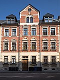 |
Tenement house | Beuststrasse 18 (map) |
around 1900 (tenement) | Apartment building in closed development; striking historicizing Wilhelminian style building with clinker ashlar facade, with the central elevation highlighted in terms of design, significant in terms of building and urban development history |
09200057 |
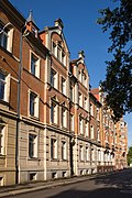 |
Tenement house | Beuststrasse 19 (map) |
re. 1894 (residential building) | Apartment building in closed development; Distinctive historicism building with an upgraded clinker plaster facade, significant in terms of building history and urban development history, also with the numbers 17 and 19 an unmistakable ensemble of urban development value (sequence of design elements, in particular the gable and symmetry) |
09200788 |
 |
Tenement house | Beuststrasse 20 (map) |
around 1900 (tenement) | Apartment building in a corner in a closed development; striking historicizing Wilhelminian style building with clinker ashlar facade, with the central elevation highlighted in terms of design, significant in terms of building and urban development history |
09200056 |
 |
Tenement house | Beuststrasse 21 (map) |
re. 1895 (residential building) | Apartment building in closed development; striking historicism building with clinker plaster facade, significant in terms of building history and urban development history |
09200789 |
 |
Place of worship | Brander Strasse (map) |
1574 (memorial and memorial) | Pre-Reformation place of worship with three crosses; important in terms of local history |
09200793 |
 |
Production building | Brander Strasse 12 (map) |
around 1910 (factory) | Production building with tower extension; historically significant and important for the townscape (dominant) |
09200791 |
 |
Mining authority building | Brander Strasse 100 (map) |
re. 1796 (mining) | Mining authority building (former) with barn and heap; characteristic building with plastered half-timbered upper floor, segmental arch portal and steep roof, the barn probably later, significant in terms of building history, mining history and local history |
09200792 |
 |
Residential building | Buchstrasse 3 (map) |
1946 (residential building) | Residential house in half-open development; So-called reconstruction house, one of the few surviving examples from the first phase after 1945 (still in the Soviet Zone), significant in terms of building and urban development history, as a building by the well-known architect Göpfert of personal history |
09200125 |
 |
Tenement house | Buchstrasse 10 (map) |
around 1900 (tenement) | Tenement house in semi-open development; Distinctive historicist building with clinker brick facade, accented by a gabled central bay window, significant in terms of building and urban development history |
09200123 |
 |
Tenement house | Buchstrasse 14 (map) |
around 1890 (tenement) | Apartment building in corner location and closed development; Significant in terms of urban development history |
09200124 |
 |
Tenement house | Dammstrasse 15 (map) |
around 1900 (tenement) | Apartment building in closed development; Significant in terms of urban development history |
09200195 |
 |
Tenement house | Dammstrasse 17 (map) |
around 1900 (tenement) | Apartment building in closed development; Significant in terms of urban development history |
09200194 |
 |
Tenement house | Dammstrasse 19 (map) |
around 1900 (tenement) | Apartment building in corner location and closed development; Significant in terms of urban development history |
09200193 |
| Tenement house | Dammstrasse 26 (map) |
around 1900 (tenement) | Apartment building in closed development; Significant in terms of urban development history |
09200192 |
|
| Tenement house | Dammstrasse 28 (map) |
around 1900 (tenement) | Tenement house in semi-open development; Striking clinker brick building with strongly shaped structural and decorative elements, the entrance axis and the first floor (the bel étage) highlighted, accents by differently colored clinker bricks, Wilhelminian style building in the style of historicism, significant in terms of building and urban development history |
09200191 |
|
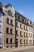 |
Tenement house | Dammstrasse 31 (map) |
re. 1907 (tenement) | Apartment building in closed development; striking building with Art Nouveau facade, significant in terms of urban development history |
09200190 |
 |
Residential building | Dammstrasse 38; 40; 42; 44 (map) |
after 1950 (residential building) | Row of houses in open development; typical GDR architecture of the 1950s, significant in terms of building and urban development history |
09200185 |
 |
Institution building | Dörnerzaunstrasse 1 (map) |
1927–1928 (bathing establishment) | Institution building with stairs, rear terrace and fencing; Multi-storey building with clinker plastered facade, large clinker brick portal with two figures, representative public building with a high-quality expressionist facade, significant in terms of building history and art |
09200066 |
 |
school-building | Dörnerzaunstraße 2 (map) |
re. 1901–1902 (in the gables) | School-building; representative four-storey building with large renaissance gables, clinker brick or plaster structure, important in terms of building and local history |
09200065 |
| Residential building | Brazen Serpent 12 (Card) |
around 1900 (residential building) | Residential house in open development; Late founding construction with a distinctive historicizing facade design, accentuation by the central stepped gable on the long side, furthermore animation by various design elements and different colored decorative stones, typical of the time but at the same time unmistakable appearance, building historically and artistically significant |
09200216 |
|
 |
Duplex house | Brazen Serpent 21; 23 (card) |
re. 1937 (residential building) | Double house in semi-open development; Significant in terms of urban development history |
09200215 |
| Residential houses | Franz-Mehring-Platz 3; 6; 8th; 11; 12; 16; 21; 27; 28 (card) |
1936–1937 (residential complex) | Residential houses (10); Remaining remnants of a once remarkable urban development, monument properties must be checked (see also Käthe-Kollwitz-Straße 77) |
09200845 |
|
 |
Part of a double house | Frauensteiner Strasse 24 (map) |
Late 19th century (tenement house) | Part of a double apartment building in open development; striking historicizing building with elaborate facade design, significant in terms of building and urban development history |
09200169 |
 |
Tenement house | Frauensteiner Strasse 26 (map) |
re. 1895 (weather vane) | Apartment house in corner position and half-open development; Building highlighted by a tower with a historicizing facade, which is clearly and balancedly structured, forms an unmistakable urban ensemble with the corner building at Frauensteiner Straße 28, the tower structures of both houses create a "gate-like" situation, the building is significant in terms of construction and development history |
09200167 |
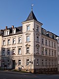 |
Tenement house | Frauensteiner Strasse 28 (map) |
around 1895 (tenement) | Apartment building in a corner and closed development (see Frauensteiner Straße 26) |
09200168 |
 |
Two railway bridges | Friedrich-Olbricht-Strasse (map) |
around 1900 (bridge) | Two railway bridges, track feeder or loading road with two wall sections and two further wall sections south of the two bridges to Brander Strasse; Architecturally and structurally remarkable facility or underpass, gate-like designed entrance areas, especially on the southern side, significant in terms of building history and traffic history, also relevant to the townscape |
09200782 |
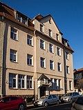 |
Tenement house | Friedrich-Olbricht-Strasse 2 (map) |
re. 1912 (residential building) | Tenement house in semi-open development; simple but characteristic example of residential building architecture after 1900, the entrance highlighted by design, forms a striking ensemble with No. 4, significant in terms of building history and urban development history |
09201010 |
 |
Tenement house | Friedrich-Olbricht-Strasse 4 (map) |
1912 (residential building) | Apartment building in closed development; A somewhat more elaborate example of residential building architecture after 1900 with objectified facade elements and a rich portal, forms a striking ensemble with No. 2, significant in terms of building history and urban development history |
09201011 |
 |
Elevated tank system | Hegelstrasse 45 (map) |
1904 & 1912 (waterworks) | Elevated tank system with embankment and two valve houses; Remarkable in terms of design, the front building with Art Nouveau decor, significant in terms of industrial, artistic and local history |
09200893 |
| Heap | Behind the Stockmühle (map) |
16th century (stockpile) | Halde (see Turmhofstraße 2) |
09200196 |
|
| Huthaus and Halde | Behind the Stockmühle 8 (map) |
around 1800 (hut house) | Huthaus and Halde; Significant in terms of mining history (see Turmhofstrasse 2) |
09200197 |
|
 |
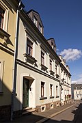
Residential building | Hirtengasse 4 (map) |
around 1880 (residential building) | Residential house in closed development; Simple but characteristic suburban house from the second half of the 19th century, part of a row with similar houses, all of which have largely been preserved in their original state and thus give a clear impression of the architecture of that time for the broad mass of the people, next to Roter Weg 10 –16 the only ensemble in such good condition, significant in terms of building history, social history and urban development history |
09200064 |
 |
Residential building | Hirtengasse 6 (map) |
around 1880 (residential building) | Residential house in closed development; Simple but characteristic suburban house from the second half of the 19th century, part of a row with similar houses, all of which have largely been preserved in their original state and thus give a clear impression of the architecture of that time for the broad mass of the people, next to Roter Weg 10 –16 the only ensemble in such good condition, significant in terms of building history, social history and urban development history |
09201061 |
| Residential building | Hirtengasse 8 (map) |
around 1880 (residential building) | Residential house in closed development; Simple but characteristic suburban house from the second half of the 19th century, part of a row with similar houses, all of which have largely been preserved in their original state and thus give a clear impression of the architecture of that time for the broad mass of the people, next to Roter Weg 10 –16 the only ensemble in such good condition, significant in terms of building history, social history and urban development history |
09201062 |
|
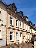 |
Residential building | Hirtengasse 10 (map) |
around 1880 (residential building) | Residential house in closed development; Simple but characteristic suburban house from the second half of the 19th century, part of a row with similar houses, all of which have largely been preserved in their original state and thus give a clear impression of the architecture of that time for the broad mass of the people, next to Roter Weg 10 –16 the only ensemble in such good condition, significant in terms of building history, social history and urban development history |
09201063 |
| Residential building | Hirtengasse 12 (map) |
around 1880 (residential building) | Residential house in closed development; Simple but characteristic suburban house from the second half of the 19th century, part of a row with similar houses, all of which have largely been preserved in their original state and thus give a clear impression of the architecture of that time for the broad mass of the people, next to Roter Weg 10 –16 the only ensemble in such good condition, significant in terms of building history, social history and urban development history |
09201064 |
|
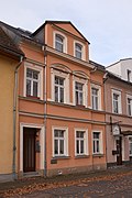 |
Residential building | Hirtengasse 16 (map) |
around 1880 (residential building) | Residential house in closed development; Simple but characteristic suburban house from the second half of the 19th century, part of a row with similar houses, all of which have largely been preserved in their original state and thus give a clear impression of the architecture of that time for the broad mass of the people, next to Roter Weg 10 –16 the only ensemble in such good condition, significant in terms of building history, social history and urban development history |
09201065 |
 |
Tenement house | Humboldtstrasse 1 (map) |
around 1900 (tenement) | Prestigious apartment building in a corner in a closed area, tower with Belvedere above the corner; Significant in terms of building and urban development history |
09200085 |
 |
Tenement house | Humboldtstrasse 3 (map) |
around 1885 (tenement) | Apartment building in closed development; Significant in terms of building and urban development history |
09200084 |
 |
Administration building | Humboldtstrasse 13 (map) |
around 1925 (administration building) | Administration building; three-storey corner building with a round railing on the corner, significant in terms of construction and local history |
09200083 |
| Residential building | Humboldtstrasse 17 (map) |
1876/1891 (tenement house) | Residential house in closed development; Part of a row with four two-storey houses showing distinctive late classicist decor, the best preserved houses within the so-called station suburb from the first building phase in the 19th century, important in terms of building and urban development history |
09200081 |
|
| Residential building | Humboldtstrasse 19 (map) |
1876/1891 (tenement house) | Residential house in closed development; Part of a row with four two-storey houses showing distinctive late classicist decor, the best preserved houses within the so-called station suburb from the first building phase in the 19th century, important in terms of building and urban development history |
08992525 |
|
| Residential building | Humboldtstrasse 21 (map) |
1876/1891 (tenement house) | Residential house in closed development; Part of a row with four two-storey houses showing distinctive late classicist decor, the best preserved houses within the so-called station suburb from the first building phase in the 19th century, important in terms of building and urban development history |
08992526 |
|
| Residential building | Humboldtstrasse 23 (map) |
1876/1891 (tenement house) | Residential house in closed development; Part of a row with four two-storey houses showing distinctive late classicist decor, the best preserved houses within the so-called station suburb from the first building phase in the 19th century, important in terms of building and urban development history |
08992527 |
|
| Tenement house | Humboldtstrasse 24 (map) |
around 1885 (tenement) | Apartment building in closed development; with house no. 28 one of the most architecturally demanding and probably also the most originally preserved residential buildings in the so-called Bahnhofsvorstadt, significant in terms of building and urban development |
09200082 |
|
| Tenement house | Humboldtstrasse 28 (map) |
around 1885 (tenement) | Apartment building in closed development; with house no. 26 one of the most architecturally demanding and probably also the most originally preserved residential buildings in the so-called Bahnhofsvorstadt, significant in terms of building and urban development history |
09200080 |
|
| Two heaps | Käthe-Kollwitz-Strasse & Thomas-Müntzer-Strasse (map) |
16th to 19th century (mining complex) | Two heaps of the shaft of the same name; largely preserved in its original form, especially the heap on Thomas-Müntzer-Strasse with a show value (Oberer Michaelisschacht), both relatively high conical heaps, with and without typical vegetation, of relevance to mining and local history |
08992440 |
|
 |
Residential building | Käthe-Kollwitz-Strasse 77 (map) |
1936–1937 (residential building) | Residential building; Remaining remnants of a once remarkable urban development, monument properties must be checked (see also Franz-Mehring-Platz 3, 6, 8, 11, 12, 16, 21, 27, 28) |
09200880 |
 |
Residential building | Körnerstrasse 1 (map) |
1873 (residential house) | Residential house in closed development; Part of a series of similarly designed buildings (except No. 3) with a prominent central projection, including roof bay, cornice, cornice as well as late classical facade design (triangular and segmented arched gables, capitals, gable decorations, consoles, lintels, etc.), significant in terms of building and urban development history |
09200090 |
 |
Production building | Körnerstrasse 2 (map) |
re. 1892 (weather vane) | Production building (former) and ancillary building with ornamental framework; The oldest still preserved and traditional brewery in Freiberg, significant in terms of local and industrial history |
09200092 |
 |
Residential building | Körnerstrasse 3 (map) |
around 1875 (residential building) | Residential house in closed development; late classical design, plaster usage, significant in terms of building and urban development history |
08992528 |
 |
school-building | Körnerstrasse 4 (map) |
1868 (school) | School building with rear building; Impressive building in neo-renaissance forms, elaborate facade structure, wide roof overhang, strong cornice, historically and artistically significant |
09200091 |
 |
Residential building | Körnerstrasse 5 (map) |
1873 (residential house) | Residential house in closed development; Significant in terms of building and urban development history (see also No. 1) |
08992529 |
 |
Residential building | Körnerstrasse 7 (map) |
1873 (residential house) | Residential house in closed development; Significant in terms of building and urban development history (see also No. 1) |
08992530 |
 |
Residential building | Körnerstrasse 9 (map) |
1873 (residential house) | Residential house in closed development; Significant in terms of building and urban development history (see also No. 1) |
08992531 |
| Residential building | Körnerstrasse 11 (map) |
1868 (residential house) | Residential house in closed development; Significant in terms of building and urban development history (see also No. 1) |
08992532 |
|
 |
Tenement house | Körnerstrasse 13 (map) |
around 1903 (tenement) | Apartment building in closed development; representative historicism building with a distinctive Gothic facade, different design of the window frames on each floor, significant in terms of building and urban development history |
09200089 |
 |
Tenement house | Körnerstrasse 15 (map) |
1903 (tenement) | Apartment building in closed development; representative historicism building, special accents through bay windows and entrance portal, variety of forms of design elements, significant in terms of building and urban development history |
09200088 |
 |
Tenement house | Körnerstrasse 17 (map) |
1903 (tenement) | Apartment building in closed development; Representative building with one of the most attractive Art Nouveau facades in Freiberg, significant in terms of building and urban development history and artistic |
09200087 |
 |
Tenement house | Körnerstrasse 19 (map) |
re. 1903 (facade) | Apartment building in closed development; Representative building with an elaborately designed historicist facade, bay windows, gables and open loggias set accents, while revitalization through architectural decoration, which is significant in terms of building and urban development history and artistically |
09200086 |
 |
Residential and commercial building | Körnerstrasse 21 (map) |
1903 (residential and commercial building) | Residential and commercial building in closed development; Corner building with a remarkable Art Nouveau facade and original shop fittings, significant in terms of urban development history and artistically, also one of the most representative corner buildings in Freiberg |
09200105 |
| Apartment building | Kurt-Eisner-Strasse 1 (map) |
around 1937 (residential building) | Apartment building in a settlement; With the other similarly designed buildings on Kurt-Eisner-Strasse in close design and urban development context with the residential complex of Franz-Mehring-Platz originally called Am Sonnenrad, a simple rectangular building with a gable roof and perforated facade, a typical example of NS housing estate architecture of architectural and contemporary value , also significant as part of an overall concept with an unusual floor plan (see also Kurt-Eisner-Straße 2–10) |
09201069 |
|
 |
Apartment building | Kurt-Eisner-Strasse 10 (map) |
around 1937 (residential building) | see Kurt-Eisner-Straße 1 |
09201078 |
 |
Apartment building | Kurt-Eisner-Strasse 2 (map) |
around 1937 (residential building) | see Kurt-Eisner-Straße 1 |
09201070 |
| Apartment building | Kurt-Eisner-Strasse 3 (map) |
around 1937 (residential building) | see Kurt-Eisner-Straße 1 |
09201071 |
|
 |
Apartment building | Kurt-Eisner-Strasse 4 (map) |
around 1937 (residential building) | see Kurt-Eisner-Straße 1 |
09201072 |
| Apartment building | Kurt-Eisner-Strasse 5 (map) |
around 1937 (residential building) | see Kurt-Eisner-Straße 1 |
09201073 |
|
| Apartment building | Kurt-Eisner-Strasse 6 (map) |
around 1937 (residential building) | see Kurt-Eisner-Straße 1 |
09201074 |
|
| Apartment building | Kurt-Eisner-Strasse 7 (map) |
around 1937 (residential building) | see Kurt-Eisner-Straße 1 |
09201075 |
|
 |
Apartment building | Kurt-Eisner-Strasse 8 (map) |
around 1937 (residential building) | see Kurt-Eisner-Straße 1 |
09201076 |
| Apartment building | Kurt-Eisner-Strasse 9 (map) |
around 1937 (residential building) | see Kurt-Eisner-Straße 1 |
09201077 |
|
 |
Residential building | Lange Strasse 13 (map) |
End of 17th century (in the core) | House and back building of a former farm (later rebuilt several times); Half-timbered rear building, one of the oldest buildings in the so-called Bahnhofsvorstadt, significant in terms of urban development |
09200119 |
 |
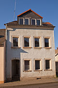
gym | Lange Strasse 44 (map) |
after 1900 (gym) | Gym; striking elongated building with elaborate design, significant in terms of building and urban development history |
09200122 |
 |
two-storey house | Lange Strasse 56 (map) |
Mid 19th century (residential building) | Small two-storey residential building in closed development; Significant in terms of urban development history |
09200115 |
 |
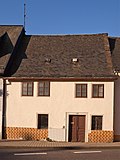
Residential building | Lange Strasse 58 (map) |
around 1800 (residential building) | Residential house in closed development; Small two-storey building, is one of the oldest buildings in the so-called Bahnhofsvorstadt, forms a remarkable and unmistakable ensemble with the neighboring buildings, significant in terms of building and urban development as well as urban planning |
09200114 |
 |
Residential building | Lange Strasse 60 (map) |
around 1800 (residential building) | Residential house in closed development; Small two-storey building, is one of the oldest buildings in the so-called Bahnhofsvorstadt, forms a remarkable and unmistakable ensemble with the neighboring buildings, significant in terms of building and urban development as well as urban planning |
09200113 |
 |
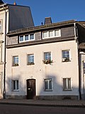
Residential building | Lange Strasse 62 (map) |
around 1800 (residential building) | Residential house in closed development; Small two-storey building, is one of the oldest buildings in the so-called Bahnhofsvorstadt, forms a remarkable and unmistakable ensemble with the neighboring buildings, significant in terms of building and urban development as well as urban planning |
09200112 |
 |
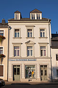
Residential building | Lange Strasse 64 (map) |
re. 1844 (residential house) | Residential house in closed development; small two-storey building, forms with the neighboring buildings a remarkable and unmistakable urban ensemble, significant in terms of urban development history and urban planning |
09200111 |
 |
Tenement house | Lange Strasse 66 (map) |
around 1895 (tenement) | Apartment building with shop in closed development; Together with the neighboring buildings, it forms a remarkable and unmistakable urban ensemble, significant in terms of urban development history and urban planning |
09200110 |
| Heap | Max-Roscher-Strasse (map) |
16th to 18th century (Halde) | Halde (see OT Zug, Schulstrasse 14/16) |
08992507 |
|
 |
Former Hospital for miners | Mühlgasse 2a (map) |
re. 1793 (hospital) | Hospital for miners; Today a residential building, a striking building with a half-hipped roof and segmented arch portal, an example of a simple, almost rural-looking Freiberg baroque building, significant in terms of architecture and local history |
09200130 |
 |
Rectangular stone made of Rochlitz porphyry tuff | October Victims Square (map) |
1945 (memorial and memorial) | Individual monument of the whole Promenadenring: high rectangular stone made of Rochlitz porphyry tuff with inscriptions and the corresponding open space equipped with stone slabs; historically significant (memorable value) (see also material document - obj 09200740) |
09200961 |
 |
Post office building | Oktoberopfer Square 1 (map) |
re. 1888, re. 1888/1889 (Post) | Post office upside down; Three-wing, extremely representative clinker-sandstone building of historicism with a highlighted entrance area, of architectural, local and urban development historical value, also of artistic importance (increased degree of aesthetic or design quality, exemplary character for the style of historicism around 1890, etc.) |
09200232 |
 |
Residential and commercial building | October sacrifice square 2 (map) |
re. 1906 (residential and commercial building) | Residential and commercial building with enclosure in the head position and open development; striking historicizing building from the beginning of the 20th century, of architectural and urban development history and artistic significance (see also Roter Weg 2) |
09200072 |
 |
Residential building | October Victims Square 4 (map) |
around 1925 (residential building) | Residential house in closed development; forms a distinctive urban ensemble with neighboring buildings, important for the townscape and the history of urban development |
09200728 |
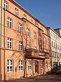 |
Residential and commercial building | October Victims Square 5 (map) |
re. 1929–1930 (residential and commercial building) | Residential and commercial building in closed development; Striking building from the 1920s, upgraded in terms of design with stone-view ground floor, entrance situation with pilasters and balcony, significant in terms of architectural, artistic and urban development history (today Deutsche Bank) |
09200727 |
 |
Residential and commercial building | October Victims Square 6 (map) |
1929–1930 (residential and commercial building) | Residential and commercial building; striking corner building of classic modernism with a functionalist structure, significant in terms of architectural history, urban development history and urban planning (today Commerzbank) |
09200726 |
 |
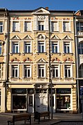
Residential building | Poststrasse 1 (map) |
re. 1895–1896 (residential and commercial building) | See Hornstrasse 2 |
09200203 |
 |
Tenement house | Poststrasse 10 (map) |
1896/1907 (tenement house) | Apartment building with shop area in closed development; distinctive historicizing building from the turn of the 19th to the 20th century with a characteristic clinker stone facade, narrow central projection, this and the window frames emphasized, significant in terms of building history, also as part of the most representative street of the Freiberg city expansion since the middle of the 19th century in terms of urban development history and Significant in terms of urban development |
08992508 |
 |
Tenement house | Poststrasse 12 (map) |
around 1900 (tenement) | Apartment building with shop in closed development; Distinctive historicism building with an elaborate facade design, significant in terms of architectural history, and as part of the most representative street of the Freiberg city expansion since the middle of the 19th century, important in terms of urban development history and urban planning |
09200212 |
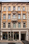 |
Tenement house | Poststrasse 14 (map) |
1898 (tenement) | Apartment building with shop in closed development; Extremely elaborate construction of the late historicism with a characteristic clinker stone facade, diverse architectural decorations, the central axis highlighted by, among other things, the Hermenpilaster, because of its special conciseness and effect on the viewer, historically and artistically significant, also as part of the most representative street of the Freiberg city expansion since the Significant in terms of urban development history and urban planning in the middle of the 19th century |
09200213 |
| Tenement house | Poststrasse 16 (map) |
around 1900 (tenement) | Apartment building with shop in closed development; Distinctive historicism building with an elaborate facade design, significant in terms of architectural history, and as part of the most representative street of the Freiberg city expansion since the middle of the 19th century, important in terms of urban development history and urban planning |
09200214 |
|
| Tenement house | Poststrasse 18 (map) |
re. 1907 (tenement) | Apartment building with shop in closed development; Distinctive building from the beginning of the 20th century, significant in terms of building history, and as part of the most representative street of the Freiberg city expansion since the middle of the 19th century, important in terms of urban development history and urban planning |
09200198 |
|
 |
Residential and commercial building | Poststrasse 1a (map) |
1900–1901 (residential and commercial building) | Residential and commercial building in closed development; representative building combines historicism and art nouveau elements, acquired shortly after completion by the Allgemeine Deutsche Creditanstalt, historically and artistically significant, and as part of the most representative street of the Freiberg city expansion since the middle of the 19th century, important in terms of urban development history and urban planning |
09200204 |
 |
Tenement house | Poststrasse 2 (map) |
1889/1896 (tenement house) | Apartment building with shop in closed development; Distinctive historicism building with an elaborate facade design, significant in terms of architectural history, and as part of the most representative street of the Freiberg city expansion since the middle of the 19th century, important in terms of urban development history and urban planning |
09200205 |
| Tenement house | Poststrasse 20 (map) |
re. 1907 (tenement) | Apartment building with shop in closed development; Distinctive building from the beginning of the 20th century, significant in terms of building history, and as part of the most representative street of the Freiberg city expansion since the middle of the 19th century, important in terms of urban development history and urban planning |
09200199 |
|
 |
Residential building | Poststrasse 22 (map) |
around 1800 (residential building) | Residential house in closed development; The last example of the suburban development before the city expansion since the middle of the 19th century on Poststrasse, two-storey building with a perforated facade, pitched roof and continuous towing hatch, documents in the most vivid way with the immediately neighboring Wilhelminian-style buildings the urban change, which is important in terms of urban development history |
09200202 |
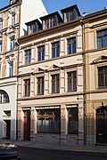 |
Tenement house | Poststrasse 3 (map) |
1871/1887 (tenement house) | Apartment building with shop in closed development; Distinctive historicism building with an elaborate facade design, significant in terms of architectural history, and as part of the most representative street of the Freiberg city expansion since the middle of the 19th century, important in terms of urban development history and urban planning |
09200208 |
 |
Tenement house | Poststrasse 4 (map) |
1889/1896 (tenement house) | Apartment building with shop in closed development; Distinctive historicism building with an elaborate facade design, significant in terms of architectural history, and as part of the most representative street of the Freiberg city expansion since the middle of the 19th century, important in terms of urban development history and urban planning |
09200206 |
 |
Tenement house | Poststrasse 5 (map) |
1871/1887 (tenement house) | Apartment building with shop in closed development; Broad facade with a central projection, highlighted by a gable triangle, striking historicism building, significant in terms of architectural history, and as part of the most representative street of Freiberg city expansion since the middle of the 19th century, important in terms of urban development history and urban planning |
09200209 |
| Tenement house | Poststrasse 6 (map) |
1889/1896 (tenement house) | Apartment building with restaurant area on the ground floor in closed development; Distinctive historicism building with an elaborate facade design, significant in terms of architectural history, and as part of the most representative street of the Freiberg city expansion since the middle of the 19th century, important in terms of urban development history and urban planning |
09200207 |
|
 |
Tenement house | Poststrasse 7 (map) |
1871/1887 (tenement house) | Apartment building with shop in closed development; Distinctive historicism building with an elaborate facade design, significant in terms of architectural history, and as part of the most representative street of the Freiberg city expansion since the middle of the 19th century, important in terms of urban development history and urban planning |
09200200 |
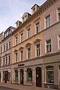
| Residential and commercial building | Poststrasse 8 (map) |
1907 (residential and commercial building) | Residential and commercial building in closed development; with bay window and triangular gable over eaves, facade with geometric Art Nouveau ornamentation and ornamentation, striking building from the beginning of the 20th century, historically and artistically significant, also as part of the most representative street of the Freiberg urban expansion since the middle of the 19th century, important in terms of urban development history and urban planning |
09200210 |
|
 |
Tenement house | Poststrasse 9 (map) |
1871/1887 (tenement house) | Apartment building with shop in closed development; Distinctive historicism building with an elaborate facade design, significant in terms of architectural history, and as part of the most representative street of the Freiberg city expansion since the middle of the 19th century, important in terms of urban development history and urban planning |
09200201 |
 |
Residential building | Red way 10 (map) |
around 1870 (residential building) | Residential building with front garden and enclosure; Suburban building from the second half of the 19th century, largely in its original state, also part of a group of houses with an unmistakable character, significant in terms of building history and urban development history (see also Roter Weg 12–16) |
09200074 |
 |
Residential building | Red path 12 (map) |
around 1870 (residential building) | Residential building with front garden and enclosure; Suburban building from the second half of the 19th century, largely in its original state, also part of a group of houses with an unmistakable character, significant in terms of building history and urban development history (see also Roter Weg 10, 12 and 16) |
09201041 |
 |
Heap | Red path 13 (map) |
around 1850 (mining) | Dump; significant in terms of mining history |
09200073 |
 |
Residential building | Red way 14 (map) |
around 1870 (residential building) | Residential building with front garden and enclosure; Suburban building from the second half of the 19th century, largely in its original state, also part of a group of houses with an unmistakable character, significant in terms of building history and urban development history (see also Roter Weg 10, 12 and 16) |
09201042 |
 |
Residential building | Red Path 16 (map) |
around 1870 (residential building) | Residential building with front garden and enclosure; Suburban building from the second half of the 19th century, largely in its original state, also part of a group of houses with an unmistakable character, significant in terms of building history and urban development history (see also Roter Weg 10-14) |
09201043 |
 |
Residential and commercial building | Red path 2 (map) |
re. 1906 (residential and commercial building) | see Platz der Oktoberopfer 2 |
09200071 |
 |
Residential building | Red way 28 (map) |
2nd half of the 19th century, ornamented around 1910 (residential building) | Residential house in open development; Figure of a miner on a pillar, striking building with emphasis on the entrance axis, sophisticated design, the economical but effective accentuating jewelry from 1910, significant in terms of building and urban development history |
09200070 |
 |
Administration building | Red route 41; 43 (map) |
before 1930 (administration building) | Administration building; Two-storey building as corner design, with clinker plaster facade, entrance building highlighted by vertical window structure, characteristic example of the architecture of the 1920s as a traditional multi-storey building, enriched by expressionistic clinker brick structures between the windows (with these forming ribbon windows typical of the time) and modern glazed stairwell, historically and artistically significant , probably the ambitious building by Stadtbaurat Salzmann, unique in this form |
09200067 |
| Villa-like house | Sachsenhofstrasse 1 (map) |
1908 (residential building) | Villa-like house with fencing; Later Art Nouveau building, enlivened by half-timbered gable and street-side extension, accentuating jewelry, distinctive enclosure design, overall sophisticated design of the property, significant in terms of building and urban development history, probably also of artistic importance |
09200260 |
|
 |
Double tenement house | Sachsenhofstrasse 10; 12 (card) |
1908 (tenement) | Double apartment building in open development; Later Art Nouveau building with facade design typical of the time, structure by two gabled risalits, here still historicizing reminiscences (tail gables and volutes), significant in terms of building and urban development history |
09200259 |
| Double tenement house | Sachsenhofstrasse 3; 5 (card) |
1909 (tenement) | Double tenement house with fencing in open development; Art Nouveau building, especially noteworthy the enclosure, significant in terms of building and urban development |
09200261 |
|
 |
Double tenement house | Sachsenhofstrasse 6; 8 (card) |
1907 (tenement) | Double apartment building in open development; Later Art Nouveau building with remarkable facade design, structure by two gabled risalits with imaginative decorative elements, significant in terms of building and urban development history, probably also of artistic importance |
09200258 |
| Section of the city wall on Schillerstrasse | Schillerstrasse (map) |
from 1397 (city wall) | Individual monument of the promenade ring and city wall: section of the city wall (ring wall, inner wall) with a wall tower on Schillerstraße; in front of it Zwinger and Wallgraben, between Flst. 49 and Kornhaus, historical city fortifications, one of the few late medieval structures in Saxony still preserved in this form, significant in terms of building history, local history, urban development history and urban planning, and with rarity value (see also Donatsturm, Donatsring and Meißner Ring as well as the whole document - obj 09200740) |
09200732 |
|
 |
villa | Schillerstraße 11 (map) |
4th quarter of the 19th century (villa) | Villa; representative late classicist building with a prominent central projection, covered entrance and elaborate facade decoration, noble and creatively sophisticated, one of the most architecturally remarkable examples of villa architecture from the end of the 19th century in Freiberg, historically and artistically significant, and with neighboring buildings also valuable in terms of urban development |
09200052 |
 |
Residential building | Schillerstraße 12 (map) |
1847 (residential house) | Residential house in half-open development; Part of the urban development that is important in terms of urban development, significant in terms of urban development history |
08992515 |
 |
Residential building | Schillerstraße 14 (map) |
1844 (residential house) | Residential house in closed development; Very simple late classicist building from the Biedermeier period, highlighting of the ground floor and the central axis, with a striking Palladian motif and a wide balcony, significant in terms of building and urban development history |
08992516 |
 |
Duplex house | Schillerstrasse 15; 17 (map) |
1864 (residential building) | Double dwelling in open development; late classicist building, significant in terms of building and urban development history |
09200053 |
 |
Tenement house | Schillerstraße 16 (map) |
around 1860 (tenement) | Apartment building in closed development; A corner building that characterizes the townscape and is important in terms of urban development history with a tower over a polygonal floor plan (see also Fischerstraße 49) |
09200612 |
 |
Villa-like residential building | Schillerstraße 5 (map) |
around 1890 (residential building) | Villa-like house in open development; Inside, high-quality fittings, such as richly designed banisters, stucco decor, Art Nouveau windows, etc., significant in terms of building and urban development history, parts of the fittings are also artistically important |
09201623 |
 |
villa | Schillerstraße 7 (map) |
1867 and 1876 (remodeling) | Villa; historicizing building with an axial structure of the facade, design accents through a prominent central axis, entrance area and side extension; Significant in terms of building history and urban development history, with neighboring buildings valuable in terms of urban planning |
09200957 |
 |
villa | Schillerstraße 9 (map) |
1867 and 1912 (renovation) | Villa; Construction of early objectivity with restrained, historicizing facade elements, significant in terms of building history and urban development history, also valuable in terms of urban planning with neighboring buildings |
09200699 |
| Painted board wall, two ceilings | Schöne Gasse 6 (map) |
17th century (component) | Painted plank wall, two ceilings, one of which is laid on a herringbone from the old building, Schöne Gasse 8, which has since been demolished; important in terms of building history and probably also artistically |
08992450 |
|
 |
Tenement house | Schönlebestrasse 10 (map) |
around 1900 (tenement) | Apartment building in closed development; Part of a striking street from the turn of the 19th and 20th centuries, significant in terms of urban development |
09200277 |
 |
Tenement house | Schönlebestrasse 12 (map) |
around 1900 (tenement) | Apartment building in closed development; Part of a striking street from the turn of the 19th and 20th centuries, significant in terms of urban development |
09200276 |
| Tenement house | Schönlebestrasse 13 (map) |
re. 1904 (tenement) | Apartment building in closed development; Representative historicizing building, enlivened by Art Nouveau ornamentation, with a balanced facade structure, decorative elements used to accentuate, especially on the two striking bay windows, significant in terms of building and urban development history, probably also of artistic importance |
09200263 |
|
 |
Tenement house | Schönlebestrasse 14 (map) |
around 1900 (tenement) | Tenement house in semi-open development; Part of a striking street from the turn of the 19th and 20th centuries, significant in terms of urban development |
09200275 |
| Tenement house | Schönlebestrasse 15 (map) |
re. 1904 (tenement) | Apartment building in closed development; Representative building with a side gabled risalit and bay window, the decoration partly with Art Nouveau ornamentation, a beautiful example of the interplay of historicism and Art Nouveau around 1900, significant in terms of building and urban development history |
09200262 |
|
 |
Tenement house | Schönlebestrasse 16 (map) |
around 1900 (tenement) | Apartment building in closed development; Representative historicist building with clinker and stone structure typical of the time and rich, varied architectural decoration, the first floor (as a so-called bel étage) and eaves area highlighted, characteristic example of the architecture of that time, significant in terms of building and urban development history |
09200274 |
 |
Tenement house | Schönlebestrasse 18 (map) |
around 1900 (tenement) | Apartment building in closed development; Representative historicism building with clinker and stone structure typical of the time and rich, varied architectural decoration, remarkable the two gabled side risalits (based on the tail gable of the German Renaissance), one of the most aesthetically effective Freiberg buildings from the period around 1900, historically important in terms of building and urban development as well as artistically significant |
09200273 |
 |
Tenement house | Schönlebestraße 20 (map) |
around 1900 (tenement) | Apartment building in closed development; Representative historicism building with a side gabled risalit and varied architectural decorations, significant in terms of building and urban development history |
09200272 |
 |
Tenement house | Schönlebestrasse 23 (map) |
around 1900 (tenement) | Apartment building in closed development; Part of a striking street from the turn of the 19th and 20th centuries, significant in terms of urban development |
09200270 |
 |
Tenement house | Schönlebestrasse 25 (map) |
around 1900 (tenement) | Apartment building in closed development; Part of a striking street from the turn of the 19th and 20th centuries, significant in terms of urban development |
09200271 |
 |
Tenement house | Schönlebestraße 26 (map) |
after 1900 (tenement) | Apartment building in closed development; Part of a striking street from the turn of the 19th and 20th centuries, significant in terms of urban development |
09200264 |
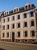 |
Tenement house | Schönlebestrasse 28 (map) |
after 1900 (tenement) | Apartment building in closed development; Distinctive building with a striking (special) Art Nouveau facade, entrance axis tending to the left, nevertheless overall impression coherent and balanced, accents through window frames and frieze under the eaves, significant building and urban development history as well as artistically |
09200265 |
 |
Tenement house | Schönlebestrasse 30 (map) |
re. 1914–1915 (tenement) | Apartment building in closed development; Part of a striking street from the turn of the 19th and 20th centuries, significant in terms of urban development |
09200266 |
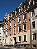 |
Tenement house | Schönlebestraße 32 (map) |
after 1900 (tenement) | Apartment building in closed development; Part of a striking street from the turn of the 19th and 20th centuries, significant in terms of urban development |
09200267 |
 |
Tenement house | Schönlebestrasse 40 (map) |
after 1900 (tenement) | Apartment building in closed development; Part of a striking street from the turn of the 19th and 20th centuries, significant in terms of urban development |
09200268 |
 |
Tenement house | Schönlebestraße 42 (map) |
after 1900 (tenement) | Apartment building in closed development; Distinctive building with Art Nouveau facade (compare with house no. 28, but not of such high quality), ornamentation used sparingly, characteristic of the late phase of Art Nouveau, significant in terms of building and urban development history |
09200269 |
| Tenement house | Schönlebestrasse 5 (map) |
1905 (tenement) | Tenement house in semi-open development; Remarkable building with an elaborate Art Nouveau facade, historically and artistically significant, also forms a striking ensemble with House No. 7 |
09200280 |
|
| Tenement house | Schönlebestrasse 7 (map) |
1905 (tenement) | Tenement house in semi-open development; Remarkable building with an elaborate Art Nouveau facade, historically and artistically significant, also forms a striking ensemble with House No. 5 |
09200281 |
|
 |
Tenement house | Schönlebestrasse 8 (map) |
around 1900 (tenement) | Apartment building in closed development; characteristic historicizing building with clinker-plaster-stone facade, revitalization in particular by window frames and roofing, significant in terms of building and urban development history |
09200278 |
| Tenement house | Schönlebestrasse 9 (map) |
1931 (tenement) | Apartment building in closed development; Objectively designed building around 1930, two balconies and window frames as the only decoration, significant in terms of building and urban development history |
09200282 |
|
 |
Three railway bridges | Silberhofstrasse (map) |
around 1900 (bridge) | Three railway bridges; architecturally and structurally remarkable underpass, significant in terms of building history and traffic history |
09201048 |
 |
Duplex house | Silberhofstrasse 2; 4 (card) |
3rd quarter of the 19th century (residential building) | Double dwelling in open development; Significant in terms of urban development history |
09200173 |
 |
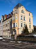
Double tenement house | Silberhofstrasse 3; 3a (card) |
after 1900 (tenement) | Double tenement house with parts of the enclosure in open development; representative group of buildings from the beginning of the 20th century, significant in terms of building and urban development history |
09200174 |
 |
Tenement house | Silberhofstrasse 7a (map) |
after 1900 (tenement) | Tenement house in semi-open development; Significant in terms of urban development history |
09205823 |
| Residential building | Silberhofstrasse 9 (map) |
in the core of the 18th century, re. 1836 (archway), re | Residential building with stables, barns, other stable buildings and archway; Last larger rural homestead in the urban expansion area of Freiberg, also a striking testimony to the folk architecture in the 18th and 19th centuries, significant in terms of urban development and architectural history |
09200243 |
|
 |
Residential building | Silberhofstrasse 10 (map) |
after 1900 (residential building) | Residential house in open development; small suburban building with half-timbered upper floor, significant in terms of urban development |
09200175 |
 |
Guard house | Silberhofstrasse 11a (map) |
around 1900 (gardener's property) | Guard house; Distinctive historic building, erected to look after the allotment gardeners of the "Bergmannsgruß" complex, significant building and local history |
09205604 |
 |
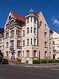
Tenement house | Silberhofstrasse 18 (map) |
1906 (tenement house) | Apartment building in open development; Elaborately designed residential building from the beginning of the 20th century with Gothicizing and Romanizing elements (pointed arched windows, arched curtain windows, shields, etc.), significant in terms of architectural and urban development history, with purely Gothicizing and Romanizing elements also unique (rarely found in buildings from 1900-1914) |
09200977 |
 |
Tenement house | Silberhofstrasse 24 (map) |
1905 (tenement) | Apartment house in corner position and half-open development; as one of the highest quality and most typical style Art Nouveau buildings in Freiberg (compare with Weingasse 8) in terms of building history and art as well as of urban development historical value |
09200975 |
| Tenement house | Silberhofstrasse 28 (map) |
around 1900 (tenement) | Apartment building in corner location and closed development; Representative historic building with clinker and stone structure typical of the time, the ground floor plastered and provided with ashlar, characteristic example of the architecture of that time, significant in terms of building and urban development history |
09200184 |
|
| Tenement house | Silberhofstrasse 30 (map) |
around 1890 (tenement) | Tenement house in semi-open development; Significant in terms of urban development history |
09200183 |
|
 |
Tenement house | Silberhofstrasse 32 (map) |
around 1890 (tenement) | Apartment building with shop in closed development; Significant in terms of urban development history |
09200182 |
| Tenement house | Silberhofstrasse 34 (map) |
around 1890 (tenement) | Tenement house in semi-open development; Significant in terms of urban development history |
09200181 |
|
 |
Tenement house | Silberhofstrasse 38 (map) |
around 1900 (tenement) | Apartment building in corner location and closed development; Significant in terms of urban development history |
09200179 |
 |
Tenement house | Silberhofstrasse 40 (map) |
around 1900 (tenement) | Tenement house in semi-open development; striking historicism building with a lavishly designed facade, significant in terms of building and urban development history |
09200178 |
| Tenement house | Silberhofstrasse 52 (map) |
1911–1913 (tenement) | Tenement house in semi-open development; forms the corner point of a striking house front on Bertholdsweg, significant in terms of building and urban development history |
09200177 |
|
| Factory building | Silberhofstrasse 80 (map) |
before 1930 (factory) | Factory building; striking corner building with expressionist facade design, significant in terms of building history |
09200172 |
|
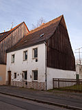 |
Residential building | Stollnhausgasse 14 (map) |
17th century (residential building) | Residential house in half-open development; characteristic small bourgeois house (or suburban house), probably from the 17th century, significant in terms of building history and urban development history, also part of an unmistakable building group of staggered houses that were built around the same time and thus of urban value two-storey houses, special urban development |
09200131 |
 |
Residential building | Stollnhausgasse 18 (map) |
18th century (residential building) | Residential house in half-open development; characteristic small bourgeois house (or suburban house), from the 18th century (in the core possibly older), significant in terms of building history and urban development history, also part of an unmistakable group of buildings of staggered houses built around the same time and thus of urban value two-storey houses, special urban development |
09200819 |
 |
Residential building | Stollnhausgasse 22 (map) |
18th century (residential building) | Residential house in half-open development; characteristic small bourgeois house (or suburban house), from the 18th century (in the core possibly older), significant in terms of building history and urban development history, also part of an unmistakable group of buildings of staggered houses built around the same time and thus of urban value two-storey houses, special urban development |
09200821 |
| Stockpile train | Thomas-Mann-Strasse (map) |
16th century (Halde) | Stockpile train; Elongated ensemble, relatively closed complex, the effect of which is underlined by the powder tower of the Grube Segen Gottes and Duke August (on the Turmhof Upper 8th dimension), essentially part of the Turmhof shaft, significant in terms of mining history and local history (see Turmhofstrasse 2) |
09200922 |
|
 |
Powder tower | Thomas-Mann-Strasse (map) |
18th century (mining) | Powder tower; Compact round tower made of quarry stone with a concluding conical roof, significant in terms of mining and local history |
09200921 |
 |
Former Youth home, later an inn | Thomas-Mann-Strasse 16 (map) |
1938 (organizational structure) | Former youth home, later an inn; striking half-timbered building with a pitched roof and granite base, erected as a HJ-Heim in connection with the former Martin-Mutzschmann-Siedlung (area south of the railway line with today's Franz-Mehring-Platz in the center), as an exposed and at the same time typical example of Nazi architecture (HJ -Heime played an important role in the building process of the Third Reich), of architectural, historical, etc. value |
09200920 |
 |
school-building | Turnerstrasse 1; 3 (card) |
1872–1874 and rel. 1872 (school) | School building with side, free-standing gymnasium; The former has an approximately U-shaped floor plan, a striking historicizing building with a pronounced central wing, two prominent portals and an elaborate structure, significant in terms of building and local history |
09200051 |
 |
school-building | Turnerstrasse 5 (map) |
1874–1876 (school) | School-building; Wide-spread building over a U-shaped floor plan, street facade with a raised central section, inside a portal, architecturally remarkable building of the Dresden School or Semper School, historically and artistically significant |
09200050 |
 |
villa | Turnerstrasse 6 (map) |
around 1875 (villa); Last quarter of the 19th century (villa garden / country house garden) | Villa with enclosure and villa garden; Lateral vestibule, late classicist building with a simple but also remarkably harmonious facade design, the central axis and the upper floor highlighted, accentuating the few decorative elements, give the building a noble appearance, property is architecturally and artistically significant |
09200045 |
 |
villa | Turnerstrasse 7 (map) |
around 1875 (villa) | Villa with enclosure and front garden (ancillary facility); simple late classicist building with pilaster structure, of architectural importance |
09200048 |
 |
Villa group | Turnerstrasse 8; 10 (card) |
around 1875 (villa) | Villa group; System on a U-shaped floor plan, late classicist property with restrained design and decoration, accented central axes and upper floor, typical of the time clearly legible, significant in terms of building history |
09200046 |
 |
Villa-like residential building | Turnerstrasse 12 (map) |
1869 (villa) | Villa-like residential building and front garden (ancillary facility) with enclosure, corner pavilion and seating area; Originally a manufacturer's villa, restrained but also sophisticated facade design with a few accentuating decorative elements, interior fittings from the time of origin, significant in terms of building and urban development history |
08992510 |
 |
Tenement house | Turnerstrasse 14 (map) |
around 1875 (tenement) | Apartment house in corner location in open development; striking historicizing corner building with window coverings reminiscent of Tudor Gothic, typical building for the time, significant in terms of architectural history |
09200049 |
 |
Residential complex | Wernerplatz 8; 9 (card) |
1938 (residential complex) | Housing complex with an L-shaped floor plan; typical system of the 1930s, granite base, (see also Wernerstraße 11), significant in terms of building and urban development history |
09200109 |
 |
Administration building | Wernerplatz 10 (map) |
re. 1906–1907 (administration building) | Administration building; Today AOK, despite the later simplified facade design, a remarkable building from the beginning of the 20th century with striking sculptural decoration on the street front and large parts of the original furnishings, significant in terms of building and urban development history, probably also artistically important |
09200108 |
 |
Huthaus and Halde | Wernerplatz 15 (map) |
Mid 18th century (mining) | Huthaus and Halde; Comparatively eye-catching and characteristic hut house with a pitched roof and bat dome as a design accent, stands on the stockpile, significant in terms of building and mining history |
09200107 |
 |
Tenement house | Wernerplatz 16 (map) |
around 1885 (tenement) | Apartment house in a corner in a semi-open development; Simple, late classicist, yet striking building at the entrance to Bahnhofstrasse, significant in terms of building and urban development history |
09200106 |
 |
Residential building | Wernerstraße 3 (map) |
around 1875 (residential building) | Residential house in closed development; Distinctive late classicist building, restrained, only accentuating jewelry, at the same time effective, significant in terms of building and urban development history |
09200134 |
 |
Tenement house | Wernerstraße 7 (map) |
around 1900 (tenement) | Apartment building with shop in closed development; characteristic Wilhelminian style residential building with clinker stone facade, striking window roofing, significant in terms of building and urban development history |
09200133 |
 |
Tenement house | Wernerstraße 9 (map) |
around 1900 (tenement) | Apartment building in closed development; characteristic Wilhelminian style residential building with clinker ashlar facade, the ground floor with rustication, balanced structure with emphasis on the center, accentuating jewelry, sophisticated design, significance for building and urban development, probably also of architectural importance |
09200132 |
 |
Residential building | Wernerstraße 11 (map) |
1938 (apartment building) | see Wernerplatz 8 and 9 |
09200135 |
literature
- Yves Hoffmann, Uwe Richter (ed.): City of Freiberg. Vol. 1. (= Monument topography Federal Republic of Germany. Monuments in Saxony). Werbung & Verlag, Freiberg 2002, ISBN 3-936784-00-0 .
- Yves Hoffmann, Uwe Richter (ed.): City of Freiberg. Vol. 2. (= Monument topography Federal Republic of Germany. Monuments in Saxony). Werbung & Verlag, Freiberg 2003, ISBN 3-936784-01-9 .
- Yves Hoffmann, Uwe Richter (ed.): City of Freiberg. Vol. 3. (= Monument topography Federal Republic of Germany. Monuments in Saxony). Werbung & Verlag, Freiberg 2004, ISBN 3-936784-02-7 .
swell
- State Office for the Preservation of Monuments Saxony Dynamic web application: Overview of the monuments listed in Saxony. The location "Freiberg, Stadt, Universitätsstadt" must be selected in the dialog box, after which an address-specific selection is made. Alternatively, the ID can also be used. As soon as a selection has been made, further information about the selected object can be displayed and other monuments can be selected via the interactive map.
Web links
Commons : Cultural monuments in Freiberg-Süd - Collection of images