List of cultural monuments in Freiberg-Ost
The list of cultural monuments in Freiberg-Ost contains the cultural monuments of the Freiberg-Ost district of the Saxon city of Freiberg , which were recorded in the list of monuments by the State Office for Monument Preservation Saxony as of June 20, 2013.
Legend
- Image: shows a picture of the cultural monument and, if applicable, a link to further photos of the cultural monument in the Wikimedia Commons media archive
- Designation: Name, designation or the type of cultural monument
-
Location: If available, street name and house number of the cultural monument; The list is basically sorted according to this address. The map link leads to various map displays and gives the coordinates of the cultural monument.
- Map view to set coordinates. In this map view, cultural monuments are shown without coordinates with a red marker and can be placed on the map. Cultural monuments without a picture are marked with a blue marker, cultural monuments with a picture are marked with a green marker.
- Dating: indicates the year of completion or the date of the first mention or the period of construction
- Description: structural and historical details of the cultural monument, preferably the monument properties
-
ID: is awarded by the State Office for the Preservation of Monuments in Saxony. It clearly identifies the cultural monument. The link leads to a PDF document from the State Office for the Preservation of Monuments in Saxony, which summarizes the information on the monument, contains a map sketch and often a detailed description. For former cultural monuments sometimes no ID is given, if one is given, this is the former ID. The corresponding link leads to an empty document at the state office. The following icon can also be found in the ID column
 ; this leads to information on this cultural monument at Wikidata .
List of cultural monuments in Freiberg-Ost
| image | designation | location | Dating | description | ID |
|---|---|---|---|---|---|
 |
Railway house | At Ostbahnhof 1; 3 (card) |
1889 (official residence) | Railway house with shed; Typical civil servants' residence at the end of the 19th century with a clinker brick facade and a few design elements, significant in terms of building and traffic history |
09201012 |
| Tenement house | Breithauptstrasse 2 (map) |
around 1910 (tenement) | Apartment building in closed development; Example of residential building architecture after 1900 with objectified facade elements of the geometric Art Nouveau, significant in terms of building history and urban development history |
09200256 |
|
 |
sgraffito | Breithauptstrasse 4 (map) |
around 1955 (sgraffito) | Sgraffito depicting a family of miners; characteristic wall design from the GDR era, one of the last in Freiberg, of art historical and socio-historical value |
09200255 |
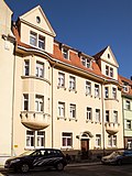 |
Tenement house | Breithauptstrasse 13 (map) |
around 1925 (tenement) | Apartment building in closed development; Significant in terms of urban development history |
09200253 |
| Residential building | Conradsdorfer Weg 4 (map) |
around 1840 (residential building) | Residential house in open development; characteristic rural building with planking and gable roof, possibly. Half-timbered construction on the upper floor, significant in terms of building history and urban development history |
09201006 |
|
 More pictures |
Unity Donatsfriedhof | Donatsring (card) |
1531 (cemetery); 1838 (New Donathsfriedhof); 1839 (cemetery gate house); 1430 (first mentioned, old Donatsfriedhof) | The Donatsfriedhof cemetery with the following individual monuments: crematorium or celebration hall (1927–1928), gatehouse, tombs, graves and enclosures (see also individual monument document - Obj. 09201487, same address); the older part (old Donatsfriedhof - Kirchhof) with all its graves, except the modern places in the peripheral areas as well as the cemetery design (garden monument); Significant in terms of location and personal history as well as significant in terms of architectural or artistic value |
09302561 |
 |
Round arch bridge | Dresdner Strasse (map) |
1924–1928 (road bridge) | Arched bridge; as a remarkable bridge structure of the twenties in terms of construction and landscape design, significant in terms of building history and traffic history, as well as of relevance for the view of the town |
09200950 |
 More pictures |
Jakobikirche | Dresdner Strasse 1 (map) |
1890-1892 (church); 1718 (organ) | Three-aisled hall church with a cross-shaped floor plan with a polygonal choir and west tower, plus valuable furnishings for the most part from the old Jakobikirche, which was demolished in 1889–1890; Distinctive neo-Gothic building, west tower with effective urban planning, remarkable example of church architecture from the end of the 19th century, takeover of the equipment from the previous building, major monument preservation achievement, church significant in terms of architectural, artistic, art-historical and urban planning |
09200237 |
 |
Rectory | Dresdner Strasse 3 (map) |
around 1895 (rectory) | Rectory; Two-storey building with gabled risalits to the street, neo-Gothic design based on the church, facade with high design standards, largely original, historically and artistically significant, and together with the church it forms an unmistakable urban ensemble |
09200238 |
 |
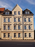
villa | Dresdner Strasse 11 (map) |
around 1925 (residential building) | Villa with enclosure; simple but well-balanced villa building from the twenties with expressionistic decorative elements; Significant in terms of building history and urban development history |
09201008 |
 |
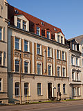
Tenement house | Dresdner Strasse 20 (map) |
around 1900 (tenement) | Tenement house in semi-open development; Distinctive historicizing building from the turn of the 19th to the 20th century, balanced facade design, special emphasis on the first floor through rich window frames, significant in terms of building and urban development history |
09200234 |
 |
Tenement house | Dresdner Strasse 22 (map) |
after 1900 (tenement) | Apartment building in closed development; Significant in terms of urban development history |
09200233 |
 |
Tenement house | Dresdner Strasse 24 (map) |
around 1910 (tenement) | Apartment building with shop in a corner and closed development; Significant in terms of urban development history |
09200257 |
 |
villa | Dresdner Strasse 28 (map) |
around 1927 (villa) | Villa with a small side entrance hall; The interior still has original furnishings, distinctive construction of the objectified architecture from 1900, clear structure, sparingly and accentuated jewelry, significant in terms of building history, artistry and urban planning |
09200235 |
| Heap | Dresdner Strasse 38 (map) |
from the 16th century (stockpile) | Halde (see Turmhofstraße 2) |
09200236 |
|
 |
villa | Frauensteiner Strasse 5 (map) |
1868 (villa) | Villa with covered entrance area; Late Classicist building with a high-quality and well-structured facade, accentuated by small balconies and aedicle-like, antique window frames on the upper floor, historically and artistically significant as a design by Carl Friedrich Göpfert, founder of a well-known Freiberg construction company, of personal history |
09200159 |
| Tenement house | Frauensteiner Strasse 12a (map) |
after 1900 (tenement) | Apartment building in a corner and open development; striking building from the time around 1900 with motifs of historicism and art nouveau, significant in terms of building and urban development history |
09200171 |
|
 |
Part of a double house | Frauensteiner Strasse 16 (map) |
Late 19th century (tenement house) | Part of a double tenement house with fencing in open development; Distinctive historic building with rich facade design, with the center highlighted, largely original, significant in terms of building and urban development history, probably also artistically important |
09200170 |
 |
Duplex house | Frauensteiner Strasse 36; 38 (card) |
re. 1923 (residential building) | Double dwelling in open development; Distinctive small apartment building from the 1920s with a plank lamellar roof, the latter rare roof construction experienced a renaissance after the First World War as the so-called Zollinger roof, a semi-detached house significant in terms of construction and urban development |
09200165 |
 |
Administration building | Frauensteiner Strasse 43 (map) |
1922 (administration building) | Administration building with extension (former test field and test field) and two garages; Four-wing complex with inner courtyard, the street side of the massive structure flanked by side towers, special effect of the facades through blinding structures, historically and artistically significant (see Frauensteiner Straße 47b – 51) |
09200162 |
 |
villa | Frauensteiner Strasse 45 (map) |
around 1914 (villa) | Villa; Erected for the director of the porcelain factory, striking residential building from the beginning of the 20th century, objectified with neoclassical and neo-baroque elements, historically and artistically significant (see Frauensteiner Straße 47b – 51) |
09200161 |
 |
Residential building | Frauensteiner Strasse 47 (map) |
around 1910 (residential building) | Residential house in open development; Former civil servants' residence, building with apartments for senior employees of the porcelain factory, striking design from the beginning of the 20th century, significant building and social history (see Frauensteiner Straße 47b – 51) |
09200163 |
 |
Factory complex | Frauensteiner Strasse 47b; 49a; 51 (card) |
1905–1906 (factory) | Factory complex with an L-shaped floor plan with a courtyard-side extension for a tunnel kiln; Complex with interesting brick architecture, characteristic of industrial buildings from around 1900, the striking corner tower on Knappenweg, associated with an administration building (see No. 43), the villa for the director (see No. 45) and two residential buildings for executives (see No. 47 and 49 ), Complex in terms of building and industrial history as well as urban planning |
09200164 |
 |
Residential building | Frauensteiner Strasse 49 (map) |
around 1910 (residential building) | Residential house in open development; Former civil servants' residence, building with apartments for executives of the porcelain factory, striking design from the beginning of the 20th century, significant building site and social history (see Frauensteiner Straße 47b / 51) |
09200062 |
 |
settlement | Frauensteiner Strasse 54; 56; 58 (card) |
1921–1927 (residential complex) | Settlement, see Bertholdsweg 56–80 |
09200160 |
 |
Two administration buildings | Frauensteiner Strasse 55; 57 (card) |
re. 1893-1894 (slaughterhouse) | Two administration buildings on the street side; representative with a striking clinker brick facade, buildings of what was originally a more extensive area; As part of the historic slaughterhouse of the city, it is significant in terms of local history and urban development history, and is also of architectural historical value (testimony to the architecture of urban utility buildings around 1900) |
09200810 |
| Tenement house | Frauensteiner Strasse 60 (map) |
around 1905 (tenement) | Tenement house in semi-open development; Highly designed residential building from the beginning of the 20th century with geometric Art Nouveau ornamentation, the windows also have an invigorating effect, largely originally preserved, significant in terms of building and urban development history |
09200153 |
|
 |
Tenement house | Frauensteiner Strasse 62 (map) |
around 1905 (tenement) | Apartment building in closed development; Sophisticated residential building, early 20th century, largely preserved in its original form, significant in terms of building and urban development history |
09200154 |
 |
Tenement house | Frauensteiner Strasse 66 (map) |
around 1905 (tenement) | Tenement house in semi-open development; Sophisticated residential building from the beginning of the 20th century, significant in terms of building and urban development history |
09200155 |
 |
Tenement house | Frauensteiner Strasse 72 (map) |
around 1900 (tenement) | Apartment building in open development; Significant in terms of building and urban development history |
09200156 |
| Heap | Fuchsmühlenweg (map) |
16.-18. Century (mining facility) | Dump; significant in terms of mining history |
08992424 |
|
| Heap | Fuchsmühlenweg (map) |
16.-18. Century (mining facility) | Dump; Significant in terms of mining history and landscape design |
08992427 |
|
 |
Railway bridge | Fuchsmühlenweg (map) |
1951 (bridge) | Railway bridge; Resting on two pillars, straight end, connecting railway to the German Fuel Institute, first oblique-angled prestressed concrete bridge in the GDR, significant in terms of traffic and technology |
09200283 |
| Dump group or train | Fuchsmühlenweg (map) |
16.-18. Century (mining facility) | Heaps group or train of seven heaps; Significant in terms of mining and local history and particularly noteworthy in terms of landscape design, despite its small size and size, the group is one of the most characteristic in the Freiberg area, picturesquely embedded in the landscape |
08992429 |
|
| Heap | Fuchsmühlenweg (map) |
16th - 18th century (mining complex) | Dump; characteristic cone dump with vegetation, still very well preserved, belongs to an area intensively used for mining, becomes clear in other dumps in the vicinity of St. Donatz, significant in terms of mining history and landscape design |
08992422 |
|
| Heap | Fuchsmühlenweg (map) |
16.-18. Century (mining facility) | Dump; significant in terms of mining history |
08992425 |
|
| Heap | Fuchsmühlenweg (map) |
16.-18. Century (stockpile) | Dump; large and distinctive heap with characteristic vegetation, of importance in terms of mining history and landscape design |
08992423 |
|
| Heap | Fuchsmühlenweg (map) |
16.-18. Century (mining facility) | Dump; significant in terms of mining history |
08992426 |
|
| Dump group or train | Fuchsmühlenweg (map) |
16.-18. Century (mining facility) | Heaps group or train of three heaps; Mining and local history significant |
08992428 |
|
 More pictures |
Mining facility | Fuchsmühlenweg 3 (map) |
16th century, 1810, 1829–1831, 1848–1849, around 1850, 1856 (mining) | Mining facility with boiler house, machine house and greenhouse or shaft building (1848–1849), prayer room (1856), cutting bench (until 1864), mountain forge (around 1850), protective building for Schwarzenberg blowers (1936), also remarkable features, e.g. Partly as pieces of the exhibition system (such as the unique Schwarzenberg blower from 1829 to 1831), as well as the large heap of the art and driving shaft and the smaller heap of the day shaft, further underground art wheel room (1810) as well as mining, routes and shafts (from the 16th century .); Unique and incomparable mining testimony of singular industrial and social historical importance, as well as of architectural, landscape and technical historical value |
09200766 |
 More pictures |
Mining ensemble | Fuchsmühlenweg 9 (map) |
from 1384 (mining facility); around 1890 (mountain forge); around 1890 (boiler and machine house); around 1890 (shaft building); around 1955 (academy) | Mining ensemble, main shaft of the Bergakademie teaching pit with buildings of a steam extraction system built from 1886, complex of old shaft building with winding tower, intermediate structure, machine house and new shaft building, plus a steiger house and mining forge, furthermore a cutting bank, ore roll, so-called ramming house and test track including shooting range and further Purpose-built building, as well as the institute building of the Bergakademie, large heap of the direction shaft (on which all buildings are located) and heap train consisting of seven heaps on the main tunnel; Mine complex with the greatest scenic impact, one of the most important dominants on the northern periphery of Freiberg (landmark of Freiberg mining), probably the most vivid mining complex in the city, structurally, historically, locally and scientifically significant, landscaping the dump of the mine shaft and the aforementioned dump train relevant |
09200986 |
 |
Inn and dump | Hammerberg 2 (map) |
re. 1801 (inn) | Inn and dump; striking half-timbered building with a half-hip roof, originally used for mining purposes, significant in terms of construction, mining and local history |
08992431 |
| War memorial, memorial stone, grave sites | Himmelfahrtsgasse (map) |
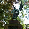
1946 (enclosure); 1946 ( World War II ) | Individual monuments and aggregate: War memorial, memorial stone, grave sites (see also aggregate document - Obj. 09200899, same address); Resting place of 114 soldiers and officers of the Red Army, either during the fighting in the Freiberg area on 6./7. May 1945 found death or later died of their wounds, historically (important for the interpretation of an era) and artistically significant |
09302560 |
|
 More pictures |
Material entirety Soviet cemetery of honor | Himmelfahrtsgasse (map) |
1946 (military cemetery); 1946 (aggregate) | Material entirety Soviet cemetery of honor with the following individual monuments: War memorial, memorial stone, graves (see also list of individual monuments - Obj. 09302560, same address) and cemetery design (garden monument); Resting place of 114 soldiers and officers of the Red Army, either during the fighting in the Freiberg area on 6./7. May 1945 found death or later died of their wounds, historically (important for the interpretation of an era) and artistically significant |
09200899 |
 |
Old china factory | Himmelfahrtsgasse 8 (map) |
1922 (factory) | Factory; Distinctive, widely visible industrial building in the New Objectivity style with a vertically structured facade and a dominating stair tower, built by one of the most famous architects working in Freiberg from the first half of the 20th century, Werner Retzlaff , important in terms of building history, industrial history and local history |
09201067 |
| Old Elisabeth | Himmelfahrtsgasse 11 (map) |
around 1700 (mining) | Hut house with heap; the small single-storey building with a gable roof, an example of the normal type of a hat house in the 17th to early 19th centuries, significant in terms of mining and local history |
09201016 |
|
 |
Inn | Himmelfahrtsgasse 13 (map) |
around 1905 (inn) | Inn; Traditional Freiberg inn with a highlighted entrance, of local historical value |
09201068 |
 More pictures |
David shaft | Himmelfahrtsgasse 30; 31; 32; 47 (card) |
1937–1942 (mining facility) | Mining facility from processing including inclined elevator, chow, machine and boiler house, residential building with shed as well as sand dump and bricked up main dump; reminds of the last resumption of mining in the 1930s, significant in terms of mining history |
08992433 |
 |
Saxon post mile pillars (totality) | Hornstrasse (map) |
re. 1723 | Electoral Saxon Post Distance Column from the former Hereditary Gate; made of pedestal, coat of arms and tip, sandstone obelisk, significant in terms of traffic history |
09200395 |
 |
Residential and commercial building | Hornstrasse 1 (map) |
re. 1896 (residential and commercial building) | Residential and commercial building in a corner and closed development; Distinctive Wilhelminian style building with elaborate facade design, figural decorations and in parts original shop fittings, significant in terms of architectural, artistic and urban development history, and also of significance for the local image at this point |
09200623 |
| Residential and commercial building | Hornstrasse 2 (map) |
Residential and commercial building in corner location and semi-open development; Rich Wilhelminian style building with opulent historicism facade, clinker cladding and sandstone structure, corner tower, bay window, etc., various accentuations through entrance designs, gables, roofing, consoles, surrounds, etc., characteristic construction of the eclectic late phase of historicism, also one of the most elaborate residential and commercial buildings in Freiberg with the post office building opposite, an unmistakable urban situation, significant in terms of building history, artistry and urban planning (see also Poststrasse 1) |
09200224 |
||
 |
balcony | Hornstrasse 3 (map) |
1898 (part of the building) | Balcony; Baroque-style building, created in 1898 when the house built in 1850 was increased; historically of value |
09200725 |
| Residential building | Hornstrasse 6 (map) |
1875 (residential building) | Residential house in half-open development; Simple late classicist building from the first phase of city expansion in Freiberg with restrained, but very noble, axial façade structure, roof structures also uniform, architecturally demanding, of importance in terms of the history of construction and urban development |
09200225 |
|
 |
Residential building | Hornstrasse 7 (map) |
1854 (residential house) | Residential house in closed development in a corner; representative historicizing building, historically significant, architecturally of high quality (artistic value), within a prominent section of the ring development also of importance from an urban planning point of view |
09200724 |
| Residential building | Hornstrasse 8 (map) |
around 1875 (residential building) | Residential house in closed development; Construction of the first phase of urban expansion in Freiberg, significant in terms of urban development |
09200226 |
|
 |
Double tenement house | Hornstrasse 9 (map) |
1890-1891 (tenement house) | Double apartment building in closed development; Cityscape-defining, representative building with an elaborate facade design and two tower-like structures at the corners, one of the most striking examples of Wilhelminian style or historicizing architecture in the late 19th century in Freiberg, significant in terms of architectural, artistic and urban development history (see also Wasserturmstraße 2) |
09200434 |
 |
Tenement house | Hornstrasse 10 (map) |
around 1900 (tenement) | Apartment building with shop in closed development; Late founding construction with facade design typical of the time, also part of the Freiberg Ring, significant in terms of building and urban development history |
09200227 |
 |
Tenement house | Hornstrasse 10a (map) |
around 1900 (tenement) | Apartment building in closed development; Late founding construction with facade design typical of the time, accentuation by bay windows and elaborate entrance portal, also part of the Freiberg ring, significant in terms of building and urban development history, |
09200228 |
 |
Tenement house | Hornstrasse 10b (map) |
around 1900 (tenement) | Apartment building in open development; Late founding construction with facade design typical of the time, also part of the Freiberg Ring, significant in terms of building and urban development history, |
09200229 |
 |
Tenement house | Hornstrasse 11 (map) |
1891 (tenement house) | Apartment building in closed development; representative building, as one of the most elaborate historicism buildings in Freiberg of architectural historical and architectural value, within a prominent section of the ring development also significant in terms of urban planning (important for the townscape) |
09200586 |
 |
Tenement house | Hornstrasse 13 (map) |
1888 (residential house) | Apartment building in closed development; representative building, structural testimony to historicism of architectural and urban development historical value, within a striking section of the ring development also significant in terms of urban planning (important for the townscape) |
09200587 |
 |
Residential building | Hornstrasse 14 (map) |
1874–1876 (residential building) | Residential house in half-open development; Design-demanding construction of the first urban development phase of Freiberg with a well-structured facade and accentuating architectural decorations, significant in terms of building and urban development history, probably also of architectural importance |
09200230 |
 |
Tenement house | Hornstrasse 15 (map) |
1880 (residential building) | Apartment building in closed development; with restrained but demanding facade design, valuable in terms of urban development history, within a striking section of the ring development also significant in terms of urban planning (important for the townscape) |
09200588 |
 |
Tenement house | Hornstrasse 17 (map) |
1867 and 1908 (residential building) | Apartment building in closed development; Clearly structured building from the 19th century, which was redesigned in 1908, with a design highlighted, unmistakable group of balconies, remarkable the elegantly curved balcony grilles and the gable triangle above the eaves, important as an architectural testimony (importance in terms of building history and urban development history), within a striking section of the ring development and also urban development valuable (important for the townscape) |
09200589 |
 |
Residential building | Hornstrasse 20 (map) |
re. 1743 (estate) | Residential house in open development; Main building of the manor, two-storey, with a gable roof, on the street side two entrances with segmental arches and apex stone (referenced), historically significant, as a former suburban property also of importance in terms of urban development history |
09200231 |
 |
Tenement house | Hornstrasse 21 (map) |
around 1860 (tenement) | Apartment building in closed development; Architecturally highlighted historicism building with plastering on the ground floor, central pilaster strips, balcony, acanthus frieze, etc., significant in terms of building history and urban development history, within a striking section of the ring development also of urban value (valuable for the townscape) |
09200590 |
 |
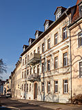
Residential building | Hornstrasse 22 (map) |
before 1871 (residential building) | Residential house in half-open development; Significant in terms of urban development history |
09200222 |
 |
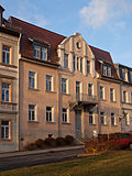
Tenement house | Hornstrasse 27 (map) |
around 1860 (tenement) | Apartment building in closed development; representative, late-classicist building, as a high-quality building from the 3rd quarter of the 19th century, significant in terms of building history, artistry and urban development history, within a prominent section of the ring development also of urban value (important for the townscape) |
09200591 |
 |
Tenement house | Hornstrasse 29 (map) |
1862 and 1907 (tenement house) | Apartment building in closed development; characteristic building, in its current form from 1907, with Art Nouveau facade, which also shows historicizing elements, as a building of the transition style between Historicism and Art Nouveau significant in terms of architectural and urban development history, within a striking section of the ring development also of urban value (important for the townscape) |
09200592 |
 |
Residential building | Hornstrasse 30 (map) |
before 1871 (residential building) | Residential house in half-open development, with shop; Significant in terms of urban development history |
09200223 |
 |
Tenement house | Hornstrasse 31 (map) |
around 1860 (residential building) | Apartment building in closed development; Significant in terms of urban development history, within a striking section of the ring development also valuable in terms of urban development (important for the townscape) |
09200593 |
 |
Residential building | Hornstrasse 33 (map) |
last quarter of the 19th century (residential building) | Residential house in closed development; Significant in terms of urban construction history, also part of an unmistakable urban ensemble |
09200798 |
 |
Residential building | Hornstrasse 35 (map) |
last quarter of the 19th century (residential building) | Residential house in half-open development; Significant in terms of urban development history, also part of an unmistakable urban ensemble |
09200795 |
| Trench and rose system | Huettenstrasse (map) |
1827–1839 and until 1855 (mining) | Graben and Rösch system of the Morgenstern mine; mining and water engineering system with alternating artificial trenches and roses as well as several mouth holes; significant mining testimony |
09200630 |
|
| Heap | Huettenstrasse (map) |
16th century (mining facility) | Dump; characteristic cone heap, the last remnant of an original series of heaps (heaps) on the ore vein standing on the cherry tree, especially significant in terms of mining and local history |
08992438 |
|
 |
Mining ensemble | Hüttenstrasse & Kohlenstrasse (map) |
1546/1624 and 1710/1840 (mining complex) | Mining ensemble with artificial ditch (Morgensterner Kunstgraben) group of heaps and individual heaps; Mining and local history significant |
08992439 |
| Tenement house | Jungestraße 12 (map) |
around 1900 (tenement) | Apartment building in closed development; Wilhelminian style building with a striking historicism facade, clinker stone design, characteristic of the time of origin, significant in terms of building and urban development history |
09200247 |
|
| Tenement house | Jungestraße 14 (map) |
around 1900 (tenement) | Apartment building in closed development; Originally preserved Wilhelminian style building with a historicizing clinker stone facade, significant in terms of building and urban development history |
09200248 |
|
 |
Artificial moat | Knappenweg (map) |
19th century (mining) | Artificial moat; Elongated moat with quarry stones, the aqueduct above Knappenweg, which was still preserved in the mid-1980s, has now been removed, remarkable evidence of mining history |
09200912 |
| Enclosure wall | Kreuzermark 6; 7 (card) |
18th century (enclosure) | Enclosure wall of the former Vorwerk; as a border of the complex of local historical importance, also important in terms of landscape design |
09200983 |
|
| Excursion restaurant | Muldenhof (map) |
E. 19th century (residential building) | Excursion restaurant (formerly); Swiss-style building, significant in terms of local history |
09200988 |
|
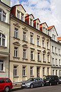 |
Tenement house | Oststrasse 8 (map) |
around 1900 (tenement) | Apartment building in closed development; Well-balanced historicist building, characteristic and largely originally preserved example of development in the urban expansion areas since around the 3rd quarter of the 19th century, significant in terms of urban development history |
09200249 |
| Tenement house | Oststrasse 12 (map) |
after 1900 (tenement) | Apartment building in closed development; Somewhat more elaborately designed historicism building with numerous figural or ornamental architectural decorations, originally preserved, also an example of the development in the urban expansion areas since around the 3rd quarter of the 19th century, significant in terms of building and urban development history |
09200250 |
|
 |
Duplex house | Oststrasse 16; 18 (card) |
around 1952 (residential building) | Double house in semi-open development; Typical example of the reconstruction of the GDR with a classical facade structure, significant in terms of building history |
09200251 |
 |
Duplex house | Peter-Schmohl-Strasse 12; 14 (card) |
after 1950 (residential building) | Double house, part of a small residential complex from the 1950s consisting of 3 buildings; These with design in the sense of the national building tradition, traditional multi-storey buildings with perforated facades and pitched roofs, enlivened by classicist decorative elements, significant in terms of building and urban development history (see also Peter-Schmohl-Straße 18/20 and 24/26) |
09200241 |
 |
Duplex house | Peter-Schmohl-Strasse 18; 20 (card) |
after 1950 (residential building) | Double house (see Peter-Schmohl-Straße 12/14) |
09200240 |
 |
Duplex house | Peter-Schmohl-Strasse 24; 26 (card) |
after 1950 (residential building) | Double house (see Peter-Schmohl-Straße 12/14) |
09200239 |
| Heap | Schachtweg (map) |
16.-18. Century (mining facility) | Dump; relatively large cone slope, significant in terms of mining history |
08992511 |
|
 |
school-building | Schachtweg 2 (map) |
1953–1954 (school) | Composition of a representative school building including hall extension and three rear boarding school buildings; Remarkable in terms of design from the fifties, significant in terms of building history |
09201044 |
 More pictures |
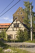
Subject aggregate Abrahamschacht | Schachtweg 9; 10; 11; 13; 14; 15; 16 (card) |
around 1790 (mining facility) | All of the Abrahamschacht shaft, main shaft of the Himmelfahrt treasure trove consisting of a greenhouse and stockpile bridge or bridge for ore transport (1839), mining forge (1834, Schachtweg 14), Scheidebank (1842, Schachtweg 16), administration building (1846, Schachtweg 13), hut house (1843 , Schachtweg 11), team house (around 1790, Schachtweg 10), set laundry (1834, Schachtweg 9), ore roll for pulling the pounding tunnels into the horse-drawn railway wagons, ore railway tunnel, dump of the artificial and driving shaft including retaining walls, underground facilities with shaft, artificial wheel as a drive for art and driving skills as well as a sweeper wheel as a haulage machine (all individual monuments - Obj. 09301507), plus mountain carpentry with ancillary building (Schachtweg 15) and ore pond or ore washing, Flst. 2627/6 (as totality parts); After 1830 the most important mine in Freiberg mining area, expanded into the 2nd half of the 19th century, well-preserved example of a large-scale ore mining facility from the 1st half of the 19th century, unique in its complexity and extremely clear, significant in terms of mining, local and urban development history and landscape design |
09200966 |
| Main shaft of the Ascension treasure trove | Schachtweg 9; 10; 11; 13; 14; 16 (card) |
1842 (Scheidebank); 1839 (greenhouse); 1834 (mountain blacksmiths); 1846 (administration building); 1843 (Huthaus) | Individual monuments of the whole Abrahamschacht: Main shaft of the Ascension treasure trove consisting of a greenhouse and stockpile bridge or bridge for ore transport, mining forge (Schachtweg 14), Scheidebank (Schachtweg 16), administration building (Schachtweg 13), Huthaus (Schachtweg 11), team house (Schachtweg 10 ), Set wash (Schachtweg 9), ore roll for pulling the poching passages into the horse-drawn railway wagons, ore railway tunnels, dump of the artificial and driving shaft including retaining wall, underground systems with shaft, artificial wheel as a drive for art and the art of driving, as well as sweeping wheel as conveying machines (see also Objective document obj 09200966); Plant is significant in terms of construction, mining, local and urban development history and landscape design |
09301507 |
|
 |
Guard house | Scheunenstrasse 2a (map) |
1907–1909 and rel. 1909 (gardener's estate) | Guard house; Small, striking building with a simple, objectified facade design, example of reform architecture after 1900, built to look after the allotment gardeners of the so-called Johannis gardens "garden section 6th Dimension Shaft", building by city planning officer Gustav Riess, important in terms of construction and local history |
09205611 |
| Heap | Schmiedestrasse (map) |
16. – 19. Century (mining facility) | Heap with partially preserved masonry; Testimony to a mining complex that was significant for Freiberg and significant in terms of mining history |
09200245 |
|
| Residential building | Siedlersteg 1 (map) |
around 1800 (residential building) | Residential house in open development; characteristic rural property, historically significant |
09200974 |
|
| Residential building | Siedlersteg 4 (map) |
re. 1838 (residential building) | Residential house in open development; characteristic rural property, historically significant |
09200973 |
|
| Heap | Talweg (map) |
16th century (Halde) | Dump; Significant in mining history (see also Freiberg district, Unteres Muldental 8) |
09200985 |
|
 More pictures |
Old hammer bridge | Talweg (map) |
1569 (bridge) | Road bridge; Bridge with mighty bridgeheads and superstructure, of architectural historical value, as the oldest bridge in Freiberg and one of the oldest in Saxony, it is also unique |
09200980 |
| Manufacturing building | Talweg 9 (map) |
18th century, in the core possibly. 17th century (factory) | Production building (former); Distinctive single-storey building with a curved roof structure, former sulfur and vitriol works, significant building and local history, also of industrial and mining historical value (evidence of the Freiberg metallurgy, which is closely connected to mining) |
09200822 |
|
| Residential building | Talweg 24 (map) |
around 1800 (residential building) | Residential house in open development; Baroque-style rural property consisting of two adjoining buildings, probably with a half-timbered upper floor, two basket arch portals with apex stone, of value in terms of both building history and local history |
09200666 |
|
| Residential building | Talweg 40 (map) |
around 1850 (residential building) | The house and barn of a small homestead; first with plastered and half-timbered upper floor, characteristic rural property, significant in terms of building history and landscape design |
09200981 |
|
| Huthaus and two heaps | Talweg 41 (map) |
18th century, 1802–1840 (mining) | Huthaus and two heaps (art and day shaft); One-storey hut house with a half-hipped roof, an important site in terms of building history and mining history |
09200982 |
|
 |
Mining facility | Tower courtyard shaft 1; 2; 3; 4 (card) |
19th century (mining facility); 1882 (mountain forge) | System with partially bricked-up dump complex, tunnel mouth hole including conveyor line, shaft building with a small headframe, attached, slightly lower separating bank, machine house? (Building north of the shaft building), mining forge, in the immediate vicinity (on Knappenweg) ore rolling mill, stamping mill including stamping wheel and washes as well as other heaps in the area; In addition to Reicher Zeche, Alter Elisabeth and Abrahamschacht, the most remarkable and still largely preserved mining complex of Freiberg, also of great landscape design importance, the main chess complex is easily visible at the eastern entrance of the city, significant in terms of mining history and local history (see also Am Maßschacht, Dresdner Straße, Hinter the Stockmühle, Thomas-Mann-Straße etc.) |
09200911 |
 |
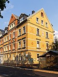
Double tenement house | Turmhofstrasse 1 (map) |
around 1900 (tenement) | Double apartment building with shop in corner position and half-open development; Distinctive historicism building with clinker stone facade typical of the time, special accents through window roofing on the first floor and various stone patterns, significant in terms of building and urban development history |
09200148 |
 |
Tenement house | Turmhofstrasse 18 (map) |
re. 1900 (tenement) | Tenement house in semi-open development; Typically designed building with clinker stone front and historicizing design elements, further revitalization through brick patterns, significant in terms of building and urban development history |
09200149 |
 |
Tenement house | Turmhofstrasse 20 (map) |
around 1900 (tenement) | Tenement house in semi-open development; Typically designed building with clinker stone front and historicizing design elements, further revitalization through brick patterns, significant in terms of building and urban development history |
09200150 |
 |
Tenement house | Turmhofstrasse 22 (map) |
around 1900 (tenement) | Tenement house in semi-open development; Typically designed building with clinker stone front and historicizing design elements, further revitalization through brick patterns, significant in terms of building and urban development history |
09200151 |
 |
Tenement house | Turmhofstrasse 24 (map) |
around 1900 (tenement) | Apartment building in corner location and closed development; Typically designed building with clinker stone fronts, forms a striking urban ensemble as a corner building with the neighboring buildings, significant in terms of urban development history |
09200152 |
 |
Mining facility | Tuttendorfer Weg (map) |
16th century, 1646/1660 and 1838–1839 (mining) | Mining complex with a group of heaps or a train of five heaps as well as a tomb or crypt for the chief miner Siegmund August Wolfgang von Herder and park on the main heap; Significant in terms of mining history, building history, local history and personal history |
09200897 |
 |
Ore transport system | Lower Muldental (map) |
1854-1857, re. 1855 (mining) | Ore transport system with ore railroad on dam and bridge as well as upper ore railway tunnel mouth hole and lower ore railway tunnel mouth hole; Significant and unique in mining history |
09200987 |
 |
Artificial moat | Lower Muldental (map) |
16th century (mining) | Artificial moat; is one of the oldest mining water retention systems in the Freiberg mining area, today carries water from the mine workings of the former Ascension Fdgr. from Kgl. Compatible Gesellschaft Stolln to Halsbrücke, where it absorbs more water from the main adit upheaval, of singular importance in the history of mining |
09200990 |
| Tunnel mouth hole | Lower Muldental (map) |
around 1820 (mining) | Tunnel mouth hole with inscription; significant in terms of mining history |
09200989 |
|
| Manufactory | Lower Muldental 2 (map) |
re. 1739, around 1830 (residential building) | Manufactory (formerly); The striking single-storey mansion with a high hipped roof and side gable as well as the residential house and outbuilding with half-timbered upper floor, as one of the largest Saxon manufacturers of the late 17th and 18th centuries, of unique industrial historical importance, also of architectural and local historical value |
09200978 |
|
| Production building | Lower Muldental 3 (map) |
1855 and re. 1830 (mining) | Production building; two buildings located on the premises of the former VEB Rohpappen, the first elongated, with a crooked hip roof, sandstone walls and segment arch portal (re. 1830), the second shorter, but with a similar volume (c. 1855), part of the ore washing for since the middle of the 19th century the ores extracted from the David shaft; significant in terms of mining history |
09200984 |
|
| Huthaus, Scheidebank, tunnel mouth hole | Lower Muldental 8 (map) |
16th century (Halde); around 1825 (Huthaus); re. 1801–1810 (mouth hole) | Huthaus, Scheidebank, tunnel mouth hole with coat of arms and inscription as well as two partially walled up heaps; The first striking building with boarded half-timbering, saddle roof and roof house, the complex is significant in terms of building history and mining history (see also OT Halsbach, Talstrasse, Halde) |
09200706 |
|
 |
Huthaus and Halde | Unterhofstrasse 2 (map) |
around 1750 (mining) | Huthaus and Halde; Typical hut house of a small pit from the 17th and 18th centuries, single-storey building with a gable roof, the complex is significant in terms of mining and local history |
09201055 |
| Two hospital buildings | Unterhofstrasse 2 (map) |
1928–1929 (hospital) | Two hospital buildings; Modern, multi-storey buildings of the 1920s in the Bauhaus style, made of rectangular cubes with open galleries, ribbon windows, flat roofs and also cubic tower structures, in this form in Freiberg and probably also unique across the country, apart from that significant in terms of building history (example of hospital architecture at that time called the "Freiberg system "became directional) |
09201054 |
|
| Huthaus and Halde | Unterhofstrasse 2a (map) |
around 1750 (mining) | Huthaus and Halde; Larger hut house with an approximately L-shaped floor plan with a gable roof, boarded gable, the facility is significant in terms of mining and local history |
09201056 |
|
 |
Tenement house | Unterhofstrasse 4 (map) |
1890/1899 (tenement house) | Apartment house in corner position and half-open development; representative building, example of residential building architecture from the end of the 19th century, significant in terms of building history and urban development history |
09200991 |
| Tenement house | Unterhofstrasse 6 (map) |
1890/1899 (tenement house) | Apartment building in closed development; Part of a striking line with historicizing residential buildings in the suburban area, significant in terms of urban development history, also of value for the townscape |
09201052 |
|
| Tenement house | Unterhofstrasse 8 (map) |
1890/1899 (tenement house) | Apartment building in closed development; Part of a striking line with historicizing residential buildings in the suburban area, significant in terms of urban development history, also of value for the townscape |
09201050 |
|
| Tenement house | Unterhofstrasse 10 (map) |
1890/1899 (tenement house) | Apartment building in closed development; Part of a striking line with historicizing residential buildings in the suburban area, significant in terms of urban development history, also of value for the townscape |
09201049 |
|
| Tenement house | Unterhofstrasse 12 (map) |
1890/1899 (tenement house) | Apartment building in closed development; Part of a striking line with historicizing residential buildings in the suburban area, significant in terms of urban development history, also of value for the townscape |
09201051 |
|
| Tenement house | Unterhofstrasse 14 (map) |
1890/1899 (tenement house) | Apartment building in closed development; Part of a striking line with historicizing residential buildings in the suburban area, significant in terms of urban development history, also of value for the townscape |
09201053 |
|
 |
Residential building | Unterhofstrasse 16 (map) |
18th century, 1st half of the 19th century (residential building) | Residential house, side building, barn and gate system of a homestead; as one of the historical courtyards (or estates) in the suburbs of Freiberg, historically significant, as well as evidence of rural construction and folk architecture of architectural historical value |
09200993 |
literature
- Yves Hoffmann, Uwe Richter (ed.): City of Freiberg. Vol. 1. (= Monument topography Federal Republic of Germany. Monuments in Saxony). Werbung & Verlag, Freiberg 2002, ISBN 3-936784-00-0 .
- Yves Hoffmann, Uwe Richter (ed.): City of Freiberg. Vol. 2. (= Monument topography Federal Republic of Germany. Monuments in Saxony). Werbung & Verlag, Freiberg 2003, ISBN 3-936784-01-9 .
- Yves Hoffmann, Uwe Richter (ed.): City of Freiberg. Vol. 3. (= Monument topography Federal Republic of Germany. Monuments in Saxony). Werbung & Verlag, Freiberg 2004, ISBN 3-936784-02-7 .
swell
- State Office for the Preservation of Monuments Saxony Dynamic web application: Overview of the monuments listed in Saxony. The location "Freiberg, Stadt, Universitätsstadt" must be selected in the dialog box, after which an address-specific selection is made. Alternatively, the ID can also be used. As soon as a selection has been made, further information about the selected object can be displayed and other monuments can be selected via the interactive map.
Web links
Commons : Cultural monuments in Freiberg-Ost - collection of images