List of cultural monuments in Freiberg-Altstadt, A – K
The list of cultural monuments in Freiberg-Altstadt, A – K contains the cultural monuments of the old town district of the Saxon city of Freiberg , which were recorded in the list of monuments by the State Office for Monument Preservation Saxony as of June 20, 2013 and whose street names begin with A – K.
Among the cultural monuments in the Freiberg Old Town, streets of L to Z, see: List of cultural monuments in Freiberg Old City, L-Z .
Legend
- Image: shows a picture of the cultural monument and, if applicable, a link to further photos of the cultural monument in the Wikimedia Commons media archive
- Designation: Name, designation or the type of cultural monument
-
Location: If available, street name and house number of the cultural monument; The list is basically sorted according to this address. The map link leads to various map displays and gives the coordinates of the cultural monument.
- Map view to set coordinates. In this map view, cultural monuments are shown without coordinates with a red marker and can be placed on the map. Cultural monuments without a picture are marked with a blue marker, cultural monuments with a picture are marked with a green marker.
- Dating: indicates the year of completion or the date of the first mention or the period of construction
- Description: structural and historical details of the cultural monument, preferably the monument properties
-
ID: is awarded by the State Office for the Preservation of Monuments in Saxony. It clearly identifies the cultural monument. The link leads to a PDF document from the State Office for the Preservation of Monuments in Saxony, which summarizes the information on the monument, contains a map sketch and often a detailed description. For former cultural monuments sometimes no ID is given, if one is given, this is the former ID. The corresponding link leads to an empty document at the state office. The following icon can also be found in the ID column
 ; this leads to information on this cultural monument at Wikidata .
List of cultural monuments in Freiberg-Altstadt, A – K
| image | designation | location | Dating | description | ID |
|---|---|---|---|---|---|
 |
Monument protection area Altstadt Freiberg (suggested) | (Map) | Monument protection area old town Freiberg |
09299948 |
|
 |
Residential building | Akademiestrasse 1 (map) |
2nd half of the 19th century (residential building) | House in corner position and closed development; Significant in terms of urban development history and as part of the distinctive Burgstrasse and Freudenstein axis |
09205886 |
 |
Residential building | Akademiestrasse 2 (map) |
Late 18th century (residential building) | House in corner position and closed development; Elongated baroque plastered building with an axially structured facade and two portals highlighted in terms of design, significant in terms of building history and urban development history |
09200506 |
 |
Residential building | Akademiestrasse 3 (map) |
re. 1780 (residential building) | Residential house in closed development; As a largely originally preserved baroque plastered building with a drilled segmented arch portal and axial facade structure, it is significant in terms of architectural history and urban development history |
09200474 |
 |
Residential building | Akademiestraße 5 (map) |
after 1548 (residential building) | Residential house in closed development; Citizens' house in the Renaissance style, largely preserved in its original state, with profiled and architraved window frames and high pitched roof, significant in terms of building history and urban development history |
09200475 |
 |
Building group ( Bergakademie ) | Akademiestraße 6 (map) |
around 1530 (Kern); 1765 (Academy); 1855 (outbuilding) | Building group consisting of the street-side front building, side gate entrance with basket arch portal as well as northern rear building and eastern auxiliary building; representative plant; the originally two-storey front building was the home of the chief miner von Oppel (died 1769); it was expanded and redesigned around the middle of the 19th century; afterwards it was the residence of the most important academy teacher AG Werner from 1784-1817, eastern outbuilding with half-timbered upper storey and clinker brick structure; in the front building Akademiestraße / Nonnengasse 1843 equipped lockup with Ausmalungen, building complex of location, personnel and history of science significantly, as the site of the first university laboratory in the world also of singular importance (memorial plaque at the back of building) |
09200507 |
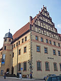 |
Residential building ( Thümerei; City and Mining Museum ) | Am Dom 1 (map) |
1484–1488 (residential building) | Residential building with back building, later a museum; Representative corner building with a large, neo-Gothic restored niche gable facing the Untermarkt, stair tower, offset pointed arched lattice portal, richly profiled window frames and lavish interior fittings, building of the former canon court, significant in terms of architectural, artistic, church, local and urban development, due to its unique design Connection with the unmistakable ensemble of the Untermarkt is also of particular importance for urban development |
09200546
|
 |
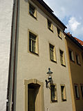
Residential building ( rectorate ) | Am Dom 2 (map) |
around 1488 (residential building) | Residential house in closed development; distinctive building with niche gable , pointed arch portal and stair tower, cellular vaulted ground floor, building of the former canon court; Significant in terms of architectural, artistic, church, local and urban development history, also of singular importance (e.g. rarity of the cell vault) |
09200545 |
 |
Residential building | Am Dom 3 (map) |
around 1490 (residential building) | Residential house in closed development; Building of the former canon court, the core of which is probably a late Gothic building, which was mainly remodeled in the 18th century, with a clearly structured facade, pitched roof and drilled segment arch portal; Significant in terms of building, church, local and urban development history |
09200743 |
 |
Residential building | Am Dom 4 (map) |
before 1490 (residential building) | Residential house in closed development; Building of the former canon court, representative with late Gothic arched curtain windows and steep roof, valuable substance inside; Significant in artistic, architectural, church, local and urban development terms |
09200742 |
 More pictures |
Freiberg Cathedral ( Cathedral of Our Dear Women ; Cathedral of St. Mary ) | Am Dom 7 (map) |
around 1225–1230 (cathedral); 1714 (large Silbermann organ); 1718–1719 (small Silbermann organ); around 1505 (tulip pulpit); 1638 (miner's pulpit) | Cathedral with rich church furnishings, Annenkapelle in the north-west, burial chapel of the von Schönberg family, so-called Green Cemetery with cloisters to the south and west of the church building, 20 tombs and fencing with iron bars to the lower market; Cathedral building with choir, enriched by side rooms in the north and south, three-aisled nave, two irregular west towers and protective structure for the golden gate, plus rich, unique furnishings, golden gate one of the earliest and richest figurine portals in Central Europe, cathedral one of the earliest Upper Saxon late Gothic hall churches in Saxony, Choir grave church of the Albertine Wettins from 1541–1694, princely crypt masterpiece of European late Mannerism , construction of the cathedral unique testimony to Christian faith and artistic feeling from past times, artistic, architectural and art-historical significance as well as the townscape |
09200542 |
 |
Stable building ( Ratsmarstall ) | Am Marstall 4 (map) |
after 1485 (northern core building) | Stable building; striking, wide-spread building with a pitched roof (slightly hipped on one side), belonging to the former city stables; Significant in terms of building, local and urban development history |
09200688 |
| Quarry stone wall | Am Mühlgraben (map) |
18./19. Century (wall) | Quarry stone wall; Characteristic of the townscape or significant in terms of landscape design (urban landscape) |
09200568 |
|
 |
School building ( Kreuzschule; Silbermannschule ) | Am Mühlgraben 1 (map) |
1903 (school) | School-building; Representative building with rich facade decoration made of historicizing forms and Art Nouveau elements , elaborate building from the beginning of the 20th century of architectural historical value as well as important in terms of local history as a historical Freiberg school, also of importance in terms of urban development history |
09200569 |
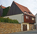 |
Tanner's house | Am Mühlgraben 23; 25 (card) |
18th century (tannery) | Tanner's house; Today two buildings, characteristic building with a protruding upper floor and pitched roof, significant in terms of building, social and urban development |
09200710 |
 |
Rectory | At the Nikolaikirche 1 (map) |
around 1600 (rectory) | Rectory; Distinctive building of the Renaissance and Baroque, important in terms of urban planning (view from Nikolaigasse), important in terms of building, local and urban development history |
09200667 |
 More pictures |
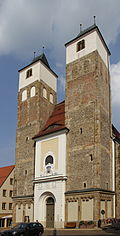
Nikolaikirche | At the Nikolaikirche 3 (map) |
around 1200 (church) | Church; Late Gothic sacred building consisting of a nave, Gothic choir, two Romanesque west towers (raised by 1530) and sacristy with ribbed vaults, converted into a Protestant gallery hall, including furnishings, unique evidence of church architecture from the Romanesque to the Baroque, also one of the most important cultural monuments in Freiberg; artistically, architecturally, church and urban development historically significant as well as singular |
09200735 |
 |
retaining wall | Aschegasse (map) |
18./19. Century (retaining wall) | Retaining wall; Quarry stone wall to delimit the property along Aschegasse and Gerbergasse, which is at right angles, and of significance for the street scene |
09200640 |
 |
Residential building | Aschegasse 3 (map) |
around 1570 (residential building) | Residential house with closed development; Renaissance building, later redesigned, significant in terms of building history and urban development history |
09200639 |
 |
Residential building | Aschegasse 4 (map) |
1st quarter of the 19th century (residential building) | Residential house in closed development; Plastered construction with segment arch portal, saddle roof, significant in terms of building and urban development history |
09200638 |
 |
Residential building | Bäckergäßchen 4 (map) |
around 1800 (residential building) | Residential house in closed development; characteristic miners' house, two-storey with a gable roof, enlivened by sandstone walls and folding shutters, important in terms of building, local and urban development history |
09200902 |
 |
Sweden Monument | Bebelplatz (map) |
1843 (monument) | Individual monument of the whole Promenadenring: Schwedendenkmal; Elaborate monument in neo-Gothic forms, erected over an octagonal floor plan, with rich figural and ornamental decoration, base and top of crenellated wreaths, significant in terms of architectural, artistic, art-historical and local history, as the richest monument in Freiberg and one of the most remarkable neo-Gothic monuments in Saxony singular (cf. . with cholera fountain in Dresden) (see also general document - Obj. 09200740) |
09201005 |
 |
War memorial for the fallen soldiers of the First World War | Bebelplatz (map) |
1925 (war memorial) | Individual monument of the whole Promenadenring: War memorial for the fallen of the First World War; Expressionistically designed system for the Jägerbataillon 26, originally with two sculptures attached; artistically, historically and militarily significant |
09200800 |
 |
Unity of Promenadenring | Bebelplatz (map) |
from 1784 (promenade); 1894 (outside staircase); 1894 (areas of the Albertpark); 1894 (fountain) | Comprehensive Promenadenring with the following individual monuments: City wall including nine preserved towers (Donatsring, Meißner Ring and Schillerstraße - Obj. 09200624, 09200731 and 09200732), Swedish Monument (Bebelplatz / Petersstraße - Obj. 09201005), Thälmann Monument (Meißner Ring - Obj. 09201000) , Kreuzbrunnen (Wallstraße - Obj. 09201004), Peter-Schmohl-Ruine (Wallstraße - Obj. 09200995), Prayer Column (Chemnitzer Straße - Obj. 09201003), War Memorial (Bebelplatz - Obj. 09200800), Wernerdenkmal (Wallstraße - Obj. 09201002) , Winklerdenkmal (Wallstraße - Obj. 09201001), memorial stone for October victims (see Platz der Oktoberopfer - Obj. 09200961) (see individual monument documents given in brackets, same addresses), with completely preserved green space consisting of a system of paths and plants on the medieval ramparts in front of the city wall ( Ring wall), running around the old town and including the reservoirs in front to the west (first mentioned in 1813), as well as the Albertpar area ks with outside staircase and fountain designed neo-baroque (1894) (garden monuments), further column with mosaic design, remains of the Claus grotto, new construction of a historical pavilion, pedestal of the singing festival monument and remains of the Horn fountain (material parts), one of the most remarkable facilities of this type in Saxony , City wall is one of the best preserved in the country, especially artistically and historically significant |
09200740 |
 |
villa | Bebelplatz 2 (map) |
around 1910 (manufacturer's villa) | Villa; Construction in typical forms of the early 20th century, once residential building of the brewery director, significant in terms of construction, local and urban development history |
09200802 |
 |
Residential building | Berggasse 3 (map) |
1534/1555 (residential building) | Residential house in open development; characteristic petty bourgeois house of the Freiberg lower town with renaissance garments, high pitched roof and prominent portal, significant in terms of urban development |
09200629 |
 |
Residential building ("potato house") | Berggasse 7 (map) |
16./17. Century (residential building) | Residential house in open development; Upper floor timber-frame boarded up, largely original bourgeois house in the Jacobiviertel, with a distinctive arched portal and pitched roof, significant in terms of building and urban development history |
09200777 |
 |
portal | Borngasse 1 (map) |
around 1500 (pointed arched portal); re. 1831, to Weingasse (keystone) | Two keystones on the facade and a portal inside the north-western building of the Borngasse 1 property; a keystone to Borngasse, bez. CE 1831, a keystone to the Weingasse, re. CFEE as well as a reused late Gothic portal inside the building, historically and artistically significant |
09200665 |
 |
City Theatre | Borngasse 1 (map) |
1789 (theater) | Theater with equipment; Eastern building on the Borngasse 1 property, with stage, auditorium, foyer, cloakrooms, refreshment room, props room, actors' dressing rooms, rehearsal rooms, business rooms, etc., originally a representative town house from 1623, converted into a theater in 1789, further expansion in 1880 and 1896–1897, today's appearance of the Rectangular two- to three-storey building complex with a gable roof and a gabled, neoclassical portico to the Buttermarkt, especially from the 1950s, auditorium as a rank theater with a distinctive ceiling design in 1880, of architectural and artistic value, also significant for theater history due to several events |
09200734 |
 |
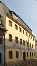
Residential building | Borngasse 2 (map) |
18th century (residential building) | Residential house in closed development; Two-storey plastered building with jamb, shop area / shop window front end of the 19th century, inside remarkable substance, including entrance area with barrel vault, important in terms of building and urban development history |
09200383 |
 |
Residential building | Borngasse 3 (map) |
re. 1570 (residential building) | Residential house in closed development; Southwestern building on the Borngasse 1 property, striking baroque building with segmented arched portal, inside substance from the 16th century preserved, parts of the cellar in the 21st century restaurant ( theater cellar ), important in terms of architectural and urban development history |
09200381 |
 |
Residential building | Borngasse 4 (map) |
16th century, later remodeled (residential building) | House in corner position and closed development; striking building with a high hipped roof, significant in terms of building and urban development history |
09200382 |
| Vaulted cellar | Borngasse 6 (map) |
15./16. Century (cellar) | Vaulted cellar; two barrel-vaulted cellars made of broken gneiss stones laid in clay and a vaulted corridor made of brickwork, significant for the local history |
08992539 |
|
 |
Residential building | Borngasse 14 (map) |
2nd half of the 16th century (residential building) | Residential house in closed development with side extension; Renaissance building remodeled in the 18th century with six profiled window frames from the time it was built and a later segmented arch portal, inside very old substance, significant in terms of building and urban development, as a corner building also important for the townscape |
09200380 |
 |
Residential building | Borngasse 15 (map) |
around 1600 (residential building) | Residential house in closed development; characteristic petty bourgeois house from around 1600, later slightly redesigned, significant in terms of building and urban development history |
09200790 |
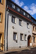 |
Residential building | Borngasse 20 (map) |
re. 1610 (residential building) | Residential house in closed development; Core bourgeois house from the 16th century, presumably redesigned in the Baroque style, with a seat niche portal, significant in terms of art, building and urban development |
09200499 |
 |
Tenement house | Brennhausgasse 1 (map) |
around 1890 (tenement) | Apartment building in corner location and closed development; high-quality historicism building, valuable in terms of building history and urban development history, in connection with the ensemble of Schloßplatz also significant in terms of urban planning |
09200585 |
 |
Institute building ("Silberbrennhaus; Hofjägereigeb Gebäude; Bergakademie") | Brennhausgasse 5; 5a (card) |
around 1550 (institute); 1880 (laboratory) | Institute, consisting of five houses, plus memorial plaques; middle core building the former Brennhaus and Hofjägereigebuilding with profiled window frames, raised arched portal and saddle roof, inside entrance hall with central column and cross vault, around 1550, two lower historicizing western houses 1860 and 1921 (No. 5), two eastern houses including laboratory from 1880 and corner building from 1898 (No. 5a), 1831–1954 location of the chemical institutes of the Bergakademie, in one of the outbuildings Winkler memorial with historical laboratory inventory, significant in terms of construction, location, people, technology and science, also unique (unique design of the Hall) |
09200583 |
 |
Residential building ( Ledebur house ) | Brennhausgasse 8 (map) |
1526 (residential building) | Residential house in open development; characteristic petty bourgeois house of the 16th century with timber frame walls and pitched roof, place of work of Adolf Ledebur (memorial plaque), important in terms of building, personal, local and urban development history |
09200584 |
 |
Institute building ( Bergakademie ; Gottlob-Werner-Bau ) | Brennhausgasse 14 (map) |
1912–1914 (institute) | Institute building; distinctive building with a rich roof landscape, representative entrance portal and a large part of the original furnishings, significant in terms of building, local and scientific history |
09200581 |
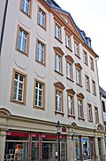 |
Administration and commercial building ( town house ) | Burgstrasse 1 (map) |
3rd quarter of the 18th century (administration) | Administrative and commercial building; Representative four-storey building with a distinctive triangular gable and facade decoration typical of the time, as a testimony to the late Baroque architecture-historically significant, especially since the character of the strictly vertically structured building with sparse ornamentation has largely been preserved despite being converted into a townhouse in 1886, and also significant in terms of local and urban development history |
09200328 |
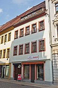 |
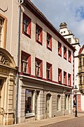
Residential building | Burgstrasse 2 (map) |
18th century (residential building); before 1724 (Secret Annex) | Residential house in closed development and rear building; Town house from the 18th century, significant in terms of building and urban development |
09200342 |
 |
Residential building | Burgstrasse 3 (map) |
re. 1542 (residential house); 1563 (two-axis extension) | Residential house in closed development; An important corner building in urban planning as a counterpart to the Renaissance house with the “beautiful bay window”, substance from the 16th century, including garments, also significant in terms of building and urban development history |
09200329 |
 |
Residential building | Burgstrasse 4 (map) |
18th century (residential building); before 1724 (Secret Annex) | Residential building with historicizing shop area in closed development and rear building; Town house from the 18th century, significant in terms of building and urban development |
09200362 |
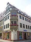 |
Residential building ("Schöne-Erker-Haus") | Burgstrasse 5 (map) |
re. 1616–1617 (residential building) | Residential house in closed development; three-story richly designed corner house with volute gable and mannerist facade design u. a. the beautiful bay window (designed as a corner bay window); Most important Freiberg town house from the 1st half of the 17th century, with the facade design also remarkable in terms of architecture in Saxony; artistically, in terms of building history, urban development history and singularly significant; In connection with the ensemble of Burgstrasse, it is also of importance in terms of urban planning (especially as a corner house) |
09200470 |
 |
Residential building | Burgstrasse 6 (map) |
18th century (residential building) | Residential house in closed development and rear building; Town house from the 18th century, later a shopping area, significant in terms of building and urban development |
09200607 |
 |
Residential building ("Zum Goldenen Löwen") | Burgstrasse 7 (map) |
1616/1617 (pharmacy) | Residential house in closed development; Stately town house of the Renaissance with profiled window frames, pitched roof and simplified central bay window from 1617, since 1651 the pharmacy Zum Goldenen Löwen founded in 1595 ; Artistically, architecturally, locally and in terms of urban development, and in connection with the ensemble of Burgstrasse, it is also of importance in terms of urban planning |
09200471 |
 |
Residential building | Burgstrasse 8 (map) |
re. 1736 (residential building) | Residential house in closed development; Very representative baroque town house, later shop installation, significant in terms of building and urban development history, in connection with the ensemble of Burgstrasse also of urban planning importance |
09200341 |
 |
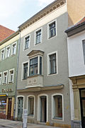
Residential building | Burgstrasse 9 (map) |
1616/1617 (residential building) | Residential house in closed development; Stately Renaissance house with profiled window frames, pitched roof and simplified central bay window from 1617, home of the poet Novalis from 1797 to 1799 as a mountain student (inscription panel); Artistically, structurally, personally (worth remembering) and in terms of urban development history, and in connection with the ensemble of Burgstrasse it is also of urban planning importance |
09200472 |
 |
Residential building | Burgstrasse 10 (map) |
around 1527 (residential building) | Residential house in closed development and rear building; Significant building in terms of building and urban development history with a striking bay window, plus a baroque rear building |
09200331 |
 |
Residential building | Burgstrasse 11 (map) |
around 1559 (residential building) | Residential house in closed development; as an imaginatively remodeled building from the 17th century in Art Nouveau 1907 (mainly concerns the facade) of architectural and urban development history as well as a certain artistic value, in connection with the ensemble of Burgstrasse also significant in terms of urban planning |
09200473 |
 |
Residential building | Burgstrasse 13 (map) |
1530/1532 (residential building) | Residential house in closed development; characteristic town house from the 16th century with late Gothic timber frame walls and pitched roof; Artistically, structurally and in terms of urban development history, and in connection with the ensemble of Burgstrasse it is also of importance in terms of urban planning |
09200508 |
 |
Residential building | Burgstrasse 14 (map) |
re. 1619 (residential building) | Residential house in closed development; Distinctive corner building with Renaissance walls on the long and gable sides as well as a pitched roof: significant in terms of building and urban development history, at an exposed point within the ensemble of Burgstrasse also of urban development importance and as the former house of the goldsmith Valerius Hessing (inscription) Document of the town's history (historically significant) |
09200456 |
 |
Residential building | Burgstrasse 15 (map) |
18th century (residential building) | Residential house in closed development; Building from the 18th century, largely preserved in its original form, with an elaborate portal, significant in terms of building and urban development history |
09200509 |
 |
Residential building | Burgstrasse 16 (map) |
re. 1561 (residential building) | Residential house in closed development; in the core town house from the 16th century, with a distinctive pitched roof, the latter highlighted by staggered towing hatches, later remodeling in the ground floor area and on the facade, significant in terms of urban development, and in connection with the ensemble of Burgstrasse also significant in terms of urban development |
09200455 |
 |
Residential building | Burgstrasse 17 (map) |
1690 (residential house) | Residential house in closed development; Basically an early baroque building, with original roof structure, redesigned facade, significant in terms of building and urban development history, in connection with the ensemble of Burgstrasse to which urban planning is important |
08992435 |
 |
Residential building | Burgstrasse 18 (map) |
Mid-16th century (residential building) | Residential house in closed development; Representative Renaissance townhouse with heightening and remodeling from the early 18th century, the profiled window frames on the first floor, stucco ceilings on the inside, significant in terms of building and urban development history, also of urban planning importance in connection with the ensemble of Burgstrasse (with its broad facade characterizing the townscape) |
09200454 |
 |
Gasthaus ("Zum Goldenen Adler") | Burgstrasse 19 (map) |
1525/1527 (inn) | Guest house with back building; impressive building from the beginning of the 16th century with late Gothic garments on the upper floor and pitched roof, simple profiles and segmented arch portal on the ground floor later, remarkable interior fittings; Artistically (striking and artistically high-quality example), building, local (historic inn) and urban development history significant, in connection with the ensemble of Burgstrasse also of urban planning importance |
09200510 |
 |
Residential and commercial building | Burgstrasse 20; 22 (card) |
around 1600 (residential building) | Residential house with side wing in closed development; Elongated building with historicizing facade design, significant in terms of urban development, of urban planning importance in connection with the ensemble of Burgstrasse, furthermore artistically valuable because of its early classicist interior and as a former manufacturing building; Significant local and industrial history (see also Thielestraße 2b) |
09200453 |
 |
Residential building | Burgstrasse 21 (map) |
around 1537 (residential building) | Residential house in closed development; A high-quality town house from the 16th century with a simplified arched portal, framework walls and a pitched roof, also remarkable the accentuated building edges; Significant artistically, in terms of building and urban development history, as the home of the machine director Brendel of local and personal historical significance, in connection with the ensemble of Burgstrasse it is also of urban development importance |
09200511 |
 |
Residential building ("main tax office; main customs office") | Burgstrasse 23 (map) |
re. 1795 (residential building) | House in corner position and closed development; Stately baroque corner house, significant in terms of building history and urban development history, as a historic main customs office valuable in terms of local history, in connection with the ensemble of Burgstrasse also of urban planning importance |
09200512 |
 |
Residential building | Burgstrasse 24 (map) |
re. 1736 (house); re. 1846 (Secret Annex) | Residential house in closed development with two rear buildings; representative corner building from the baroque era, which was built in the 19th century (1846 and 1850) z. T. was overformed, with three striking portals to Burgstrasse and Thielestrasse, significant in terms of building and urban development history, and also of urban planning importance in connection with the ensemble of Burgstrasse |
09200440 |
 |
Residential building | Burgstrasse 26 (map) |
1500/1530 (residential building) | Residential house in closed development; Typical Freiberg town house from the early 16th century with rich window frames on the upper floors, significant in terms of building and urban development history, also of urban development importance in connection with the ensemble of Burgstrasse |
09200439 |
 |
Residential building | Burgstrasse 28 (map) |
around 1500 (residential building) | Residential house in closed development; Typical Freiberg town house from the early 16th century with timber framing and a pitched roof, probably overformed in the Baroque (especially the ground floor), significant in terms of building and urban development history, in connection with the ensemble of Burgstraße also of urban planning importance |
09200452 |
 |
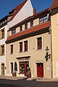
Residential building | Burgstrasse 30 (map) |
1560/1600 (residential building) | Residential house in closed development; simple town house mostly from the 16th century, with a baroque entrance door, significant in terms of urban development history, also of urban development importance in connection with the ensemble of Burgstrasse |
09200451 |
 |
Residential building | Burgstrasse 32 (map) |
18th century, core older (residential building) | Residential house in closed development; Building with substance from the 16th and 18th centuries, significant in terms of urban development history, in connection with the ensemble of Burgstrasse also of urban planning importance |
09200539 |
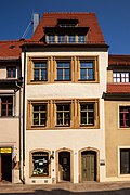 |
Residential building | Burgstrasse 34 (map) |
around 1510 (residential building) | Residential house in closed development; with almost symmetrical upper storeys, characteristic frame walls and high pitched roof, it is one of the most distinctive town houses of the early 16th century in Freiberg; Artistically, architecturally and in terms of urban development, it is also of urban significance in connection with the Burgstraße ensemble |
09200450 |
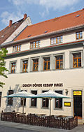 |
Residential building | Burgstrasse 36 (map) |
1520/1530 (residential building) | Residential house in closed development; Characteristic town house from the early 16th century with timber frame walls on the upper floor and a pitched roof, later remodeled (probably in the 18th century), interior rich late Gothic furnishings, significant in terms of building and urban development history, also of urban development importance in connection with the ensemble of Burgstrasse |
09200449 |
 |
Residential building | Burgstrasse 38 (map) |
around 1537 (residential building) | Residential house in closed development; striking corner building with Renaissance walls on the two upper floors, high roof and wide gable side facing Moritzstrasse, as a largely original Freiberg town house from the 16th century; Significant in terms of building and urban development history, also of urban significance in connection with the ensemble of Burgstrasse |
09200448 |
 |
Back building | Burgstrasse 42 (map) |
18th century (rear building) | Back building; characteristic and largely originally preserved, significant in terms of building and urban development history |
09200799 |
 |
Residential building | Burgstrasse 44 (map) |
after 1565 (residential building) | Residential house in closed development; Characteristic Renaissance townhouse with profiled and architraved window frames and pitched roof, segmental arch portal on the ground floor, probably from the 18th century, significant in terms of building and urban development history, in connection with the ensemble of Burgstraße also of urban planning importance |
09200525 |
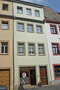 |
Residential building | Burgstrasse 46 (map) |
around 1594 (residential building) | Residential house in closed development; renaissance building in the core, later redesigned in particular in the roof area, significant in terms of building and urban development history, in connection with the ensemble of Burgstrasse to the urban planning issue |
08992436 |
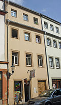 |
Residential building | Burgstrasse 48 (map) |
around 1594 (residential building) | Residential house in closed development; renaissance building in the core, later redesigned in particular in the roof area, significant in terms of building and urban development history, in connection with the ensemble of Burgstrasse to the urban planning issue |
08992437 |
 |
Residential building | Burgstrasse 50 (map) |
before 1539 (residential building) | Residential house in closed development; Buildings with substance from the 16th century to the 18th century, interior remnants from the 16th century, significant in terms of building and urban development history, in connection with the ensemble of Burgstraße also of urban planning importance |
09200524 |
| Tenement house | Buttermarktgasse 1 (map) |
around 1880 (residential building) | Apartment house in corner position and half-open development; Well-proportioned early historicism building, significant in terms of building and urban development history, as a striking corner building on Buttermarkt that characterizes the townscape, it is also of importance for urban planning |
09200477 |
|
| Tenement house | Buttermarktgasse 5 (map) |
1890 (residential building) | Tenement house in semi-open development; forms a design unit with Heubnerstraße 22, both buildings still authentically preserved, document architecture from the end of the 19th century, which is significant in terms of building and urban development history |
09200487 |
|
 |
Residential building | Buttermarktgasse 10 (map) |
around 1600 (residential building) | House in corner position and closed development; characteristic building from the period around 1600 (relief arches resting on ornate consoles in the corridor area) with later modifications, significant in terms of building and urban development history |
09200476 |
| Basement and beamed ceiling | Domgäßchen 2 (map) |
around 1600 (wooden ceiling) | Basement and beamed ceiling of a residential building; Residential house built around 1600, after demolition today a new building on a historic cellar with preservation of the beamed ceiling, important in terms of building and house history |
09200522 |
|
 |
Residential building | Domgäßchen 4 (map) |
1553/1560 (residential building) | Residential house in closed development; Building from the 16th century with irregular windows, significant in terms of building and urban development |
09200531 |
 |
Residential building | Domgasse 3 (map) |
around 1540 (residential building) | Residential house in half-open development; Typical renaissance town house with profiled and achit-engraved walls, probably added on the second floor after 1850, significant in terms of building and urban development history |
09200442
|
 |
Old superintendent | Domgasse 6 (map) |
E. 15th century (superintendent) | Superintendent; representative corner house with arched curtain windows, renaissance portal and courtyard-side stair tower, building of the former canon court; Significant in artistic, architectural, church, local and urban development terms |
09200544 |
 |
Tenement house | Domgasse 7 / 7a (map) |
around 1885 (tenement) | Apartment building in corner location and closed development; Distinctive Wilhelminian style building, highlighted in terms of design, significant in terms of building and urban development history, as a conspicuous corner building also of importance for urban planning |
09200517 |
| Tenement house | Donatsgasse 2 (map) |
before 1900 (tenement) | Apartment building in closed development; Distinctive Wilhelminian style building with a balanced and at the same time representative facade, significant in terms of building and urban development history |
09200835 |
|
 |
Gasthaus ("Bräustübel") | Donatsgasse 3 (map) |
around 1500 (inn) | Inn; striking, late medieval or renaissance building, significant in terms of building and urban development history |
09200625 |
 |
Tenement house | Donatsgasse 4 (map) |
1901 (tenement) | Tenement house in semi-open development; as structural evidence of architecture around 1900 of urban development and architectural historical value, largely preserved originally (authenticity) |
09200626 |
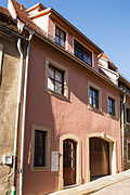 |
Facade and cellar vault | Donatsgasse 7 (map) |
after 1532 (facade) | Facade and cellar vault of a former residential building in closed development; characteristic petty bourgeois house from the 16th century in the Jacobiviertel with typical axial proportions and pitched roof (three-cell type), facade redesigned after 1700, significant in terms of building and urban development history; In the 21st century, only the outer wall with sandstone window and door walls on the ground floor is available |
09200600 |
 |
Residential building | Donatsgasse 8 (map) |
around 1520 (house); re. 1553 (portal) | Residential house in half-open development; Typical renaissance petty bourgeois house in the Jacobiviertel with artistically highlighted openings (seat niche portal) and pitched roof, significant in terms of building and urban development history |
09200598 |
 |
Residential building | Donatsgasse 9 (map) |
after 1532 (residential building) | Residential house in closed development; Typical small bourgeois house in the Jacobiviertel, in the core probably still 16th century, later redesigned, significant in terms of building and urban development history |
09200599 |
| Residential building | Donatsgasse 10 (map) |
18th century (possibly even older) | Residential house in closed development; characteristic small bourgeois house with pitched roof and segment arch portal, significant in terms of building and urban development history, also of urban value in connection with the Donatsgasse ensemble |
09200836 |
|
| Residential building | Donatsgasse 16 (map) |
18th century (residential building) | Residential house in half-open development; simple plastered facade, striking roof houses, significant in terms of urban development history |
09200837 |
|
 |
Tenement house | Donatsgasse 17 (map) |
1890-1891 (tenement house) | Apartment building in closed development; Historicism building with largely originally preserved facade, remarkable the entrance door, significant in terms of building and urban development and urban planning |
09200597 |
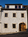 |
Residential building | Donatsgasse 21 (map) |
after 1520 (residential building) | Residential house in closed development; simple but originally preserved building from the beginning of the 16th century, later remodeled; Significant in terms of building and urban development history |
09200596 |
 |
Residential building | Donatsgasse 22 (map) |
1565 (residential building) | Residential house in half-open development; Typical renaissance petty bourgeois house in the Jacobiviertel with profiled window frames and pitched roof, unique in Freiberg the still preserved half-timbering with block room on the upper floor, inside wall paintings from the Renaissance and early Baroque as well as barrel-vaulted cellars, of particular architectural, social and urban development historical importance (documents exemplary the formerly typical construction in the Jacobiviertel with half-timbered upper floor), also singular |
09200595 |
 |
Residential building | Donatsgasse 23 (map) |
bez.1561 (relief); re. 1841 (residential building) | Residential house in closed development; Building from the middle of the 19th century, the house sign marked with the year 1561 in the facade of the building is evidence of a previous building, a typical middle class house in the Jacobiviertel, significant in terms of urban development |
09200838 |
 |
Residential building | Donatsgasse 24 (map) |
1921–1922 (residential building) | Residential house with archway in half-open development; striking example of traditional architecture of the first half of the 20th century, significant in terms of building and urban development history |
09200756 |
 More pictures |
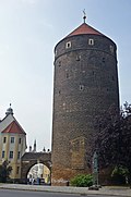
Donatsturm | Donatsring (card) |
Middle of the 15th century (wall tower); 1923 (city gate) | Individual monument of the promenade ring and city wall: round tower with side archway
Landscape design (shapes the silhouette of the urban landscape), significant in terms of construction, military, local and urban development history, and also singular |
09200594 |
 |
Section of the city wall on Donatsring ("Irbischs Turm; Lazarett-Turm") | Donatsring (card) |
from 1397 (city wall) | Individual monument belonging to the promenade ring and city wall: section of the city wall (curtain wall, inner wall) with Irbisch's tower and hospital tower, two inward-facing buildings and outer wall (landside wall) on Donatsring; between the Zwinger and Wallgraben, reaching from Donatsturm to Terrassengasse, historical city fortifications, one of the few late medieval structures in Saxony that have survived in this form;
Significant in terms of building, local and urban development history and urban planning, as well as being of rarity |
09200624 |
 |
Donatsfriedhof (aggregate) | Donatsring (card) |
1927–1928 ( crematorium or celebration hall); 1839 (cemetery gate house); around 1680 (south of the crypt, family Herberger / Gerlach); around 1780 (north of the crypt, Wahl / Klemm family); 1655/1670 (enclosure) | Individual monuments of the entity age and Neuer Donatsfriedhof: Alter Donatsfriedhof: gatehouse, two crypt houses, 15 graves, 185 gravestones, four memorial stones and nine war memorials for the fallen of the First World War as well as enclosure, Neuer Donatsfriedhof: crematorium or celebration hall (1927-1928), 41 Tombs and 24 tombs; Significant in terms of location and personal history as well as of architectural or artistic value |
09201487 |
| City Hospital and District Hospital | Donatsring 20 (card) |
1928-1929 (hospital) | Two hospital buildings ; Modern multi-storey buildings from the late 1920s in the Bauhaus style, made of rectangular cubes with open galleries, ribbon windows, flat roofs and also cubic tower structures, in this form in Freiberg and probably also unique across the country, apart from that, significant in terms of building history (example of hospital architecture at that time, which is called » Freiberg System "became a trend-setter) |
09201054 |
|
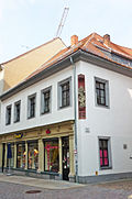 |
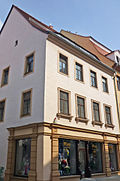
Residential building | Narrow Alley 1 (map) |
around 1511 (house); around 1550 (eastern extension) | Residential house in closed development in a corner, with an eastern extension on an angled floor plan; Characteristic petty bourgeois house of the 16th century with timber frame and renaissance garments from two buildings combined, steep roof hipped, ground floor in 1885, the shop area from this period, and redesigned in 1928, significant in terms of building and urban development, figure of Anna Selbdritt on the corner artistically significant |
09200327 |
 |
Residential building | Narrow Alley 2 (map) |
after 1724 (residential building) | House in corner position and closed development; Originally a baroque town house (created after the fire in 1724) with a clearly structured facade and pitched roof, remodeled in 1883, significant in terms of urban development history |
09200332 |
 |
Residential building | Narrow Alley 7 (map) |
3rd third of the 17th century, essentially older (residential building) | Residential house in closed development; Renaissance building, remodeled in the last third of the 17th century, significant in terms of building and urban development |
09200631 |
 |
Residential building | Erbische Strasse 1 (map) |
around 1530 (residential building) | Residential house in closed development; Renaissance building with profiled window frames on the first and second floors, with shop; Significant in terms of building and urban development history |
09200334 |
 |
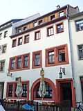
Residential building | Erbische Strasse 2 (map) |
around 1870 (residential building) | Residential house in closed development; Well-proportioned late classicist building with well-balanced facade decoration, with shop: significant in terms of building and urban development history |
09200333 |
 |
Inn ("Zum Goldenen Löwen") | Erbische Strasse 3 (map) |
before 1567 (guest house) | Inn; Renaissance building with architraved and profiled window frames, partly rebuilt and probably also increased, Weber composed his first opera here; Significant in terms of construction, location, urban development and personal history (memorable) |
09200335 |
 |
Residential building | Erbische Strasse 4 (map) |
after 1592 (residential building) | Residential house with shop on the ground floor in closed development; Despite being remodeled in the 19th century with shop installation, a striking building with a pitched roof, in the core of the 16th century, significant in terms of urban development, and in connection with other buildings on Erbische Strasse, it also shapes the townscape |
09200394 |
 |
Residential building | Erbische Strasse 5 (map) |
2nd half of 17th century (residential building) | Residential house in closed development; clearly structured baroque building, inside largely the original substance, relief arches in the hallway and apparently also in the upper floors; Significant in terms of building and urban development history |
09200397 |
 |
Residential and commercial building | Erbische Strasse 6 (map) |
around 1870, essentially older (residential and commercial building) | Residential and commercial building in closed development; Wilhelminian style building with a representative historicist facade including the design highlighted shop area, in the core probably still substance from the 16th-18th centuries. Century; Significant in terms of building and urban development history |
09200396 |
 |
Residential and commercial building | Erbische Strasse 7 (map) |
around 1870 (residential and commercial building) | Residential and commercial building in closed development; Wilhelminian style building with a representative historicism facade made of strong structural elements; Significant in terms of building and urban development history |
09200398 |
 |
Residential building | Erbische Strasse 8 (map) |
last V. 19th century (residential building) | Residential house in closed development; simple plastered building with historicizing facade; Significant in terms of building and urban development history |
09200400 |
 |
Residential building | Erbische Strasse 9 (map) |
2nd third of the 16th century (residential building) | Residential house in closed development; Originally preserved baroque building with distinctive window frames drilled on four sides (rare), significant in terms of building and urban development history |
09200399 |
 |
Residential and commercial building | Erbische Strasse 10 (map) |
re. 1912 (residential building) | Residential house in closed development as well as courtyard building; Buildings with reform style elements from around 1910, remarkable the colored glass windows and colored mosaics, significant in terms of building history and urban development history, of high quality in terms of design, in addition there are house history panels and significant set pieces from the Erbischer Tor on the courtyard buildings of local historical value |
09200401 |
 |
Residential and commercial building | Erbische Strasse 11 (map) |
re. 1906 (residential and commercial building) | Residential and commercial building in closed development; striking Art Nouveau building with historicizing elements; Significant in terms of building and urban development history |
09200403 |
 |
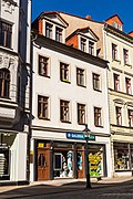
Residential building | Erbische Strasse 12 (map) |
18th century (residential building) | Residential house in closed development; Two-storey building with a characteristic mansard roof, with no. 20 the last small-scale building from the time before the conversion of Erbische Strasse into a modern shopping street, significant in terms of urban development |
09200402 |
 |
Residential building | Erbische Strasse 13 (map) |
18./19. Century (residential building) | Residential house in closed development; with the neighboring buildings of importance for the townscape (closed impression of the street), also important in terms of urban development history |
09200406 |
 |
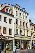
Residential and commercial building ("Zur Sonne") | Erbische Strasse 14 (map) |
after 1733 (residential and commercial building) | Residential and commercial building in closed development; in its present form largely after 1910, significant in terms of urban development, and also valuable in terms of local history as the former Gasthof zur Sonne |
09200404 |
 |
Residential and commercial building | Erbische Strasse 15 (map) |
1867 (residential and commercial building) | Residential and commercial building in closed development; striking historicism building with high-quality facade design; Significant in terms of building and urban development history |
09200409 |
 |
Residential and commercial building | Erbische Strasse 16 (map) |
re. 1905 (residential and commercial building) | Residential and commercial building in closed development; striking building from the period after 1900 in the late historic style; Significant in terms of building and urban development history |
09200405 |
 |
facade | Erbische Strasse 17; 19 (card) |
2nd half of the 19th century (facade) | Facade of a residential building; clearly structured facade of the 19th century, figurative decoration in the form of a putto (only facade protected - building is completely hollowed out); historically important and defining the townscape |
09200410 |
 |
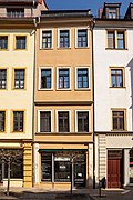
Residential building | Erbische Strasse 18 (map) |
1668/1669 (residential house) | Residential house in closed development; Residence of the important Freiberg goldsmith Daniel Klemm, impressive baroque building with a distinctive two-storey bay window; Significant in terms of art, architecture, local people and urban development history |
09200407 |
 |
Residential building | Erbische Strasse 20 (map) |
2nd half of the 17th century and after 1724 (residential building) | Residential house in closed development; with no. 12 the last such small building from the time before the conversion of the Erbische Strasse into a modern shopping street, inside a remarkable staircase, significant in terms of urban development |
09200408 |
 |
Residential building | Erbische Strasse 22 (map) |
after 1724 (residential building) | Residential house in closed development; clearly structured baroque building with original substance inside (staircase), shop area at the end of the 19th century; Significant in terms of building and urban development history |
09200414 |
 |
Residential building | Erbische Strasse 24 (map) |
re. 1725 (residential building) | Residential house in closed development; the core of the baroque building with moderate window design from the 19th century and an antique-looking shop front with a rich side portal, valuable inscription plaque inside; Significant in terms of urban development and local history, the ground floor design is of high artistic quality |
09200337 |
 |
Residential building | Färbergasse 4 (map) |
2nd half of the 16th century (residential building) | Residential house in closed development; Small bourgeois house from the 16th century, largely preserved in its original state, with typical axial proportions, profiled window frames and pitched roof, segment arch portal, probably baroque, significant in terms of building and urban development history |
09200486 |
 |
Factory building ("Jahn dye works") | Färbergasse 5 (map) |
around 1815 (factory) | Factory building of a former dye works; distinctive, elongated building with two large gate entrances and a high hipped roof including a continuous eaves-side towing hatch, the rounded roof corners give the building an unmistakable appearance; Significant in terms of building, industrial, local and urban development history, also unique in terms of design (unique roof design) |
09200485 |
 |
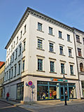
Residential and commercial building | Fischerstrasse 1 (map) |
re. 1883 (residential house) | Residential and commercial building in closed development and in a corner location; two combined buildings, representative building in neo-baroque forms on Erbische Strasse, simpler building on Fischerstrasse a little older, significant in terms of building and urban development history |
09200358 |
 |
Residential building | Fischerstraße 2 / 2a (map) |
1861 (residential building) | Residential house in closed development; Eye-catching corner building with a strictly horizontally structured neo-renaissance facade, part of the street ensemble of the Erbische Strasse, significant in terms of urban development and defining the appearance of the town (characteristic of the appearance of the Erbische Strasse, which in the 19th century became a commercial street) |
09200425 |
 |
Residential building | Fischerstrasse 3 (map) |
around 1555 (residential building) | Residential house in closed development; Characteristic town house from the 16th century, redesigned in baroque style (ground floor) with a pitched roof and window frames on the upper floor, suggesting the profile of the Renaissance, significant in terms of building and urban development history |
09200359 |
 |
Residential and commercial building | Fischerstraße 4a (map) |
re. 1896 (residential and commercial building) | Residential and commercial building in half-open development; representative Gründerzeit building, with stylistic elements of the German Renaissance, striking stepped gable; Significant in terms of building and urban development history |
09200360 |
 |
Residential building | Fischerstrasse 5 (map) |
between 1484 and 1700 (residential building) | Residential house in closed development; today used as a hotel, broad-based building with a gable roof, accents are set by the basket arch portal and the window frames; Significant in terms of building and urban development history |
08992421 |
 |
Residential building | Fischerstrasse 6 (map) |
18th century (residential building) | House in corner position and closed development; distinctive shop zone on the ground floor, representative building with high mansard roof, the ground floor grooved; Significant in terms of building and urban development history |
09200028 |
 |
Residential building | Fischerstrasse 6a (map) |
around 1550 (residential building) | House in corner position and closed development; Renaissance building with profiled walls and pitched roof, later redesigned; Significant in the history of building and urban development. In 1628, Emil Lange furnished it as a shop, added an outbuilding in 1858, last redesigned in 1908 |
09200363 |
| Residential building | Fischerstrasse 7 (map) |
around 1584 (residential building) | Residential house in closed development; elongated building with renaissance garments on the first floor, later redesigned; Significant in terms of building and urban development history |
09200361 |
|
 |
Residential building | Fischerstrasse 13 (map) |
last quarter of the 16th century (residential building) | Residential house in closed development; largely originally preserved building from the end of the 16th century with irregular windows on the upper floor; Significant in terms of building and urban development history |
09200364 |
 |
Residential building | Fischerstrasse 14 (map) |
1877 (residential house) | Residential house in closed development; Here in January 1919 the local group Freiberg of the KPD was founded (plaque on the corner), a local historical monument relevant to the interpretation of an era (history of the Weimar Republic, party history of the 20th century, etc.) |
09200424 |
 |
Residential building | Fischerstrasse 15 (map) |
between 1484 and 1700 (residential building) | Residential house in closed development; largely originally preserved building with irregular window structure on the upper floor; Significant in terms of building and urban development history |
09200365 |
 |
Residential building | Fischerstrasse 20 (map) |
3rd quarter of the 19th century (residential building) | Residential house in closed development; Plastered building with economical decor, five roof houses, significant in terms of building history and in connection with the old town in terms of urban development history |
09200839 |
 |
Basement, wall arches and shop fitting | Fischerstrasse 23 (map) |
15./16. Century (cellar) | Basement, wall arches and shop fittings; structurally valuable components |
09201088 |
 |
Residential building | Fischerstrasse 25 (map) |
End of the 16th century (residential building) | Residential house in closed development; Renaissance petty bourgeois house with profiled window frames and pitched roof, remodeled in the 19th century, significant in terms of building and urban development history |
09200368 |
 |
Residential building | Fischerstraße 26 (map) |
1st half of the 19th century (residential building) | Residential house in closed development; Simple plastered building with eight axes, significant in terms of urban development |
09200610 |
 More pictures |
Residential building | Fischerstrasse 27 (map) |
around 1570 (residential building) | Residential house in closed development with rear building; representative Renaissance townhouse with profiled and architraved walls and pitched roof, later slightly overformed, significant in terms of building and urban development history |
09200369 |
 |
Residential building | Fischerstrasse 28 (map) |
1874 (residential building) | Residential house in half-open development in a corner; Wilhelminian style building with western wooden verandas, significant in terms of urban development |
09200357 |
 |
Residential building | Fischerstrasse 29 (map) |
around 1600 (residential building) | Residential house in closed development with rear building; Renaissance burgher house with profiled and architraved walls and pitched roof, remodeled in the 19th century; Significant in terms of building and urban development history |
09200370 |
 |
Residential building | Fischerstraße 31 (map) |
Mid-16th century (residential building) | Residential house in closed development; Renaissance town house, later heavily remodeled; Significant in terms of building and urban development history |
09200371 |
 |
Residential building | Fischerstrasse 33 (map) |
after 1523 (residential house) | Residential house in closed development; characteristic town house in baroque forms (older in essence), significant in terms of building and urban development history |
09200605 |
 |
Lomonosov memorial plaque | Fischerstrasse 41 (map) |
around 1970 (inscription panel) | Lomonosov memorial plaque; significant in terms of personal history |
09200609 |
 |
Tenement house | Fischerstrasse 49 (map) |
around 1860 (tenement) | Apartment building in closed development; Corner building with a tower over a polygonal floor plan (see also Schillerstraße 16), also significant in terms of urban development history |
09200611 |
 |
Pavement | Gerbergasse (map) |
16th - 18th century (plaster) | Pavement; Significant in terms of local and urban development history, also of relevance to the appearance of the town |
09200636 |
 |
Retaining wall (see Aschegasse) | Gerbergasse (map) |
18th - 19th century (retaining wall) | Retaining wall (see Aschegasse) |
08992430 |
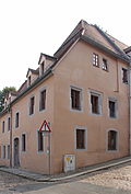 |
Residential building | Gerbergasse 2 (map) |
3rd third of the 16th century (residential building) | Residential house in half-open development; Renaissance building with profiled walls, later redesigned, significant in terms of building and urban development |
09200645 |
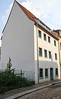 |
Residential building | Gerbergasse 7 (map) |
late 16th / 17th century Century (residential building) | Residential house in half-open development; Late Renaissance building, later redesigned, significant in terms of building and urban development history |
09200644 |
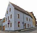 |
Residential building | Gerbergasse 8 (map) |
16.-18. Century (residential building) | Residential house in half-open development; An important corner building in terms of urban planning, as a building from the 16th to 18th centuries also of architectural and urban development historical value |
09200637 |
 |
Residential building | Gerbergasse 9 (map) |
after 1800 (residential building) | Residential house in closed development; characteristic building from the time after 1800, significant in terms of building and urban development history |
09200643 |
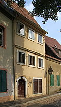 |
Residential building | Gerbergasse 13 (map) |
around 1800, essentially older (residential building) | Residential house in closed development; characteristic building with pitched roof and segment arch portal, significant in terms of building and urban development history |
09200642 |
 |
Residential building | Gerbergasse 15 (map) |
late 15th century to around 1700 (residential building) | Residential house in half-open development; striking building with a high gable facing Aschgasse, significant in terms of building and urban development history |
09200641 |
 |
School building ( Gymnasium Albertinum ; Geschwister-Scholl-Gymnasium ) | Geschwister-Scholl-Strasse 1 (map) |
1873–1875 (school) | School building with an E-shaped floor plan; Broad, representative building with a prominent central section, as one of the most elaborate historicism buildings in Freiberg and an example of the so-called Dresden School (Semper-Nicolai style) of particular architectural significance, also of local history (traditional high school in the city) and artistically significant |
09200580 |
 |
Building with enclosure ( Fronfeste ) | Geschwister-Scholl-Strasse 2; 4 (card) |
around 1800 (residential building) | Enclosed building; Broad plastered building with a half-hip roof, historically significant building |
09200700 |
 |
Building in open development ( Königl. Schrotfabrik ) | Helmertplatz 1 (map) |
1st half of the 19th century (residential building) | Buildings in open development; clearly structured late Biedermeier building, significant in terms of building history and urban development history, as a former royal. Shot factory also of local historical value |
09200431 |
 |
Tenement house | Helmertplatz 4 (map) |
1906–1907 (residential building) | Tenement house in semi-open development; Representative Art Nouveau building with the original facade design, significant in terms of building and urban development history, also of artistic importance |
09200432 |
 |
facade | Herderstrasse 1 (map) |
around 1550 (facade) | Facade of a residential building in a semi-open development; Small bourgeois house of the Renaissance, profiled and architraved windows on the upper floor, typical axial relationship, overformed ground floor facade, significant in terms of building and urban development history |
09200806 |
 |
Tenement house | Herderstrasse 10 (map) |
1906–1907 (tenement house) | Apartment building in corner location and closed development; Originally preserved building from the turn of the century with elaborate Art Nouveau ornamentation and historicizing elements, significant in terms of building and urban development history, due to its prominent corner location also of importance for urban planning (characterizing the townscape) |
09200488 |
 |
Residential building ( Herder house ; later boys 'citizens' school ) | Herderstrasse 2 (map) |
around 1624 (house); from 1848 (school) | Residential building, later school building; representative, broad building with two large portals and other remarkable architectural details (also on the courtyard front and inside), once the home of the chief miner von Herder and since 1848 boys 'citizens' school; Significant in terms of art, architecture, local people and urban development history |
09200492 |
 |
Residential building | Herderstrasse 3 (map) |
around 1548 (residential building) | Residential house in closed development; Renaissance facade largely preserved in its original form with profiled window frames, remarkable grotesque portal and steep roof; Valuable artistically, in terms of building and urban development history, portal also of unique design significance |
09200491 |
| Residential building | Herderstrasse 5 (map) |
1531/1532 (residential building) | Residential house in closed development; Renaissance building, one storey added in the 19th century, significant in terms of building and urban development |
09200807 |
|
| Residential building | Herderstrasse 6 (map) |
Mid-16th century (residential building) | Residential house in closed development; Essentially a late-Gothic building with remarkable frame profiles on the first floor and a pitched roof, which was remodeled in the 18th century, significant in terms of building and urban development history |
09200489 |
|
| Residential building | Herderstrasse 7 (map) |
between 1484 and around 1700 (residential building) | Residential house in closed development; Renaissance building, fundamentally redesigned in the 19th century, with neighboring buildings important for the townscape (ensemble effect), significant in terms of building and urban development history |
09200809 |
|
 |
Residential building | Herderstrasse 8 (map) |
after 1900 (residential building) | Residential house in closed development; Façade with historicizing elements in the sense of Art Nouveau, evidence of architecture after 1900, also an ensemble with a more elaborate corner building, significant in terms of architectural history, important for the townscape |
09200808 |
| Residential building | Herderstrasse 9 (map) |
1887 (residential house) | Residential house in closed development; striking historicism building with strongly protruding facade decorations and remnants of the original shop design; Significant in terms of building and urban development history |
09200490 |
|
 |
Pavement | Heubnerstrasse (map) |
around 1900 (plaster) | Pavement; high quality mosaic plaster in the form of a stylized flower, artistically significant, rare in this form in Freiberg and beyond (singularity) |
09200496 |
| Tenement house | Heubnerstrasse 1 (map) |
1885 (tenement house) | Apartment building in corner location and closed development; clearly structured historicism facade with uniformly designed window frames, which underline the character of the townscape, significant in terms of urban development history |
09200463 |
|
 |
Residential building | Heubnerstrasse 2 (map) |
before 1547 (residential building) | Residential house in closed development; essentially still substance from the 16th century, fundamental changes with shop installation and an increase of one storey in the 19th century; Significant in terms of building and urban development history |
09200898 |
| Residential building | Heubnerstrasse 3 (map) |
1520/1530 (residential building) | Residential house in closed development; Freiberg Renaissance house with typical axial proportions, profiled window walls on all floors, pitched roof and original floor plan (three-cell type); artistically, building and urban development history significant |
09200464 |
|
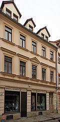 |
Residential building | Heubnerstrasse 4 (map) |
from 1529 (residential building) | Residential house in closed development; Originally a Renaissance building, fundamental renovation in the 19th century, well-proportioned, symmetrically designed facade, significant in terms of building and urban development history |
09200498 |
 |
Residential building | Heubnerstrasse 6 (map) |
after 1531 (residential house) | Residential house in closed development; Originally a Renaissance building, fundamental renovation at the end of the 19th century, as a dominant corner, of particular importance in terms of urban development, furthermore with a historicizing facade design that is unmistakable for Freiberg, including a massive, rustic-style ground floor, marbled columns, etc .; Significant in terms of urban planning, building and urban development history |
09200497 |
 |
Residential building | Heubnerstrasse 7 (map) |
around 1600 (residential building) | Residential house in closed development; Building from around 1600 with typical renaissance garments, after 1800 remodeling and adding a storey, characteristic Biedermeier or late classicist entrance door from this period. Partly significant artistically (door) and in terms of urban development history |
09200465 |
| Tenement house | Heubnerstrasse 8 (map) |
1908 (tenement) | Apartment building in closed development; Historicism building largely preserved in its original form, cellar with central column (16th century), significant in terms of building and urban development history |
09200493 |
|
 |
Residential building | Heubnerstrasse 9 (map) |
between 1531 and 1541 (residential building) | Residential house in open development; essentially renaissance building with typical window division, later redesigned, significant in terms of building and urban development history |
08992514 |
 |
Residential building | Heubnerstrasse 11 (map) |
1st quarter of the 19th century (residential building) | Residential house in closed development; striking late baroque corner building with drilled segment arch portal, axial facade structure and high pitched roof, significant in terms of building and urban development history |
09200466 |
 |
Residential building | Heubnerstrasse 12 (map) |
around 1518 (residential building) | Residential house in closed development; characteristic building with a high pitched roof, in the core probably still the 16th century, significant in terms of building and urban development history |
09200553 |
 |
Residential building | Heubnerstrasse 13 (map) |
18th century, older in the core (residential building) | Residential house in closed development; Baroque building with a segmented arched portal, high pitched roof including bat dormers, with a Renaissance core, largely preserved in its original form, has an impact on the street space of the smaller section of Heubnerstraße, in terms of town planning (characterizing the townscape), building and town development history |
09200495 |
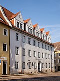 |
Administration building ( Kreisamtshaus ; Stadthaus II ) | Heubnerstrasse 15 (map) |
16th century, older in essence (administration) | Administration building; distinctive building from the middle of the 19th century, remains of a presumably high medieval stone house in the eastern gable area have been preserved, multiple alterations, architecturally and town-planning remarkable, it is also associated with Richard Wagner (panel); Significant in terms of building, local people (memorable) and urban development history |
09200494 |
 |
Tenement house | Heubnerstrasse 22 (map) |
after 1891 (tenement) | Apartment building in corner location and closed development; characteristic small-town Wilhelminian style building with a simple but balanced facade and a prominent corner; Significant in terms of building and urban development history |
09201082
|
 |
Saxon post mile pillars (totality) | Hornstrasse (map) |
re. 1723 (post distance column) | Post mileage column; Original of a distance column, significant in terms of traffic and local history |
09200395 |
 |
Residential and commercial building | Hornstrasse 1 (map) |
re. 1896 (residential and commercial building) | Residential and commercial building in a corner and closed development; distinctive Wilhelminian style building with elaborate facade design, figural decorations and in parts original shop fittings; Significant artistically, in terms of building and urban development history, and at this point it also shapes the townscape |
09200623 |
| Residential building | Hornstrasse 7 (map) |
1854 (residential house) | Residential house in closed development in a corner; representative historicizing building, historically significant, architecturally of high quality (artistic value), within a prominent section of the ring development also of importance from an urban planning point of view |
09200724 |
|
| Tenement house | Hornstrasse 9 (map) |
1890/1891 (tenement house) | Apartment building in closed development and corner location; Townscape-defining, representative building with an elaborate facade design and tower-like structure on the corner, one of the most striking examples of Wilhelminian style and historicizing architecture in the late 19th century in Freiberg, significant in terms of architectural, artistic and urban development history |
09200434 |
|
| Tenement house | Hornstrasse 11 (map) |
1891 (tenement house) | Apartment building in closed development; representative building, as one of the most elaborate historicism buildings in Freiberg of architectural historical and architectural value, within a prominent section of the ring development also significant in terms of urban planning (important for the townscape) |
09200586 |
|
| Tenement house | Hornstrasse 13 (map) |
1888 (tenement house) | Apartment building in closed development; representative building, structural testimony to historicism of architectural and urban development historical value, within a striking section of the ring development also significant in terms of urban planning (important for the townscape) |
09200587 |
|
| Tenement house | Hornstrasse 15 (map) |
1880 (tenement) | Apartment building in closed development; with restrained but demanding facade design, valuable in terms of urban development history, within a striking section of the ring development also significant in terms of urban planning (important for the townscape) |
09200588 |
|
| Tenement house | Hornstrasse 17 (map) |
1867 (tenement house) | Apartment building in closed development; Clearly structured building from the 19th century that was remodeled in 1908, with a design highlighted, unmistakable group of balconies, remarkable the elegantly curved balcony grilles and the gable triangle above the eaves, important as an architectural testimony (important in terms of building and urban development history), within a striking section of the ring development town planning valuable (important for the townscape) |
09200589 |
|
| Tenement house | Hornstrasse 21 (map) |
1860 (tenement house) | Apartment building in closed development; Stylishly highlighted historicism building with plastering on the ground floor, central pilaster strips, balcony, acanthus frieze, etc., significant in terms of building and urban development history, within a striking section of the ring development also of urban value (valuable for the townscape) |
09200590 |
|
| Tenement house | Hornstrasse 27 (map) |
1860 (tenement house) | Apartment building in closed development; representative, late-classicist building, as a high-quality building from the 3rd quarter of the 19th century, significant in terms of building history, artistry and urban development history, within a prominent section of the ring development also of urban value (important for the townscape) |
09200591 |
|
| Tenement house | Hornstrasse 29 (map) |
1862 (tenement house) | Apartment building in closed development; characteristic building in its current form from 1907 with Art Nouveau facade, which also shows historicizing elements, as a building of the transition style between Historicism and Art Nouveau; Significant in terms of building and urban development history, within a prominent section of the ring development also of urban value (important for the townscape) |
09200592 |
|
| Residential building | Hornstrasse 31 (map) |
1860 (tenement house) | Residential house in closed development; Significant in terms of urban development history, within a striking section of the ring development also valuable in terms of urban development (important for the townscape) |
09200593 |
|
| Residential building | Hornstrasse 33 (map) |
last quarter of the 19th century (residential building) | Residential house in closed development; Significant in terms of urban construction history, also part of an unmistakable urban ensemble |
09200798 |
|
| Residential building | Hornstrasse 35 (map) |
last quarter of the 19th century (residential building) | Residential house in half-open development; Significant in terms of urban development history, also part of an unmistakable urban ensemble |
09200795 |
|
| city wall | Hornstrasse 35 (map) |
from 1397 (city wall) | Individual monument of the whole Promenadenring and city wall: section of the city wall; historical city fortifications, one of the few late medieval structures in Saxony that has been preserved in this form; Significant in terms of building, location and urban development and urban planning; Rarity |
09305709 |
|
 |
Residential building | Jakobigasse 5 (map) |
around 1600 (residential building) | Residential house in closed development; characteristic petty bourgeois house, probably still with substance from the 16th century; Significant for building and urban development history as well as for the townscape |
09200718 |
 |
Residential building | Jakobigasse 7 (map) |
1575/1588 (residential building) | Residential house in closed development; characteristic petty bourgeois house, probably still with substance from the 16th century, significant in terms of urban development and architectural history, important for the townscape |
09200719 |
 |
Residential building | Kaufhausgasse 1 (map) |
around 1500 (residential building) | Residential house in closed development; Highlighted by its corner location, renaissance building with framework and arched curtain windows as well as with a high pitched roof visible from afar, significant in terms of building and urban development history, also of singular urban development importance in connection with the upper market ensemble |
09200420 |
 |
Residential building | Kaufhausgasse 9 (map) |
re. 1525 (residential building) | Residential house in open development; Probably one of the oldest buildings in Freiberg, characteristic late Gothic building independent of the gable, valuable in terms of building and urban development history, also of singular importance and, with its high gable, also of urban planning importance |
09200323 |
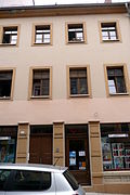 |
Residential building | Kesselgasse 1 (map) |
after 1724 (residential building) | Residential house in closed development; Baroque building with axially structured windows and a pitched roof, the ground floor zone was remodeled in the second half of the 19th century, significant in terms of building and urban development |
09200339 |
 |
Residential and commercial building | Kesselgasse 1a (map) |
re. 1887 (residential and commercial building) | Residential and commercial building in a corner and closed development; one of the most representative Wilhelminian-style buildings on site with an elaborate historicizing facade design, a shop window on the ground floor; Significant in terms of building and urban development history, also unique in this form in Freiberg (singularity) |
09200338 |
 |
Residential and commercial building | Kesselgasse 2 (map) |
1887 (residential and commercial building) | Residential and commercial building in closed development; impressive historicizing corner building with strong window frames and horizontal structure, built in the neo-renaissance style; Significant in terms of building and urban development history, and also of high quality in terms of design |
09200336 |
 |
Residential building | Kesselgasse 3 (map) |
1st half of the 18th century (residential building) | Residential house in closed development; Baroque building with an axial structure of the facade and a pitched roof, significant in terms of urban development |
09200340 |
 |
Residential building | Kesselgasse 4 (map) |
after 1724 (residential building) | Residential house in closed development; largely originally preserved building from the 18th century, significant in terms of urban development |
09200374 |
 |
Residential building | Kesselgasse 5 (map) |
around 1590 (residential building) | Residential house in closed development; Renaissance building with profiled window frames on the first and second floors, significant in terms of building and urban development |
09200372 |
 |
Residential building | Kesselgasse 6 (map) |
after 1724 (residential building) | Residential house in closed development; Largely originally preserved baroque building (especially the interior), heightened in 1887 and the facade z. Partly changed, significant in terms of urban development history, important for the townscape in connection with neighboring buildings |
09200375 |
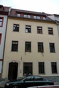 |
Residential building | Kesselgasse 7 (map) |
1769 (residential house) | Residential house in closed development with rear building including arcade to the courtyard; Typical baroque building with axial window structure and drilled segment arch portal, inside evidently still substance from the 16th century, significant in terms of building and urban development history |
09200373 |
 |
Residential building | Kesselgasse 8 (map) |
re. 1725 (residential building) | Residential house in closed development; typical baroque building with axial window structure and drilled segment arch portal, significant in terms of building and urban development history |
09200376 |
 |
Residential building | Kesselgasse 9 (map) |
18th century (residential building) | Residential house in closed development; in the 19th and 20th Century redesigned baroque building, in the core probably still original, significant in terms of building and urban development history |
09200910 |
| Residential building | Kesselgasse 10 (map) |
18th century (residential building) | Residential house in closed development; typical baroque building with axial window structure and drilled segment arch portal, significant in terms of building and urban development history |
09200377 |
|
| Residential building | Kesselgasse 12 (map) |
re. 1723 (residential house) | Residential house in closed development; Despite the new shop fittings, the building from the 18th century is largely preserved in its original form, significant in terms of building and urban development history |
09200378 |
|
 |
Residential building | Kesselgasse 14 (map) |
around 1614 (residential building) | Residential house in closed development; Impressive renaissance building with profiled cloaks, very high gable (highest, free-standing gable in the old town) and former seating niche portal, significant in terms of building and urban development history, as one of the most striking Freiberg town buildings also of singular importance, also characterizing the townscape (formation of the Freiberg roof landscape) |
09200379 |
 |
Residential building | Kesselgasse 16 (map) |
16th and 18th century (residential building) | House in corner position and closed development; As an originally preserved building from the Renaissance, significant in terms of building and urban development history, partially demolished in summer / autumn 2013 |
09200505 |
 |
Residential building | Kesselgasse 20 (map) |
1545/1561 (residential building) | Residential house in closed development; Building with an impressive Renaissance cubature and profiled window frames on the upper floor, partly overformed in the 18th century (especially the ground floor), important in terms of building and urban development |
09200504 |
| Residential building | Kesselgasse 22 (map) |
before 1528 (residential building) | Residential house in closed development; Distinctive town house from the 16th century with a late Gothic core, framework and simply profiled cloaks as well as a high, characteristic pitched roof, significant in terms of architectural history, artistic (high-quality Renaissance building with Gothic elements) and urban development history |
09200503 |
|
| Ground floor walls with sandstone portal | Kesselgasse 23 (map) |
re. 1734 (portal) | Ground floor walls with sandstone portal; Remains of a manufacturing building, mainly from the 18th century, of certain value in terms of urban development |
09200678 |
|
 |
Residential building | Kesselgasse 24 (map) |
re. 1534 (residential building) | Residential house in closed development; today used as St. Nicolai's wine tavern, Freiberg petty bourgeois house from the 16th century with a Gothic seat niche portal, half-timbered upper floor and pitched roof; Significant in artistic, architectural and urban development terms, very rare / unique due to the distinctive portal and the half-timbered structure with St. Andrew's crosses |
09200502 |
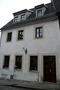 |
Residential building | Kesselgasse 26 (map) |
2nd half of the 16th to 17th century (residential building) | House in corner position and closed development; Renaissance building, largely preserved in its original state, with remarkable furnishings, significant building and urban development history, furnishings with rarity value (singularity) |
09200500 |
| Residence ( to the old master distiller ) | Kesselgasse 30 (map) |
around 1670 (residential building) | Residential building; Today an inn, important in terms of architecture, urban development and local history (unusually old inn) |
09200680 |
|
| Residential building | Kesselgasse 32 (map) |
between 1484 and around 1700 (residential building) | Residential house in closed development; striking building with a high pitched roof, significant in terms of building and urban history |
09200679 |
|
 |
Residential building | Kirchgäßchen 1 (map) |
last quarter of the 15th century (residential building) | Residential house in closed development; Freiberg town house as part of the late medieval development of the market, with this ensemble of unique urban significance, interior remarkable late Gothic and Renaissance furnishings (wooden beam ceiling, plank wall, vault, stucco ceiling ...), historically and artistically important, also valuable in terms of urban development history |
09200291 |
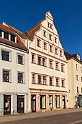 |
Residential building | Kirchgäßchen 3 (map) |
1539 to 1542 (residential house); re. 1538 (rear building) | Residential house with intermediate wing and rear building in closed development; characteristic Renaissance townhouse with high gable towards the upper market, ground floor remodeled in 1891; Artistically, architecturally and in terms of urban development, the facade with pilaster- linked tail gable is unique in Freiberg, and in connection with the upper market ensemble of unique urban development value |
09200967 |
 |
Residential building | Kirchgasse 1 (map) |
between 1484 and around 1700 (residential building) | Residential house in closed development; Renaissance building remodeled in the Baroque style with clearly structured facade, distinctive portal and extended saddle roof, significant in terms of building and urban development history, in connection with the unmistakable street also of urban planning importance |
09200526 |
 |
Residential building | Kirchgasse 2 (map) |
around 1880 (residential building) | Residential house in closed development; Well-proportioned early historicism building with striking details, significant in terms of building and urban development history |
09200811 |
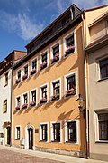 |
Residential building | Kirchgasse 3 (map) |
16th century (residential building) | Residential house in closed development; Renaissance building remodeled in the Baroque style with axial façade structure, segmental arch portal and extended roof, significant in terms of building and urban development history, in connection with the unmistakable street also of urban planning importance |
09200527 |
 |
Residential building | Kirchgasse 5 (map) |
between 1484 and around 1700 (residential building) | Residential house in closed development; Small bourgeois house from the 16th century (three-cell type) with typical axial proportions, timber frame walls on the upper floor and pitched roof, slightly overformed in 1821; Significant in terms of building and urban development history, in connection with the unmistakable street course also of importance in terms of urban planning |
09200528 |
 |
Residential building | Kirchgasse 6 (map) |
1537/1539 (residential building) | Residential house in closed development; Renaissance petty bourgeois house typical of the time (three-cell type) with the usual distribution of axes and pitched roof, in the 18th century mainly the facade was overformed, significant in terms of building and urban development history |
09200516 |
 |
Residential building | Kirchgasse 7 (map) |
16th century (residential building) | Residential house in closed development; A characteristic example of a simple Freiberg petty bourgeois house from the Renaissance with a narrow floor plan and pitched roof, today's shape after 1800, accents are set by the continuous tow hatch and a bat gaupe , significant in terms of building and urban development history, in connection with the unmistakable street, also of urban planning importance |
09200529 |
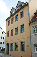 |
Residential building | Kirchgasse 8 (map) |
16th century (residential building) | Residential house in half-open development; Renaissance building remodeled in the Baroque era, significant in terms of building and urban development history |
09200515 |
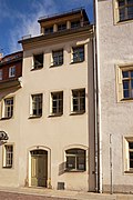 |
Residential building | Kirchgasse 9 (map) |
after 1588 (house); 1st quarter of the 19th century (residential building) | Residential house in closed development; Small bourgeois house from the Renaissance period, remodeled in the early 19th century, significant in terms of building and urban development history, in connection with the unmistakable street layout also of importance for urban planning |
09200530 |
 |
Building complex ( Oberbergamt ) | Kirchgasse 11 (map) |
around 1530 (eastern part of the building) | Oberbergamt with back building; representative, with a broad, multi-axis street facade with truss walls, truss arched portal (right half) and simply profiled windows (left half) as well as pitched roof studded with bat dome, in the central part (right half) the late Gothic free house of the Schönlebe family, with halls on the ground and upper floors Star and net vaults, seat niche portal, 1679 to 1945 seat of the Oberbergamt (again since 1991); Artistic, architectural, local, urban development and mining history valuable, due to the rich furnishings of singular importance, in connection with unmistakable streets also of urban development importance |
09200535 |
| basement, cellar | Kirchgasse 12a / 12b (map) |
13-15 Century (cellar) | Basement, cellar; Significant in terms of building and urban development history |
09200532 |
|
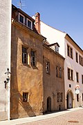 |
Residential building | Kirchgasse 13 (map) |
1590/1595 (residential building) | Residential house in closed development; Renaissance town house with typical axial proportions, seat niche portal and pitched roof, later slightly overformed; Significant artistically, in terms of building and urban development history, in connection with the unmistakable street course also of importance in terms of urban planning |
09200537 |
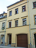 |
basement, cellar | Kirchgasse 14 (map) |
13-15 Century (cellar) | Basement, cellar; Significant in terms of building and urban development history |
09200533 |
 |
Residence ( Schönbergscher Hof ) | Kirchgasse 15 (map) |
1682 using older components (residential building) | Closed four-wing system with all buildings; simple, early baroque complex with inner courtyard, a round stair tower at the rear of the building, impressive groin vaults in the gate passage, striking round arched gate, residence of the chief miners Abraham von Schönberg (died 1711) and von Trebra (died 1819), visit of Goethe in 1810 (memorial plaque); Artistically, structurally, locally, personally (memorable) and in terms of urban development history, due to the furnishings of singular importance, in connection with unmistakable streets also of urban planning importance |
09200536 |
 |
Residential building | Kirchgasse 16 (map) |
1863 (residential house) | Residential house in closed development; Small bourgeois house from the 19th century, significant in terms of urban history, in connection with the unmistakable street, also of importance in terms of urban development |
09200534 |
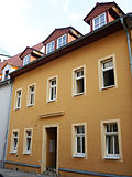 |
Residential building | Kirchgasse 18 (map) |
early 19th century, essentially older (residential building) | Residential house in closed development; Building from the early 19th century, probably older in its core, significant in terms of urban development |
09201119 |
 |
Residential building ("Domkeller") | Kirchgasse 20 (map) |
around 1516 (residential building) | Residential house in closed development; Characteristic Freiberg town house from the 16th century with a pitched roof, striking the lateral passage into Domgasse, significant in terms of building and urban development history, in connection with the unmistakable street also of urban planning importance |
09200538 |
 |
Residential building ( Alnpeck house ) | Korngasse 1 (map) |
around 1510 (residential building) | Residential house in closed development and corner location; Former patrician house of the wealthy Alnpeck family from Freiberg, characteristic late Gothic building with arched curtain windows on the first floor, corner bay windows and valuable substance inside, the last place of the Freiberg mint until 1556 ; Artistically, architecturally, locally and in terms of urban development, of unique urban significance within the market ensemble (singular) |
09200601 |
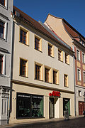 |
facade | Korngasse 2 (map) |
1614 (facade) | Facade, gable walls and basement of a residential building in closed development; former petty bourgeois house from the 16th century, later slightly remodeled (early 17th century), significant in terms of urban development |
09200603 |
 |
Residential building | Korngasse 4 (map) |
around 1875 (residential building) | Residential house in closed development; Wilhelminian style building with a clearly structured facade, significant in terms of urban development history |
09200604 |
 |
Residential building | Korngasse 5 (map) |
re. 1550 and rel. 1953 (residential building) | Residential house in closed development; characteristic renaissance building, with profiled and architraved window frames as well as rich substance inside, significant in terms of building and urban development history |
09200602 |
 |
Residential and commercial building | Korngasse 6 (map) |
re. 1884 (residential and commercial building) | Residential and commercial building in a corner and closed development; one of the richest and most representative Wilhelminian style houses in Freiberg, with the original shop fittings preserved; artistically, building and urban development history significant |
09200618 |
| Inn building ("Red Deer") | Korngasse 7 (map) |
around 1578 (inn) | Inn building; historical Freiberg inn, substance from the 16th century (profiled window frames); Significant in terms of building, local and urban development history |
09200617 |
|
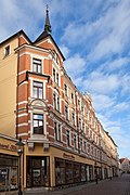 |
Double tenement house | Korngasse 10; 12 (card) |
around 1900 (tenement) | Double apartment building with a shop area in closed development; extremely representative Gründerzeit building with clinker-sandstone facade (different colored clinker bricks); Significant in terms of building and urban development history |
09200616 |
 |
Storage building ("Kornhaus") | Korngasse 14 (map) |
around 1510 (Speicher) | Storage building with attached corner tower; multi-storey building with a high gable roof and characteristic niche gables, made of quarry stone and brick, the interior of the late Gothic roof structure is remarkable; Building, military (as part of the city fortifications), local and urban development history significant as one of the oldest and most impressive storage buildings in Saxony; singular |
09200614 |
 |
Residential building | Kreuzgasse 1 (map) |
around 1800 (residential building) | Residential house in half-open development; Residential building to the neighboring factory (factory converted into a Catholic church in 1830 and the factory's residential building converted into a parish building, temporarily), market-like classicist building from the Biedermeier period with a prominent entrance portal, front side with pilaster strips, historically important |
09300812 |
 |
Catholic parish church of St. John the Baptist | Kreuzgasse 3 (map) |
1830 (church) | Catholic Church; Former manufactory building, converted into a Catholic church in 1830, striking hall church with historicizing facade, saddle roof and turret, testimony to the church architecture of the late 19th century, significant in terms of building history |
09200550 |
| Tenement house | Kreuzgasse 4 (map) |
1907 (residential building) | Apartment building in closed development; characteristic historicizing building, ensemble effect with No. 6 and Herderstrasse 10, significant in terms of urban development history |
09200552 |
|
 |
Residential building | Kreuzgasse 5 (map) |
1616/1617 (residential building) | Residential house in closed development; Renaissance townhouse with a pitched roof (the window frames probably removed), remodeled in the 18th century, inside window architecture made of half-columns and consoles as well as wall paintings; artistically, building and urban development historically valuable, due to the equipment also singular (rarity) |
09200549 |
| Tenement house | Kreuzgasse 6 (map) |
1906 (residential building) | Apartment building in closed development; Example of early objectivity architecture after 1900, ensemble effect with No. 4 and Herderstrasse 10, significant in terms of building and urban development history |
09200551 |
|
 |
Gable and eaves side building ("Dunkelhof") | Kreuzgasse 7 (map) |
after 1519 (eaves standing house); after 1525 (gable-independent house) | Two houses with an L-shaped floor plan; western eaves-side building with four irregularly arranged window axes, segmented arched gate entrance and pitched roof including a continuous towing hatch, inside a simple plank ceiling, eastern building with stepped gable and neo-Gothic facade design, is one of the few Freiberg gabled houses, the home and home of the Freiberg architect Eduard Heuchler; artistically, building, local and urban development history significant, due to the equipment (beam ceiling) also singular (rarity) |
09200548 |
literature
- Yves Hoffmann, Uwe Richter (ed.): City of Freiberg. Vol. 1. (= Monument topography Federal Republic of Germany. Monuments in Saxony). Werbung & Verlag, Freiberg 2002, ISBN 3-936784-00-0 .
- Yves Hoffmann, Uwe Richter (ed.): City of Freiberg. Vol. 2. (= Monument topography Federal Republic of Germany. Monuments in Saxony). Werbung & Verlag, Freiberg 2003, ISBN 3-936784-01-9 .
- Yves Hoffmann, Uwe Richter (ed.): City of Freiberg. Vol. 3. (= Monument topography Federal Republic of Germany. Monuments in Saxony). Werbung & Verlag, Freiberg 2004, ISBN 3-936784-02-7 .
Web links
Commons : Cultural monuments in Freiberg-Altstadt - collection of pictures
swell
- State Office for the Preservation of Monuments Saxony Dynamic web application: Overview of the monuments listed in Saxony. The location "Freiberg, Stadt, Universitätsstadt" must be selected in the dialog box, after which an address-specific selection is made. Alternatively, the ID can also be used. As soon as a selection has been made, further information about the selected object can be displayed and other monuments can be selected via the interactive map.
- ↑ Information on house Fischerstraße 6a according to the facade inscription