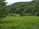
List of listed objects in Hallein-Dürnberg
The list of listed objects in Hallein-Dürnberg contains the 14 listed , immovable objects of the cadastral community of Dürnberg in the city of Hallein in the Salzburg district of Hallein .
Monuments
| photo | monument | Location | description | Metadata |
|---|---|---|---|---|

|
Settlements and grave fields on the Dürrnberg ObjectID: 7582 |
Dürrnberg location KG: Dürnberg |
ObjectID: 7582 Status: Notification Status of the BDA list: 2020-02-29 Name: Settlements and grave fields on the Dürrnberg GstNr .: 128/1; 130/1; 191/1; 192; 204/1; 205; 207; 215/1; 217/1; 217/3; 219; 221/1; 222; 223; 224/2; 225/3; 245; 248/1; 250/2; 253/1; 253/2; 253/4; 253/5; 254/1; 254/2; 258/2; 262; 265/1; 265/2; 266; 268/1; 268/3; 268/4; 268/5; 270; 271/2; 271/3; 273/1; 278/1; 281; 282/2; 296; 297/1; 302/1; 303/1; 304/2; 316/1; 316/5; 317/1; 326/1; 331; 332; 333; 334/1; 335/6; 335/7; 336/1; 337/1; 341; 342/1; 355/1; 355/2; 355/5; 382; 383/1; 383/2; 383/3; 383/5; 384; 385; 387/2; 403/1; 406/7; 424; 425; 426; 427/2; 428; 430; 433/1; 433/2; 434/1; 438/2; 470; 471; 476/1; 483; 485/4; 486; 646/3 |
|

|
Relief ObjectID: 6639 |
Dürrnberg-Landesstraße KG location : Dürnberg |
Crucifixion relief donated by Jacob Tukner in 1524. |
ObjectID: 6639 Status: § 2a Status of the BDA list: 2020-02-29 Name: Relief GstNr .: 48 Crucifixion Relief Dürrnberg |

|
Wayside shrine ObjectID: 6640 |
Dürrnberg-Landesstraße KG location : Dürnberg |
Twisted column made of Adnet marble from the 14th century, with a cube capital and a younger attachment, in it the mining symbol mallet and iron . Note: The property is "old Dürnbergstraße" near Gasthaus Wegscheid. The wayside shrine is part of the ensemble on the main road |
ObjectID: 6640 Status: § 2a Status of the BDA list: 2020-02-29 Name: wayside shrine GstNr .: 79 |

|
Cross from the devil's mill ObjectID: 6641 |
Dürrnberg-Landesstraße KG location : Dürnberg |
The several times revised, probably late Gothic crucifix from the 16th century supposedly comes from the so-called "devil's mill". |
ObjectID: 6641 Status: § 2a Status of the BDA list: 2020-02-29 Name: Kreuz von der Teufelsmühle GstNr .: 49/1 Crucifix Teufelsmühle |

|
Inscription plaque ObjectID: 6642 |
Dürrnberg-Landesstraße KG location : Dürnberg |
Inscription plaque dated 1518 with text on a well foundation. |
ObjectID: 6642 Status: § 2a Status of the BDA list: 2020-02-29 Name: Inscription board GstNr .: 48 Inscription board 1518 Dürrnberg |
|
|
Niche figure ObjectID: 6643 |
Dürrnberg-Landesstraße KG location : Dürnberg |
Colored figure Madonna and Child, 19th century (?). |
ObjectID: 6643 Status: § 2a Status of the BDA list: 2020-02-29 Name: Niche figure GstNr .: 48 Niche figure Madonna Dürrnberg |

|
Chapel of the St. Josef Sanatorium ObjectID: 4852 since 2015 |
at Hellstrasse 1 location KG: Dürnberg |
ObjectID: 4852 Status: Notification Status of the BDA list: 2020-02-29 Name: Chapel of the St. Josef Sanatorium GstNr .: 313 Chapel of the Kuranstalt Dürrnberg |
|

|
Fuchsturm Object ID: 22809 since 2013 |
Dürnberg-Landesstrasse 15 KG location : Hallein |
The arched house passage was a city gate of Hallein and is now built up. |
ObjectID : 22809 Status : Notification Status of the BDA list: 2020-02-29 Name: Fuchsturm GstNr .: 222 Fuchsturm (Hallein) |

|
Mining Office Building , Steigerhaus ObjectID : 21348 |
Ramsaustraße 3 KG location : Dürnberg |
The two-storey mining office building from the 18th century stands behind a former baroque garden. |
ObjectID : 21348 Status : Notification Status of the BDA list: 2020-02-29 Name: Mining Office Building , Steigerhaus GstNr .: 322 |

|
Parish and pilgrimage church of the Assumption of Mary ObjectID: 4847 |
Rupertusplatz KG location : Dürnberg |
ObjectID: 4847 Status: § 2a Status of the BDA list: 2020-02-29 Name: Parish and pilgrimage church of the Assumption of the Virgin GstNr .: 287 Parish and pilgrimage church of Our Lady of the Assumption, Hallein-Dürrnberg |
|

|
Liebfrauenbründl ObjectID: 4848 |
Rupertusplatz KG location : Dürnberg |
The marble basin of the Liebfrauenbründl to the west of the parish church dates from around 1685, the fountain column from around 1530. The figure of Maria with child is marked 1963. |
ObjectID: 4848 Status: § 2a Status of the BDA list: 2020-02-29 Name: Liebfrauenbründl GstNr .: 686 Liebfrauenbründl (Hallein-Dürrnberg) |

|
Doctor's house, old mining forge ObjectID: 4851 |
Rupertusplatz 2 KG location : Dürnberg |
ObjectID: 4851 Status: Notification Status of the BDA list: 2020-02-29 Name: Doktorhaus , alte Bergschmiede GstNr .: 671 |
|

|
Elementary school ObjectID: 4849 |
Rupertusplatz 3 KG location : Dürnberg |
The mighty building of the elementary school originates in the core from the 16th century and received its facade structure in the late 19th century. |
ObjectID: 4849 Status: § 2a Status of the BDA list: 2020-02-29 Name: Volksschule GstNr .: 292/2 |

|
Vicarage ObjectID: 4850 |
Rupertusplatz 4 KG location : Dürnberg |
The core of the two-storey rectory dates from the 17th century, but was rebuilt in 1730 and again in 1979. |
ObjectID: 4850 Status: § 2a Status of the BDA list: 2020-02-29 Name: Pfarrhof GstNr .: 289 |
Web links
Commons : Listed objects in Hallein - collection of pictures, videos and audio files
Individual evidence
- ↑ a b Salzburg - immovable and archaeological monuments under monument protection. (PDF), ( CSV ). Federal Monuments Office , as of February 17, 2020.
- ↑ Anniversary tour “130 years of the PES section Hallein and the climb on the Kleine Barmstein”. In: www.alpenverein.at. Retrieved May 23, 2020 .
- ↑ § 2a Monument Protection Act in the legal information system of the Republic of Austria .
