List of listed objects in Hardegg (Lower Austria)
The list of listed objects in Hardegg contains the 33 listed , immovable objects of the municipality of Hardegg .
Monuments
| photo | monument | Location | description | Metadata |
|---|---|---|---|---|

|
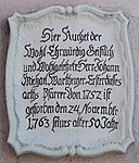
Memorial plaque JM Wartberger ObjektID : 12043 |
Location KG: Felling |
The memorial plaque for Johann Michael Wartberger, the first pastor of Felling from 1763 is on the outside of the parish church of Felling . |
ObjectID : 12043 Status: § 2a Status of the BDA list: 2020-02-29 Name: Memorial plaque JM Wartberger GstNr .: 1 |

|
Figure of Saint John of Nepomuk ObjectID : 12044 |
Location KG: Felling |
The baroque figure of St. John of Nepomuk stands in front of the parish church of Felling and dates from the middle of the 18th century. |
ObjectID : 12044 Status: § 2a Status of the BDA list: 2020-02-29 Name: Figure Saint John of Nepomuk GstNr .: 1 Felling Statue Johannes Nepomuk |

|
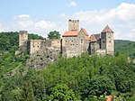
Hardegg Castle with chapel and outbuildings ObjectID: 11996 |
Hardegg City 38 KG location : Hardegg |
Around the year 1041, the extensive medieval complex was built by the Babenbergers to defend the Thaya border against the northern neighbors. Rebuilt, expanded and rebuilt several times after fire, the Thirty Years War and earthquake. |
ObjectID: 11996 Status: Notification Status of the BDA list: 2020-02-29 Name: Hardegg Castle including chapel and outbuildings GstNr .: 16/1; 13; 14; 16/2 Hardegg Castle |

|
City or clock tower ObjectID: 11994 |
Hardegg City 39 KG location : Hardegg |
The essentially medieval defense tower with a steep hipped roof was part of the fortifications and was renovated several times - most recently in 1928. |
ObjectID: 11994 Status: § 2a Status of the BDA list: 2020-02-29 Name: City or clock tower GstNr .: 92 Hardegg clock tower |

|
former town hall, city library ObjectID: 11979 |
Hardegg City 68 KG location : Hardegg |
Square two-axis building with a gable roof and secessionist decor. |
ObjectID: 11979 Status: § 2a Status of the BDA list: 2020-02-29 Name: former town hall, city library GstNr .: 292/3 Hardegg town hall (former) |

|
Joseph König grave monument ObjectID : 11980 |
KG location : Hardegg |
Metal grave monument from 1842. |
ObjektID : 11980 Status: § 2a Status of the BDA list: 2020-02-29 Name: Grabdenkmal Joseph König GstNr .: 1/2 Hardegg Grabdenkmal Joseph König |

|
catholic parish church hl. Veit ObjectID: 11982 |
KG location : Hardegg |
The Romanesque nave from the beginning of the 13th century was probably extended by the side aisle at the beginning of the 14th century. The Gothic sacristy and the baroque tower from 1754 adjoin the north side. |
ObjectID: 11982 Status: § 2a Status of the BDA list: 2020-02-29 Name: Catholic parish church hl. Veit GstNr .: 1/1 Parish Church Hardegg |

|
Figure of Saint John Nepomuk ObjectID: 11989 |
Hardegg 39 KG location : Hardegg |
The statue of Johannes Nepomuk stands in front of the clock tower at the entrance to Hardegg Castle . It is dated 1724. |
ObjectID: 11989 Status: § 2a Status of the BDA list: 2020-02-29 Name: Figure Saint Johannes Nepomuk GstNr .: 292/11 Hardegg Statue Johannes Nepomuk (clock tower) |

|
Brandlesturm ObjectID: 11995 |
KG location : Hardegg |
The medieval signal tower with loopholes was part of the fortifications. |
ObjectID: 11995 Status: § 2a Status of the BDA list: 2020-02-29 Name: Brandlesturm GstNr .: 137 Hardegg Brandlesturm |

|
Karner ObjectID: 11991 |
KG location : Hardegg |
The Karner von Hardegg is the oldest Karner in Lower Austria. It dates from between 1150 and 1160. |
ObjectID: 11991 Status: § 2a Status of the BDA list: 2020-02-29 Name: Karner GstNr .: 1/2 Hardegg Karner |

|
City Gate, Iron Gate ObjectID: 11993 |
KG location : Hardegg |
The remains of a city gate can be found on the road to Felling. |
ObjectID: 11993 Status: § 2a Status of the BDA list: 2020-02-29 Name: Stadttor, Eisernes Tor GstNr .: 298/2 |

|
City wall ObjectID : 28615 |
KG location : Hardegg |
Remains of the medieval fortifications, probably from the 14th century. |
ObjectID : 28615 Status: § 2a Status of the BDA list: 2020-02-29 Name: Stadtmauer GstNr .: 2; 3; 4; 298/2; 92; 137; 1/2 |

|
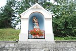
Wegkapelle ObjektID : 12046 |
KG location : Heufurth |
The wayside shrine at the eastern end of the village of Heufurth is a triangular-gabled broad pillar with a round arch niche. |
ObjectID : 12046 Status: § 2a Status of the BDA list: 2020-02-29 Name: Wegkapelle GstNr .: 126/1 |

|
Local chapel ObjectID : 12077 |
Location KG: Mallersbach |
Mallersbach's local chapel dates from the middle of the 18th century and has a retracted round apse and a roof turret. |
ObjectID : 12077 Status: § 2a Status of the BDA list: 2020-02-29 Name: Ortskapelle GstNr .: 39 Mallersbach Chapel |

|
Local chapel ObjectID : 12041 |
KG location : Merkersdorf |
The local chapel of Merkersdorf was built in 1763 with a retracted round apse, roof turret and arched windows. |
ObjectID : 12041 Status: § 2a Status of the BDA list: 2020-02-29 Name: Ortskapelle GstNr .: 25 |

|
Wayside shrine, Lange Marter ObjektID: 11990 |
KG location : Merkersdorf |
The " Lange Marter " is a pillar marked 1694 with a square top. On the pillar there are reliefs of tools of torture, on the top there are reliefs of the Crucifixion and Saints Rochus, Sebastian and Immaculata. |
ObjectID: 11990 Status: § 2a Status of the BDA list: 2020-02-29 Name: wayside shrine, Lange Marter GstNr .: 993/4 Lange Marter, Hardegg |

|
Corridor / path chapel, Kurz Marter ObjektID: 11988 |
KG location : Merkersdorf |
The " Kurz Marter " is a triangular gabled broad pillar from the end of the 18th or the beginning of the 19th century with a round arch niche on the road from Merkersdorf to Hardegg. |
ObjectID: 11988 Status: § 2a Status of the BDA list: 2020-02-29 Name : Flur- / Wegkapelle, Kurz Marter GstNr .: 1001 Kurz Marter, Hardegg |

|
Karlslust Palace ObjectID : 128972 |
Niederfladnitz 100, 101, 102 KG location : Niederfladnitz |
The hunting lodge is located in an extensive forest area and was part of the Kaja-Fladnitz rule. The elongated two-storey, fifteen-axis castle wing with a hipped roof and elevated hall wing over a three-axis central projection was designed in late Baroque classicism in the years 1795–98; the entire complex with ancillary buildings was completed in 1801. |
ObjectID : 128972 Status : Notification Status of the BDA list: 2020-02-29 Name: Schloss Karlslust GstNr .: 1343; 1344; 1345 Niederfladnitz Castle Karlslust |

|
Niederfladnitz Castle ObjectID : 12029 |
Niederfladnitz 138 KG location : Niederfladnitz |
The irregular structure from the 17th century is grouped around a square inner courtyard. |
ObjectID : 12029 Status: § 2a Status of the BDA list: 2020-02-29 Name: Schloss Niederfladnitz GstNr .: 1/2 Niederfladnitz Schloss Niederfladnitz |

|
Parsonage Object ID: 12031 |
Niederfladnitz 15 KG location : Niederfladnitz |
Simple one-storey building from 1912 with plaster decoration and arched door. |
ObjectID : 12031 Status: § 2a Status of the BDA list: 2020-02-29 Name: Pfarrhof GstNr .: 44 Niederfladnitz Pfarrhof |

|
Catholic parish church Mariae Himmelfahrt ObjektID : 12032 |
Location KG: Niederfladnitz |
Around the middle of the 17th century, the simple hall building with arched windows and plastered fields was created. The tower with sacristy on the ground floor and steep pyramid gable was built over an older core at the end of the 18th century. |
ObjectID : 12032 Status: § 2a Status of the BDA list: 2020-02-29 Name: Catholic Parish Church Mariae Himmelfahrt GstNr .: 47/1 Niederfladnitz Church |

|
Shrine Object ID: 12035 |
Location KG: Niederfladnitz |
The wayside shrine consists of a partially chamfered stone column and a tabernacle with an opening. A stone cross with clover-like ends sits on it. |
ObjectID : 12035 Status: § 2a Status of the BDA list: 2020-02-29 Name: wayside shrine GstNr .: 1405 Niederfladnitz wayside shrine (ObjektID: 12035) |

|
Funerary monuments ObjectID : 12036 |
Location KG: Niederfladnitz |
Classicist tombstones. |
ObjectID : 12036 Status: § 2a Status of the BDA list: 2020-02-29 Name: Grabdenkmäler GstNr .: 47/2 Niederfladnitz Grabdenkmäler |

|
Kaja Castle Ruins ObjectID : 12026 |
Location KG: Niederfladnitz |
The high medieval complex of keep and palas was first mentioned in a document in 1196. The outer bailey with gate tower dates from the 15th century. |
ObjectID : 12026 Status : Notification Status of the BDA list: 2020-02-29 Name: Castle ruins Kaja GstNr .: 1379 Burg Kaja |

|
former gallows ObjectID : 12028 |
Location KG: Niederfladnitz |
The former execution site of the Retz municipal authorities is located in the Fladnitzer Forest. Of the originally 3 stone four-sided gallows columns from 1727, which were connected with wooden beams at the time, 2 are still preserved. |
ObjectID : 12028 Status : Notification Status of the BDA list: 2020-02-29 Name: former Galgen GstNr .: 1334 Niederfladnitz Galgen |

|
Vicarage ObjectID : 12024 |
Pleissing 1 location KG: Pleissing |
The rectory of Pleissing dates from the third quarter of the 18th century and is covered with a high hip roof. |
ObjectID : 12024 Status: § 2a Status of the BDA list: 2020-02-29 Name: Pfarrhof GstNr .: 12 |

|
Figure Saint Florian ObjectID: 12022 |
Location KG: Pleissing |
The statue of St. Florian stands on a volute pedestal in front of the Pleissing cemetery and dates from the second half of the 19th century. |
ObjectID: 12022 Status: § 2a Status of the BDA list: 2020-02-29 Name: Figur Heiliger Florian GstNr .: 1676 |

|
Catholic parish church hl. Kunigunde ObjectID : 12023 |
Location KG: Pleissing |
The parish church of Pleissing, consecrated to St. Kunigunde, is a Gothic core and a baroque building in the nave with a retracted Gothic choir. |
ObjectID : 12023 Status: § 2a Status of the BDA list: 2020-02-29 Name: Catholic parish church hl. Kunigunde GstNr .: 10 |

|
Figure of Saint John Nepomuk ObjectID : 12025 |
Location KG: Pleissing |
The depiction of Johannes Nepomuk donated by Georg Müller dates back to 1732. |
ObjectID : 12025 Status: § 2a Status of the BDA list: 2020-02-29 Name: Figur Heiliger Johannes Nepomuk GstNr .: 1300/5 |

|
Riegersburg Castle ObjectID: 12054 |
Riegersburg 1 KG location : Riegersburg |
Representative baroque four-wing building around an almost square inner courtyard, which was created between 1730 and 1770 by redesigning a moated castle from the last quarter of the 16th century according to plans by Franz Anton Pilgram . |
ObjectID: 12054 Status: Notification Status of the BDA list: 2020-02-29 Name: Schloss Riegersburg GstNr .: 63 Schloss Riegersburg |

|
former windmill ObjectID: 12056 |
Riegersburg 71 KG location : Riegersburg |
The former Riegersburg windmill, visible from the road to Mallersbach, was probably built around 1800 and is used as a residential building. |
Object ID: 12056 Status: notice prior BDA list: 2020-02-29 Name: former windmill GstNr .: 831/1 |

|
Shrine Object ID: 12048 |
Location KG: Riegersburg |
The wayside shrine with a square top and a stone cross at the end probably dates from the 17th century. On the pillar there are reliefs of the tools of suffering , the top is also in relief. |
ObjectID : 12048 Status: § 2a Status of the BDA list: 2020-02-29 Name: wayside shrine GstNr .: 898 |

|
Marian column Maria Immaculata ObjectID: 12050 |
Riegersburg 1 KG location : Riegersburg |
The statue of Maria Immaculata stands on a volute base with a cylindrical structure. |
ObjectID: 12050 Status: § 2a Status of the BDA list: 2020-02-29 Name: Mariensäule Maria Immaculata GstNr .: 896/1 Riegersburg Mariensäule |
literature
- DEHIO Lower Austria - north of the Danube 1990, ISBN 3-7031-0652-2 .
Web links
Commons : Listed objects in Hardegg - collection of images, videos and audio files
Individual evidence
- ↑ a b Lower Austria - immovable and archaeological monuments under monument protection. (PDF), ( CSV ). Federal Monuments Office , as of February 14, 2020.
- ↑ § 2a Monument Protection Act in the legal information system of the Republic of Austria .
