List of listed objects in Karlstein an der Thaya
The list of listed objects in Karlstein an der Thaya contains the 10 listed , immovable objects of the municipality of Karlstein an der Thaya .
Monuments
| photo | monument | Location | description | Metadata |
|---|---|---|---|---|

|
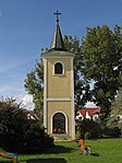
Bell Tower ObjectID: 10420 |
KG location : Hohenwarth |
At the bell tower in Hohenwarth there is a memorial for the fallen of the two world wars . |
ObjectID: 10420 Status: § 2a Status of the BDA list: 2020-02-29 Name: Glockenturm GstNr .: 55 |

|
Karlstein Castle ObjectID : 10422 |
Schloßweg 4 KG location : Karlstein |
Karlstein Castle is a spur castle that lies on a steep mountain ridge in the south high above the town. On the mountain side it is separated by a double neck ditch and secured in the southwest by an embankment wall against the rising plateau. Upstream to the west are a farm and farm buildings. |
ObjectID : 10422 Status : Notification Status of the BDA list: 2020-02-29 Name: Schloss / Burg Karlstein GstNr .: 218 Schloss Karlstein |

|
Figure shrine St. Johann Nepomuk ObjectID : 10425 |
KG location : Karlstein |
At the Thaya bridge there is a partially renewed statue of John Nepomuk from the 18th century. |
ObjectID : 10425 Status: § 2a Status of the BDA list: 2020-02-29 Name: Figurine picture stick hl. Johann Nepomuk GstNr .: 734 |

|
Vicarage ObjectID : 10428 |
Münichreith an der Thaya 29 KG location : Münichreith an der Thaya |
The parsonage south of the church is a two-story, late historical building. |
ObjectID : 10428 Status: § 2a Status of the BDA list: 2020-02-29 Name: Pfarrhof GstNr .: 3/2 |

|
Former Karner, former Anna Chapel ObjectID: 10427 |
Münichreith an der Thaya 30 KG location : Münichreith an der Thaya |
The former Anna chapel was originally a Karner . It was profaned in 1786 and divided into a two-story residential building. The high, Gothic, three-sided closed building made of plastered quarry stone has a barrel-vaulted crypt basement. At the polygon you can see the beginnings of the former buttresses and traces of the probably Baroque rounded window frames. The building is covered by a tiled hipped roof. Fragments of the Gothic nave are embedded in the cemetery wall. These are octagonal columns with ribs, round bars from wall templates, a keystone from the second half of the 14th / 15th centuries. Century, ribs from the organ gallery as well as the fragment of a tabernacle house from around 1500. |
ObjectID: 10427 Status: § 2a Status of the BDA list: 2020-02-29 Name: Former Karner, former Annakapelle GstNr .: 2/2 |

|
Catholic parish church hl. Bartholomäus ObjectID : 10426 |
KG location : Münichreith an der Thaya |
The parish church hl. Is surrounded by a cemetery with a former karner and is situated in the west of Münichreith on a stepped terrain . Bartholomäus is an aisle church with a Gothic core and baroque style in 1781/1784 with a baroque west tower. The simple west tower presented is marked 1701 and crowned by arched sound windows, clock gables and an onion helmet. The simple nave has a low lancet window from the 14th century from the Gothic core on both sides at the east end, from the Baroque style round arched stone windows, a rectangular portal to the south with a late Baroque double wooden door and baroque buttresses on the north side. The Gothic choir of the 14th and 15th centuries, which has not been drawn in. Century has a five-eighth end, stepped buttresses and lancet windows, one of which has two lanes in the apex with tracery and the sides were renewed in the second half of the 19th century with plaster profiling. In the south there is a two-storey extension with rounded corners from 1784 and in the north a sacristy from the second half of the 19th century. |
ObjectID : 10426 Status: § 2a Status of the BDA list: 2020-02-29 Name: Catholic parish church hl. Bartholomäus GstNr .: 1/1 parish church Münichreith an der Thaya |

|
Figure shrine St. Johannes Nepomuk ObjectID : 10429 |
KG location : Münichreith an der Thaya |
ObjectID : 10429 Status: § 2a Status of the BDA list: 2020-02-29 Name: Figurine picture stick hl. Johannes Nepomuk GstNr .: 1032 |
|

|
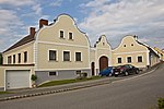
Farmhouse ObjectID : 10431 |
Obergrünbach 53 KG location : Obergrünbach |
The farmhouse in Obergrünbach 53 has a Baroque curved round gable facade. |
ObjectID : 10431 Status : Notification Status of the BDA list: 2020-02-29 Name: Farmhouse GstNr .: 88/1 |

|
Catholic parish church hl. Vitus ObjectID : 10430 |
KG location : Obergrünbach |
Surrounded by a wall and a former parsonage in the east, the parish church of St. Vitus is an originally Gothic church. The appearance of the three-aisled hall structure is almost entirely determined by the renovation in 1868. The simple facade is opened by a shoulder arch portal and circular window. On the side aisles, which were probably added in 1868 , you can see pointed arch windows and in the south a pointed arch portal with a tracery tympanum . To the east, the complex is continued by older, two-storey choir additions from 1783 (?). These are accessible through neo-Gothic shoulder arch portals. In between protrudes the five-eighth end of the choir with double stepped, probably neo-Gothic buttresses and pointed arched windows. The building is covered by a continuous tile gable roof. In the south the tower rises with coupled pointed arched tracery windows and a pyramid helmet. |
ObjectID : 10430 Status: § 2a Status of the BDA list: 2020-02-29 Name: Catholic parish church hl. Vitus GstNr .: 137/1 |

|
Cemetery portal with figure crowning ObjektID : 25639 |
KG location : Obergrünbach |
On the gate pillars of the enclosure wall there are baroque stone figures of St. Vitus and Sebastian from 1745. |
ObjectID : 25639 Status: § 2a Status of the BDA list: 2020-02-29 Name: Cemetery portal with figure crowning GstNr .: 137/1 |
literature
- DEHIO Lower Austria north of the Danube . Berger, Vienna 2010, ISBN 978-3-85028-395-3 .
Web links
Commons : Listed objects in Karlstein an der Thaya - collection of pictures, videos and audio files
Individual evidence
- ↑ a b Lower Austria - immovable and archaeological monuments under monument protection. (PDF), ( CSV ). Federal Monuments Office , as of February 14, 2020.
- ↑ § 2a Monument Protection Act in the legal information system of the Republic of Austria .
