List of listed objects in Raabs an der Thaya
The list of listed objects in Raabs an der Thaya contains the 54 listed , immovable objects of the municipality of Raabs an der Thaya .
Monuments
| photo | monument | Location | description | Metadata |
|---|---|---|---|---|

|
Local chapel Alberndorf ObjektID : 17268 |
KG location : Alberndorf |
The Silly Dorfer local chapel is a simple building from the first half of the 19th century, with semicircular apse and gable tab under high pyramidal roof . The flat-roofed interior with a vaulted apse and tile floor has two mighty pillar arcades on the west side . The furnishings include a columned altar with a picture of the Coronation of Mary , marked 1845 FM ( Franz Mayerhofer ), a votive picture of St. Florian and baroque pews . |
ObjectID : 17268 Status: § 2a Status of the BDA list: 2020-02-29 Name: Ortskapelle Alberndorf GstNr .: 42 |

|
Part of the road 8065 ObjectID : 22596 |
KG location : Alberndorf |
Note: The protected parts of the state road 8065 extend over the cadastral communities Alberndorf, Raabs an der Thaya and Speisendorf . An avenue of lime trees stretches along the state road, which is also protected as a natural monument in the three cadastral communities . |
ObjektID : 22596 Status : Notification Status of the BDA list: 2020-02-29 Name: Street section of Landesstraße 8065 GstNr .: 646/1; 646/2 state road L8065 |
|
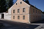
Former Mansion ObjectID: 7161 |
Eibenstein 10 location KG: Eibenstein |
ObjectID: 7161 Status : Notification Status of the BDA list: 2020-02-29 Name: Former Herrenhaus GstNr .: 44/2 |
|

|
Catholic parish church hl. Aegyd ObjectID : 17269 |
KG location : Eibenstein |
A church in Eibenstein has been documented since 1153. The current parish church is dedicated to St. Aegyd . |
ObjectID : 17269 Status: § 2a Status of the BDA list: 2020-02-29 Name: Catholic parish church hl. Aegyd GstNr .: 1 parish church Eibenstein |

|
Parsonage Object ID: 17270 |
KG location : Eibenstein |
The rectory of Eibenstein lies to the west below the church. It was built in 1730 and damaged by fire in 1859. A wooden beam ceiling marked 1730 has been preserved within the four-wing system with a segmented arched door in aedicular framing . |
ObjectID : 17270 Status: § 2a Status of the BDA list: 2020-02-29 Name: Pfarrhof GstNr .: 1 Pfarrhof (Eibenstein, ObjektID: 17270) |

|
Catholic parish church hl. Laurenz ObjectID : 17272 |
Kirchengasse 1 KG location : Großau |
The parish church of Großau is consecrated to St. Lawrence . The late baroque hall church with west tower was built in 1785–1790 after the parish was raised in 1784 in the north-east of the village, opposite the castle park and renovated in 1891. The tile-roofed nave and the drawn-in, three-sided closed choir are uniformly structured by plastering flanges, flat arched windows with stucco base and surrounding beams. The sacristy and oratory extensions on the south side of the choir are included in the structure of the nave . The facade tower in the west has a bell-shaped spire between sloping gable, pilasters and arched sound windows over parapet fields . |
ObjectID : 17272 Status: § 2a Status of the BDA list: 2020-02-29 Name: Catholic parish church hl. Laurenz GstNr .: 32/4 Saint Lawrence Church (Großau) |

|
Parsonage Object ID: 17273 |
Kirchengasse 1 KG location : Großau |
The two-storey building with a hipped roof is divided into a fascia and cornice and was built at the same time as the church and is located northwest of the same in Kirchengasse 1. |
ObjectID : 17273 Status: § 2a Status of the BDA list: 2020-02-29 Name: Pfarrhof GstNr .: 32/4 |

|
Großau palace complex ObjectID : 17274 |
Schloßgasse 1 KG location : Großau |
The castle in the southeast of the village is a small, four-wing complex from the late Renaissance. |
ObjectID : 17274 Status : Notification Status of the BDA list: 2020-02-29 Name: Schlossanlage Großau GstNr .: 6/1; 8/2; 7; 775 Grossau Castle |
|
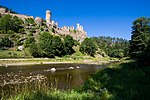
Kollmitz castle ruins with the so-called Bohemian Wall ObjectID : 17279 |
Kollmitzdörfl location KG: Kollmitzdörfl |
The originally medieval and mighty baroque castle on the eastern tip is one of the most important castle complexes in Lower Austria. |
ObjektID : 17279 Status : Notification Status of the BDA list: 2020-02-29 Name: Kollmitz castle ruins with so-called Bohemian Wall GstNr .: 163/1; 176/2; 247; 168 Kollmitz castle ruins |

|
Figure shrine St. Johannes Nepomuk ObjectID : 17283 |
KG location : Kollmitzdörfl |
The statue of St. John Nepomuk stands in the middle of Kollmitzdörfl and, together with a bell tower, serves as a chapel replacement. |
ObjectID : 17283 Status: § 2a Status of the BDA list: 2020-02-29 Name: Figurine picture stick hl. Johannes Nepomuk GstNr .: 243/1 Statue of Saint Johannes Nepomuk (Kollmitzdörfl, ObjektID: 17283) |

|
Klinger Mausoleum ObjectID : 17281 |
KG location : Kollmitzdörfl |
The Klinger mausoleum is the burial place of the Klinger von Klingerstorff family, built between 1926 and 1929. |
ObjectID : 17281 Status : Notification Status of the BDA list: 2020-02-29 Name: Klinger-Mausoleum GstNr .: 176/3 Klinger-Mausoleum |

|
Local chapel St. Laurenz, former branch church ObjectID: 7511 |
Liebnitz location KG: Liebnitz |
The chapel in the southeast of the village rises on the edge of the steep Thayatalabhang . The tall, simple, Romanesque rectangular building was originally connected to a former stately two-storey house in the west. On the plastered quarry stone masonry, traces of a local stone scratch frame can still be seen. The building has round arched windows, a round arched portal in the north, slotted windows in the east wall and a protruding, Romanesque console stone in the north-west corner , which is possibly a remnant of the earlier eaves. The gable rider with a pyramid helmet on the west side was built in 1796. |
ObjectID: 7511 Status: Notification Status of the BDA list: 2020-02-29 Name: Ortskapelle hl. Laurenz, former branch church GstNr .: 1 |

|
Local mountain Gaber with chapel ruins Gaberkirche ObjektID : 17288 |
Gaberwald location KG: Luden |
The Gaberkirche is the best preserved remnant of the ruined Gaber Castle. |
ObjectID : 17288 Status : Notification Status of the BDA list: 2020-02-29 Name: Hausberg Gaber with chapel ruin Gaberkirche GstNr .: 829 Gaberkirche |
|
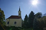
Local chapel, St. Veit ObjectID : 17287 |
Location KG: Luden |
The local chapel, renewed in 1853 and raised in the west of the village, goes back to a Baroque building. The simple, Baroque style, tile-roofed building with flat arched windows, semicircular apse and facade tower with gable-pointed helmet was restored in 1979. |
ObjectID : 17287 Status: § 2a Status of the BDA list: 2020-02-29 Name: Ortskapelle, hl. Veit GstNr .: 28 |

|
Local chapel St. Mary and Crucified ObjectID : 17289 |
KG location : Modsiedl |
The simple baroque chapel, built between 1765 and 1767, with small round arched windows, a retracted semicircular apse and a front tower with a bell- shaped helmet stands in the middle of the village of Angers between trees. The brick-roofed building has a plastered portal gable lintel and a figured niche. The baroque crucifixion group in the interior dates from 1767. |
ObjectID : 17289 Status: § 2a Status of the BDA list: 2020-02-29 Name: Ortskapelle hl. Mary and crucified GstNr .: 45 |

|
Former Bürgerspitalkapelle ObjectID: 1579 |
Oberndorf bei Raabs Location KG: Oberndorf bei Raabs |
In the south of Oberndorf is the former All Saints Hospital Church. Construction began in 1511. The late Gothic, high and smooth hall building was initially under the patronage of the Holy Spirit and served as a supply hospital for lordly subjects. The church was profaned in 1786 and re-consecrated in 1971 after restoration. The building has rich, two-lane tracery windows and some chamfered rectangular windows . The base with a water hammer cornice is continuously profiled. The simple facade of the nave is broken through in the east by a profiled shoulder arch portal under a keel- arched gallery window and in the south by a beveled portal with a profiled shoulder arch. On the north side of the retracted choir, closed on three sides, there is a baroque sacristy annex. The six-sided ridge turret on the hip roof was built around 1971. |
ObjectID: 1579 Status : Notification Status of the BDA list: 2020-02-29 Name: Former Bürgerspitalkapelle GstNr .: 77 All Saints Church (Raabs an der Thaya) |

|
Raabs Castle ObjectID: 1580 |
Oberndorf bei Raabs 1 location KG: Oberndorf bei Raabs |
Raabs Castle is an elongated spur castle that dates back to the 11th century. |
ObjectID: 1580 Status: Notification Status of the BDA list: 2020-02-29 Name: Burg Raabs GstNr .: 897/2; 897/5; 5/2; 6/2; 7 Raabs Castle on the Thaya |

|
Parsonage Object ID: 21459 |
Oberndorf bei Raabs 7 KG location : Oberndorf bei Raabs |
The rectory to the northwest of the churchyard is a mighty, two-storey four-wing complex from the late 16th / early 17th century, which was damaged by fires in 1654 and 1718. The south wing is mostly used as a storage facility . The eastern part is a former bulk box. The western part as a gate wing has decorative battlements, a segment arch portal and window frames from the second half of the 16th century. In the courtyard, framed cantilever windows can be seen on the east, north and west wings and former coach houses in the south-east . The late baroque portal is decorated by a wall fountain with a spout mask and vase attachments. To the west is the farm yard enclosed by a wall. |
ObjectID : 21459 Status: § 2a Status of the BDA list: 2020-02-29 Name: Pfarrhof GstNr .: 120/1 Pfarrhof, Oberndorf bei Raabs |

|
Catholic parish church Mariae Himmelfahrt ObjectID: 21458 |
KG location : Oberndorf near Raabs |
The Catholic parish church Mariae Himmelfahrt lies to the west above the castle, at the highest point of the settlement and, together with the churchyard and the rectory, seals off the western entrance. It is surrounded by the wall of a former cemetery. The essentially Romanesque nave, probably dating back to the second half of the 11th century, perhaps not until the 13th century aisle additions made it a basilica , Gothic vaulted, three-aisled nave with staggered, Gothic long choirs from the first half of the 14th century, is covered by a crooked roof . The tower, which was Gothic in essence and was raised in Baroque style in 1705, with gothic sound windows and a pyramid helmet from 1910 rises above the south choir. The unadorned west facade is pierced by a Gothic portal block with a multi-profiled funnel portal from the 14th century, a studded wooden gate from the 18th century and baroque flat arched windows. The side aisles, the core of which dates back to the 13th century at the latest, is extended by eastern yokes , which were probably created later together with the choirs connected by a base profile and a coffin cornice . |
ObjectID: 21458 Status: § 2a Status of the BDA list: 2020-02-29 Name: Catholic parish church Mariae Himmelfahrt GstNr .: 1/1 Parish church Raabs an der Thaya |

|
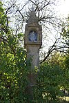
Figure shrine St. Leopold ObjectID: 1581 |
KG location : Oberndorf near Raabs |
The figure shrine of Saint Leopold is a stone figure in the south of Oberndorf. It was built in the second half of the 18th century. |
ObjectID: 1581 Status: § 2a Status of the BDA list: 2020-02-29 Name: Figurine picture stick hl. Leopold GstNr .: 909/5 |
|
Wayside shrine ObjectID: 1583 |
KG location : Oberndorf near Raabs |
The Black torture , (also: peak torture or bread torture ), west of Oberndorf on the road to Pfaffendorf is a powerful, Late Gothic, octagonal Granittabernakelbildstock with Blendmaßgiebelchen . He is to a forecast have been prepared in accordance with in 1301 by a certain Nicholas Darx memory of a journeyman, that of a baker because of theft one bread loaf was killed. |
ObjectID: 1583 Status: § 2a Status of the BDA list: 2020-02-29 Name: Bildstock GstNr .: 900/3 |
|
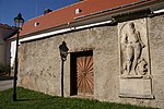
Former Kirchhof ObjektID: 1169 |
KG location : Oberndorf near Raabs |
The surrounding wall of the churchyard is broken through on the southwest side by a baroque pillar portal and on the northwest by a square arched portal with a rectangular niche between jagged bulges from the second half of the 17th century. A two-story school was added to the northeast in 1762 and expanded in 1862 and 1895. The war memorial in the churchyard dates from 1921. |
ObjectID: 1169 Status: § 2a Status of the BDA list: 2020-02-29 Name: Former. Kirchhof GstNr .: 1/1 Former churchyard, Oberndorf near Raabs |

|
Gutshof Pommersdorf ObjectID : 11198 |
Pommersdorf 28 KG location : Pommersdorf |
ObjectID : 11198 Status : Notification Status of the BDA list: 2020-02-29 Name: Gutshof Pommersdorf GstNr .: 503/1; 505; 506 |
|

|
Castle Primmersdorf including outbuildings and castle park ObjektID: 17295 |
Primmersdorf 1 location KG: Primmersdorf |
Primmersdorf Castle is an irregular, one to two-storey four-wing complex, which was modified by the reconstruction of the early baroque core in the 18th and 19th centuries, which is surrounded by farm buildings and a park laid out around 1860 . The previous building was first mentioned in a document in 1251; In 1567 it was deserted. The present castle was rebuilt in 1667. The four-winged main building, which is slightly shifted in angles and axes , around the almost rectangular courtyard is covered by tile gable roofs. In the middle of the west wing rises the originally three- story gate tower with baroque window sills and transverse oval hatches , the top floor of which was built in its current form with romanized quarry stone masonry in 1929 under a tent roof. The middle of the courtyard is occupied by a fountain with a water-spouting swan from the first half of the 19th century. The chapel in the south wing dates from 1724. Various farm buildings are in front of the castle to the west and north. To the south-west is a three-storey, baroque bulk box. Stone vases in the style of Johann Fischer von Erlach have been preserved in the castle park .
see also: Schüttkasten Primmersdorf |
ObjectID: 17295 Status: Notification Status of the BDA list: 2020-02-29 Name: Primmersdorf Castle including outbuildings and castle grounds GstNr .: 6/3; 6/1; 7/2; 34; 6/4; 6/6; 6/7; 11; 7/1 Primmersdorf Castle |
|
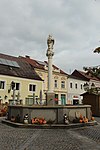
Marian column ObjectID : 17302 |
Hauptplatz location KG: Raabs an der Thaya |
The Maria Immaculata column on the main square was built around 1710/20. |
ObjectID : 17302 Status: § 2a Status of the BDA list: 2020-02-29 Name: Mariensäule GstNr .: 1032/1 Mariensäule (Raabs an der Thaya) |

|
Medieval defense tower ObjectID : 17299 |
Hauptplatz 11 KG location : Raabs an der Thaya |
The round tower from the middle of the 14th century, whose conical roof structure is still faithfully preserved, originally served as the southeast corner tower of the city wall . |
ObjectID : 17299 Status : Notification Status of the BDA list: 2020-02-29 Name: Medieval defense tower GstNr .: 153/1 |

|
Alter Meierhof ObjectID : 128356 |
Schloßstraße 4-6 KG location : Raabs an der Thaya |
The former Meierhof is located northeast of the castle between the castle rock and the Thaya and was probably originally fortified. |
ObjektID : 128356 Status : Notification Status of the BDA list: 2020-02-29 Name: Alter Meierhof GstNr .: 187/1 Alter Meierhof, Raabs an der Thaya |

|
Residential building ObjectID : 21451 |
Schloßstraße 23 KG location : Raabs an der Thaya |
The residential building with a baroque core was partially rebuilt in a late-historic style in 1886 and features a late-baroque medallion Maria Immaculata and an adjoining gable interior wall of a formerly stately bulk box. |
ObjectID : 21451 Status : Notification Status of the BDA list: 2020-02-29 Name: Residential building GstNr .: 4 Residential building Schlossstrasse 33, Raabs an der Thaya |

|
City wall ObjectID : 17298 |
Schulstrasse 8, 10 KG location : Raabs an der Thaya |
Remains of the medieval city fortifications have been preserved between Schulstrasse 8 and 10. |
ObjectID : 17298 Status : Notification Status of the BDA list: 2020-02-29 Name: Stadtmauer GstNr .: 102; 100/1 City wall of Raabs an der Thaya |

|
Pillory ObjectID: 21452 |
KG location : Raabs an der Thaya |
The former pillory with Roland's figure is located on the main street and dates from the 17th century. |
ObjectID: 21452 Status: § 2a Status of the BDA list: 2020-02-29 Name: Pranger GstNr .: 1032/1 |

|
Figure shrine St. Johannes Nepomuk ObjectID : 21454 |
KG location : Raabs an der Thaya |
The stone statue of the kneeling Johannes Nepomuk with putto stands on the Thaya bridge and dates from the second half of the 18th century. |
ObjectID : 21454 Status: § 2a Status of the BDA list: 2020-02-29 Name: Figurine picture stick hl. Johannes Nepomuk GstNr .: 1032/5 Johann Nepomuk, Thayabrücke, Raabs an der Thaya |

|
Part of the road 8065 ObjectID : 21453 |
KG location : Raabs an der Thaya |
The protected parts of the state road 8065 extend over the cadastral communities Alberndorf (see there), Raabs an der Thaya and Speisendorf . |
ObjektID : 21453 Status : Notification Status of the BDA list: 2020-02-29 Name: Street section of Landesstraße 8065 GstNr .: 1035/1 Landesstraße L8065 |

|
Former Gallows ObjectID : 103168 |
KG location : Raabs an der Thaya |
The former gallows is located on Galgenberg in the east of Raabs. It consists of two high, parallel, downward-widening walls made of stone and mortar, which were originally probably connected by a lower wall. The hollows where the scaffold was attached can still be seen on the walls. The last execution took place in 1818. |
ObjectID : 103168 Status : Notification Status of the BDA list: 2020-02-29 Name: Former Galgen GstNr .: 713 Former gallow, Raabs an der Thaya |
|
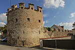
City wall ObjectID : 74656 |
KG location : Raabs an der Thaya |
From the medieval city fortifications, which originally enclosed the former market in a rectangle, preserved and largely unobstructed sections on the western corner and the north-eastern line have been preserved. On the south-western line, the river Thaya partly replaced the walls as a natural obstacle. The preserved remains include quarry stone crenellated walls with loopholes . At the northwest corner and at the Thaya bridge there are semicircular towers open at the back with battlements and a round tower with a conical roof at the southeast corner. The former western Spitzertor was demolished in 1855; the east clock gate 1895. |
ObjectID : 74656 Status : Notification Status of the BDA list: 2020-02-29 Name: Stadtmauer GstNr .: 167; 114; 104/3; 99/2; 95; 1032/5; 178/1; 175/1; 130 City wall of Raabs an der Thaya |
|
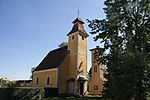
Local chapel hll. John and Paul ObjectID : 18200 |
KG location : Schaditz |
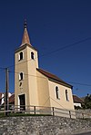
The local chapel of Schaditz is consecrated to Saints John and Paul . The simple, fused, tile-roofed building with a semicircular apse and a facade tower under a stepped pyramid roof, arched windows and grave slabs in front of the entrance stands in the middle of the village green and was built in the late 18th / early 19th century. |
ObjectID : 18200 Status: § 2a Status of the BDA list: 2020-02-29 Name: Ortskapelle hll. Johannes and Paulus GstNr .: 1 |
|
Shrine Object ID: 18201 |
KG location : Schaditz |
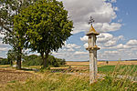
The high stone cross marked 1910 rises at the eastern end of the village. |
ObjectID : 18201 Status: § 2a Status of the BDA list: 2020-02-29 Name: wayside shrine GstNr .: 414 |

|
Catholic parish church hl. Nikolaus ObjectID : 18202 |
KG location : Speisendorf |
The parish church of Speisendorf is consecrated to St. Nicholas . The Romanesque, Baroque-style hall church with a Gothic choir and south tower is located in the north-west of the village, pushed into the Anger a little higher and was originally surrounded by a cemetery. One parish has been recorded since the 13th century; a church consecration was documented in 1335. On the south side of the simple nave, a walled up round arch portal from the Romanesque core has been preserved. The Gothic renovation in the 14th / 15th The two stepped buttresses of the east bays on the north side go back to the 19th century. The facade is pierced by baroque arched windows and on three sides by baroque arched portals from the first half of the 18th century. In the unadorned, baroque west facade with rounded corners, oval windows and a figure niche are incorporated. The retracted Gothic choir is elevated between the tower and the sacristy. The exit in the apex, crowned by a Gothic niche figure and covered by a baroque roof, was built in 1719 and leads to a tomb-like, barrel-vaulted fountain, which originally served a pilgrimage function. The simple south tower has arched sound windows and a pyramid helmet from 1860. The baroque sacristy is on the north side. There is a spring under the high altar, which is collected in a walled-up well. Since 1718 there has been a staircase in the vault where you can see the fountain. |
ObjectID : 18202 Status: § 2a Status of the BDA list: 2020-02-29 Name: Catholic parish church hl. Nikolaus GstNr .: 1 |

|
Part of the road 8065 ObjectID : 22597 |
KG location : Speisendorf |
The protected parts of the state road 8065 extend over the cadastral communities Alberndorf (see there), Raabs an der Thaya and Speisendorf. |
ObjektID : 22597 Status : Notification Status of the BDA list: 2020-02-29 Name: Street section of Landesstraße 8065 GstNr .: 550 Landesstraße L8065 |

|
Hadermühle ObjectID : 127230 |
Süssenbach 20 KG location : Süssenbach |
ObjectID : 127230 Status : Notification Status of the BDA list: 2020-02-29 Name: Hadermühle GstNr .: 842; 375; 377/2; 1064 |
|

|
Bell Tower ObjectID: 18206 |
Location KG: Unterpertholz |
The two-storey bell tower from 1878 with a pointed gable helmet and cleaning bottles has round-arched sound windows, blind niches and a high stone cross inserted into the tower, which is marked 1842. |
ObjectID: 18206 Status: § 2a Status of the BDA list: 2020-02-29 Name: Glockenturm GstNr .: 1124/1 |
|
Local Chapel of the Holy Trinity ObjectID : 18207 |
Location KG: Unterpfaffendorf |
The local chapel of the Holy Trinity is a simple building from 1893 with arched windows, semicircular apse and a facade tower with a pyramid helmet. Inside it has brick arches, a flat ceiling , baroque seating and an apse painting from 1979. |
ObjectID : 18207 Status: § 2a Status of the BDA list: 2020-02-29 Name: Ortskapelle Hl. Dreifaltigkeit GstNr .: 477/2 |

|
Figure shrine St. Johannes Nepomuk ObjectID : 18208 |
Location KG: Unterpfaffendorf |
The Nepomuk statue in Unterpfaffendorf dates from the 18th century. |
ObjectID : 18208 Status: § 2a Status of the BDA list: 2020-02-29 Name: Figurine picture stick hl. Johannes Nepomuk GstNr .: 477/7 |

|
Eibenstein castle ruins ObjectID: 7803 |
Location KG: Unterpfaffendorf |
The core of the former spur castle is Romanesque and was expanded to include two courtyards with a Gothic extension. It was mentioned in a document around 1194. |
ObjectID: 7803 Status: Notification Status of the BDA list: 2020-02-29 Name: Burgruine Eibenstein GstNr .: 375 Burgruine Eibenstein |
|
Catholic parish church hl. Stephan ObjectID : 18210 |
Location KG: Weikertschlag |
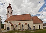
The parish church of Weikertschlag is essentially a Romanesque, Baroque-style basilica building with a baroque west tower. It is dedicated to St. Stephen . The church rises on a step in the north-east above the village and is opposite the former castle on the other side of the Thaya valley. It was mentioned in a document in the middle of the 12th century and renewed after fires in 1659 and 1755. The baroque west tower dates from the third quarter of the 18th century and has stone frames above the banded ground floor, pilasters and arched openings in the sound floor, as well as an onion helmet. The simple, broad nave with buttresses has a bricked-up Romanesque high nave window, on the south side a Romanesque round arched portal with a bulge profile and a groin vault in the vestibule. On the west side, two oval windows are overlapped by the tower. The side nave apses are encased in a rectangular shape. In the central nave of the three-aisled and five-bay basilica, instead of the original flat ceiling, there is a stab cap barrel, which probably goes back to the renovation after 1755 . |
ObjectID : 18210 Status: § 2a Status of the BDA list: 2020-02-29 Name: Catholic parish church hl. Stephan GstNr .: 1/1 |
|
Parsonage Object ID: 18211 |
Location KG: Weikertschlag |
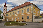
The rectory adjoining the church and the cemetery is a mighty, two-story building with a hipped roof, which was renovated after a fire in 1755. The courtyard gate in the service wing is crowned by three round gable attachments. The school attached to the parsonage was built on one floor after a fire in 1849, and in 1881 it was extended and given a historical facade. |
ObjectID : 18211 Status: § 2a Status of the BDA list: 2020-02-29 Name: Pfarrhof GstNr .: 1/1 |

|
Town Hall ObjectID : 18213 |
Location KG: Weikertschlag |
The Romanesque town hall, built in 1932 by Emmerich Siegris in place of a waiting tower attested to in 1672, with curved stepped gables, inserted tower and arcade staircase dominates the center of the square. |
ObjectID : 18213 Status: § 2a Status of the BDA list: 2020-02-29 Name: Rathaus GstNr .: 73 |

|
Shrine Object ID: 18216 |
Location KG: Weikertschlag |
Not far from the parish church is a high, eight-sided granite abernacle pillar of the 16th / 17th century type. |
ObjectID : 18216 Status: § 2a Status of the BDA list: 2020-02-29 Name: Bildstock GstNr .: 666/1 |

|
Klafferkapelle ObjektID : 18218 |
Location KG: Weikertschlag |
The Klafferkapelle at the southern end of the village is a fused, square-vaulted building from 1835 with a curved gable under a wrought iron cross with folkloric devotional objects inside. It rises above the Klafferquelle on a step near the Thaya . |
ObjectID : 18218 Status: § 2a Status of the BDA list: 2020-02-29 Name: Klafferkapelle GstNr .: 666/2 |

|
Pillory ObjectID : 18219 |
Location KG: Weikertschlag |
The granite pillar marked 1735 with Roland's figure stands in the middle of the square. |
ObjectID : 18219 Status: § 2a Status of the BDA list: 2020-02-29 Name: Pranger GstNr .: 666/2 |

|
Weikertschlag Castle ruins ObjectID : 18222 |
Location KG: Weikertschlag |
The castle ruins are located on the hill west of the market on the other side of the Moravian Thaya. The castle, built in the 12th century by the ministerial Heinrich von Zöbing, was later captured by Ulrich von Rosenberg and destroyed during the reconquest in 1399. In 1633 it is documented as a desolate castle stable . The former castle chapel was dedicated to Saint Pankraz , but was closed in 1784. A tower-like ruin made of quarry stone masonry with north-facing arched windows is preserved from the entire complex. |
ObjectID : 18222 Status: § 2a Status of the BDA list: 2020-02-29 Name: Weikertschlag Castle Ruins GstNr .: 117/1 Weikertschlag Castle |

|
Bulk box and stable building ObjectID : 18224 |
Wetzles 1 location KG: Wetzles |
The baroque, three-storey bulk box in the north-east of the village with wide windows, stone blocks, offset volute gables with oval hatches and tenons and a figure niche on the north side dates from the 18th century. |
ObjectID : 18224 Status : Notification Status of the BDA list: 2020-02-29 Name: Schüttkasten und stable building GstNr .: 41 |
|
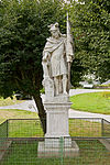
Figure shrine St. Florian ObjectID: 18228 |
KG location : Zabernreith |
The figure shrine of St. Florian was built in the village at the end of the 18th / beginning of the 19th century. |
ObjectID: 18228 Status: § 2a Status of the BDA list: 2020-02-29 Name: Figurine picture stick hl. Florian GstNr .: 704/6 |

|
Catholic parish church hl. Nikolaus ObjectID: 18231 |
Niklasberg location KG: Ziernreith |
The partly Romanesque and Gothic, Baroque hall church with west tower in the middle of the walled cemetery is dedicated to St. Nicholas . It was first mentioned in a document in 1188. In front of the unadorned outer facade is a three-storey, square tower from 1855 with round-arched sound windows, baroque plaster structure and an onion helmet. The baroque nave from 1757 and the retracted choir bay, which is essentially Gothic, are pierced by baroque arched windows. In the south there is a gabled porch and a sacristy annex to the choir on the north side. The drawn-in, low, Romanesque semicircular apse is equipped with Romanesque arched windows. |
ObjectID: 18231 Status: § 2a Status of the BDA list: 2020-02-29 Name: Catholic parish church hl. Nikolaus GstNr .: 404 |

|
Former Parsonage Object ID: 18232 |
Niklasberg 1 KG location : Ziernreith |
The former rectory southwest of the church is a two-storey building built between 1892 and 1894 with a hook-shaped floor plan, ribbons and pilasters in the plaster, a grid-like, curved south gable on the courtyard side and a gable roof. The courtyard wall is broken through by a central basket arch gate with a baroque monogram (?) Stuccoed on the curved end . A wooden door has a sun motif. The farm also has farm wings. |
ObjectID : 18232 Status : Notification Status of the BDA list: 2020-02-29 Name: Former Vicarage GstNr .: 405 |
literature
- DEHIO Lower Austria north of the Danube . Berger, Vienna 2010, ISBN 978-3-85028-395-3 .
Web links
Commons : Listed objects in Raabs an der Thaya - collection of pictures, videos and audio files
Individual evidence
- ↑ a b Lower Austria - immovable and archaeological monuments under monument protection. (PDF), ( CSV ). Federal Monuments Office , as of February 14, 2020.
- ↑ Kollmitzdörfl. Parish Raabs an der Thaya, accessed on November 18, 2012 .
- ↑ Carl Calliano: The pointed or black torture . In: Niederösterreichischer Sagenschatz, Vol. IV, 1927, p. 84
- ↑ Description. In: nordwald.heimat.eu. August 21, 2005. Retrieved January 22, 2012 .
- ↑ Stefan Lefnaer: gallows Raabs an der Thaya. In: Legal monuments in the Waldviertel and Weinviertel and gallows in Austria. June 17, 2010, accessed January 22, 2012 .
- ↑ Entry on Speisendorf, "Wunderquelle" in the Austria Forum (in the Heimatlexikon)
- ↑ § 2a Monument Protection Act in the legal information system of the Republic of Austria .
