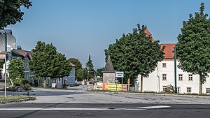
Losensteinleiten (municipality of Wolfern)
|
Losensteinleiten ( village ) locality |
||
|---|---|---|
|
|
||
| Basic data | ||
| Pole. District , state | Steyr-Land (SE), Upper Austria | |
| Judicial district | Steyr | |
| Pole. local community | Wolfern ( KG Losensteinleithen) | |
| Coordinates | 48 ° 6 '57 " N , 14 ° 21' 30" E | |
| height | 350 m above sea level A. | |
| Residents of the village | 569 (January 1, 2020) | |
| Statistical identification | ||
| Locality code | 12023 | |

|
||
| Source: STAT : index of places ; BEV : GEONAM ; DORIS | ||
Losensteinleiten is a village in the market town of Wolfern in the Steyr-Land district in Upper Austria .
Around the small main town Losensteinleiten north of Losensteinleithen Castle , which is located north of Wolfern, numerous districts developed, namely Hagleiten, Haidach, Hainbach, Hamet, Leihmannsdorf and Piesting, some of which are larger than the main town. Until the end of the First World War, the community was called Losensteinleiten and was renamed Wolfern in 1919 . The cadastral community of Losensteinleiten bears the name Losensteinleithen .
Individual evidence
- ^ Spiegelfeld-Schneeburg buys Losensteinleiten Castle. In: nachrichten.at. Retrieved January 1, 2019 .
- ↑ History on wolfern.at
