Loshult
| Loshult | ||||
|
||||
| State : | Sweden | |||
| Province (län): | Skåne County | |||
| Historical Province (landskap): | Gentle | |||
| Municipality : | Osby | |||
| Coordinates : | 56 ° 30 ' N , 14 ° 7' E | |||
| SCB code : | S2993 | |||
| Status: | Småort | |||
| Residents : | 117 (December 31, 2015) | |||
| Area : | 0.48 km² | |||
| Population density : | 244 inhabitants / km² | |||
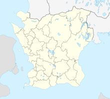
Loshult is a place ( småort ) in the northeast of the Swedish province of Skåne län and the historical province (landskap) Schonen , not far from the border with Småland . The place is in the municipality of Osby .
The current Loshult Church was built in 1591. It was heavily rebuilt in the 19th century and a tower was added in 1861–1863.
Loshult coup
The place went down in Swedish history , especially through the so-called “Loshult Coup” . On 26./27. In July 1676, during the Scandinavian War between Denmark-Norway and Sweden, the entire war chest of Charles XI fell to rebellious peasants and the Snapphanar free-soldiers . in the hands. They caught the guard of only ten Swedish soldiers by surprise. The war chest consisted of around 250 wagons with valuable metal coins, the so-called copper slips . It was worth around 50,000 Reichstalers .
Several participants in the attack were later captured by the Swedish authorities and sentenced to death, but were partially pardoned after the war. The war chest was never found. Most recently, ten copper plates from the coin treasure appeared in 1996 during tree planting work.
There is now a plaque commemorating the attack on Loshult Church.
The Loshulthort was found in 1898. The objects are exhibited under the number SHM 11217 in the Stockholm Historical Museum. They come from the years 1500–1300 BC. BC belong to the Scandinavian Bronze Age .
Web links
- Loshult on the Osby Municipality website (Swedish)
- Information Coup von Loshult (German)
