Lunsemfwa
| Lunsemfwa | ||
|
The Lunsemfwa in the Luangwa catchment area (bottom left) |
||
| Data | ||
| location |
Central Province of Zambia |
|
| River system | Zambezi | |
| Drain over | Luangwa → Zambezi → Mozambique Strait | |
| origin | The confluence of the streams in mountain Mumpuwelume 13 ° 19 '17 " S , 29 ° 38' 15" O |
|
| muzzle | in the Luangwa coordinates: 14 ° 54 ′ 28 " S , 30 ° 12 ′ 4" E 14 ° 54 ′ 28 " S , 30 ° 12 ′ 4" E
|
|
| Catchment area | 44,000 km² | |
| Discharge at level PL-4 (2) A Eo : 43,137 km² at the mouth |
MNQ 1963-1992 MQ 1963-1992 Mq 1963-1992 MHQ 1963-1992 |
31 m³ / s 286 m³ / s 6.6 l / (s km²) 859 m³ / s |
| Left tributaries | Lukusashi | |
| Right tributaries | Mulingushi | |
| Reservoirs flowed through |
Mita Hill Reservoir 14 ° 14 ′ 5 ″ S , 29 ° 7 ′ 7 ″ E |
|
|
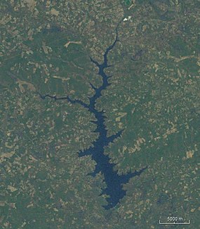
Satellite photo of the Mita Hill Reservoir |
||
The Lunsemfwa is a river in the central province of Zambia and a tributary of the Luangwa .
course
It rises near the border with the Democratic Republic of the Congo at the southeastern tip of the Katanga spur in the Muchinga Mountains . It flows south, is dammed by the Mita Hill Dam, built in the 1950s, to generate electricity, falls further over the Muchinga escarpment and from there to the east. Together with the Lukusashi , it forms the mightiest tributary of the Luangwa in the Luana Valley .
The river is very popular with anglers because of its large population of tiger characins , which can weigh up to 15 kg.
Hydrology
The flow rate of the river was measured in m³ / s at the mouth of the Lukusashi in a good half of the catchment area.

Individual evidence
- ^ Patterns of Hydrological Change in the Zambezi Delta, Mozambique
- ↑ JICA publication
- ^ JICA report
- ↑ Environmental Impact Assessment for Munshiwemba Intermediate Dam Project

