Lynnville, Indiana
|
|
This article was on the basis of substantive defects quality assurance side of the project USA entered. Help bring the quality of this article to an acceptable level and take part in the discussion ! A closer description on the resolving issues is missing. |
| Lynnville | ||
|---|---|---|
|
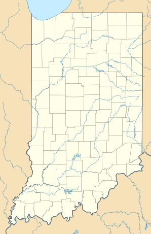
Location in Indiana
|
||
| Basic data | ||
| State : | United States | |
| State : | Indiana | |
| County : | Warrick County | |
| Coordinates : | 38 ° 12 ′ N , 87 ° 19 ′ W | |
| Time zone : | Central ( UTC − 6 / −5 ) | |
| Residents : | 781 (as of: 2000) | |
| Population density : | 177.5 inhabitants per km 2 | |
| Area : | 5.0 km 2 (approx. 2 mi 2 ) thereof 4.4 km 2 (approx. 2 mi 2 ) land |
|
| Height : | 141 m | |
| Postal code : | 47619 | |
| Area code : | +1 812 | |
| FIPS : | 18-45486 | |
| GNIS ID : | 0438435 | |
Lynnville is a location in Warrick County , Indiana , United States . In the United States Census 2000 there were 781 residents here. The area of the place is 5.0 square kilometers and 11.86 percent of this is water.

