Mühlenbach (Jamunder See)
|
Kösliner Mühlenbach in Polish Dzierżęcinka |
||
|
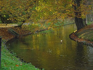
Mühlenbach near Köslin in Western Pomerania |
||
| Data | ||
| location | Polish West Pomeranian Voivodeship | |
| River system | Kösliner Mühlenbach | |
| origin | Lake Lubiatowo Północne near the village of Bonin southeast of Köslin 54 ° 9 ′ 46 ″ N , 16 ° 16 ′ 8 ″ E |
|
| muzzle | in the Jamunder See Coordinates: 54 ° 15 ′ 6 ″ N , 16 ° 7 ′ 58 ″ E 54 ° 15 ′ 6 ″ N , 16 ° 7 ′ 58 ″ E
|
|
| length | approx. 29 km | |
| Catchment area | approx. 120 km² | |
The mill stream , by the hinterpommersche city Koszalin ( Koszalin , also flows) Kösliner Mühlebach or Köslinscher Mühlebach called Polish Dzierżęcinka , is about 29 km long coastal river in the Polish province West Pomerania , which in the Baltic connected Jamno lake empties.
course
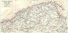
The entire riverbed of Kösliner mill Bach from the headwaters up to the confluence with the with the Baltic connected Jamno Lake ( Jamno ) is located in Pomerania . The catchment area of the Mühlenbach is about 120 km².
The Mühlenbach comes from a lake near the village of Bonin southeast of Köslin, flows between the villages of Dörsentin and Kretemin through the village of Roggow to Köslin and flows between the villages of Jamund ( Jamno ) and Puddemsdorf into the Jamunder See, which flows over the flowing Deep Canal is connected to the Baltic Sea.

literature
- Ludwig Wilhelm Brüggemann : Detailed description of the current state of the Königl. Prussian Duchy of Vor and Hinter Pomerania . Part II, Volume 1, Stettin 1784, p. XXXIII.
