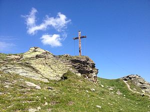
Madrisella
| Madrisella | ||
|---|---|---|
| height | 2466 m above sea level A. | |
| location | Vorarlberg , Austria | |
| Mountains | Silvretta | |
| Dominance | 1.25 km → Heimspitze | |
| Notch height | 75 m ↓ Matschunerjoch | |
| Coordinates | 46 ° 57 '34 " N , 9 ° 59' 10" E | |
|
|
||
|
Madrisella summit cross |
||
The Madrisella is a 2466 m above sea level. A. high mountain in the Austrian state of Vorarlberg and belongs to the Silvretta mountain group .
Location and surroundings
The Madrisella is located in the Montafon region , southwest of the village of Gaschurn and east of the village of Gargellen . The border between the communities of Gaschurn and St. Gallenkirch runs over the Madrisella , the border with Switzerland is only a few kilometers away. Neighboring mountains in the Silvretta include Versettla , Heimspitze and Schafboden .
Routes to the summit
From the mountain station of the Versettlabahn ( 2010 m above sea level ) the summit of the Madrisella can be reached via the Versettla ( 2372 m above sea level ) in an hour and a half.
Alternatively, there is the possibility of a five-hour round tour from the mountain station over the Alpe Nova ( 1730 m above sea level ) and the Matschuner Joch ( 2390 m above sea level ) to the summit. The descent to the mountain station is via the Versettla.
Individual evidence
- ^ Brigitte Schäfer: Bregenzerwald · Montafon . 50 tours with a height profile. 1st edition. Hiking guide 911. KOMPASS maps , Rum / Innsbruck 2007, ISBN 978-3-85491-317-7 , p. 38–39 (Tour 38: Madrisella 2466 m (Versettlaweg). Top-class panorama high-altitude path).
Web links
- Madrisella on the AMAP Austrian Map online
- Panoramic view from the Madrisella (with descriptions)


