Magharibi B (District)
| Magharibi District B
|
||
|---|---|---|
| Basic data | ||
| Country | Tanzania | |
| region | Unguja Mjini Magharibi | |
| surface | 130 km² | |
| Residents | 203,000 (2012) | |
| density | 1562 inhabitants per km² | |
| ISO 3166-2 | TZ-15 | |
Coordinates: 6 ° 15 ′ S , 39 ° 16 ′ E
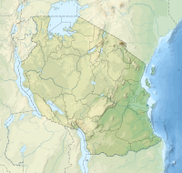
Magharibi B is a district in the Tanzanian region of Unguja Mjini Magharibi . The district is bordered to the north by the Magharibi A district , to the east by the Unguja Kusini region , to the south and west by the Indian Ocean and to the northwest by the Mjini district , which corresponds to the city of Zanzibar.
geography
In addition to the mainland in the southwest of the island of Unguja , the district also includes the small islands of Chumbe, Nguruwe, Kwale, Sume, Miwi and Ukanga. Magharibi B has a size of approximately 130 square kilometers and 203,000 inhabitants (as of 2012). The country has a tropical climate, Aw according to the effective climate classification . The temperatures fluctuate between 20 and 40 degrees Celsius. There are two rainy seasons, the long rains from April to May are called "Masika", it rains 900 to 1200 millimeters, the period of short rain showers from October to December is called "Vuli" and there are 400 to 500 millimeters of rainfall.
history
Until 2015, the Unguja Mjini Magharibi region consisted of the two districts of Magharibi and Mjini, then the Magharibi district was divided into the two districts of Magharibi A in the north and Magharibi B in the south.
Administrative division
The district is divided into seven constituencies (constituencies) and 14 parishes (wards):
| Constituency | local community |
|---|---|
| Dimani | Maungani |
| Kibondeni | |
| Fuoni | Kipungani |
| Mambosasa | |
| Gill samaki | Mbweni |
| Mombasa | |
| Chukwani | Chaukwani |
| Kisaiuni | |
| Mwanakwerekwe | Jitimai |
| Mwanakwerekwe | |
| Pangawe | Muembe Majogoo |
| Pangawe | |
| Kijitoupele | Melinne |
| Kijitoupele |
population
The 203,000 inhabitants live in 39,426 households, which results in an average household size of 5.15 people per household. The gender ratio is 90. That means for every 100 women there are 90 men (as of 2012).
Facilities and services
Economy and Infrastructure |
 |
Economic sectors
The main industries in the district are agriculture, trade, construction and commerce.
- Agriculture: Agriculture is an important industry. The main crops are rice, sweet potatoes, cassava, millet and bananas, as well as fruits and vegetables.
- Fishing: 686 tons of fish were caught in the district in the third quarter of 2019, about a third of the amount of Magharibi B or eight percent of Zanzibar. 810 seaweed farmers produced almost one hundred tons of seaweed per month in 2016.
- Hospitality: As much of the district is urban in character, there is a well-developed hospitality industry with hotels and guest houses.
Infrastructure
Due to its proximity to the city of Zanzibar, the district has good transport links:
|
 |
environmental issues
The following environmental problems were identified in 2016:
- overfishing
- Beach erosion from sand mining
- Water pollution
- Deforestation through heavy felling to obtain construction and firewood
- Landscape destruction through uncontrolled quarries
- Sea flooding
Web links
Individual evidence
- ^ A b Magharibi B, District Profile. (PDF) The Revolutionary Government of Zanzibar, June 2017, p. 1 , accessed on January 4, 2020 .
- ↑ Mkunguni climate: Average Temperature, weather by month, Mkunguni water temperature - Climate-Data.org. Retrieved January 6, 2020 .
- ^ Coastal Profile for Tanzania 2014, Volume III. (PDF) p. 55 , accessed on January 7, 2020 .
- ^ Magharibi B, District Profile. (PDF) The Revolutionary Government of Zanzibar, June 2017, pp. 2–3 , accessed on January 4, 2020 .
- ^ Magharibi B, District Profile. (PDF) The Revolutionary Government of Zanzibar, June 2017, p. 6 , accessed on January 4, 2020 .
- ^ Magharibi B, District Profile. (PDF) The Revolutionary Government of Zanzibar, June 2017, pp. 21–23 , accessed on January 4, 2020 .
- ^ Magharibi B, District Profile. (PDF) The Revolutionary Government of Zanzibar, June 2017, p. 31 , accessed on January 4, 2020 .
- ^ Magharibi B, District Profile. (PDF) The Revolutionary Government of Zanzibar, June 2017, p. 29 , accessed on January 4, 2020 .
- ^ Magharibi B, District Profile. (PDF) The Revolutionary Government of Zanzibar, June 2017, p. 49 , accessed on January 4, 2020 .
- ^ A b Magharibi B, District Profile. (PDF) The Revolutionary Government of Zanzibar, June 2017, p. 7 , accessed on January 4, 2020 .
- ^ Magharibi B, District Profile. (PDF) The Revolutionary Government of Zanzibar, June 2017, p. 9 , accessed on January 6, 2020 .
- ↑ The Agricultural Statistics Release, Third Quarter 2019. (PDF) Zanzibar Official Statistics Provider, pp. 2, 16 , accessed on January 6, 2020 .
- ^ Zanzibar Ports Corporation. Retrieved January 7, 2020 .
- ↑ Fumba to Zanzibar Port. Retrieved January 7, 2020 (de-US).
- ↑ Google Maps. Retrieved January 7, 2020 (de-US).
- ^ Magharibi B, District Profile. (PDF) The Revolutionary Government of Zanzibar, June 2017, p. 20 , accessed on January 4, 2020 .
- ↑ Statistical Release Zanzibar Road Accidents and Offences, 2018. (PDF) Office of the Chief Government Statistician and Police Headquarter Zanzibar, pp. 8–9 , accessed on January 6, 2020 .
- ^ Magharibi B, District Profile. (PDF) The Revolutionary Government of Zanzibar, June 2017, p. 47 , accessed on January 7, 2020 .


