Unguja Mjini Magharibi
| Unguja Mjini Magharibi | |
|---|---|
| Basic data | |
| Country | Tanzania |
| Capital | City of Zanzibar |
| surface | 232 km² |
| Residents | 593,678 (2012) |
| density | 2559 inhabitants per km² |
| ISO 3166-2 | TZ-15 |
Coordinates: 6 ° 12 ′ S , 39 ° 15 ′ E
The Unguja Mjini Magharibi region (English Zanzibar Urban / West , German Sansibar City / West ) is one of a total of 31 regions ( mkoa ) in Tanzania , one of five in the state of Zanzibar and one of three on the main island of Unguja . The administrative seat is the city of Zanzibar . The region borders in the north on the Unguja Kaskazini region in the east on the Unguja Kusini region and in the south and west on the Indian Ocean .
geography
The region has 593,678 inhabitants (2012 census) on an area of 232 square kilometers, making the region the most densely populated area of Tanzania after Dar es Salaam . Unguja Mjini Magharibi is located in the west of the island of Unguja and has two climate zones. For the most part there is a tropical monsoon climate, Am according to the effective climate classification , but there is also a tropical savanna climate (Aw). The capital has a tropical monsoon climate. Significant rain falls here in almost all months with a large peak around April and a smaller peak in November / December. Every year an average of 1512 millimeters of rain falls, the average temperature is 26.9 degrees Celsius:
|
Climate table Zanzibar (city)
Source: climate-data.org
|
||||||||||||||||||||||||||||||||||||||||||||||||||||||||||||||||||||||||||||||||||||||||||
history
In 1900 Zanzibar was a British protectorate with Pemba , it became independent in 1963 and merged with Tanganyika to form the state of Tanzania in 1964. At that time, Zanzibar had two regions, Zanzibar West (also Zanzibar City) and Zanzibar Land, which was divided into the two regions of North and South in 1967. The region of Zanzibar West is called “Mjini Magharibi” in Swahili, which means “city in the west”. Unguja Mjini Magharibi originally consisted of the two districts Mjini and Magharibi, in 2015 the district Magharibi was divided into the two districts Magharibi A and Magharibi B.
Administrative division
The region is divided into the three districts of Mjini, which corresponds to the city of Zanzibar, Magharibi A and Magharibi B:
| District | Residents
1967 |
Residents
1978 |
Residents
1988 |
Residents
2002 |
Residents
2012 |
|---|---|---|---|---|---|
| Magharibi A | 26,514 | 31,535 | 50,945 | 184.204 | 370,645 |
| Magharibi B | |||||
| Mjini (city) | 68,380 | 110.506 | 157,626 | 205,870 | 223.033 |
| total | 98,894 | 142.041 | 208,571 | 390.074 | 593,678 |
population
As in many African regions, the population is young, with almost forty percent of the population under the age of 15. Overall, there are significantly more women than men in Unguja Mjini Magharibi, there are only 92 men for every hundred women. The excess of women is particularly pronounced in the age group 20 to 29, where there are fewer than 80 men for every 100 women. The representation of the city dwellers (narrow bars in the pyramid) shows that the majority of the population lives in the city. The bulge that is also present here among women between the ages of 20 and 29 indicates an immigration from other regions.

Facilities and services
Economy and Infrastructure |
|
The number of farms in the region rose from 8,570 in 2004 to 13,280 in 2016, of which 395 were active in agriculture, 1,460 in production, 8,820 in trade and 2,605 in the service sector. These businesses employed 86,775 people, two thirds of them in services, compared to the number of businesses (17,569) in trade. Unguja Mjini Magharibi is an above-average wealthy region in Tanzania. While 58 percent of households nationwide are low-income, this is only 12% in Unguja Mjini Magharibi. In contrast, 52 percent in the region are in the upper income bracket, compared with 12 percent nationwide. AgricultureOf the 113,000 households in the district, 26,000 were engaged in agriculture, the majority of which were manioc and bananas. Around 16 percent of households also owned farm animals. 270,000 chickens, 20,000 cattle and 15,000 goats were kept (as of 2012). fishingIn 2018, 10,723 tons of fish were caught in the region. |
 |
production
Of the 1,460 businesses in the production sector, 1,243 belong to the manufacturing sector, mostly family businesses with fewer than five employees (as of 2016).
trade
In the Unguja Mjini Magharibi region there are 8820 companies, more than half of the trading companies in all of Zanzibar. The companies are predominantly family-owned small businesses.
Services
In 2016 there were 2,605 companies in the service sector, the most important sectors being transport (15%), education (13%), finance and insurance (10%) and accommodation and meals (8%). Here, too, they were mostly family businesses, but the businesses were larger than in the other economic sectors.
tourism
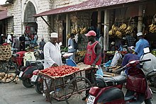
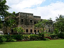
The main attraction for tourism is the stone city in Zanzibar with the old fortress, the slave market and the Forodhani garden.
Infrastructure
- Port: The modernization of the port between 2005 and 2008 was funded by the European Union. The port has two berths with quay lengths of 240 and 113 meters, and container ships with a draft of up to ten meters can dock. Around 95 percent of Zanzibar's imports and exports are processed here.
- Airport: Abeid Amani Karume International Airport has a runway length of 2462 meters and is served by airlines from Africa and Europe (as of 2020).
Nature reserves, sights
- Stone Town : The Stone Town of Zanzibar was declared a UNESCO World Heritage Site in 2000 . It has an almost completely preserved cityscape with African, Arabic, Indian and European cultural elements that have emerged over a period of over a thousand years.
Web links
Individual evidence
- ^ National Bureau of Statistics & Office of Chief Government Statistician: Basic Demographic and Socio-Economic Profile, Tanzania Zanzibar . Dar es Salaam, Zanzibar 2014, on www.tanzania.go.tz, PDF document p. 52 (English)
- ^ Coastal Profile for Tanzania 2014. (PDF) The Government of Tanzania, p. 57 , accessed on January 5, 2020 .
- ^ Environmental and Social Management Framework. (PDF) Ministry of Education and Vocational Training, April 20, 2015, p. 18 , accessed January 5, 2020 .
- ↑ Climate Zanzibar Urban / West: Temperature, climate graph, Climate table for Zanzibar Urban / West - Climate-Data.org. Retrieved January 4, 2020 .
- ^ Tanzania Regions. Retrieved January 4, 2020 .
- ↑ Google Translate. Retrieved January 4, 2020 .
- ^ A b Tanzania Regional Profiles, 53. Mjini Magharibi Regional Profile. (PDF) The United Republic of Tanzania, p. 15 , accessed on January 4, 2020 .
- ^ A b Magharibi B, District Profile. (PDF) The Revolutionary Government of Zanzibar, June 2017, p. 1 , accessed on January 4, 2020 .
- ↑ Zanzibar Figures 2018. (PDF) Office of the Chief Government Statsticia, June 2019, p. 12 , accessed on January 4, 2020 .
- ↑ Zanzibar in Figures 2018. (PDF) Office of the Chief Government Statisticia, June 2019, p. 47 , accessed on January 5, 2020 .
- ↑ Tanzania Regional Profiles, 53. Mjini Magharibi Regional Profile. (PDF) The United Republic of Tanzania, pp. 19-20 , accessed January 4, 2020 .
- ↑ Tanzania Regional Profiles, 53. Mjini Magharibi Regional Profile. (PDF) The United Republic of Tanzania, p. 69 , accessed on January 4, 2020 .
- ↑ Zanzibar in Figures 2018. (PDF) Office of the Chief Government Statisticia, June 2019, p. 35 , accessed on January 5, 2020 .
- ↑ Tanzania Regional Profiles, 53. Mjini Magharibi Regional Profile. (PDF) The United Republic of Tanzania, p. 121 , accessed January 4, 2020 .
- ↑ Tanzania Regional Profiles, 53. Mjini Magharibi Regional Profile. (PDF) The United Republic of Tanzania, pp. 109–110 , accessed on January 4, 2020 .
- ↑ Tanzania Regional Profiles, 53. Mjini Magharibi Regional Profile. (PDF) The United Republic of Tanzania, p. 114 , accessed January 4, 2020 .
- ↑ Census of Establishments 2016. (PDF) In: http://www.ocgs.go.tz/publication.php?page=2# . Office of Chief Government Statistician-Zanzibar, March 2017, pp. 21, 24, 30 , accessed on January 3, 2020 .
- ↑ Zanzibar Report 2017. FinScope Tanzania, p. 19 , accessed on January 5, 2020 .
- ↑ Tanzania Regional Profiles, 53. Mjini Magharibi Regional Profile. (PDF) The United Republic of Tanzania, pp. 122–126 , accessed January 4, 2020 .
- ↑ The Annual bulletin of agricultural statistics 2018. (PDF) In: http://www.ocgs.go.tz/publication.php?page=2# . Office of Chief Government Statistician-Zanzibar, p. 3 , accessed January 4, 2020 .
- ↑ Census of Establishments 2016. (PDF) In: http://www.ocgs.go.tz/publication.php?page=2# . Office of Chief Government Statistician-Zanzibar, March 2017, pp. 40–41 , accessed January 4, 2020 .
- ↑ Census of Establishments 2016. (PDF) In: http://www.ocgs.go.tz/publication.php?page=2# . Office of Chief Government Statistician-Zanzibar, March 2017, pp. 43-44 , accessed January 4, 2020 .
- ↑ Census of Establishments 2016. (PDF) In: http://www.ocgs.go.tz/publication.php?page=2# . Office of Chief Government Statistician-Zanzibar, March 2017, pp. 46-48 , accessed January 4, 2020 .
- ↑ Popular things to do in Zanzibar Town. Retrieved January 5, 2020 .
- ^ European Union Assistance to Tanzania. (PDF) October 2011, p. 3 , accessed on January 5, 2020 .
- ^ Zanzibar Ports Corporation. Retrieved January 5, 2020 .
- ^ Zanzibar - Tanzania. Retrieved January 5, 2020 (American English).
- ↑ UNESCO World Heritage Center: Stone Town of Zanzibar. Retrieved January 5, 2020 .


