
Tanga (region)
| tanga | |
|---|---|
  |
|
| Basic data | |
| Country | Tanzania |
| Capital | tanga |
| surface | 27,348 km² |
| Residents | 2,045,205 (2012) |
| density | 75 inhabitants per km² |
| ISO 3166-2 | TZ-25 |
| politics | |
| Regional Commissioner | Martine Reuben Shigela |
Coordinates: 5 ° 4 ′ S , 39 ° 6 ′ E
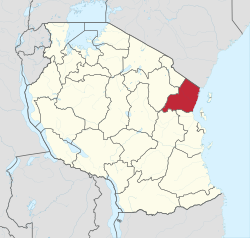
Tanga is one of the total of 31 administrative regions in Tanzania , in the northeast of the state, its capital is also called Tanga . The region is bordered by the Kilimanjaro region in the north, Kenya in the northeast, the Indian Ocean in the east, the Pwani and Morogoro regions in the south and the Manyara region in the west .
geography
The region is 27,348 square kilometers and has around 2 million inhabitants (2012 census).

Tanga consists of:
- The plain of the Umba River in the northeast: The Umba rises in the Usambara Mountains . There is a lot of precipitation here in the season of short rains, so that the river has its highest water level in December.
- The plain of the Pangani River in the southwest: The river has its source on Kilimanjaro and Mount Meru in the Kilimanjaro region. Important tributaries are the Mkomazi and the Luengera , which have their source in the Usambara Mountains.
- The Usambara Mountains between the plains of the Umba and Pangani rivers: the highest point is the Sungwi at 2293 meters.
- The coastal strip and the offshore islands on the Indian Ocean.
In the Tanga region there are different climate zones, from the subtropical oceanic highland climate (Cwb according to the effective climate classification ) to the tropical monsoon climate (Am) to the oceanic climate (Cfb). However, sixty percent of the area has a tropical savannah climate (Aw).
|
Climate table Tanga
Source: climate-data.org
|
||||||||||||||||||||||||||||||||||||||||||||||||||||||||||||||||||||||||||||||||||||||||||
history
Finds in the foothills of the Pare and Usambara Mountains show that the country was settled as early as the Iron Age. The capital Tanga was founded by Persian traders in the 14th century. In the 16th and 17th centuries the Shamba ethnic group dominated the area, in the 18th century Ottoman Arabs raided the coast. From 1840 onwards, Arab and Swahili traders advanced inland to buy ivory and slaves. In the 1880s the country came under German rule, after the end of the First World War the British took it over. The area around Tanga belonged to Tanganyika until it gained independence. The region was originally called Tanga Province. However, this also included the Same and Mwanga districts, which now belong to the Kilimanjaro region.

Administrative division
The Tanga region is divided into eight districts and ten councils (Panganai DC, Mkinga DC, Muheza DC, Tanga CC , Korogwe DC, Korogwe TC, Handeni DC, Handeni TC, Kilindi DC and Lushoto DC):
| District | Residents
1988 |
Residents
2002 |
Residents
2012 |
|---|---|---|---|
| Lushoto | 357.492 | 418,652 | 492,441 |
| Korogwe | 218,849 | 260.238 | 310.346 |
| Muheza | 229.139 | 182.935 | 204,461 |
| tanga | 186,818 | 242,640 | 273,332 |
| Pangani | 37,670 | 43,920 | 54.025 |
| Handeni | 250.244 | 248,633 | 355.702 |
| Kilindi | n / A | 143,792 | 236.833 |
| Mkinga | n / A | 95,470 | 118.065 |
population
In 2012, 43 percent of the region's population were under 15 years old and only five percent were over 65 (as of 2012).

The largest ethnic groups in Tanga are the Shambaa (Sambara) Zigula Language , Bondei and the Mijikenda counting Digo .
Facilities and services
|
 |


Economy and Infrastructure
|
Of those over ten, 62 percent were employed, eight percent worked in the household, 24 percent in training, two percent unemployed and four percent unable to work. More than three quarters of the employees worked in agriculture (as of 2012).
|
 |
- Roads: The Tanga region has a road network of 3907 kilometers. Of these, 327 kilometers are paved national roads and 1,485 kilometers are regional roads, of which 176 kilometers are paved (as of 2018). The main connections are the national roads T2 and T13. The T2 crosses the region from south to north, from where the T13 branches off, which continues through the capital Tanga to Kenya.
- Railroad: The Tanga railway line was closed in 2007 but reopened in 2019. It leads from the capital Tanga at the foot of the Usambara Mountains to Moshi and on to Arusha .
- Airport: Tanga Airport is located west of the capital Tanga and has an asphalt runway of 1260 meters.
- Port: Tanga is a small seaport with an annual turnover of 700,000 tons (as of 2019).
- Energy: Two run-of-river power stations on the Pangani River supply electrical energy: The Pangani Fall power station was opened in 1994 and has a nominal output of 68 MW. The Hale power plant went online in 1961 and has a nominal output of 21 MW.
Nature reserves, sights


- Amani Nature Reserve: In the southernmost part of the Usambara Mountains, this 8,380 hectare forest area is located in the Muheza and Korogwe districts at an altitude of between 300 and 1100 meters.
- Amboni Caves: The Amboni Caves are limestone caves from the Jura , eight kilometers north of the city of Tanga. Out of ten caves explored, one is open for guided tours.
- Tongoni Ruins: Tongoni was a thriving trading center in the 15th century. The ruins of a mosque and forty graves date from this period. Now Tongoni is a small fishing village 17 kilometers south of Tanga.
Others
- Church: The diocese of Tanga of the Catholic Church has around 235,000 members. Other large denominations are Islam , the Evangelical Church and the Anglican Church .
Web links
Individual evidence
- ^ National Bureau of Statistics & Office of Chief Government Statistician: Basic Demographic and Socio-Economic Profile, Statistical Tables, Tanzania Mainland . Dar es Salaam, Zanzibar 2014, on www.tanzania.go.tz, PDF document p. 15 (English)
- ^ Tanga Region, Socio Economic Profile. (pdf) The United Republic of Tanzania, April 1997, p. 1 , accessed October 29, 2019 .
- ↑ Tanzania in Figures 2018. (pdf) The United Republic of Tanzania, June 2019, p. 17 , accessed on October 29, 2019 .
- ^ Temporal Flow Variations: A Challenge for Water Management in Tanzania. University of Dar Es Salaam, accessed October 30, 2019 .
- ^ Pangani River System. (pdf) Pangani Basin Water Board, 2011, p. 6 , accessed on October 30, 2019 .
- Jump up ↑ Tanzania Mountains, Tanga. Retrieved October 30, 2019 .
- ↑ Maps for the world, Map 500k - xb37-1. Retrieved October 30, 2019 .
- ^ Climate Data, Tanga. Retrieved October 30, 2019 .
- ↑ thong. Encyclopaedia Britannica, accessed October 30, 2019 .
- ^ Tanzania Regional Profiles, 05 Tanga Regional Profiles. (pdf) The United Republic of Tanzania, 2016, p. 16 , accessed on October 20, 2019 .
- ^ Tanzania Regional Profiles, 05 Tanga Regional Profiles. (pdf) The United Republic of Tanzania, 2016, p. 20 , accessed on October 30, 2019 .
- ^ Tanga Region, Socio Economic Profile. (pdf) The United Republic of Tanzania, April 1997, pp. 116–118 , accessed October 29, 2019 .
- ^ Tanzania Regional Profiles, 05 Tanga Regional Profiles. (pdf) The United Republic of Tanzania, 2016, p. 78 , accessed on October 30, 2019 .
- ^ Tanga Region, Socio Economic Profile. (pdf) The United Republic of Tanzania, April 1997, p. 132 , accessed on October 29, 2019 .
- ^ Tanzania Regional Profiles, 05 Tanga Regional Profiles. (pdf) The United Republic of Tanzania, 2016, pp. 96–97 , accessed on October 30, 2019 .
- ^ Tanga Region, Socio Economic Profile. (pdf) The United Republic of Tanzania, April 1997, pp. 160-164 , accessed on October 29, 2019 .
- ^ Tanzania Regional Profiles, 05 Tanga Regional Profiles. (pdf) The United Republic of Tanzania, 2016, pp. 133, 136 , accessed on October 30, 2019 .
- ^ Tanzania Regional Profiles, 05 Tanga Regional Profiles. (pdf) The United Republic of Tanzania, 2016, p. 138 , accessed October 30, 2019 .
- ↑ Popote Africa, Tanga Region. Retrieved October 31, 2019 .
- ^ Tanga Region, Socio Economic Profile. (pdf) The United Republic of Tanzania, April 1997, p. 82 , accessed on October 29, 2019 .
- ↑ TANROADS Official Website :: Regional Roads Network. Retrieved January 28, 2020 .
- ↑ Mapcarta, Tanga. Retrieved October 30, 2019 .
- ^ Daily News, Tanga-Moshi Railway relaunched. October 31, 2019, accessed October 31, 2019 .
- ↑ World Airport Codes, Tanga. Retrieved October 31, 2019 .
- ↑ Tanzania Ports Authority, Tanga Seaport. Retrieved October 31, 2019 .
- ^ Tanzania Electric Supply Company, Pangani Hydro System. Retrieved October 31, 2019 .
- ^ Tanzania Electric Supply Company, Hale Hydro Power Plant. Retrieved October 31, 2019 .
- ^ Tanzania Forest Services, Amani Nature Reserve. The United republic of Tanzania, accessed October 31, 2019 .
- ↑ Tanzania Tourist Board, Amboni Caves. Retrieved October 31, 2019 .
- ↑ TouristLink, Tongoni Ruins. Retrieved October 31, 2019 .
- ↑ Diocese of Tanga. Retrieved June 8, 2020 .
Arusha | Dar es Salaam | Dodoma | Geita | Iringa | Kagera | Katavi | Kigoma | Kilimanjaro | Lindi | Manyara | Mara | Mbeya | Morogoro | Mtwara | Mwanza | Njombe | Pemba Kaskazini | Pemba Kusini | Pwani | Rukwa | Ruvuma | Shinyanga | Simiyu | Singida | Songwe | Tabora | Thong | Unguja Kaskazini | Unguja Kusini | Unguja Mjini Magharibi