
Pangani (river)
| Pangani | ||
 Catchment area of the Pangani |
||
| Data | ||
| location |
|
|
| River system | Pangani | |
| origin |
Nyumba ya Mungu Reservoir 3 ° 49 ′ 38 ″ S , 37 ° 28 ′ 9 ″ E |
|
| muzzle | at Pangani in the Indian Ocean Coordinates: 5 ° 26 ′ 2 " S , 38 ° 59 ′ 1" E 5 ° 26 ′ 2 " S , 38 ° 59 ′ 1" E
|
|
| Catchment area | 43,650 km² | |
| Discharge at the Korogwe gauge (1289200) A Eo : 25,110 km² Location: 110 km above the mouth |
NNQ (min. Month Ø) MNQ 1959–1977 MQ 1959–1977 Mq 1959–1977 MHQ 1959–1977 HHQ (max. Month Ø) |
7 m³ / s 20.9 m³ / s 27 m³ / s 1.1 l / (s km²) 38.8 m³ / s 123 m³ / s |
| Left tributaries | Mkomazi ; Luengera | |
| Right tributaries | Lumoromo; Fukda; Mkalami | |
| Reservoirs flowed through | Nyumba ya Mungu Reservoir | |
| Medium-sized cities | Korogwe | |
| Small towns | Arusha Chini , Mbuyuni , Segera , Hale , Pangani | |
| Residents in the catchment area | 3.7 million | |
 The Pangani at the mouth |
||
The Pangani is a river in northeastern Tanzania .
geography
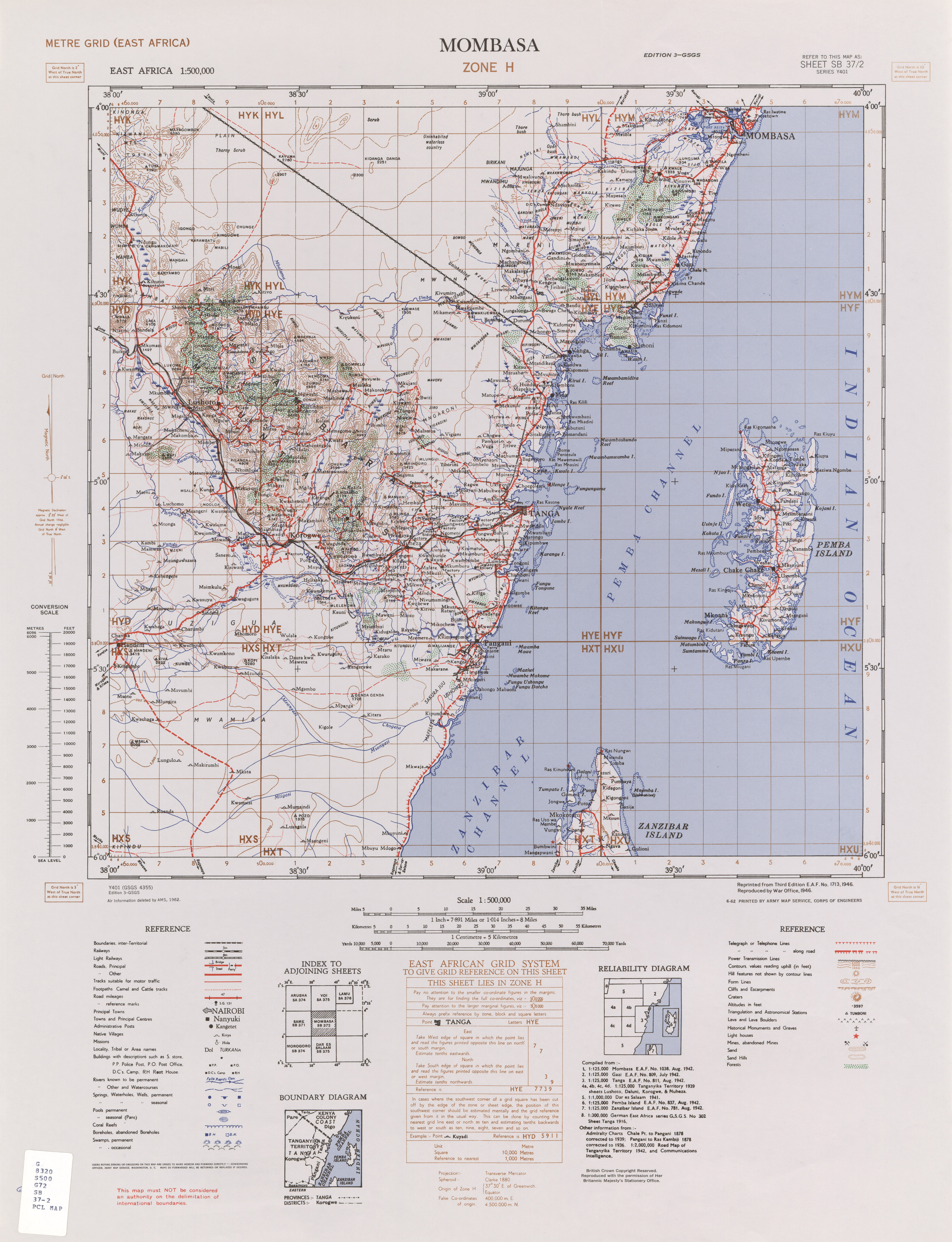
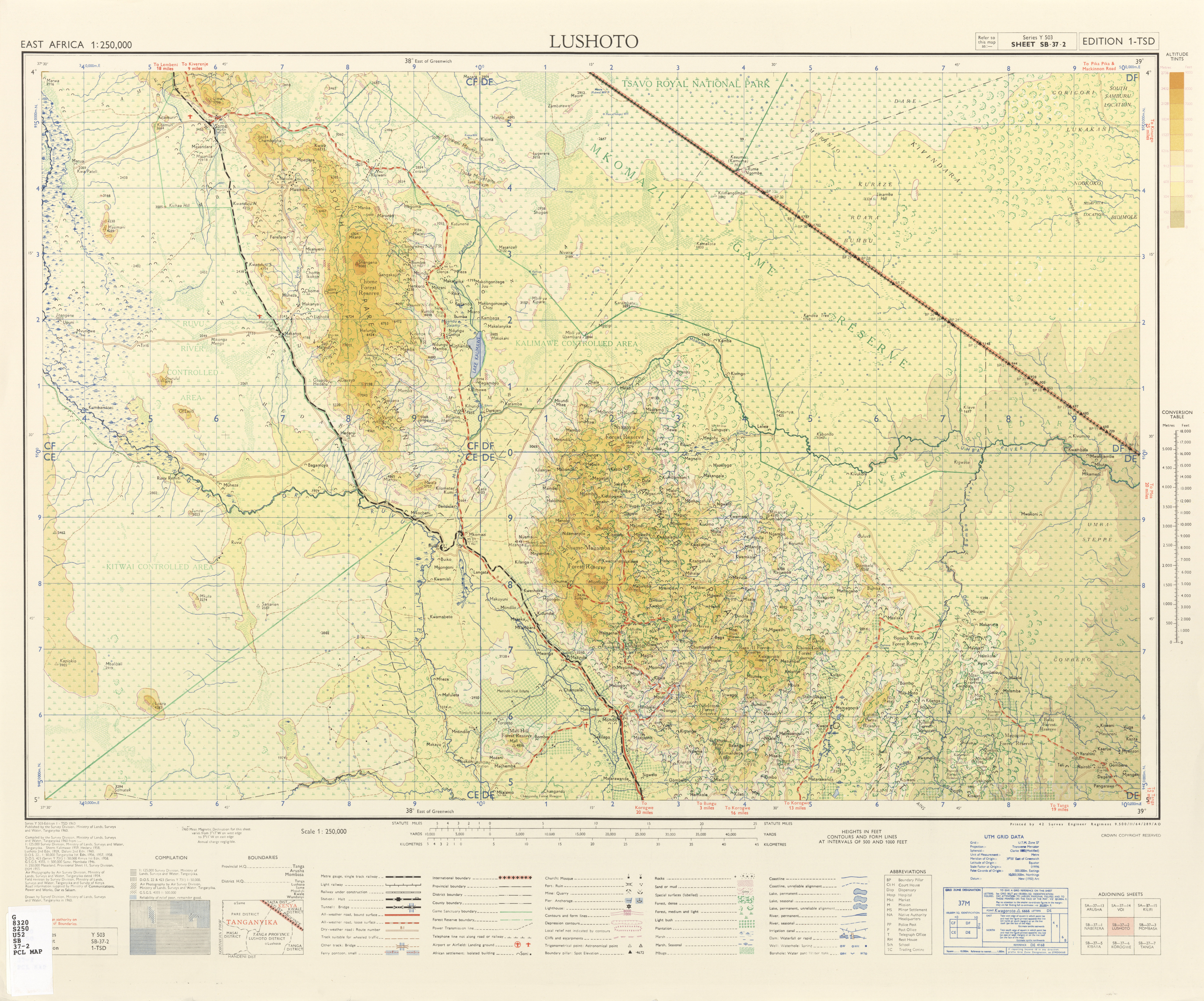
It arises from two source rivers. One is Kikuletwa, which rises on Mount Meru near the city of Arusha . The other is the from the Lake Jipe coming Ruvu , the other on his way inflows from Kilimanjaro receives. Today the two source rivers flow into the Nyumba ya Mungu reservoir . On the stretch between the reservoir and the city of Mkomazi , the river forms the border of the Kilimanjaro and Manyara regions . Although the tributary Mkomazi is only 4 kilometers away, it only flows 60 kilometers further before the town of Korogwe in the Tanga region . At the city of Pangani the Pangani flows into the Indian Ocean. Cities along its course are Arusha Chini on the Nyumba-ya-Mungu reservoir, Mbuyuni just before the border between Kilimanjaro and Tanga regions, Korogwe, Segera and Hale in Tanga.
Surname

The river crosses the area of different language groups and therefore had different names. In the recent past it was mainly the name Ruvu from the upper reaches and the name Pangani from the mouth.
Both names were used side by side on British Colonial and Independence maps.
In the meantime, “Pangani” has established itself for the run from Nyumba-ya-Mungu reservoir to the sea.
Hydrometry
The flow rate of the river was measured over 18 years (1959-77) in Korogwe, a town in Tanga, about 110 kilometers upstream from the mouth in m³ / s. The mean annual flow rate observed in Korogwe during this period was 27 m³ / s.

Individual evidence
- ^ Pangani basin: a situation analysis. Retrieved November 16, 2010 .
- ↑ a b GRDC - The Pangani in Korogwe
- ^ Pangani basin: a situation analysis (IUCN). (No longer available online.) Formerly in the original ; Retrieved November 20, 2010 . ( Page no longer available , search in web archives ) Info: The link was automatically marked as defective. Please check the link according to the instructions and then remove this notice.
- ^ Entry "Pangani" in the colonial dictionary
- ↑ cf. the cards Sheet SB 37/2, Series Y401, by War Office 1946 from 1946 and this card from 1960 Sheet SB-37-2 Series Y503, Edition 1-TSD, Published by the Survey Division, Ministry of Lands, Survey and Water, Tanganyika 1960 . Both give "Pangani or Ruvu River" as the river name.
Web links
- Water & Nature Initiative of IUCN (PDF, 120 pages) (PDF, 1.2 MB)
- Map in the Kiswahili Wikipedia
- Entry "Pangani" in the colonial dictionary