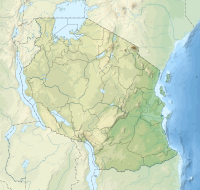
Mkinga (district)
| Mkinga district
|
||
|---|---|---|
| Basic data | ||
| Country | Tanzania | |
| region | tanga | |
| surface | 2948 km² | |
| Residents | 118,065 (2012) | |
| density | 40 inhabitants per km² | |
| ISO 3166-2 | TZ-25 | |
Coordinates: 4 ° 50 ′ S , 39 ° 7 ′ E
Mkinga is a district in the Tanzanian region of Tanga with the administrative headquarters in Kasera . The district is bordered by Kenya to the north, the Indian Ocean to the east, the Tanga and Muheza districts to the south and the Korogwe and Lushoto districts to the west .
geography
The district is 2948 square kilometers and has 118,065 inhabitants (as of 2012). Topographically, the country can be divided into two areas:
- Coastal strip: From the Indian Ocean the land rises in a 20 to 30 kilometer wide strip to about 100 meters above sea level.
- Inland: Subsequently, the country rises gradually to the west to 400 meters, in the northern area, on the border with Kenya, in the Umba hills, a height of 800 meters is also reached.
The southern part of the territory is drained into the Indian Ocean by the Sigi River , which forms the border with the Muheza district. The Umba River , which drains the northern part, flows east to Kenya and also flows into the Indian Ocean.
The climate is tropical, Aw according to the effective climate classification . The precipitation is usually sufficient at 450 to 1000 millimeters, it falls mainly in the months of November to April.
history
Mkinga was created in 2007 when it was separated from the Muheza district.
Administrative division
The district is divided into 21 parishes (wards):
- Mwakijembe
- Mkinga
- Duga
- Moa
- Manza
- Kwale
- Mtimbwani
- Gombero
- Mhinduro
- Maramba
- Kigongoi
- Daluni
- Bosha
- Mapatano
- Bwiti
- Mnyenzani
- Doda
- Boma
- Parungu Kasera
- Mayo bonuses
- Sigaya
populationThe population of Mkinga increased from 95,470 in 2002 to 118,065 in 2012. Growth was stronger in the countryside at 25 percent than in the city, where the population only increased by 10 percent. Sixty percent of those over five spoke Swahili, nine percent English and Swahili, and thirty percent were illiterate (as of 2012). Facilities and services |
 |
- Education: There are 79 elementary schools and 15 high schools in the district.
- Health: Three health centers and 24 pharmacies are available to provide medical care for the population (as of 2018). A hospital in Mazola is under construction (as of 2019).
- Water: 55 percent of the population had access to safe and clean water within 400 meters (as of 2018).
Economy and Infrastructure
|
 |
- Traffic: The coast runs through the district along the asphalt main road T14 from Tanga to Kenya.
Attractions
- Mkomazi National Park : The district is part of the 3,245 square kilometer Mkomazi National Park and the associated buffer zone, the Umba Game Reserve.
Web links
Individual evidence
- ↑ a b c History | Mkinga District Council. Retrieved December 11, 2019 .
- ^ Tanzania Regional Profiles, 05 Tanga Regional Profiles. (pdf) The United Republic of Tanzania, 2016, p. 15 , accessed on December 11, 2019 .
- ^ District Strategic Plan 2011/12 to 2015/16. (pdf) pp. 2–3 , accessed on December 11, 2019 .
- ↑ Mkinga climate: Average Temperature, weather by month, Mkinga weather averages - Climate-Data.org. Retrieved December 11, 2019 .
- ↑ Maps for the world, Map 500k - xb37-1, Map 500k - xb37-2. Retrieved December 11, 2019 .
- ↑ 2012 Population and Housing Census. (pdf) National Bureau of Statistics and Ministry of Finance, March 2013, p. 52 , accessed on December 11, 2019 .
- ^ Tanzania Regional Profiles, 05 Tanga Regional Profiles. (pdf) The United Republic of Tanzania, 2016, pp. 18, 75 , accessed on December 11, 2019 .
- ↑ Statistics | Mkinga District Council. Retrieved December 11, 2019 .
- ↑ Health Service | Mkinga District Council. Retrieved December 11, 2019 .
- ↑ zansaitos project 2019 Hospital in Mazola. (pdf) Accessed December 11, 2019 .
- ^ Construction of District Hospital | Mkinga District Council. Retrieved December 11, 2019 .
- ↑ Water Service | Mkinga District Council. Retrieved December 11, 2019 .
- ^ Agriculture | Mkinga District Council. Retrieved December 11, 2019 .
- ^ Tanzania Regional Profiles, 05 Tanga Regional Profiles. (pdf) The United Republic of Tanzania, 2016, pp. 133, 136 , accessed on December 11, 2019 .
- ↑ Fishery | Mkinga District Council. Retrieved December 11, 2019 .
- ↑ Beekeeping | Mkinga District Council. Retrieved December 11, 2019 .
- ^ Trunk Roads Network. Retrieved December 11, 2019 .
- ↑ Tanzania in Figures 2018. (pdf) National Bureau of Statistics, June 2019, p. 8 , accessed December 11, 2019 .


