Malgomaj
| Malgomaj | ||
|---|---|---|
| Geographical location | Lapland , Sweden | |
| Tributaries | Ångermanälven | |
| Drain | Ångermanälven | |
| Location close to the shore | Vilhelmina | |
| Data | ||
| Coordinates | 64 ° 45 ′ N , 16 ° 12 ′ E | |
|
|
||
| Altitude above sea level | 343.9 m above sea level | |
| surface | 103 km² | |
| length | 40 km | |
| width | 3 km | |
| volume | 3,117,000,000 m³ | |
| Maximum depth | 107 m | |
| Middle deep | 40.3 m | |
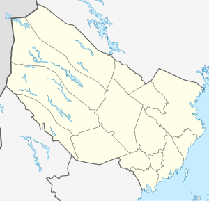
The Malgomaj ( South Sami : Jetneme ) is located in the municipality of Vilhelmina in Västerbotten County in the Swedish historical province of Lapland west of Vilhelmina . Located at an altitude of 343.9 m above sea level, the lake is 103 km² in size and has a maximum depth of 107 meters. The Ångermanälven , Sweden's most water-rich river, flows through the lake . The distance to the sea is 272 km.
The lake is around 40 long and up to 3 km wide and extends from its upper end in the northwest to its outlet in the southeast. It is accompanied on its southern bank by a side road that forms part of the Wilderness Road (Sweden) (Vildmarksvägen), which branches off in Vilhelmina from Europaväg 45 and via Malgovik , Strömnäs and Stalon at the upper end of the lake to Kultsjön and on to the disused mine of Stekenjokk near the border with Norway .
Individual evidence
- ↑ [1]
- ↑ Sverige vägatlas, Norstedts, Stockholm, 2014, ISBN 978-91-1305683-8
- ↑ Sverige vägatlas, Norstedts, Stockholm, 2014, ISBN 978-91-1305683-8
- ↑ a b c Sjödjup och sjövolym (712.6 kB; PDF) , Svenskt vattenarkiv (SVAR), Sveriges meteorologiska och hydrologiska institut (Swedish)
