
Mandara Mountains
| Mandara Mountains | |
|---|---|
 The Mandara Mountains near Yola in Nigeria |
|
| Highest peak | Oupay ( 1494 m ) |
| location | Cameroon / Nigeria border |
| part of | Adamaua Highlands |
| Coordinates | 10 ° 28 ' N , 13 ° 36' E |
The Mandara Mountains are a volcanic mountain range in the Adamaua highlands , along the northern part of the Cameroon - Nigerian border. It stretches for 200 km, from the Benue River in the south to a point northwest of the Cameroonian city of Maroua in the north, and then drops into the plains of the Chad Basin .
The rivers El Beid , Ngadda and Yedseram , which head towards Lake Chad , and the northern tributaries of the Mayo Kébbi , a tributary of the Benue , have their source in the Mandara Mountains .
The highest peak is the Oupay with 1494 m , other mountains are the Ramada ( 1321 m ) and the Chidlél ( 1069 m ). The average altitude is 800–900 m. The region is densely populated, especially by speakers of the Chad languages or the Kirdi .
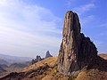
Kapsiki Peak at Rhumsiki

Web links
- Mandara Mountains in the German Colonial Lexicon