Marshallton (Northumberland County, Pennsylvania)
| Marshallton | ||
|---|---|---|
 In Marhallton |
||
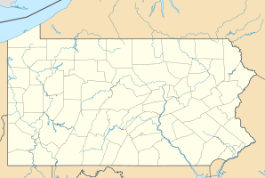
| Location in Pennsylvania | ||
|
|
||
| Basic data | ||
| State : | United States | |
| State : | Pennsylvania | |
| County : | Northumberland County | |
| Coordinates : | 40 ° 47 ′ N , 76 ° 32 ′ W | |
| Time zone : | Eastern ( UTC − 5 / −4 ) | |
| Residents : | 1,441 (as of 2010) | |
| Population density : | 626.5 inhabitants per km 2 | |
| Area : | 2.3 km 2 (approx. 1 mi 2 ) of which 2.3 km 2 (approx. 1 mi 2 ) is land |
|
| Height : | 268 m | |
| Postal code : | 17866 | |
| FIPS : | 42-47736 | |
| GNIS ID : | 1180481 | |
Marshallton is a census-designated place (CDP) in Coal Township in Northumberland County , Pennsylvania , United States . At the time of the 2010 United States Census , Marshallton had 1,441 residents.
geography
Marshallton's geographic coordinates are 40 ° 47 ' N , 76 ° 32' W (40.787484, −76.538358). Marshallton lies in the valley of Coal Run , a right tributary of Shamokin Creek and borders Shamokin to the west. To the east joins Boydtown , an unincorporated community .
According to the United States Census Bureau , the CDP has a total area of 2.4 km 2 , all of which is land. The road system is largely laid out at right angles, but it is not in the north, but "hangs" a little to the southeast. The east-west streets are North to South Maple Avenue, Webster Street, Tioga Street, Mohawk Street, Pulaski Avenue, Hemlock Street, Wabash Street, South Street, and Eagle Street, with Pulaski Avenue dividing the continuous North- South streets into North and South . From east to west, these are Thomas Street, Meade Street, and Sheridan Street. Further west are Saint Edward Avenue / Sherman Street, Logan Street, Howard Street, Emory Street, and Howard Street. The network structure is not fully developed, but there are some gaps.
The Pennsylvania Route 61 Marshallton is linked only indirectly; on the one hand via Hakes Street and Fleeney Street and on the other hand via streets in Shamokin.
Demographics
At the time of the United States Census 2000, Marshallton lived in 1,437 people. The population density was 637.7 people per km 2 . There were 756 housing units, an average of 335.5 per km 2 . The Marshallton population was 99.51% White , 0.14% Black or African American , 0% Native American , 0% Asian , 0% Pacific Islander , 0.% said they were racial , and 0.28% named two or more races. 0.56% of the population declared to be Hispanic or Latino of any race.
Marshallton residents were distributed among 640 households out of which 24.5% had children under the age of 18. 40.6% of households were married, 12.8% had a female head of household without a husband, and 40.0% were not families. 35.5% of households were made up of individuals and someone lived in 20.3% of all households aged 65 years or older. The average household size was 2.22 and the average family size was 2.82 people.
The population was divided into 21.8% minors, 5.5% 18–24 year olds, 26.2% 25–44 year olds, 22.2% 45–64 year olds and 24.3% aged 65 and over or more. The median age was 43 years. For every 100 women there were 90.8 men. For every 100 women over the age of 18, there were 85.8 men.
The median household income in Marshallton was 23,173 US dollars, and the median family income reached the level of 28,679 US dollars. The median income for men was $ 35,161 compared to $ 16,793 for women. The per capita income was $ 13,135. 14.6% of the population and 9.7% of families had an income below the poverty line , including 15.2% of minors and 12.2% of those aged 65 and over.
