Martim Vaz
| Martim Vaz | |
|---|---|
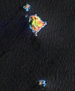
| Landsat picture by Martim Vaz | |
| Waters | Atlantic Ocean |
| archipelago | Trindade and Martim Vaz |
| Geographical location | 20 ° 29 ′ S , 28 ° 51 ′ W |
| Number of islands | 4th |
| Main island | Martim Vaz |
| Total land area | 0.37 |
| Residents | uninhabited |
| Map by Martim Vaz | |
Martim Vaz ( Portuguese Ilhas de Martim Vaz , sometimes also referred to as Martin Vaz ) is an uninhabited Brazilian archipelago of volcanic origin in the Atlantic Ocean , about 1,200 kilometers east of Vitória .
geography
The islands belong to the Trindade and Martim Vaz archipelago and are around 47 km east of the main island of Trindade . With an area of around 37 hectares , they represent the significantly smaller part of this group.
The Martim Vaz archipelago includes four islands and numerous small rocky cliffs, which rise steeply from the Atlantic and in the Ilha Martim Vaz reach a height of up to 175 m above sea level. Landing with boats is considered very difficult.
Tabular overview of the islands:
![]() Map with all coordinates: OSM | WikiMap
Map with all coordinates: OSM | WikiMap
| island | Area ha |
Height m |
Coordinates | location |
|---|---|---|---|---|
| Ilha do Norte | 2.84 | 75 | 20 ° 28 ′ 8 ″ S , 28 ° 51 ′ 19 ″ W. | 300 m NNW of Martim Vaz |
| Rochedo Agulha | 0.38 | ... | 20 ° 28 ′ 20 ″ S , 28 ° 51 ′ 19 ″ W. | 120 m northwest of the Martim Vaz |
| Ilha Martim Vaz (Ilha da Racha) | 30.8 | 175 | 20 ° 28 ′ 32 ″ S , 28 ° 51 ′ 3 ″ W. | |
| Ilha do Sul 1 | 3.34 | 122 | 20 ° 29 ′ 48 ″ S , 28 ° 50 ′ 56 ″ W. | 1.6 km south of Ilha Martim Vaz |
history
The islands were discovered in 1512 by the Portuguese navigator João da Nova and sighted in 1514 by the Spanish navigator Juan de la Cosa , who baptized them Santa Maria Esmeralda . In 1761, two sailors belonging to the French explorer Jean-François de La Pérouse lost their lives while trying to climb the steep islands. In 1951 the Brazilian Navy finally took possession of the islands for Brazil and called them Martim Vaz from then on . While trying to reach the islands in order to hoist the Brazilian flag, the ship crashed on the reef of the islands and 12 sailors lost their lives.
Web links
- Information about Martim Vaz (English)
Individual evidence
- ↑ measured on Here Satellite
- ↑ Map on blogger site


