
Mason (moon crater)
| mason | ||
|---|---|---|

|
||
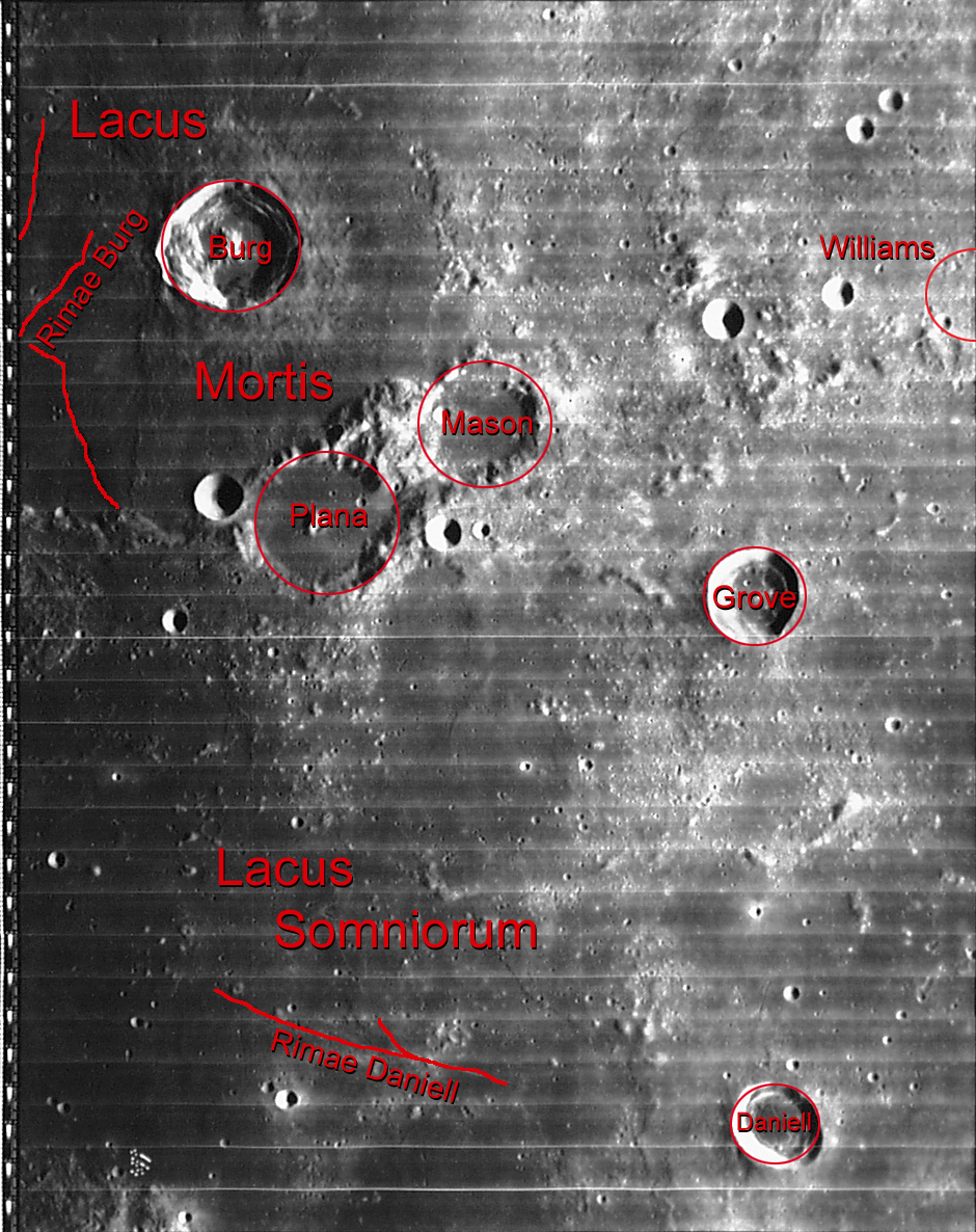
| Lacus Mortis with Mason on the southeastern edge ( LROC -WAC) | ||
|
||
| position | 42.67 ° N , 30.54 ° O | |
| diameter | 33 km | |
| depth | 1390 m | |
| Card sheet | 26 (PDF) | |
| Named after | Charles Mason (1728–1786) | |
| Named since | 1935 | |
| Unless otherwise stated, the information comes from the entry in the IAU / USGS database | ||

Mason represents the remains of a heavily eroded impact crater on the south bank of Lacus Mortis in the northeast quadrant of the Earth's moon . It is closely connected to the eastern edge of the flooded Plana crater . In the northwest lies the Bürg crater and in the south the Lacus Somniorum spreads out.
The outline of the heavily eroded Mason Crater is irregular and elongated in an east-west direction. The rim of the crater is an uneven ring of crumbling hills that merge into the rough terrain in the south and east. Canyons or valleys break through the western rim and extend to the eastern rim of the Plana crater . The inside of the crater is flooded by basaltic lava and an almost flat basin within the crater rim.
In the north-western area of the crater floor the small crater 'Mason A' can be seen.
| Letter | position | diameter | link |
|---|---|---|---|
| A. | 42.9 ° N , 30.11 ° O | 5 km | [1] |
| B. | 41.83 ° N , 29.63 ° E | 10 km | [2] |
| C. | 42.88 ° N , 33.85 ° O | 12 km | [3] |
The crater was officially named by the IAU in 1935 after the British astronomer Charles Mason .
Individual evidence
- ^ John Edward Westfall: Atlas of the Lunar Terminator. Cambridge University Press, Cambridge 2000, ISBN 0-521-59002-7 , p. 279
Web links
- Mason in the Gazetteer of Planetary Nomenclature of the IAU (WGPSN) / USGS
- Mason on The-Moon Wiki
- Mason Crater in the Digital Lunar Orbiter Photographic Atlas of the Moon
- Spektrum.de : Amateur recordings [4]