
Maudacher break

The Maudacher Bruch (with a long [uː], to the word “break” for “wetland” ) is a landscape protection area in the city of Ludwigshafen am Rhein and a former arm of the old Rhine that was separated from the Rhine around 900 BC.
location and size


The Maudacher Bruch runs in the shape of a horseshoe between the districts of Ludwigshafen-Gartenstadt , Oggersheim and Maudach in the city of Ludwigshafen on the Rhine.
The fracture site covers an area of 523 hectares with a width of around 300 to 500 meters and a length of five kilometers. It extends to the districts of Maudach , Oggersheim and Mundenheim, with Maudach accounting for around 90 percent of the total area.
history
Surname
The word break is related to brook , Anglo-Saxon for stream or river, and is used today for a wet meadow, swamp, morass or bog soil.
Excavation finds
During excavations, a sword was found at the cross moat. A bronze sword from the earlier Hallstatt period lay under a layer of peat 1.42 meters deep . The Mannheim professor H. Gropengießer also determined by means of a pollen analysis that the silting up of the break was rapid. At the beginning of the Hallstatt period, the Old Rhine was already silted up. When digging peat in the 19th century, mammoth bones were found that came from the Ice Age .
Peat extraction

Originally the area was a loop of the Rhine that silted up in pre-Christian times and was partially drained. In the past, peat was also cut in the quarry . That is why the peat cutter - next to the lapwing - is the symbolic figure of Maudach.
The peat was cut in April as soon as the water had sunk somewhat. Usually three large groups of ten to twenty men each worked in peat cutting. The top soil layer first had to be cleared about 30 centimeters deep. Then came a one to two meter thick layer of peat. Two workers operated the water screw and turned a crank to pump the pressurized water into a ditch. The depression filled with water overnight, which is why the so-called “water men” had to get up up to two hours earlier, usually before 3 am.
The “detours” cut the peat into regular prisms the size of a brick, the so-called “peat stones” or “peat cheese”. The wages and the sales price were calculated according to a thousand pieces of these "peat stones". The detour worked with a wide and rectangular spade and a lath. He was followed by five or six "engravers" who cut off the pieces at the bottom and on the side. They had a small peat knife that was just as wide at the cutting edge as the piece of peat should be.
“Kärchler” brought the pieces out of the peat hole on one-wheeled carts that ran on floorboards and put them on to dry. If the pieces were a little dry, they were "curled", i.e. H. 50 pieces were placed on top of each other so that the air could pass through. This work was done by the “peat ringers”. The peat was curled twice until it was finished.
planting
After the Second World War, trees were planted in the Bruch. Later, the 32 meter high rubble mountain ( Monte Scherbelino , the highest point in Ludwigshafen at 125 meters above sea level), which was then called Michaelsberg, was planted with greenery. It offers a good all-round view over the city of Ludwigshafen, the Vorderpfalz to the Palatinate Forest and the Rhine plain.

nature
Since agriculture has been drawing its process water from the Rhine via pipes, the groundwater level has risen again, which has given the landscape its moor character again , since fallen trees are no longer generally removed.
140 different types of grass and shrubbery were counted in the quarry, as well as more than 50 types of trees and shrubs. The ornithological observation station also reported nearly 160 species of birds. In addition, more than 350 species of butterflies, 35 of which are butterfly species.
plants
The following plants can be found in the Maudacher Bruch:
Yarrow , marsh bedstraw , marsh bedstraw , marsh forget-me , bitterling , Hoary Plantain , Lotus pedunculatus , arrowhead , downy brome , sharp stonecrop , Everlasting flower , Silene conica , alyssum alyssoides , ear spoon Campion , sprout end Felsennelkenanger , Colorful vetch .
activities
Today the Bruch is used as a leisure and recreational area. Since the 1970s there is also a now neglected fitness trail. In addition, festivals are often held on the site in summer.
Image gallery

Way in the Maudacher Bruch
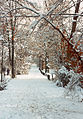
Maudacher Bruch in winter

Breakage site

Fracture playground


Web links
- Ordinance on the "Maudacher Bruch" landscape protection area of April 25, 1978 (PDF file; 1.51 MB)
- Changed ordinance LSG "Maudacher Bruch" Change September 1st, 2004
Individual evidence
Coordinates: 49 ° 27 ′ 50 ″ N , 8 ° 22 ′ 15 ″ E