Maui County
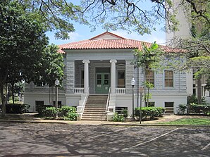
 Maui County Courthouse |
|
| administration | |
|---|---|
| US state : | Hawaii |
| Administrative headquarters : | Wailuku |
| Foundation : | 1905 |
| Demographics | |
| Residents : | 154,834 (2010) |
| Population density : | 51.6 inhabitants / km 2 |
| geography | |
| Total area : | 6213 km² |
| Water surface : | 3210 km² |
| map | |
| Website : www.co.maui.hi.us | |
Maui County is a county in the state of Hawaii in the United States of America . It includes the islands of Maui , Kahoʻolawe , Lanai and most of Molokaʻi (except Kalawao ).
The population was 128,094 in 2000. Estimates from July 2003 assume a population of 135,605. Maui County's area is 6,213 square kilometers, of which a little more than half (51.67%) is water.
The administrative headquarters are in Wailuku .
There are 5 National Historic Landmarks in the county . 62 other structures and sites are on the National Register of Historic Places.
Town twinning
Web links
Commons : Maui County - collection of pictures, videos, and audio files
Individual evidence
- ↑ Search mask database in the National Register Information System. National Park Service , accessed August 25, 2017.
Coordinates: 20 ° 53 ′ N , 156 ° 39 ′ W
