Mavrovo (village)
| Mavrovo Маврово Mavrova / Mavrovë |
||||
|---|---|---|---|---|
|
||||
| Basic data | ||||
| Region : | Polog | |||
| Municipality : | Mavrovo i Rostuša | |||
| Coordinates : | 41 ° 39 ' N , 20 ° 44' E | |||
| Height : | 1230 m. i. J. | |||
| Residents : | 166 (2002) | |||
| Telephone code : | (+389) 042 | |||
| Postal code : | 1256 | |||
| License plate : | GV | |||
| Structure and administration | ||||
| Website : | ||||
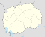
Mavrovo ( Macedonian Маврово ; Albanian Mavrova / -ë ) is a village in the municipality of Mavrovo i Rostuša in western North Macedonia . It is also the official seat of this municipality, which includes 41 other villages in addition to Mavrovo, and is located on the lake of the same name at around 1230 meters above the Adriatic Sea . The famous Zare Lazarevski ski area is located near Mavrovo .
The place had 166 inhabitants according to the last census of 2002. 163 described themselves as ethnic Macedonians and 3 as Serbs .
In 1850 the orthodox St. Niklaus Church was built. In 1953, however, it was flooded by the reservoir and only drained again in the 21st century.
Mavrovo can be reached via winding roads from Gostivar , Kičevo and Debar . It lies on the area of the national park of the same name .
Web links
Individual evidence
- ↑ 2002 census (PDF; 2.3 MB)


