Kičevo
| Kičevo Кичево Kërçova / Kërçovë |
||||
|---|---|---|---|---|
|
||||
| Basic data | ||||
| Region : | southwest | |||
| Municipality : | Kičevo | |||
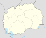
| Coordinates : | 41 ° 31 ' N , 20 ° 58' E | |||
| Height : | 618 m. i. J. | |||
| Area (Opština) : | 823.68 km² | |||
| Residents : | 27,067 (2002) | |||
| Inhabitants (Opština) : | 56,734 (2002) | |||
| Population density : | 69 inhabitants per km² | |||
| Telephone code : | (+389) 045 | |||
| Postal code : | 6250 | |||
| License plate : | AI | |||
| Structure and administration | ||||
| Community type: | Opština | |||
| Mayor : | Fatmir Dehari ( BDI ) | |||
| Website : | ||||
| Others | ||||
| City Festival : | September 11 | |||
Kičevo ( Macedonian Кичево ; Albanian Kërçova / Kërçovë ; Turkish Kırçova ) is a city in the mountainous west of North Macedonia and the official seat of the Opština of the same name (Alb. Komuna ), to which 78 other localities in the surrounding area belong. With around 27,067 inhabitants, the city is an important industrial and mining location for North Macedonia. In terms of traffic, Kičevo has an important function. All the national roads of Western Macedonia meet here and the North Macedonian Railway also has a train station in the city.
geography
Kičevo is narrowed between the mountain massif of the Bistra in the west and the mountain range of the Dobra Voda (alb. Ujmiri ). The Kičevo Valley is traversed by a tributary of the Treska and is around 1.5 kilometers wide at Kičevo. South of the city, the Treska flows further east and at Makedonski Brod to the north. The surrounding area is very mountainous and forested.
On the eastern edge of the city is the hill Kitino , which is bordered in the east by the tributary of the Treska.
history
Very little is known about the early history of Kičevo. Historians suspect that the ancient Uskana , which was built during the war between the Macedonian king Perseus and Rome 170-169 BC, is close by. Is mentioned. There is no further information about this place, the location of Uskana is also unknown.
The city was first mentioned as Kičevo in 1018. It appeared on a map of the Byzantine emperor Basil II , who named the place Kicavis and counted it to the Archdiocese of Ohrid . In the High Middle Ages this region fell under the rule of the Serbian Empire . In 1294, the Serbian King Stefan Uroš II Milutin donated the construction of the St. George Monastery in the village of Knežino , the western neighbor of Kičevos.
At the end of the 14th century the Ottoman Empire conquered the place and under its rule the city experienced its greatest development. This was mainly due to the many deposits of minerals in the region, including copper and manganese . Kırçova was fortified and a clock tower ( Sahat-Kula ) was built next to mosques .
After the reform of the opštini (municipalities) in 2004, thousands of ethnic Macedonians demonstrated in Kičevo as well as in Struga , as the Albanians will now be the largest percentage of the community population and the Macedonians will form a (large) minority. In the following years, however, the situation stabilized again.
Attractions
Numerous buildings from Ottoman times were destroyed by nationalists or foreign armies in the 20th century, including the clock tower by Serbian troops in 1938. Its year of construction was dated 1741 and towered over the market square ( bazaar ) at that time . In the 20th century, the old town was almost completely built over, whereby numerous historical buildings disappeared. Individual mosques and churches survived this development.
An important building in North Macedonia is the Kičevo Monastery , which is located southeast of the city on a mountain at 920 m. i. J. was built in the 16th century.
population
Kičevo has 27,067 inhabitants (as of 2002). Of these, 15,031 are Macedonians , 7,641 Albanians , 2406 Turks , 1329 Roma and 660 belong to other ethnic groups. 16,931 stated Macedonian , 7635 Albanian , 2183 Turkish and 318 stated other languages as their mother tongue. 15,139 were Orthodox , 11,759 Muslim and 169 belonged to other religions.
economy
Kičevo was heavily industrialized after the Second World War . Factories emerged in the food industry , cement production , textile and clothing industry and canning industry . At the time of Yugoslavia around 6000 people found work in this branch of industry. Almost all of them were ethnic Macedonians. However, more than half of the employees lost their jobs after the collapse of Yugoslavia . Most companies have closed and only a few administrative jobs are still available.
An important branch of the economy in Kičevo, which also gained momentum especially after the Second World War, was mining . Although the mining of manganese at Dvorci (southeast of Kičevo) began as early as 1937 , it was only after the World War that the mining industry began to develop more strongly due to the industrialization that began in Yugoslavia. In addition to manganese, copper and xylitol , which were mined to a greater extent, were added later.
Since August 10, 1920, the city was connected to the railway network. However, the light railroad with a track width of 600 mm did not enable large-scale transport. Therefore, the distance between been Skopje and Kičevo restored in the post, and the field web was replaced by the non-electrified railway Skopje-Kičevo in standard gauge .
Agriculture and animal husbandry have always played an important role in the region. Although it does not add much to the gross domestic product, many people, especially in the villages, are employed in this sector. However, trade and services have created more jobs in recent years and have far higher sales than the primary economic sector. The main crops are maize , individual grains , vegetables such as tomatoes , peppers and cabbage , legumes such as beans and fruits, including chestnuts , grapes , apricots , apples and cherries . In the past, tobacco planting was much more important than it is today, as the restrictions on private cultivation have now been greatly increased.
A small part of the workforce is also employed in the catering and tourism sectors . Restaurants have mainly sprung up along the national road in the north of the city, namely on the Straža pass towards Gostivar. In summer, they are mainly used by the Diaspora Albanians who organize their family festivities here in great luxury. This part of the population, i.e. the diaspora from Switzerland , Germany and other Central European countries, brings large sums of money into the city every year and thus contributes to a large extent to stabilizing the economy.
Due to the local industry, Kičevo suffered and still suffers from severe air pollution.
traffic
Street
Kičevo is a crossroads of the national roads of North Macedonia and a transit point for traffic in the Balkans . The national road M4 connects Skopje , the capital of the country, with Albania at the border crossing Čafasan / Qafë Thana , west of Struga . It leads through the western part of the city from the north to the south and branches off at the end of the city with the M513, which connects Kičevo with Prilep via Makedonski Brod . After a few kilometers, the M4 branches off at Popolžani with the M416, which connects Kičevo to Bitola via Demir Hisar . The M4 finally continues over the mountainous south-west of North Macedonia into the plains of Struga and Ohrid and on to the Albanian border. On this route from Kičevo to Čafasan / Qafë Thana, it forms the Pan-European Transport Corridor 8 , which connects the Adriatic Sea near Durrës and Vlora (Albania) with the Black Sea near Varna and Burgas ( Bulgaria ). The Skopje-Kičevo-Ohrid route is also the European route 65 .
In May 2014, construction of the motorway between Kičevo and Ohrid began. The length of the motorway is 45 km. In terms of infrastructure, it means an important gain for the country.
railroad
Kičevo is the terminus of the Skopje – Kičevo railway . During the First World War, the line was initially built as a narrow-gauge railway with a gauge of 600 mm as the Skopje – Ohrid railway line . Since 1969, the standard gauge line has stretched from Skopje to Kičevo, the section from here to Ohrid has been abandoned.
air traffic
The national airports of Skopje and Ohrid are 140 and 55 km away, respectively.
Sports
KF Vëllazërimi (Macedonian KF Vlazrimi ) , which has existed since 1977, is the football club primarily for the city's Albanians .
sons and daughters of the town
- Kaliopi (* 1966), rock and pop singer
- Nataša Kocevska (* 1984), handball player
- Vlatko Lozanoski (* 1985), rock and pop singer
- Besart Ibraimi (* 1986), football player
- Uran Dervishi (* 1993), folk singer
Web links
- Official website (English, Macedonian)
Individual evidence
- ↑ About the Opština. (No longer available online.) In: Opština Kičevo. Archived from the original on November 21, 2012 ; Retrieved October 9, 2012 (Macedonian). Info: The archive link was inserted automatically and has not yet been checked. Please check the original and archive link according to the instructions and then remove this notice.
- ↑ a b Narrow gauge in western Macedonia. (No longer available online.) In: Freewebs.com. Archived from the original on October 3, 2011 ; Retrieved October 9, 2012 (Macedonian). Info: The archive link was inserted automatically and has not yet been checked. Please check the original and archive link according to the instructions and then remove this notice.
- ↑ a b History of Kičevo. (No longer available online.) In: Opština Kičevo. Archived from the original on December 20, 2012 ; Retrieved October 9, 2012 (Macedonian). Info: The archive link was inserted automatically and has not yet been checked. Please check the original and archive link according to the instructions and then remove this notice.
- ↑ Struga and Kicevo threaten to split off. Is the dispute over decentralization in Macedonia escalating? In: Neue Zürcher Zeitung . August 14, 2004, accessed October 11, 2012 .
- ↑ Clock towers of Macedonia. (PDF) In: Национален конзерваторски центар ( Nacionalen konzervatorski centar ). Vera Gavrovska Bojčevska, accessed on October 11, 2012 (Macedonian, PDF; 273 kB).
- ↑ Census of Macedonia 2002 by locality. (PDF; 2.3 MB) In: State Statistics Office. Retrieved October 9, 2012 .
- ↑ Björn victims: In the Shadow of War: . Occupation or connection - liberation or oppression? - a comparative study of the Bulgarian rule in Vardar-Macedonia 1915–1918 and 1941–1944 (= studies on the history, culture and society of Southeast Europe . Volume 3 ). LIT Verlag, Münster 2005, ISBN 3-8258-7997-6 , VI, p. 234 ( limited preview in Google Book search).
- ↑ Map of North Macedonia with mineral deposits . CIA
- ↑ Profile Macedonia (country). (No longer available online.) In: Alpen-Adria-Universität Klagenfurt. Archived from the original on March 4, 2016 ; Retrieved October 11, 2012 . Info: The archive link was inserted automatically and has not yet been checked. Please check the original and archive link according to the instructions and then remove this notice.


