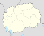
Makedonski Brod
| Makedonski Brod Македонски Брод |
||||
|---|---|---|---|---|
|
||||
| Basic data | ||||
| Region : | southwest | |||
| Municipality : | Makedonski Brod | |||
| Coordinates : | 41 ° 31 ' N , 21 ° 13' E | |||
| Height : | 570 m. i. J. | |||
| Area (Opština) : | 888.97 km² | |||
| Residents : | 3,740 (2002) | |||
| Inhabitants (Opština) : | 7,141 (2002) | |||
| Population density : | 8 inhabitants per km² | |||
| Telephone code : | (+389) 045 | |||
| Postal code : | 6530 | |||
| License plate : | MB | |||
| Structure and administration | ||||
| Mayor : | Zivko Siljanoski (Живко Силјаноски) ( SDSM ) | |||
| Website : | ||||
Makedonski Brod [ ˌmakɛˈdɔnski brɔd ] ( Macedonian-Cyrillic : Македонски Брод; short also M. Brod ; in German about: Macedonian ford ) is a small town in western North Macedonia with 3740 inhabitants on the banks of the Treska . The place is the seat of the Opština named after her , which includes 50 other villages and has a total of over 7100 inhabitants.
geography
Geographical location
Makedonski Brod is located in a basin of the Treska, a tributary of the Vardars , at an altitude of between 530 and 610 meters. In the north rises the forest mountains Pesjak , in the south the Buševa and in the east the Dautica . The city is the center of the rather sparsely populated region of Poreče , which stretches from Skopje to Kičevo . A side valley east of the city leads to the wide plain of Prilep . Nearby is the Albanian-speaking village of Debreshte .
climate
The climate is continental because of the mountainous location . The winters are cold and rich in precipitation and the summers are hot and low in precipitation.
population
The city of Makedonski Brod has 3740 inhabitants, almost all of whom are Orthodox Macedonians . Of the 7,141 inhabitants in the Opština, 6927 are Orthodox Macedonians, and there are 181 Muslim Turks . 33 inhabitants also belong to other ethnic groups.
history
In ancient times, the area was inhabited by the Romans . A Roman tombstone was found near the village of Krapa, northeast of the city. Later the Slavic tribe of the Berzites immigrated .
A bridge has always stood on the site of the present-day town, connecting Kičevo in the west with Prilep in the southeast.
In the vicinity of the village of Devič in the north, ruins of many buildings have been found, from which it can be judged that there was a settlement there that acted as the center for the whole region. Not far from these ruins is the Pešna Cave, which is up to 30 meters high inside and belongs to a cave system up to 10 kilometers long.
In 1445 the Battle of Mokra between Skanderbeg's armies and the Ottoman army took place nearby , which ended with the victory of the League of Lezha .
Web links
- Official website of Opština Makedonski Brod (Macedonian and English)
Individual evidence
- ↑ Census of Macedonia 2002 (by location). (PDF) In: State Statistics Office. Retrieved January 25, 2014 (English, PDF file, 3.05 MB).
- ↑ Census of Macedonia 2002 (by municipality). (PDF) In: State Statistics Office. Retrieved January 25, 2014 (English, PDF file, 384 kB).
- ↑ Census of Macedonia 2002 (by location and ethnicity / religion). (PDF) In: State Statistics Office. Retrieved January 25, 2014 .
- ↑ Peshna cave, Makedonski Brod. In: Culturemap.mk. Retrieved January 25, 2014 .


