Demir Hisar
| Demir Hisar Демир Хисар |
||||
|---|---|---|---|---|
|
||||
| Basic data | ||||
| Region : | Pelagonia | |||
| Municipality : | Demir Hisar | |||
| Coordinates : | 41 ° 13 ' N , 21 ° 12' E | |||
| Height : | 655 m. i. J. | |||
| Area (Opština) : | 480.13 km² | |||
| Residents : | 2,593 (2002) | |||
| Inhabitants (Opština) : | 9,497 (2002) | |||
| Population density : | 20 inhabitants per km² | |||
| Telephone code : | (+389) 047 | |||
| Postal code : | 7240 | |||
| License plate : | BT | |||
| Structure and administration | ||||
| Mayor : | Toni Angelevski (VMRO-DPMNE) | |||
| Website : | ||||
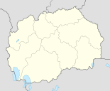
Demir Hisar ( Macedonian Демир Хисар ) is a small town and the official seat of the Opština named after it in the south-west of North Macedonia . It is located in the Crna Reka river valley , about 25 kilometers northwest of Bitola , the capital of the Pelagonia region .
In addition to the city, Demir Hisar's Opština includes 40 other localities in the area. It has 9497 inhabitants, 2987 households and 4327 apartments. The population density is just under 20 inhabitants per square kilometer. A household has an average of 3 members. 9,179 people are Macedonians , 232 Albanians , 35 Turks and 51 belong to other ethnic groups . The literacy rate is around 95.13 percent in the population of over 10-year-olds (8,645 people). For men, it is about 96.96 percent, a little higher than for women, at 93.23 percent (all data come from the 2002 census).
| year | population |
|---|---|
| 1961 | 1129 |
| 1981 | 2283 |
| 1985 | 2633 |
| 2002 | 2593 |
The city has 2593 inhabitants (2002). The local population has more than doubled since 1961.
Neighboring towns of Demir Hisar are Belče, Graište, Vardino, Suvodol, Zagoriče, Strugovo and Slepče, turning clockwise from the north. Neighboring communities are also turning clockwise from the north Kruševo , Bitola, Resen , Ohrid , Debarca and Drugovo .
Demir Hisar was a small market town on the road between the regional trading center Bitola and the market town of Kičevo during the Ottoman period (14th to 20th centuries) . The place name "Demir Hisar" means something like "iron fortress" in Turkish .
In 2009 Toni Angelevski ( VMRO-DPMNE ) was elected mayor (maz. Gradonačalnik Градоначалник) of the Opština. The city council (maz. Sovet na Opštinata Совет на Општината) consists of 11 members.
Web links
- Website of the Opština Demir Hisar (Macedonian)
Individual evidence
- ↑ a b Census of Macedonia 2002. In: State Statistics Office. Retrieved September 27, 2012 (English, PDF file, 384 KB).
- ↑ a b c Brief information on the Opština Demir Hisar. In: makedonija.name. Retrieved September 27, 2012 (English).
- ↑ Macedonia's postal network. (No longer available online.) In: Makedonska Pošta. Archived from the original on December 6, 2015 ; Retrieved September 27, 2012 (Macedonian). Info: The archive link was inserted automatically and has not yet been checked. Please check the original and archive link according to the instructions and then remove this notice.
- ↑ a b Local elections Macedonia 2009. (No longer available online.) In: Staatliche Wahlkommission. Archived from the original on October 16, 2014 ; accessed on September 27, 2012 (English, PDF file, 221 KB). Info: The archive link was inserted automatically and has not yet been checked. Please check the original and archive link according to the instructions and then remove this notice.
- ↑ a b c About Demir Hisar. In: demirhisar.gov.mk. Retrieved September 27, 2012 (Macedonian).
- ↑ Local administration. In: demirhisar.gov.mk. Retrieved September 27, 2012 (Macedonian).


