Makedonska Kamenica
| Makedonska Kamenica Македонска Каменица |
||||
|---|---|---|---|---|
|
||||
| Basic data | ||||
| Region : | east | |||
| Municipality : | Makedonska Kamenica | |||
| Coordinates : | 42 ° 1 ' N , 22 ° 35' E | |||
| Height : | 550 m. i. J. | |||
| Area (Opština) : | 189 km² | |||
| Residents : | 5,147 (2002) | |||
| Inhabitants (Opština) : | 8,110 (2002) | |||
| Population density : | 43 inhabitants per km² | |||
| Telephone code : | (+389) 33 | |||
| Postal code : | 2304 | |||
| License plate : | DE | |||
| Structure and administration | ||||
| Community type: | Opština | |||
| Structure : | 9 localities | |||
| Mayor : | Darko Mitevski ( VMRO-DPMNE ) | |||
| Website : | ||||
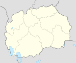
Makedonska Kamenica [ makɛˈdɔnska kamɛˈnit͡sa ] ( Macedonian Македонска Каменица ) is a small town in eastern North Macedonia . It has 5147 inhabitants (status: 2002) and is the official seat of the Opština of the same name , which includes eight other villages in addition to the city and has a total of 8110 inhabitants (status: 2002).
geography
Makedonska Kamenica is located in Eastern Macedonia near the border with Bulgaria . The city extends in the river valley of the Kamenička Reka and borders in the south on the Kalimanci reservoir , where the river flows and which the Bregalnica dams.
The hilly foothills of the Osogovo rise to the north and west . Due to heavy clearing, the forest areas there are much smaller than they were 20 years ago.
population
In the Opština Makedonska Kamenica there are 8,110 inhabitants in 2,437 households, which makes about three people per household. Compared to many other parts of the country, the ethnic structure of the population in Makedonska Kamenica is relatively homogeneous. 99.32 percent are Macedonians , the remaining 0.68 percent are split between Serbs , Roma , Bosniaks and others.
history
Makedonska Kamenica and its surroundings are known for the many mines where lead and zinc are mined. As early as 1282, miners from the Ore Mountains settled there . The place name of the village Sasa still reminds of its German-speaking immigrants.
In an Ottoman census from 1570–1572 ( Defter ) 80 Christian families and 59 single men were registered in Kamenica. The village had five flour mills and ten fulling mills.
politics
Darko Mitevski ( VMRO-DPMNE ) has been Mayor of the Opština since 2013 .
traffic
The city is connected to the neighboring cities of Delčevo (further to Bulgaria) and Kočani (further to Štip ) by the national road M5 . The Makedonski železnici operate a railway line between Štip and Kočani .
Sports
FK Sasa is the city's football club, which was founded in 1968 and plays in the third division of Macedonia (East).
Web links
- Official website of the Opština Makedonska Kamenica (English and Macedonian)
Individual evidence
- ↑ a b c 2002 census by municipalities. (PDF) In: State Statistics Office. Retrieved April 5, 2014 (English, PDF file, 384 kB).
- ↑ a b 2002 census by locality. (PDF) In: State Statistics Office. Retrieved April 5, 2014 (English, PDF file, 3.05 MB).
- ↑ Goran Mitevski: Short History of Municipality of Makedonska Kamenica . From the Neolithic Period to the creation of the modern mining settlement of Makedonska Kamenica. Kočani 2013, p. 7–12 ( online version [accessed April 5, 2014]).
- ^ Biography of the mayor. (No longer available online.) In: Official website of Opština Makedonska Kamenica. Archived from the original on April 7, 2014 ; Retrieved April 5, 2014 (Macedonian). Info: The archive link was inserted automatically and has not yet been checked. Please check the original and archive link according to the instructions and then remove this notice.


