Treska
| Treska | ||
|
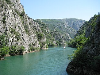
The Matka lake |
||
| Data | ||
| location | Macedonia | |
| River system | Vardar | |
| Drain over | Vardar → Thermaic Gulf (Aegean Sea) | |
| Source height | approx. 740 m | |
| muzzle | in Skopje's suburb Gjorče Petrov from the right in the Vardar Coordinates: 42 ° 0 ′ 8 ″ N , 21 ° 20 ′ 48 ″ E, 42 ° 0 ′ 8 ″ N , 21 ° 20 ′ 48 ″ E
|
|
| length | 132 km | |
| Catchment area | 2350 km² | |
The Treska is a river in the west of the Republic of Macedonia . The right tributary of the Vardar is 132 km long and its catchment area covers 2350 km².
The Treska rises near the village of Izvor at an altitude of around 740 meters and flows eastward through the valley of Kičevo . At Makedonski Brod it turns north, flows between the mountains of Suva Gora and Karadžica and finally flows into the Vardar in Skopje's suburb Gjorče Petrov .
Are located on the Treska two reservoirs for electricity production: The 1937 built Matkadamm impounds Matkasee , and in 2004 built the Kozjakdamm Kozjaksee .
Web links
Commons : Treska - collection of images, videos and audio files

