Qafë Thana
| Qafë Thana | |||
|---|---|---|---|
|
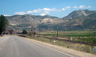
West ramp of the pass seen from Përrenjas |
|||
| Compass direction | west | east | |
| Pass height | 937 m above sea level A. | ||
| Qark | Elbasan | Korça | |
| Watershed | Shkumbin | Inside | |
| Valley locations | Përrenjas | Lin | |
| expansion | Street | ||
| Lock | - | ||
| particularities | Railway tunnel (1979) | ||
| map | |||
|
|
|||
| Coordinates | 41 ° 3 '55 " N , 20 ° 36' 31" E | ||
The Qafë Thana , also known as Kafasan or Čafasan ( Macedonian Чафасан ; German Cornelian cherry pass ), is a mountain pass in Albania . It is crossed by the SH 3 and the European route 852 and connects the Shkumbin valley , in which the city of Librazhd is located, with the basin of Lake Ohrid , in which Pogradec is located. It is the most important connection from central Albania to south-east Albania with the Korça region .
The ascent to the pass begins on the east side at Qukës at an altitude of around 400 meters, where the road leaves the Shkumbin valley. At Përrenjas at around 550 meters, the ascent is interrupted by a plain several kilometers long before the road from Uraka climbs steeply and with many curves to the pass. On the east side, the road leads in a few large bends down to Lake Ohrid, which is almost 700 meters above sea level.
Directly at the top of the pass, the SH 9 branches off to North Macedonia , which then runs on the ridge to the border. The border crossing named after the pass is a little higher at 994 m above sea level. A. The Qafë Thana is part of the Pan-European Transport Corridor VIII and the most important connection route from Albania to North Macedonia.
A single-lane, 3015 meter long tunnel of the Albanian railway crosses under the pass at a height of around 700 meters. The line, opened in 1979, was built to develop the mines near Pogradec. The construction period for the tunnel lasted from 1975 to 1979. Around 650 liters of water per second collect in the tunnel, which was originally used to irrigate the Fusha e Domosdovës plain .
Web links
Individual evidence
- ↑ a b c Akademia e Shkencave e RPSSH (ed.): Fjalor enciklopedik shqiptar . Tirana 1985.


