Meckhofen
|
Meckhofen
City of Leverkusen
Coordinates: 51 ° 2 ′ 55 " N , 7 ° 4 ′ 57" E
|
||
|---|---|---|
|
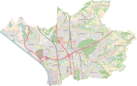
Location of Meckhofen in Leverkusen |
||
Meckhofen is a district and housing estate with 300 residential units for 800 residents in the district Steinbuechel the municipality III of Leverkusen . It covers an area of 8.4 hectares.
location
The Meckhofen settlement is located in the east of the city of Leverkusen. It borders Mathildenhof in the west, Fettehenne in the south and Neuboddenberg in the east. The Mühlenbach rises in Meckhofen . Meckhofen is at an altitude of 130 meters above sea level. NN .
history
Due to numerous conflicts over nature and landscape protection, the planning history of this area dragged on: "Between the first urban development competition for this area and a legally binding development plan there were ten years because compromises were struggled", says the administrative report of the city of Leverkusen . In 1998, a development plan was finally implemented that was supposed to enable “future-oriented construction” with low-energy houses .
The name comes from a farm in the north of the new development area, which in the Middle Ages was an individual homestead that was dependent on the former knight's seat Steinbüchel.
traffic
Meckhofen is on the federal highway 51 , which here as Berliner Straße represents the connection between Burscheid / Wermelskirchen and Leverkusen- Schlebusch / Cologne . The Meckhofer Feld bus stop is served by the VRS lines 260, 213 and 215, and there are other stops in the nearby Mathildenhof housing estate.
Worth seeing
On May 28, 2002, a sundial with a diameter of 20 meters was inaugurated on a square in Meckhofen . Railway tracks and paving tapes indicate the hour lines and the solstices, as well as the equinox. You can sit on the hour markers and use the appropriate markings to see when it is midday in the partner cities of Leverkusen. The pointer, with a metal disc with a round opening at the top, is two meters high.
In addition, there is a primary school and an allotment garden association in Meckhofen .
Streets
In Meckhofen there are almost exclusively paved streets. These are all designed as traffic-calmed areas . This means that you can only drive 7 km / h, which seems a bit unrealistic, especially since Meckhofen's roads lead downhill or uphill. All streets in Meckhofen are dead ends and have many roundabouts.
literature
- Leverkusen City Archives (ed.): Leverkusen. History of a city on the Rhine. Publishing house for regional history, Bielefeld 2005; P. 535f. ISBN 3-89534-575-X
Web links
Individual evidence
- ^ Administrative report of the city of Leverkusen 1984 to 1994, p. 100; Quoted from the Leverkusen City Archives (ed.), 2005.
- ↑ http://www.leverkusen.com/guide/index.php?view=00102
- ↑ Archived copy ( memento of the original from July 26, 2010 in the Internet Archive ) Info: The archive link was inserted automatically and has not yet been checked. Please check the original and archive link according to the instructions and then remove this notice.
