Mesilinka River
| Mesilinka River | ||
|
|
||
| Data | ||
| location | British Columbia (Canada) | |
| River system | Mackenzie River | |
| Drain over | Peace River → Slave River → Mackenzie River → Arctic Ocean | |
| source | in the Osilinka Ranges 56 ° 19 ′ 54 ″ N , 126 ° 8 ′ 16 ″ W |
|
| muzzle |
Williston Lake Coordinates: 56 ° 7 '52 " N , 124 ° 27' 57" W 56 ° 7 '52 " N , 124 ° 27' 57" W. |
|
| Mouth height | approx. 660 m
|
|
| length | approx. 150 km | |
| Catchment area | approx. 3000 km² | |
| Discharge at the gauge above Gopherhole Creek A Eo : 2980 km² |
MQ 1976/2000 Mq 1976/2000 |
45 m³ / s 15.1 l / (s km²) |
| Right tributaries | Tutizika River | |
|
Location of the Mesilinka River |
||
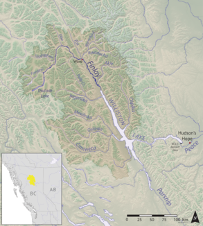
The Mesilinka River is a tributary of Williston Lake in the Canadian province of British Columbia .
The Mesilinka River rises in the Osilinka Ranges , a part of the Omineca Mountains . It initially flows in an easterly direction, but later turns to the south-southeast. The river eventually flows into the Omineca Arm , the mouth of the Omineca River , whose tributary was the Mesilinka River before the Peace River was dammed . The Mesilinka River has a length of about 150 km. It drains an area of around 3000 km². The mean discharge above Gopherhole Creek is 45 m³ / s.
Web links
- Mesilinka River . In: BC Geographical Names (English)
Individual evidence
- ↑ a b Mesilinka River at the gauge above Gopherhole Creek - hydrographic data from R-ArcticNET
