Middleton Island (Alaska)
| Middleton Island | ||
|---|---|---|
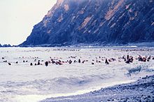
| Middleton Island 1964 | ||
| Waters | Gulf of Alaska ( Pacific Ocean ) | |
| Geographical location | 59 ° 26 ′ N , 146 ° 20 ′ W | |
|
|
||
| length | 8.4 km | |
| width | 3 km | |
| surface | 13.1 km² | |
| Residents | uninhabited | |

Middleton Island is an isolated island in the northern Gulf of Alaska . It belongs to the US state of Alaska ( Valdez-Cordova Census Area ) and has an area of 13.1 km².
geography
The island is about 8.4 km long and 3 km wide; in its shape and orientation it resembles the New Zealand South Island . In the south it is wider than in the north, on the south and southwest coast there are eight peninsulas, some of them very narrow, up to 600 m long, with bays in between. On the north coast there is a 600 m long bay that is flooded at high tide. In front of the south-east coast there is an approximately 500 m long sub-island, in front of the south and south-west coast there are still a few smaller ones. The closest land is Fish Island of the Wooded Islands off the coast of Montague Island , 74 northwest. In the east-northeast it is 102 km to Kayak Island , the nearest mainland is 115 km north-northeast. The next place is Cordova 123 km north. After St. Matthew Island , Buldir Island and St. Lawrence Island , Middleton is one of the most remote islands in the 50 US states (excluding Hawaii ).
history
Middleton Island was formed 4,300 years ago. Already Chutach -Ureinwohner visited the island. From 1958 to 1963, the Middleton Island Air Force Station , an early radar warning station , operated here. In the middle of the north is the runway of Middleton Island Airport , and there is also a NEXRAD weather radar. A road runs almost the entire length of the island, from the north end past a collection of five houses, along the airfield, to the abandoned Aircraft Control and Warning settlement with seven buildings (including the largest on the island) in the middle. Here it is divided in two: one road leads first to the southeast and then two kilometers to the southwest, another two kilometers to the southwest, past a collection of four houses. In total there are at least 17 buildings on the island. There is also the 5,000-ton cargo ship USS Coldbrook from World War II, which the sailors had to leave in June 1942. Today Middleton Island is uninhabited and the bird research station is open seasonally. Every now and then biologists, FAA personnel, bird watchers, rabbit hunters and beachcombers visit the island.
During the Good Friday quake in 1964 , the island was raised by over three meters, creating a lot of new stony land that was flooded by high tide. The raised cliffs erode and overgrow over time, which endangers cliff-nesting bird species; there are also landslides from time to time. It has been awarded a Registered Natural Landmark by the National Park Service , and a designation as an Important Bird Area is planned.
Fauna and use
It is covered with flat vegetation (mainly grass), there is a lot of flat or slightly sloping gravel and sand beach. 116 plant species were counted. The island is the abode of many migratory birds, 20 of the 130 species observed breed here, such as rhinoceros , sea shags , kittiwakes (formerly one of the largest colonies in the world), guillemots and thick-billed muzzles . In addition, there is the largest colony of cliff oyster fishermen on the Pacific coast and one of the few island population of Canada goose . Bird populations have been closely monitored since 1976. The only native mammals are Steller sea lions and California sea lions . A fox farm was operated from 1890 to the 1930s, and four rabbits were brought here in 1954 and have been breeding since then.
Surname
Middleton Island was named in 1794 by George Vancouver after the rear admiral and state controller of the Navy, Charles Middleton, 1st Baron Barham . The island used to be called Hijosa or Galiano , the Inuit called it Achakoo . The Russian captain Tevenkov of the Imperial Navy named the island Ostrov Ochek .
Web links
- Armand Biron: A little history and facts of Middleton Island, Alaska (detailed page on the history of Middleton Island)
- Middleton Island , overview page
- Information for Middleton Island AFS, AK , Randomes Inc. (documents and photos)
- This job is for the birds! , Blog of a researcher about the work on Middleton Island with many photos (also evidence)
Individual evidence
- ↑ Calculated using the ACME Plaimeter .
- ↑ Distances from Google Maps
- ↑ a b c d e f Middleton Island , National Audubon Society
- ^ EB Fussell: Army Racing Winter in North . Seattle Post-Intelligencer , September 1, 1955.
- ↑ US Geological Survey Geographic Names Information System: Middleton Island airport
- ↑ Data from OpenStreetMap
- ^ U, SS Coldbrook-Middleton Island , National Geographic Society , March 7, 2010.
- ↑ a b c Tim van Nus: Middleton Island, Gulf of Alaska (blog of a scientist about (avi) fauna and flora as well as the history of Middleton Island with many photos)
- ↑ Middleton Island , United States Geological Survey Geographic Names Information System

